Devpost
Participate in our public hackathons
Devpost for Teams
Access your company's private hackathons
Grow your developer ecosystem and promote your platform
Drive innovation, collaboration, and retention within your organization
By use case
Blog
Insights into hackathon planning and participation
Customer stories
Inspiration from peers and other industry leaders
Planning guides
Best practices for planning online and in-person hackathons
Webinars & events
Upcoming events and on-demand recordings
Help desk
Common questions and support documentation
Sort by:
AI-powered, physics based crowd safety simulation for live events - optimize schedules, predict crowd crush risk, save lives, and prevent injury.
UrbanPilot — AI agents that analyze any current address for climate, accessibility, and housing risk, then show you 2040 and 2075 predictions of what could come next.
Predict flood-isolated communities before roads fail, helping responders deliver aid faster and smarter.
AI that classifies, drafts, and tracks city complaints until they get fixed.
Medical Desert Planner finds India's highest-risk healthcare gaps — and tells planners how confident they should be that each gap is real, not just a data-poor region.
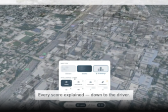
Spatial AI that scores Atlanta on climate risk and opportunity, shows exactly why each score landed where it did, and runs its scoring locally at a fraction of cloud-AI energy.
GroundCheck transforms how cities make infrastructure decisions, turning what residents observe on the ground into data-driven intelligence that guides every repair decision.
Atlanta's 2030 climate goal runs through its old buildings. Substrate turns benchmarking data into a ranked retrofit plan — cheapest carbon cuts first.
CarbonCurb uses spatial AI to map safe neighborhood walking routes for students—wiping out stressful morning drop-off traffic lines and cutting CO2 while keeping parents entirely in control.
Local Climate Intelligence for Schools
A living city simulation where AI citizens react, adapt, and evolve in real time.
CoolCast ATL asks: What if buildings cooled before the heat hits? Our dashboard shows which Atlanta buildings could conserve the most energy, money, and emissions through predictive HVAC scheduling.
World Cup 2026 AI concierge powered by Gemini & MongoDB Atlas. Helping matchday groups plan itineraries, track budgets, find local commerce, and vote on decisions with grounded database proof.
HazAlert is a multilingual, voice-first emergency dashboard that tells any resident whether they are in an active evacuation zone and exactly what to do next, powered by eleven Google pro1ducts.
AI-powered wildfire spread prediction and visualization for faster emergency response and disaster awareness.
Stop pouring tire waste into your local river. Trace your route, and cut the pollution using this app.
SAR teams still coordinate with paper maps and radios. OpenSAR replaces human SAR commanders with a Nemotron agent that coordinates volunteers in real time. Think Google maps for SAR
Tire pollution is the #1 source of ocean microplastics. Every rainstorm washes toxic tire particles from roads into nearby rivers. We built an app to give humanity a way to fight back.
AI-powered hyperlocal forecasting and real-time disaster risk intelligence that helps people predict, prepare, and respond faster.
AI-powered route and truck-loading planner that optimizes Damm deliveries by reducing distance, improving unloading order, and visualizing the best pallet layout.
Live your trip before you spend a cent—a Gemini-powered journal that unfolds one day at a time, every choice yours, grounded in real geography and budget by MongoDB Atlas.
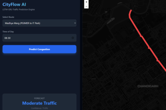
A Spatio-Temporal deep learning engine that forecasts urban traffic bottlenecks without relying on expensive live APIs
COMPETING CLAIMS. ONE VERDICT.
Automates drone-footage review for high-voltage transmission lines. Detects damaged insulators and vegetation encroachment, ranks by NERC severity, and exports work-order-ready CSV and GeoJSON.