Inspiration
Atlanta has committed to cutting greenhouse-gas emissions 59% by 2030. But buildings are the city's single largest source of those emissions, and most of the building stock predates modern energy codes. The data to target retrofit and resilience spending already exists. The tool to make that decision defensible to a city council did not. We kept hitting the same wall: a model returns a score, nobody can explain it. A score you cannot explain is a score you cannot fund.
What it does
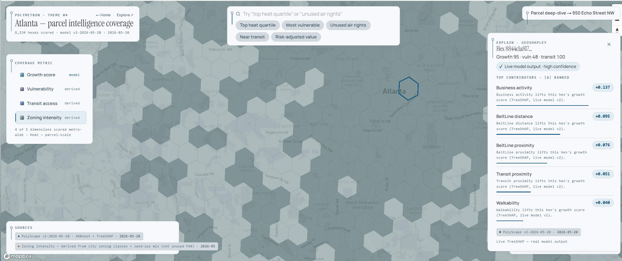
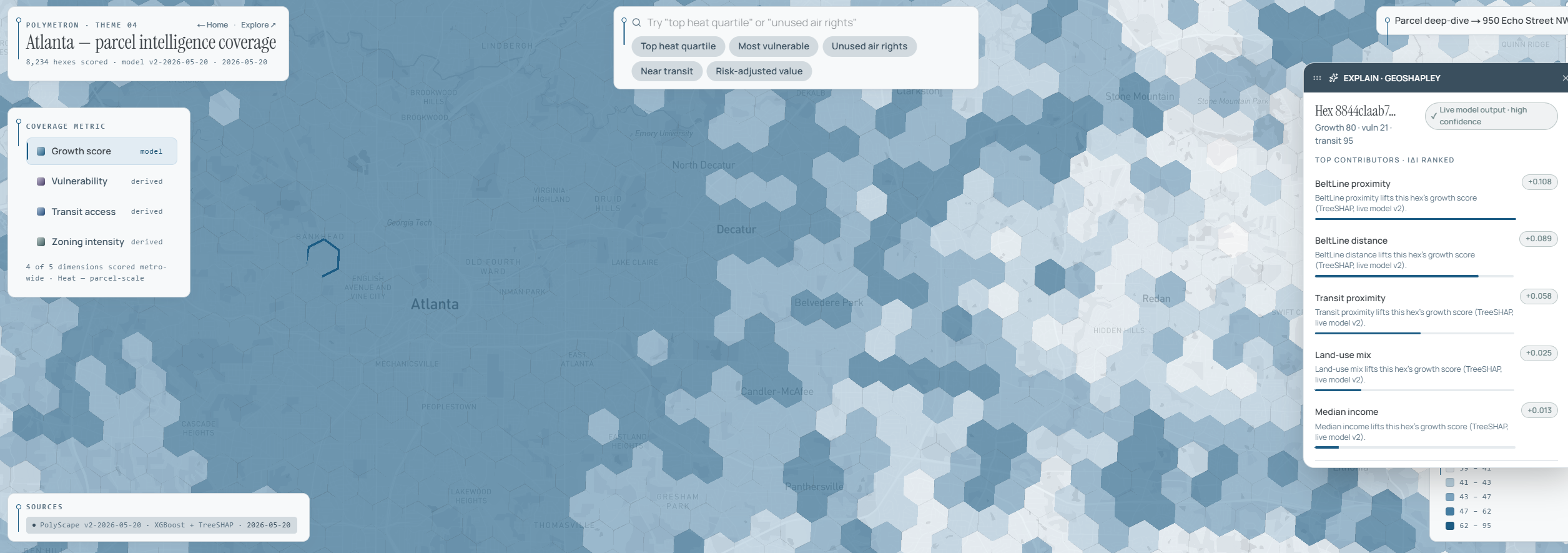
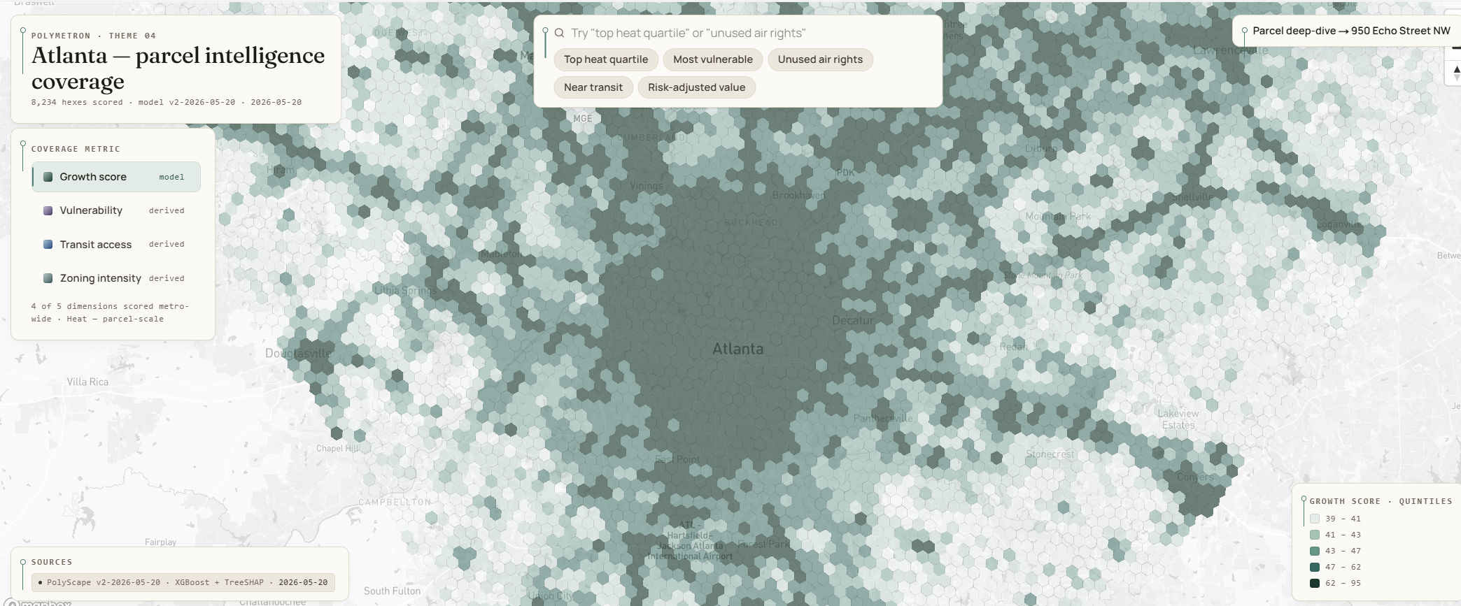
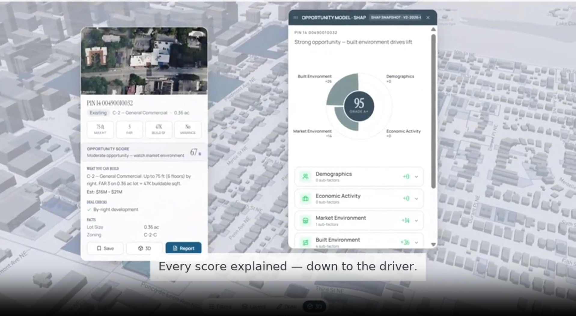
Polymetron scores metro Atlanta on development opportunity and climate exposure using a gradient-boosted model, then decomposes every score with Spatially-Aware ML algorithm so each prediction carries the exact contribution of every factor: built environment, market, demographics, and economic activity and so on. Click a location and you see not just the rank but the reason. For example, Parcel PIN in Tech Square scores 95 (Grade A+), driven by built environment (+26) with market a secondary factor (+14). A planner sees the drivers, each traced to its source.
What we built this weekend
Polymetron is our existing platform. Over the hackathon we turned it into a climate-decision tool for Atlanta's resilience goals by adding three things:
- Weatherize First: a ranked view that orders buildings by retrofit priority, built only from data we already had: building age, an ACS energy-burden index, current use, and lot size. It pushes pre-1980 occupied buildings to the top and vacant development sites to the bottom.
- Live energy counter: a heads-up readout that tallies, in real time, how many AI operations ran locally versus in the cloud and estimates the cloud energy avoided.
- Reproducible explainability: the wiring that makes the GeoShapley breakdown land on a real Atlanta parcel live during the demo.
How we built it
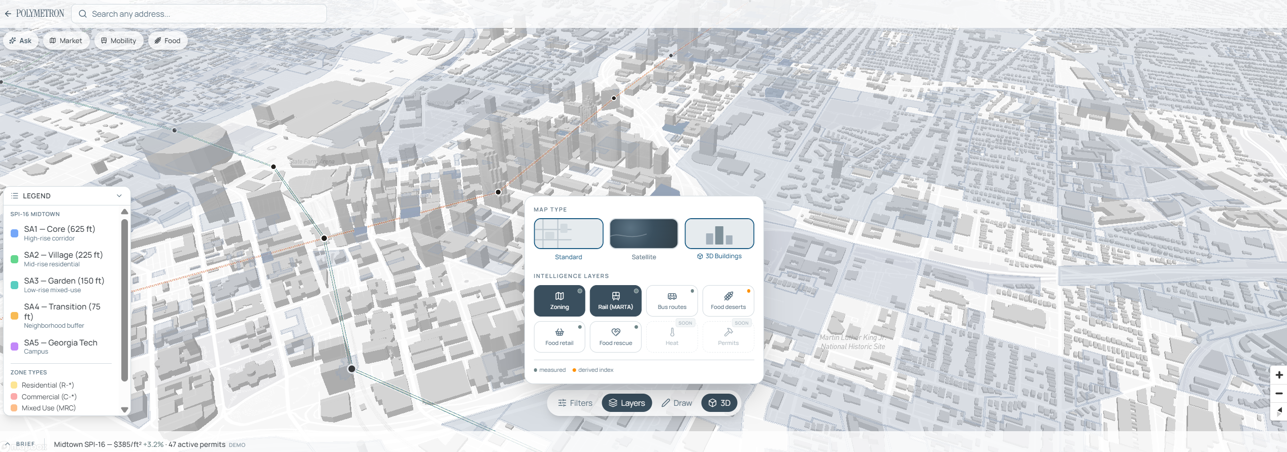
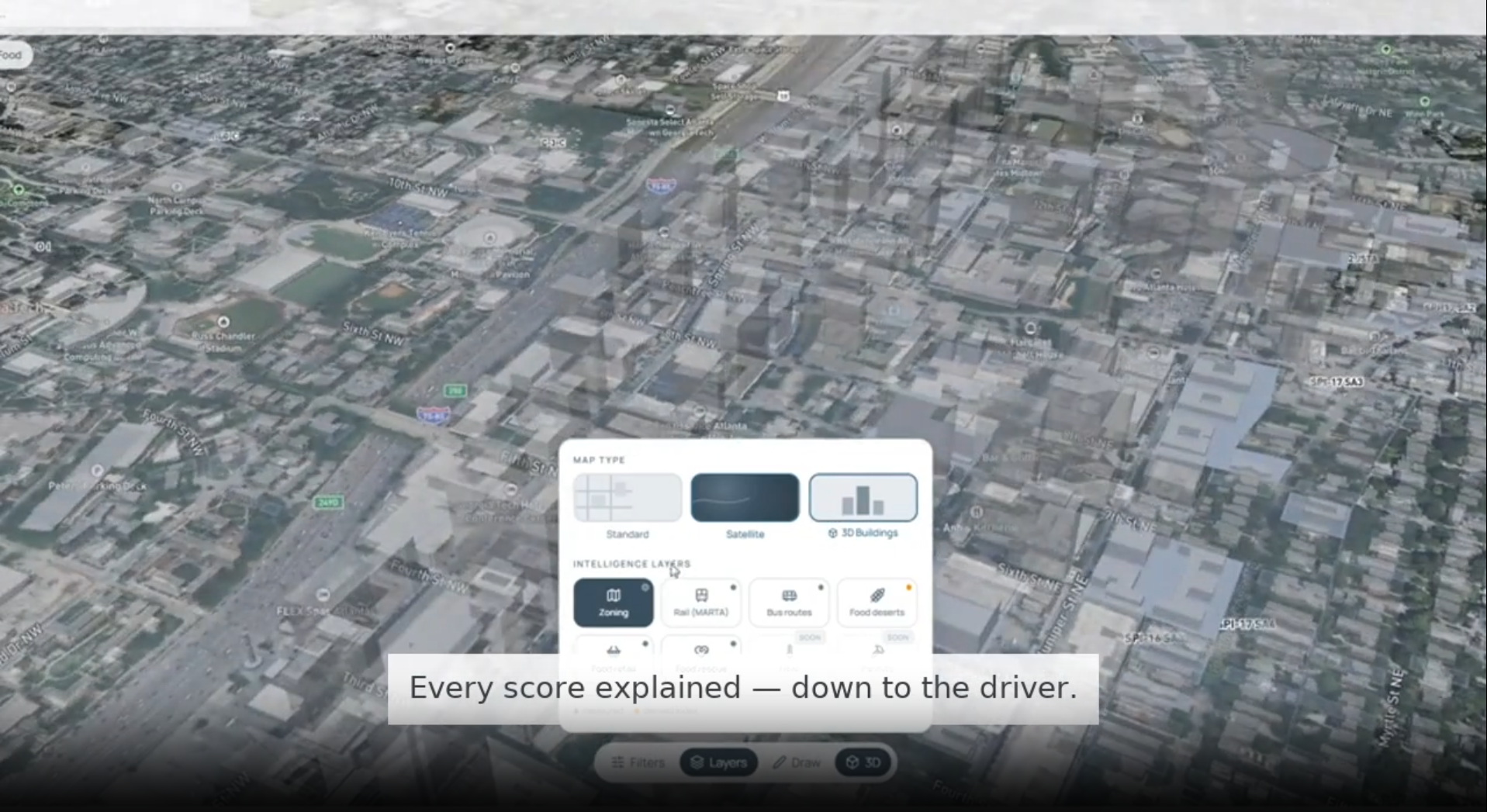
Next.js 16 (App Router) with React and TypeScript, deck.gl and Mapbox GL for the 3D map, Tailwind for the interface. The scoring model is gradient-boosted trees (XGBoost) trained on Atlanta open data, including 34,729 building permits and 21,443 business openings. It validates at R² 0.64 with 68% top-decile precision, spatially cross-validated. SHAP attributions are precomputed for 8,234 H3 hexes covering metro Atlanta and served from a static export, so the live demo needs no running backend. The "Ask Polymetron" assistant uses Open AI's GPT model for cited zoning Q&A, with a local keyless fallback.
Sustainability impact
Two levers. First, targeting: directing retrofit spend to the right buildings is one of the fastest paths toward Atlanta's 59%-by-2030 goal, and an explainable score is one a city can actually approve. Second, footprint: a cloud AI query draws roughly 0.3 to 19 watt-hours in a grid that is about half fossil-powered, while local inference draws about 0.0007 watt-hours. Polymetron runs its high-volume scoring locally, so most of that energy is never spent. A sustainability tool should not burn data-center energy to tell you how to save it.
Challenges we ran into
The hardest part was discipline. It would have been easy to demo a heat map or a vulnerability layer we had not actually validated. We kept the live claims to what genuinely ships today (parcel scoring, explainability, local inference) and narrated heat and occupant-vulnerability layers as roadmap, not as shipped. We also kept every energy figure as a sourced range rather than a single impressive number.
What we learned
These programs rarely die in the modeling. They die in the justification. The decision that gets funded is the one a planner can defend line by line, which is why we put the explanation, not the score, at the center of the product.
What's next
Edge AI for the built environment: the same spatial engine on a phone, a building sensor, or an inspection drone, working offline. Heat and occupant-vulnerability layers join the index to find the households where energy waste, heat exposure, and vulnerability overlap.
Built by
Sam Duong ( UA 2026') and Cassie Duong (IE 2026') , building on the methodology behind a national-scale urban digital twin.
Built With
- deck.gl
- esri
- framer-motion
- geojson
- geoshapley
- gpt-4o
- h3
- mapbox-gl
- next.js
- openai
- python
- react
- react-map-gl
- shap
- tailwind-css
- typescript
- vercel
- vitest
- xgboost

Log in or sign up for Devpost to join the conversation.