Devpost
Participate in our public hackathons
Devpost for Teams
Access your company's private hackathons
Grow your developer ecosystem and promote your platform
Drive innovation, collaboration, and retention within your organization
By use case
Blog
Insights into hackathon planning and participation
Customer stories
Inspiration from peers and other industry leaders
Planning guides
Best practices for planning online and in-person hackathons
Webinars & events
Upcoming events and on-demand recordings
Help desk
Common questions and support documentation
Sort by:
An extension that helps chat, access offline maps, connect people when low/no cellular network or internet nearby in case of emergency
A inexpensive way to study
A web app for Wesleyan students enabling carpooling for more eco/cost-friendly Lyft/Uber rides
From Data to Decisions: Weather Simplified.
A website where you can find events happening around campus, from study sessions to exercise to partying or you can add your own event! Feel more connected with campus and find new friends!
An interactive map tool that allows users to view accessibility ratings on places, along with add their own reviews.
BillBoard empowers Canadians with real-time policy updates, a community forum for discussions, and a map to find representatives. Stay informed, engage with your community, and make your voice heard!
From Symptom to Solution: Accurate Diagnosis, Possible Causes, and Tailored Remedies Your personal AI Doctor
A map that can be toggled between all stations in NYC and accessible stations only.
Uni-Guesser is a fun game for UC students to explore campus! Guess locations from images around UC, earn points for accuracy, and discover hidden spots while connecting with fellow students!
Built for Everyone, Guided by You
An green technology application that gathers live data regarding fires and uses multi-stage data processing, A* (dijkstra's) algorithm, and LLMs to return the best route in an evacuation scenario.
Street Bites is a platform where customers can find food trucks based on preferences and locations, making it easy to navigate and locate food trucks in an urban area.
Our innovative map allows users to travel around New York City while showing them scenic sites along the way.
Connecting neighbors to share skills, learn new ones, and build a stronger community!
GreenView is an easy tool that identifies and displays greenery in a city and maps it out, making it easier for cities to prioritize adding green spaces where they are most needed.
Campus Parking Finder simplifies campus parking with real-time occupancy, smart lot suggestions, walking routes, and Google Maps integration—saving time and reducing stress for everyone.
Our web application aims to help reduce unnecessary driving looking for parking on campus. It also can find disability and charging spots on campus. It can predict future parking availability.
BINyc is a community-driven platform designed to tackle NYC’s litter problem by empowering pedestrians and locals to report trash hotspots in real time.
ChasQuiTuri brinda al usuario un recorrido turístico único dependiendo de las ubicaciones que quiera visitar, que zona quiere visitar y el presupuesto que tenga.
GeoStory: All the info about the world's nations at your fingertips, from population to world heritage sites!
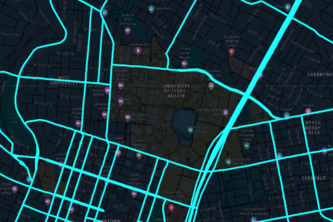
This is an interactive map of the traffic around UT Austin
Discover a future where steampunk aesthetics meet air quality monitoring. Explore real-time and historical data to understand the evolution of our environment and breathe easier.
AcciGuard is an interactive map application designed to enhance road safety by alerting users when they are near accident hotspots.