Devpost
Participate in our public hackathons
Devpost for Teams
Access your company's private hackathons
Grow your developer ecosystem and promote your platform
Drive innovation, collaboration, and retention within your organization
By use case
Blog
Insights into hackathon planning and participation
Customer stories
Inspiration from peers and other industry leaders
Planning guides
Best practices for planning online and in-person hackathons
Webinars & events
Upcoming events and on-demand recordings
Help desk
Common questions and support documentation
Sort by:
Test your knowledge of countries and regions using Open Street Maps.
An app for travelers and foodies to find their desired eateries in just a few clicks!
Do you struggle to plan your interrailing holidays? This website could help you to explore different cities by suggesting routes and providing train timetables for those routes.
Encore gives tech a second life by refurbishing and donating devices to those in need. We reduce waste and bridge the digital divide empowering communities with access to education, jobs, and growth
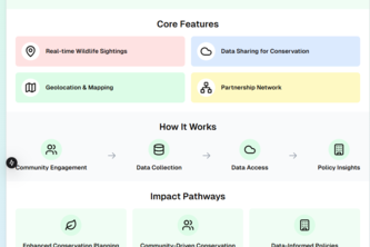
WildSpotter is a biodiversity conservation tool that maps real-time wildlife sightings to support data-driven conservation efforts. Built with Next.js, TypeScript, and Leaflet
Learn about UNC study abroad opportunities with an easy-to-use map and intuitive interface!
Urban Refuge users can quickly locate nearby services—shelters, clinics, and more, with our new GIS tool. Integrated into the existing site, our map makes finding vital resources easier than ever.
Disasters force people to evacuate to stressful shelters, impacting mental health. OpenBnB offers evacuees a better option, connecting them with hosts who provide welcoming, supportive homes.
Local Pioneer is a web app connecting people with volunteer opportunities and promoting community service, relationships, and empowerment through personalized event matching and interactive maps.
An interactive platform for astronauts to combat isolation in space, share task photos on a communal feed, and track the ISS location to connect with Earth, fostering connection and support.
axwrld connects cultures through authentic recipes. Discover, share, and personalize dishes from around the world with our AI Chef, preserving flavors and stories for every taste and tradition.
How confident are you in your ability to recognize where you are on UNC's campus? In this celebration of UNC's lovely campus, your knowledge is put to the test in a Geoguessr-esque map guessing game.
This tool enables users to report and visualize hurricane impacts in real time, helping citizens and governments quickly identify and address critical issues for effective relief efforts.
Our neighbor volunteer website connects communities by enabling users to request or offer help. A smart chatbot infers local needs and coordinates resources for effective support
A digital platform to assist communities struggling with resources and evacuation planning.
Find smarter, safer, and faster bike routes
Roadie Rescue is website designed to assist travelers with roadside issues. When facing challenges, users can share their location and problems through it, allowing people to provide quick help.
The Journal tells the poignant story of an Alzheimer's patient on a journey to retrace the path to his friend's house using a journal he once wrote.
The newest and latest campus dorm review platform for Purdue University, Boiler Dorms provides a sleek interface and several quality features to consume and post reviews to your heart's content.
An interactive map tool purposed for displaying the degradation of each of NJ TRANSIT’s railways.
Snake on a real life map for some real fun. Explore stations and transport customers in a rather calming game of snake.
Connecting shelters with nearby inventories for fast, efficient government and volunteer-led disaster aid. Real-time updates ensure supplies reach those in need when it matters most.
helping save lives
Connecting you to vital relief resources in times of need, wherever you are in Canada.