Devpost
Participate in our public hackathons
Devpost for Teams
Access your company's private hackathons
Grow your developer ecosystem and promote your platform
Drive innovation, collaboration, and retention within your organization
By use case
Blog
Insights into hackathon planning and participation
Customer stories
Inspiration from peers and other industry leaders
Planning guides
Best practices for planning online and in-person hackathons
Webinars & events
Upcoming events and on-demand recordings
Help desk
Common questions and support documentation
Sort by:
Live disaster map with real-time updates, nearby safe zones & hospitals, WhatsApp alerts for instant safety info, powered by Oracle APEX for secure disaster data management.
SafeRoute uses traffic and accident data to provide directions focused on safety over speed.
BlazeMap harnesses real-time weather and terrain data to predict wildfire pathways and momentums, empowering communities to act swiftly and save lives
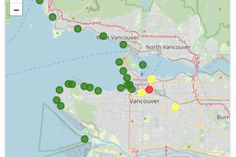
🌊 Vancouver Beaches E. coli Tracker is a web app that displays latest E. coli levels at local beaches through a color-coded table and interactive map to ensure safe swimming
Mapping the World Above
Query the forest! Analysis and visualization of animal population data, and prediction of species which are at risk of endangerment using AI model.
Providing easy access to affordable, sustainable, and nutritious food in food deprived areas.
"throw-a-pin emulates the oldest form of spontaneous adventure: throwing a pin at a spinning globe. Find new locations, uncover hidden gems, and share the path less traveled with the world."
Fridge gamifies the experience of supporting local restaurants! Add rare collectibles to your "fridge" and show off to friends!
TrackNTrip uses AI to optimize your road trips, finding the best gas stations for your budget and the environment. Discover nearby landmarks and compete with friends to lower your carbon footprint.
Allows communities to request and give assistance in times of need
Automatically recommend the nearest available parking spots to the user based on their current location, considering their time and budget.
Check ARRIVA line buses in West Yorkshire, you should be able to view if the Route between bus stops is late compared to timetable, averaged out for the day. Data provided by Tom @DataCity.
"MapFit is an enhanced version of Mapty, letting you log and delete workouts on an interactive map. Track your runs and rides effortlessly with auto-calculations and local storage. Stay fit smarter!"
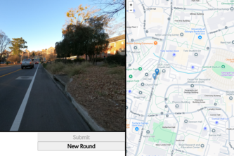
You know the game Geoguessr? Well, this is that but in a local area. It is UGeoguessor. Use your knowledge of the UGA campus to pick out the points from pictures. I am Bret Jones and I made this alone
Parking in Montreal often requires high reading comprehension skills, luck and the alignment of several astral bodies. With this website, we simplify parking by showing which spots are available!
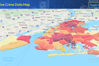
SAFE-NY empowers women and New York residents with essential safety tools that provide crime data insights as well as a panic button that captures critical information for rapid emergency response.
Because connections are better when you’re out 🏳️🌈🏙️
Combining NASA wildfire detection and FlightAware path data to catch remote wildfires before they grow out of control
A multiplayer geography game that tests your reaction time and how well you know the names of streets in your city--choose from four characters with different abilities and start guessing!
Real-time wildfire tracking, for civilians and authorities.
AidAtlas connects users to nearby shelters and disaster relief volunteering and job listings using geolocation, providing critical support and opportunities to aid communities in times of need.
Your SoCal neighborhood guide – for travelers, new home seekers, and more. Get comprehensive data insights into the best areas in the LA/OC area.
A virtual portal to the past