-
-
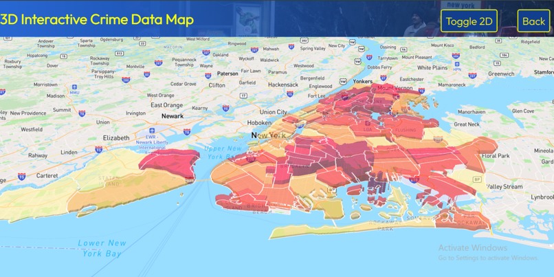
3D Interactive Choropleth
-
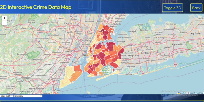
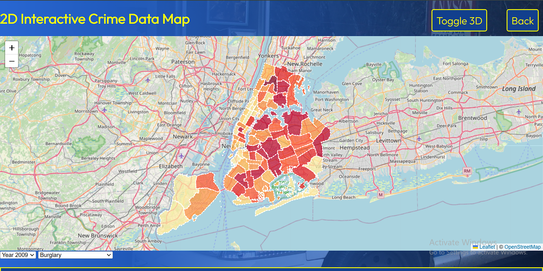
2D Interactive Choropleth
-
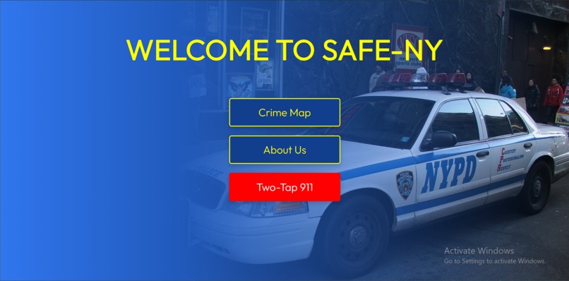
Main Page
-
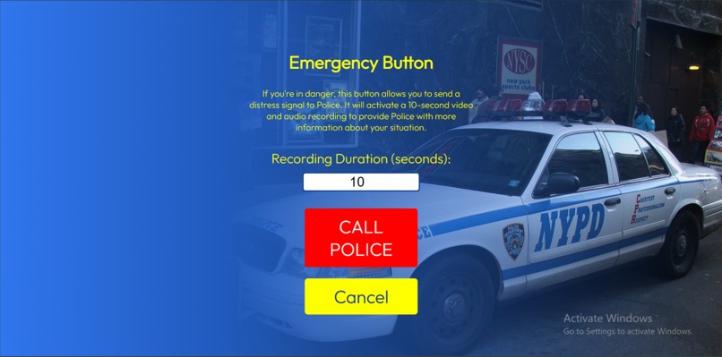
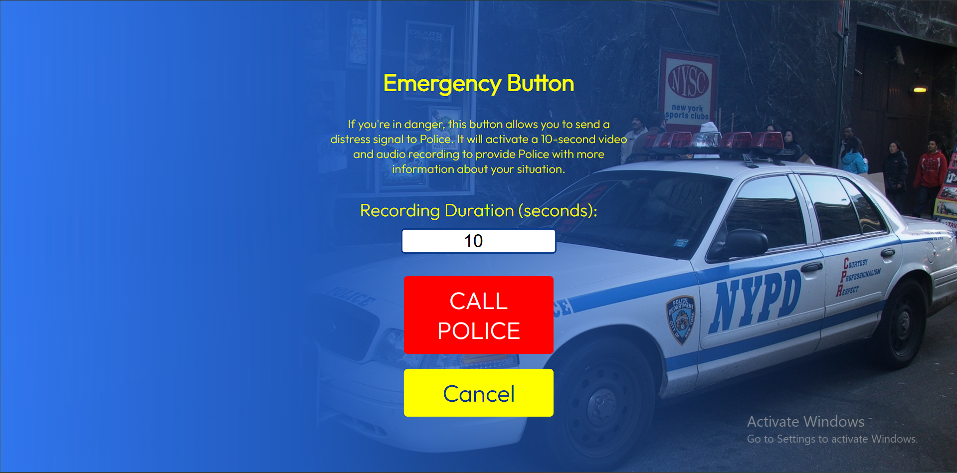
Panic Button
-

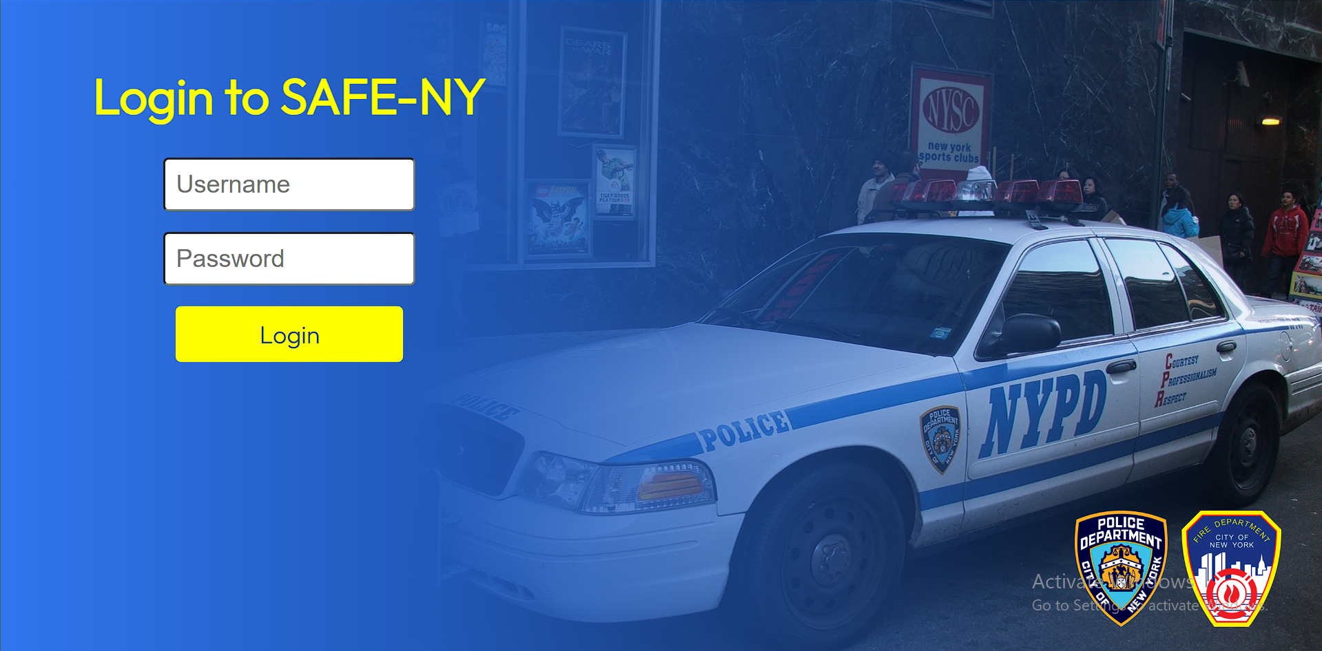
Login
-
ReGex Chat System

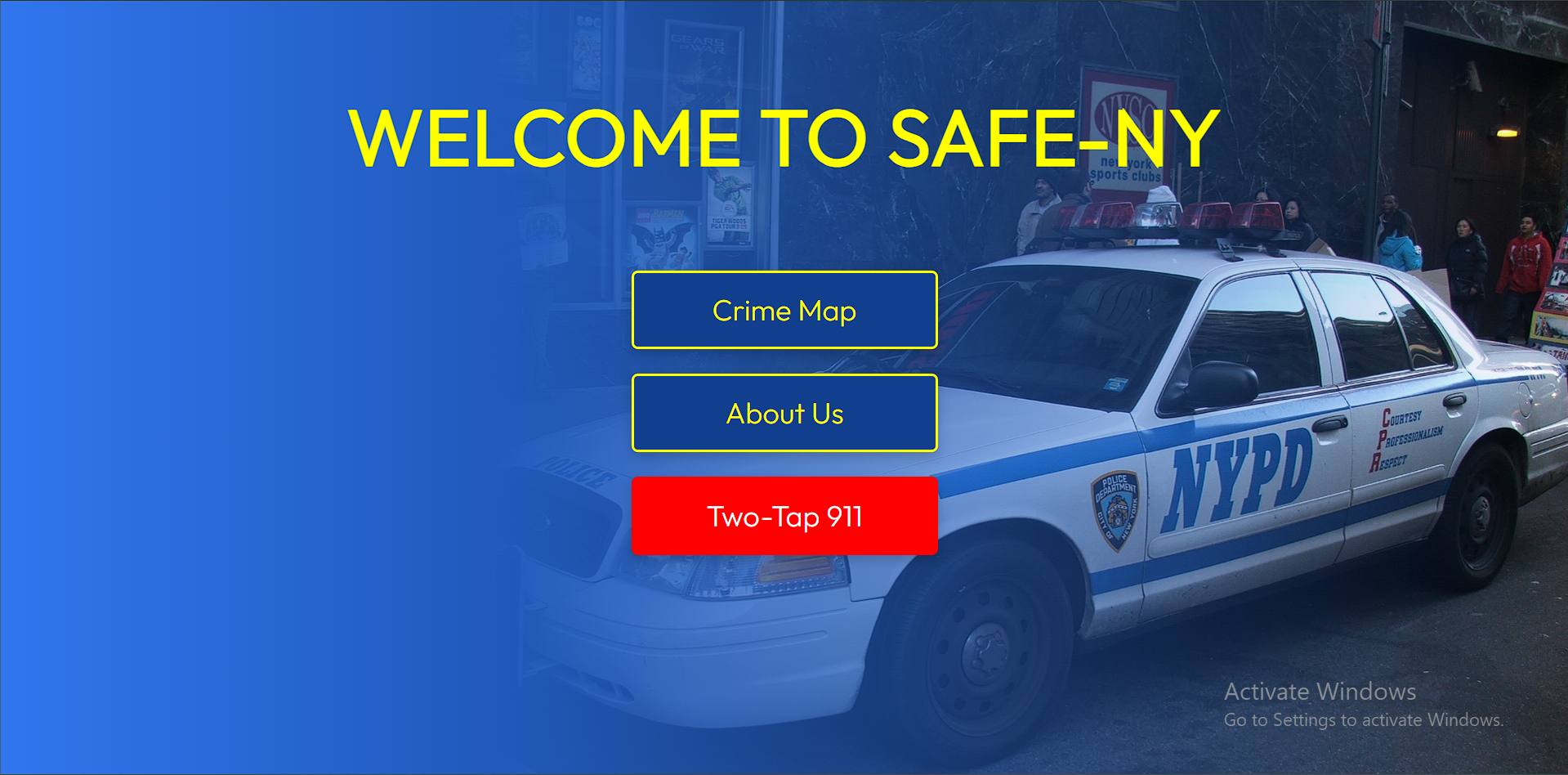
SAFE-NY
Inspiration
SAFE-NY was inspired by the growing need for accessible safety solutions for New York residents and especially women. We wanted to create a tool that empowers users with real-time crime insights and provides a reliable emergency communication feature to enhance personal security and community awareness.
What It Does
SAFE-NY is a comprehensive safety application designed to keep users informed and secure. Key features include:
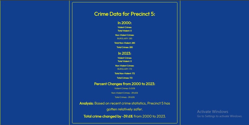
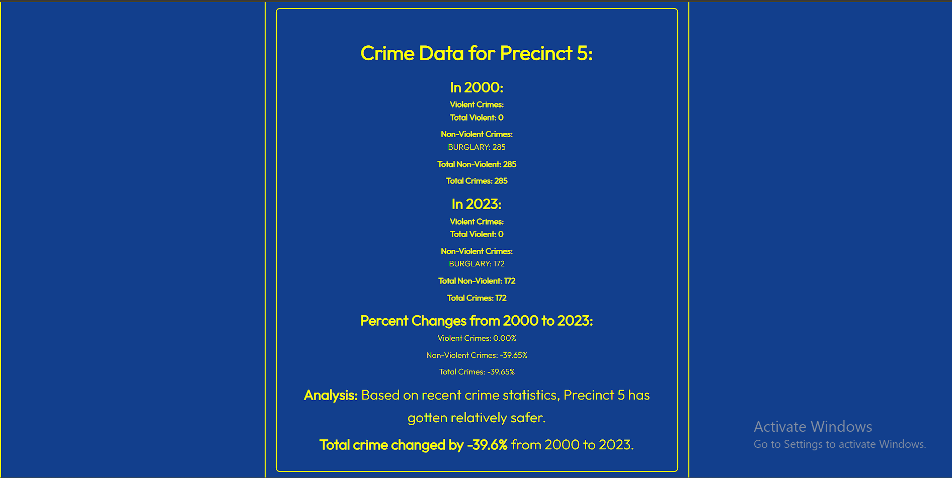
- Crime Insights: Interactive choropleth and 3D maps as well as detailed data on precinct/district safety trends.
- Panic Button: Instantly captures audio, video, and location data, generating AI-powered transcripts for emergency response before sending the information to law enforcement.
- Regex Chat System: Provides specific, intelligent responses to safety-related queries with 100% accuracy and minimal words required.
By combining powerful data insights with real-time emergency tools, SAFE-NY helps users navigate their environment confidently.
How We Built It
We developed SAFE-NY using:
- Frontend: Utilized Mapbox and leaflet.js for 2D and 3D choropleth maps.
- Backend: Used email.message and smtplib to send an email of video, transcript, and location. Implemented Flask to connect the backend and frontend seamlessly.
- Data Collection: Used QGIS software to split a crime data CSV file into multiple files and joined with a New York City GeoJSON shapefile to create a JSON file that contains all the crimes along with the precincts they occurred at.
- Emergency Capture: Integration with device sensors through cv2, pyaudio, moviepy, and wave to get instant video and audio recording for real-time multimedia capture. Harnessed ipstack to acquire latitude, longitude, city, and zip code.
- AI Transcription: Leveraged the Google Web Speech NLP model to transcribe the video to text for quick response.
Our team collaborated to ensure a user-friendly design, accurate data processing, and secure communication features.
Challenges We Ran Into
During development, we encountered several challenges:
- Data Preprocessing: Preprocessing the CSV data file to integrate it by precinct, crime, and year.
- Data Integration: Implementing the chat system to accurately and robustly reflect data from the dataset.
- Emergency Capture: Developing a rapid system for capturing and securely transmitting multimedia data during emergencies.
- Interactive Maps: Creating intuitive and responsive data visualizations for a better user experience.
Accomplishments That We're Proud Of:
- Successfully building an application that provides meaningful crime insights and empowers user safety.
- Developing a functional and reliable panic button feature for rapid emergency response.
- Designing an intuitive user interface that simplifies access to complex data.
What We Learned
Through this project, we gained valuable experience in:
- Effective data visualization and geospatial mapping techniques.
- Building secure and reliable real-time emergency capture systems.
- The importance of user feedback and usability in safety-critical applications.
What's Next for SAFE-NY
Moving forward, we plan to:
- Expand Data Sources: Incorporate additional datasets for broader crime insights in other cities.
- Enhanced AI Features: Improve transcript generation and add predictive crime pattern analysis.
- Authority Collaboration: Collaborate with authorities around the country to expand the service and ensure the safety of citizens.
- Community Engagement: Develop features for community reporting and awareness.
- User Feedback: Continuously refine the platform based on user input to ensure it meets safety needs effectively.
Built With
- css
- cv2
- flask
- google-web-speech-api
- html
- ipstack
- javascript
- leaflet.js
- mapbox
- moviepy
- pandas
- pyaudio
- python
- qgis
- regex
- smtplib
- threading
- wave


Log in or sign up for Devpost to join the conversation.