Inspiration
Traffic accidents claim over 40,000 lives annually in the United States. While most navigation apps focus solely on finding the fastest route, we recognize the need for a navigation system that prioritizes safety for both new drivers learning to navigate unfamiliar roads and experienced commuters who may be unaware of the hazardous zones they regularly commute through.
What it does
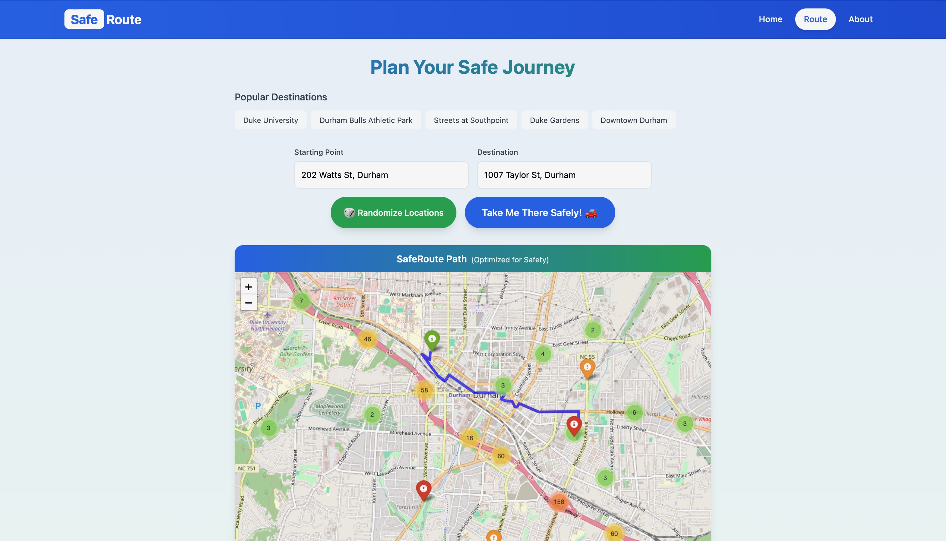
SafeRoute transforms traditional navigation by analyzing comprehensive accident data to generate safer driving routes. Our system identifies high-risk areas and automatically calculates alternative paths that reduce exposure to historically dangerous locations, all while maintaining reasonable travel times.
How we built it
Our technology stack combines Open Source Routing Machine (OSRM) and Leaflet for routing and visualization. We integrate extensive data from multiple authoritative sources, including the US and State Departments of Transportation, Law Enforcement Agencies, Traffic Cameras and Sensors, and Road Network Monitoring Systems.
Challenges we ran into
Our biggest challenge was initially over-engineering the solution. We spent considerable time developing a custom OSRM API before discovering we could just modify the output from the existing API.
Accomplishments that we're proud of
We successfully created a functional system that actively identifies and routes users away from high-risk areas. In other words, it works!
What we learned
We learned routing software implementation and how to effectively combine multiple data sources to create a more comprehensive safety analysis system.
What's next for SafeRoute
Our vision extends beyond our current application. While major navigation platforms like Google Maps and Apple Maps offer basic features such as highway avoidance, they've yet to implement comprehensive safety-based routing. We want to inspire these industry leaders to incorporate similar safety features into their platforms.


Log in or sign up for Devpost to join the conversation.