Devpost
Participate in our public hackathons
Devpost for Teams
Access your company's private hackathons
Grow your developer ecosystem and promote your platform
Drive innovation, collaboration, and retention within your organization
By use case
Blog
Insights into hackathon planning and participation
Customer stories
Inspiration from peers and other industry leaders
Planning guides
Best practices for planning online and in-person hackathons
Webinars & events
Upcoming events and on-demand recordings
Help desk
Common questions and support documentation
Sort by:
"Smart Vision for Smarter Harvests" FasalVision is an AI tool for accurate and scalable crop identification, enabling better yield prediction and food security.
Enhance your crops clearly from sky to soil
Bridging SAR and multispectral intelligence for accurate crop type mapping in India’s diverse farmlands
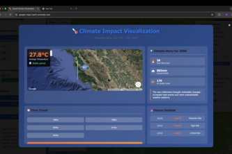
See 40 years of climate change in seconds. Our tool uses Google Earth Engine and AI to visualize the past and predict the future, turning abstract global data into your personal reality.
Forest Sentinel: Giving our forests a voice.
HazMap uses AI and Google Maps to predict wildfires before they strike alerting users, guiding evacuations and empowering actions to save lives, protect air and protect our Earth.
"Earth" is an AI-powered planetary intelligence platform that fuses satellite, ocean, and atmospheric data to predict environmental disasters and protect critical infrastructure in real-time.
Mapping Every Property: A GIS-Powered Platform Transforming Tax Collection in Nigeria
Our project turns Google Earth into a virtual drone experience. Whether you're planning your next drone flight, creating an immersive tour to showcase your Airbnb, or just exploring the world.
We combine multispectral satellite data both machine learning and AI to deliver instant insights on land health, crop suitability, and risk—directly in your browser, no installs needed.
Our AI-powered platform optimizes food distribution, reducing waste and ensuring that excess food efficiently reaches those facing hunger.
FreshBay uses AI to eliminate food waste and fight hunger by seamlessly connecting food banks, pantries, and underserved communities in real time.
Replay transforms raw GNSS data into interactive and easy visualizations. It moves beyond static reports to provide a seamless and interactive way to analyze geospatial data.
Making climate change data accessible to land managers and farmers. Includes an interactive map, different climate scenarios, and downloads to support informed decisions and sustainable practices.
Revolutionizing Solar Planning: Harnessing ray tracing, 3D reconstruction, and auto segmentation for calculating precise solar potential in partially shaded areas with advanced data-driven insights.
Empowering Precision Agriculture with Automated Cotton Field Detection Using Satellite Data and AI.
Discover Destinations, Reduce Emissions
A website that integrates data of location, quantity, quality and potential of Indonesia's water body that have been collected by researchers and citizen science
coastlens: Synthesizing sentinel satellite, hurricane, and webscraped news data through Gemini LLM to deliver precise coastal insurance risk metrics for property buyers.
AI-powered risk management suite safeguarding homes from natural disasters
"Experience the Wonders of the World, one click at a time"