-
-

Welcome to coastlens
-

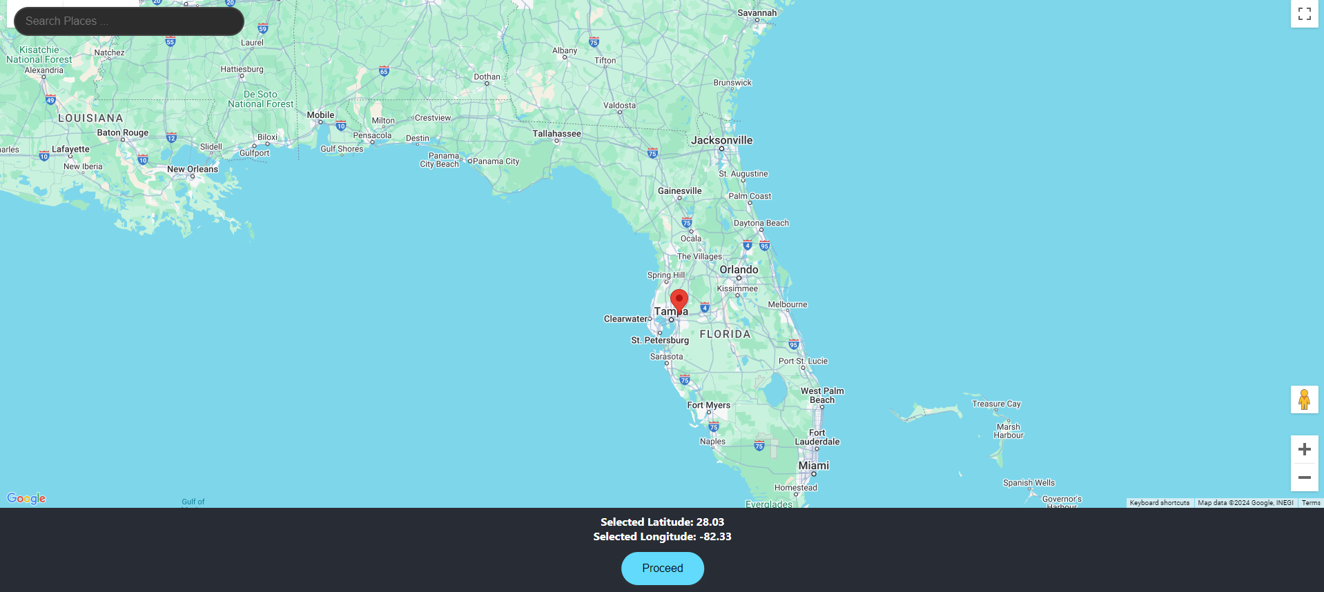
Marker Capability
-

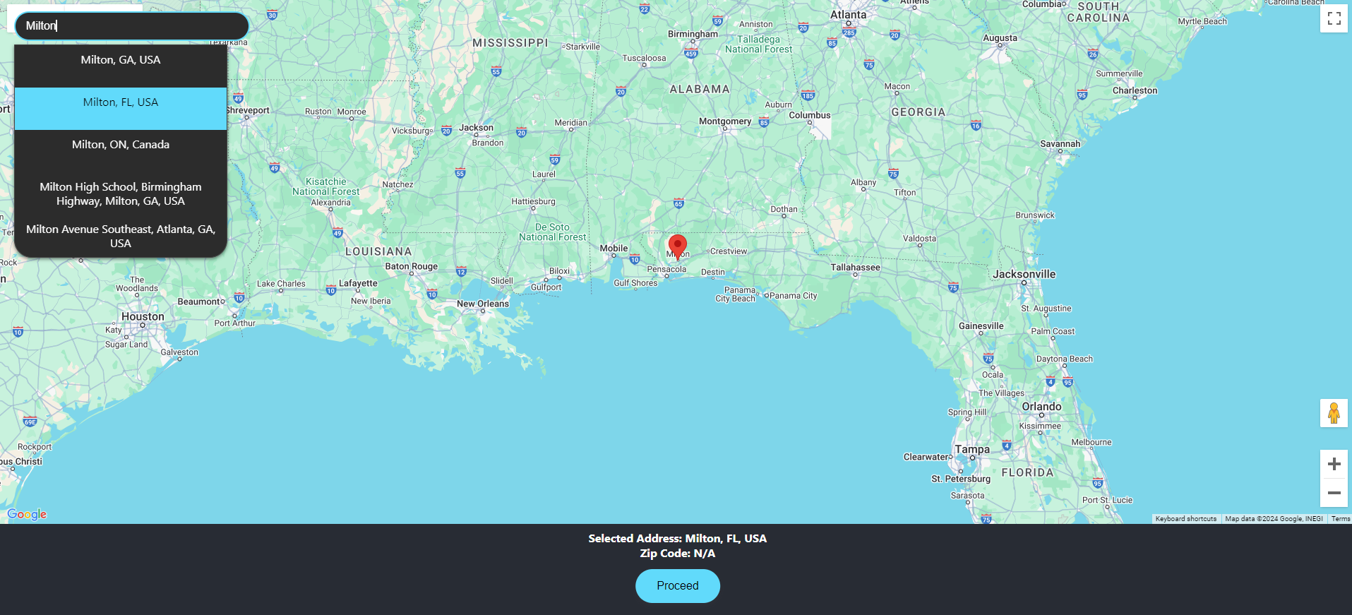
Enter in your desired Address
-
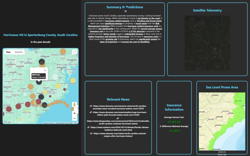
Full dashboard

Coastlens
Inspiration
In coastal regions where hurricanes pose significant threats, property insurance costs have become increasingly volatile and burdensome. Through analysis of insurance market trends and historical hurricane data, we identified a critical need for a more data-driven approach to risk assessment. Coastlens was born from the recognition that by combining real-time satellite data, historical hurricane patterns, and comprehensive insurance analytics, we could create a more accurate and dynamic risk assessment tool for both insurers and property owners.
What it does
Coastlens transforms multiple data streams into actionable insurance insights. Our platform scrapes thousands of news articles and reports using Firecrawl, processes Sentinel satellite data, and analyzes historical hurricane patterns. This data is vectorized using HuggingFace's model and stored in Pinecone, allowing Gemini to generate comprehensive risk assessments. Through ArcGIS and Google Maps integration, users can visualize risk patterns and insurance cost predictions in an intuitive interface.
How we built it
Our development leveraged a sophisticated tech stack combining React frontend with Google Maps integration and a Flask backend for API handling. The system integrates multiple data sources through an AI pipeline, utilizing Firecrawl for web scraping, Sentinel satellite data processing, and NOAA hurricane data analysis. At the core of our system, we implemented HuggingFace's multilingual-e5-large model for text processing, Pinecone for vector storage, and Gemini for comprehensive analysis, while using ArcGIS and Google Earth for sophisticated geospatial processing and visualization.
Challenges we ran into
Throughout development, we encountered significant challenges processing vast amounts of satellite data and maintaining efficient web scraping while ensuring data quality. The complexity of managing multiple large-scale datasets and optimizing vector embeddings for real-time analysis required innovative solutions. Initially, CORS errors complicated our API POST requests, leading us to pivot from FastAPI to Flask for smoother integration. These obstacles ultimately strengthened our technical implementation and team problem-solving capabilities.
Accomplishments that we're proud of
Our team successfully created a vector database encompassing over 2000 relevant insurance and climate documents. The development of an efficient pipeline for processing satellite telemetry data marks a significant technical achievement. Our hurricane path prediction models have achieved remarkable accuracy, while our web scraping system maintains high data integrity at scale. The implementation of our RAG system using HuggingFace's language model has proven highly effective, and our system handles real-time satellite data updates with impressive reliability.
What we learned
The project provided deep insights into satellite data processing, large-scale web scraping, and implementing RAG systems with vector databases. We mastered the integration of multiple data sources for comprehensive risk assessment. Above all, we learned fast-pace integration with a small team to deliver a polished product.
What's next for Coastlens
Future developments include expanding satellite data integration, enhancing scraping capabilities, and implementing more sophisticated hurricane modeling. We plan to create an API for insurance providers and expand our coverage to international markets.
Built With
- cloud
- esri
- firecrawl
- flask
- gemini
- google-earth
- google-maps
- huggingface
- llm
- pinecone
- react

Log in or sign up for Devpost to join the conversation.