Inspiration
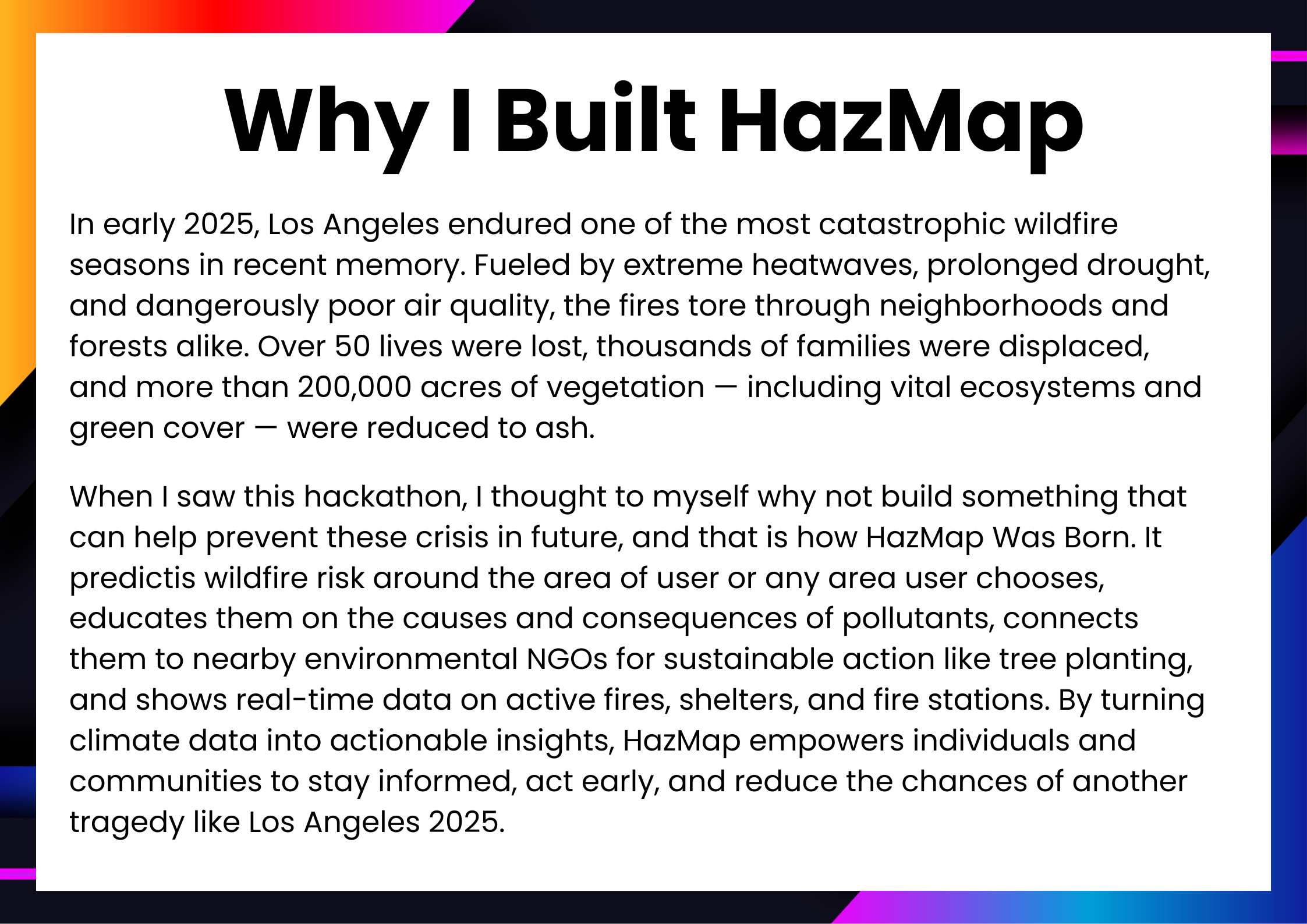
When the wildfires tore through Los Angeles in early 2025, they didn’t just burn trees, they stole lives, homes, memories. Over 200,000 acres vanished in flames. Families had to flee. Many didn’t make it let it be humans or animals. Whole ecosystems were turned to ashes. And what hit the hardest? Most people never saw it coming. There were no clear warnings. No personalized alerts. People lacked knowledge about what do to prevent these and what to do during these crisis. There was just chaos.
This hackathon made me realize something, we live in an age of AI and satellite data, we still couldn’t answer a basic question “Am I safe where I am right now?” That question became this app's mission.
HazMap was born to fill that silent, dangerous gap — to become the tool we didn’t know we so desperately needed. By turning environmental data into life-saving insights, HazMap helps people understand their surroundings, get early warnings, and take action — all from the phone in their pocket. It’s not just a wildfire predictor, It’s the kind of tool we all wish had existed sooner and one I hope no one has to live without again.
What it does
HazMap is highly scalable and built with global applicability in mind. It uses Google Maps Platform APIs that are available worldwide, meaning the app can be used in any region — from California to Australia to Southern Europe. The fire-risk prediction and evacuation guidance are dynamically adjusted to user location, making it useful for residents, emergency responders, and local authorities alike. With every new user, the system becomes useful due the community updates feature, making it future-proof and extensible.
So overall-
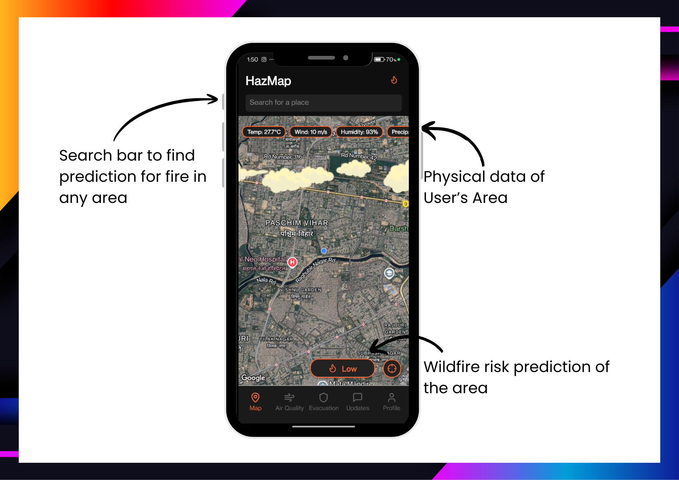
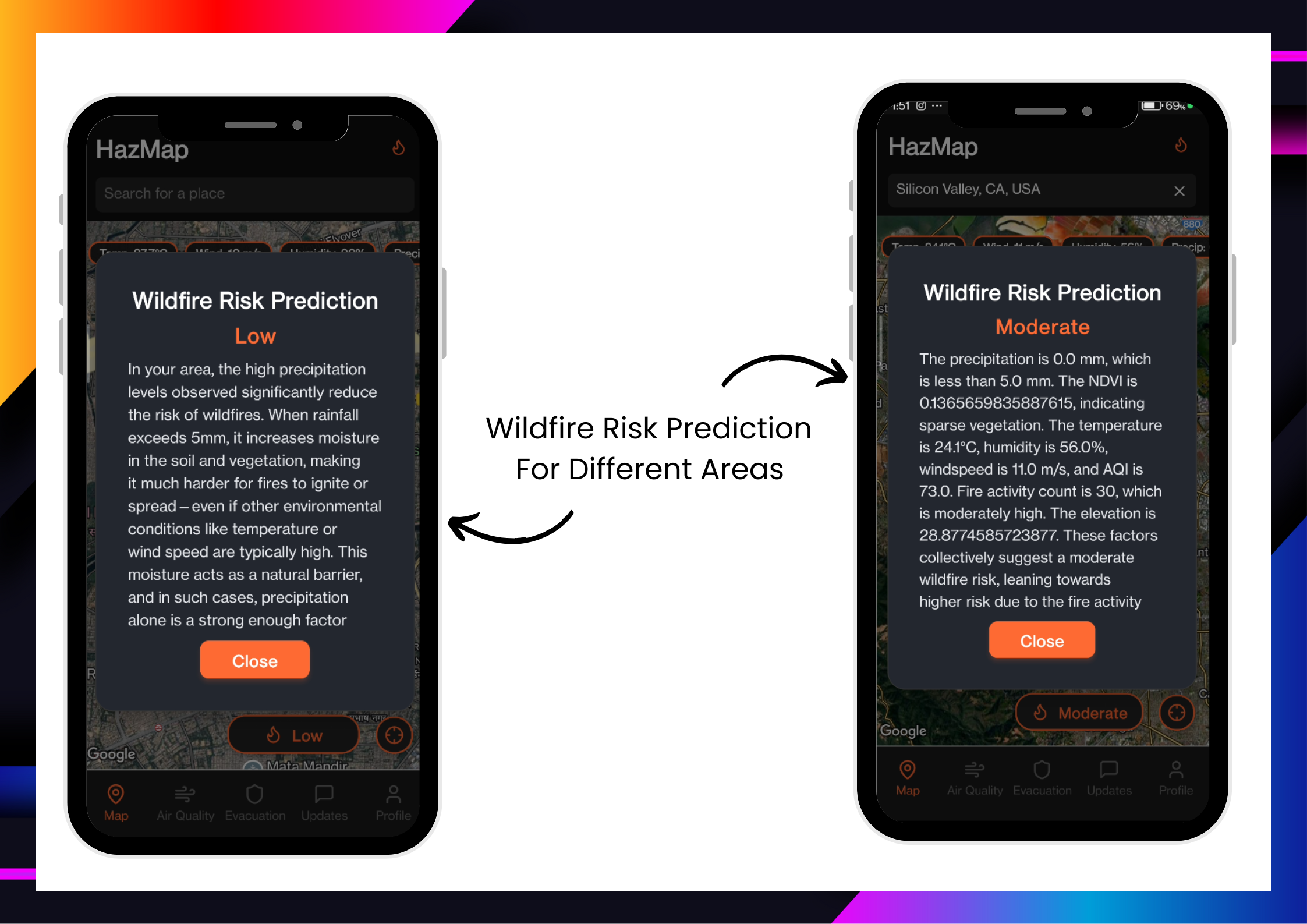
HazMap is an AI-powered wildfire risk and environmental awareness app that leverages the Google Maps Platform, Google Earth Engine, and Gemma AI to:
Predict wildfire risk based on real-time data like temperature, wind speed, humidity, vegetation cover, precipitation, elevation and AQI
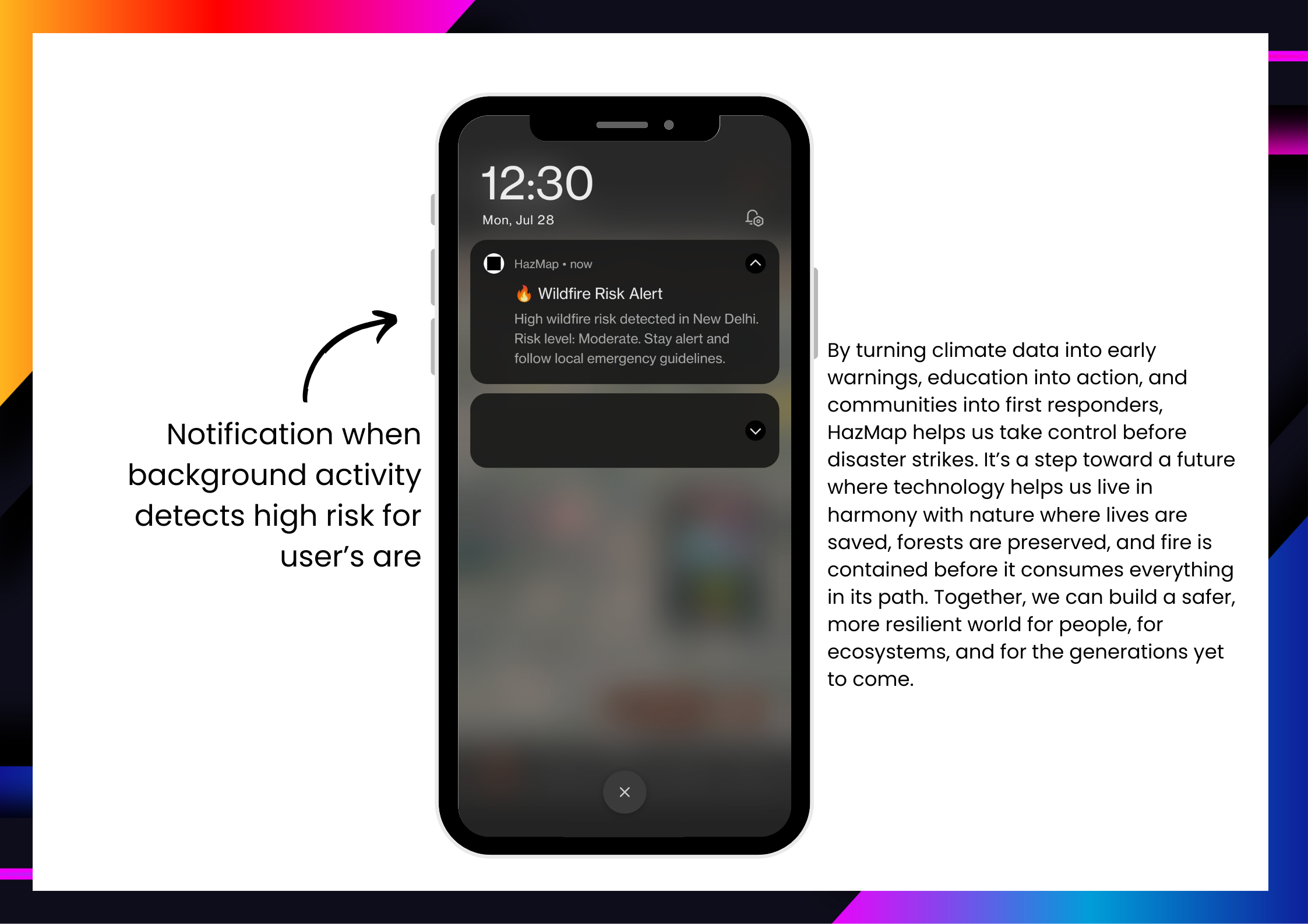
Deliver alerts and push notifications when risk is high
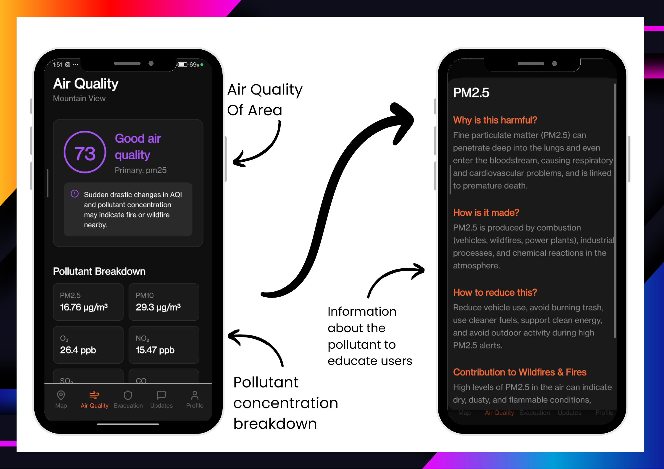
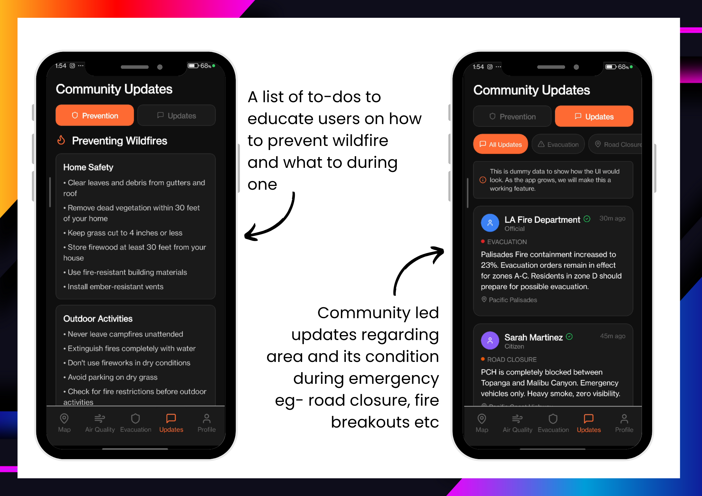
Educate users about pollutant health effects and how they contribute to wildfires, Dos And Donts during a wildfire breakout and how to prevent one from happening
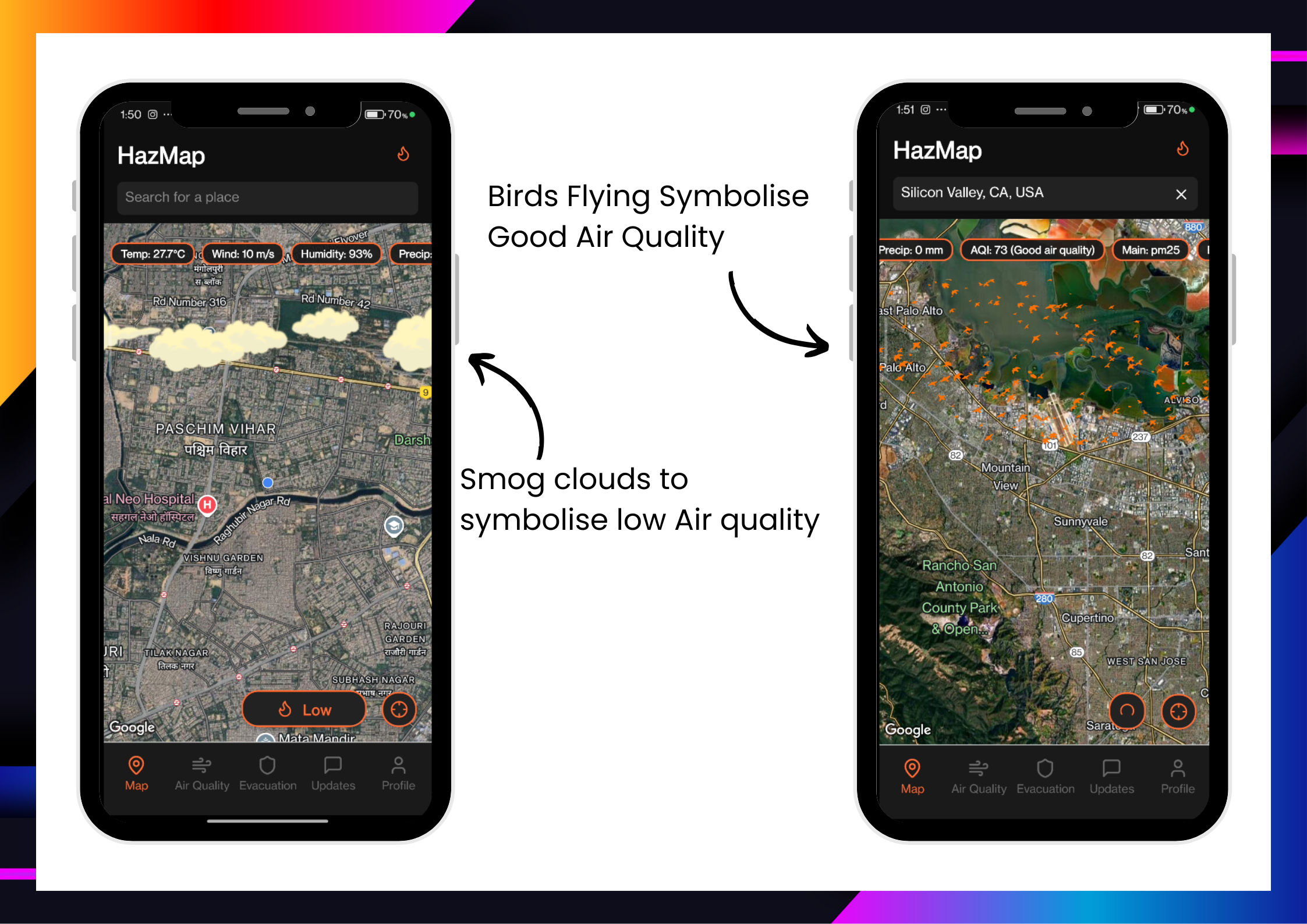
Display pollutant breakdowns and local air quality
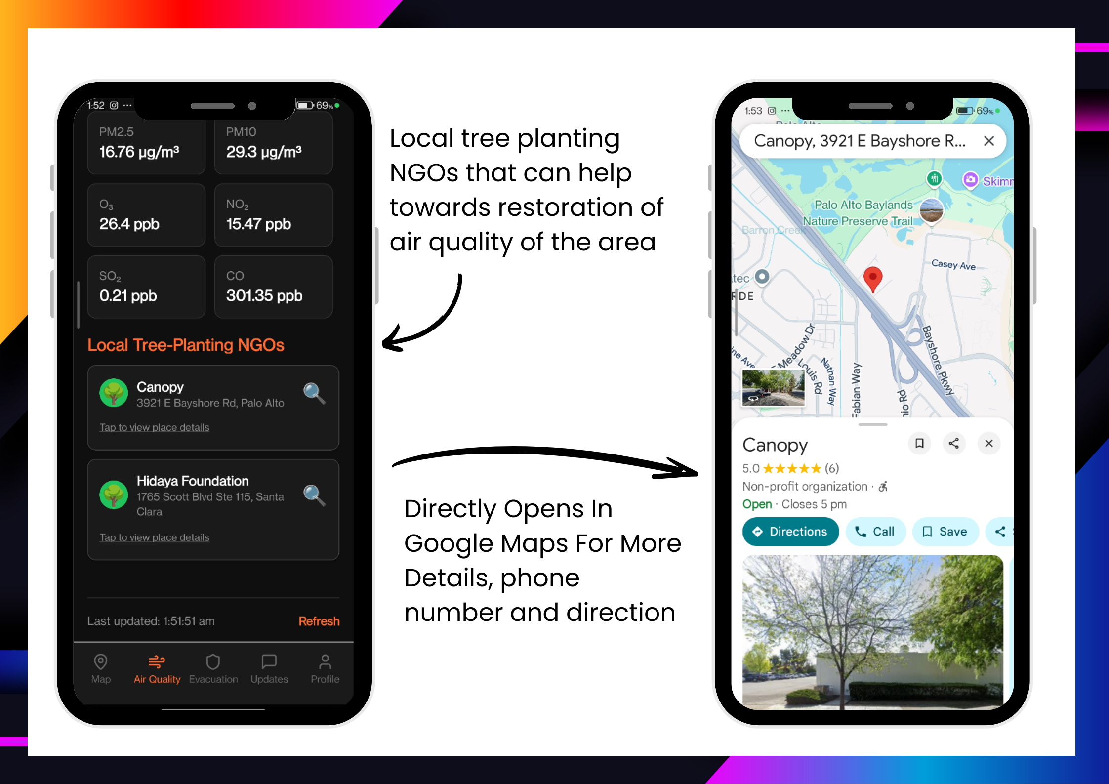
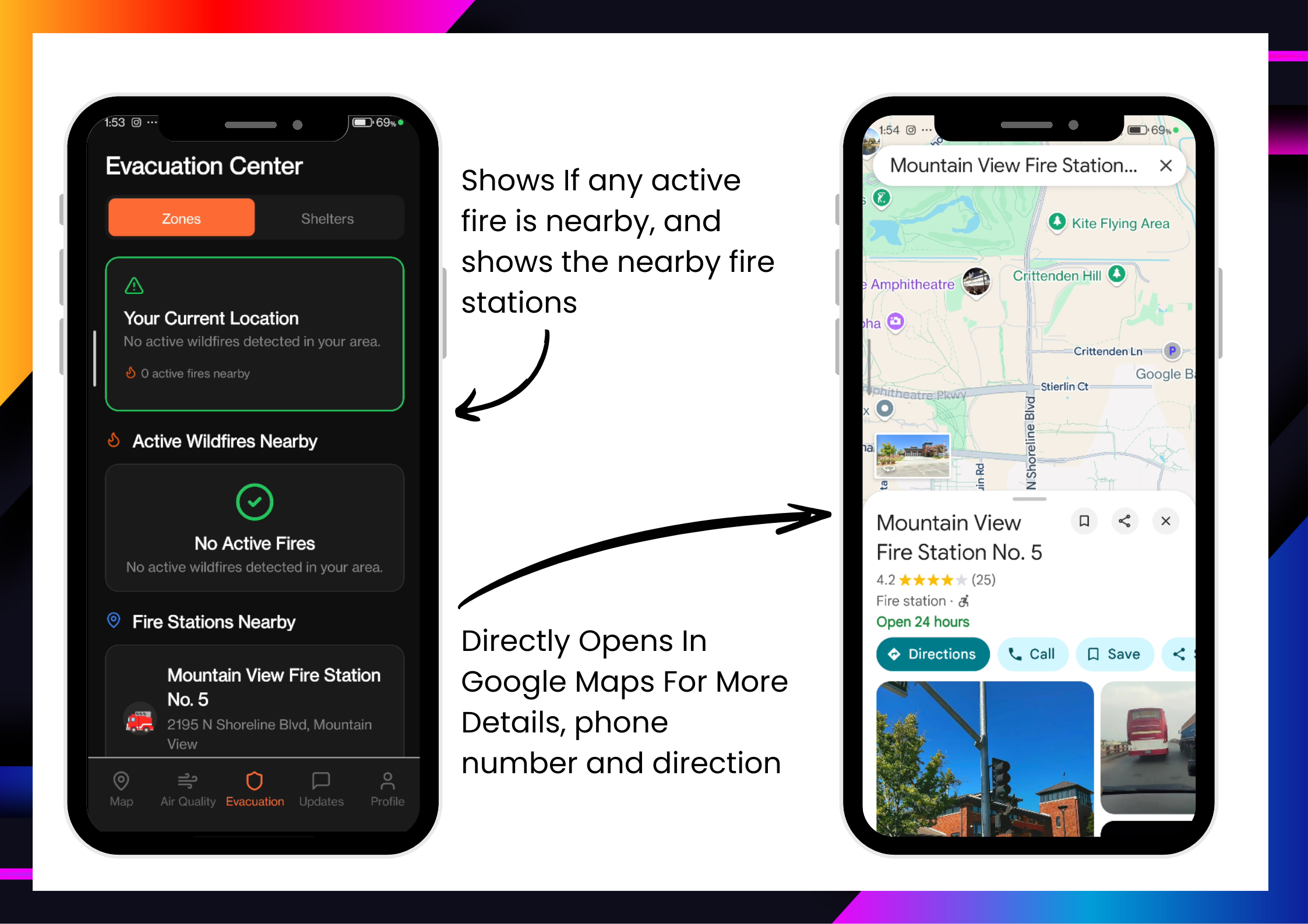
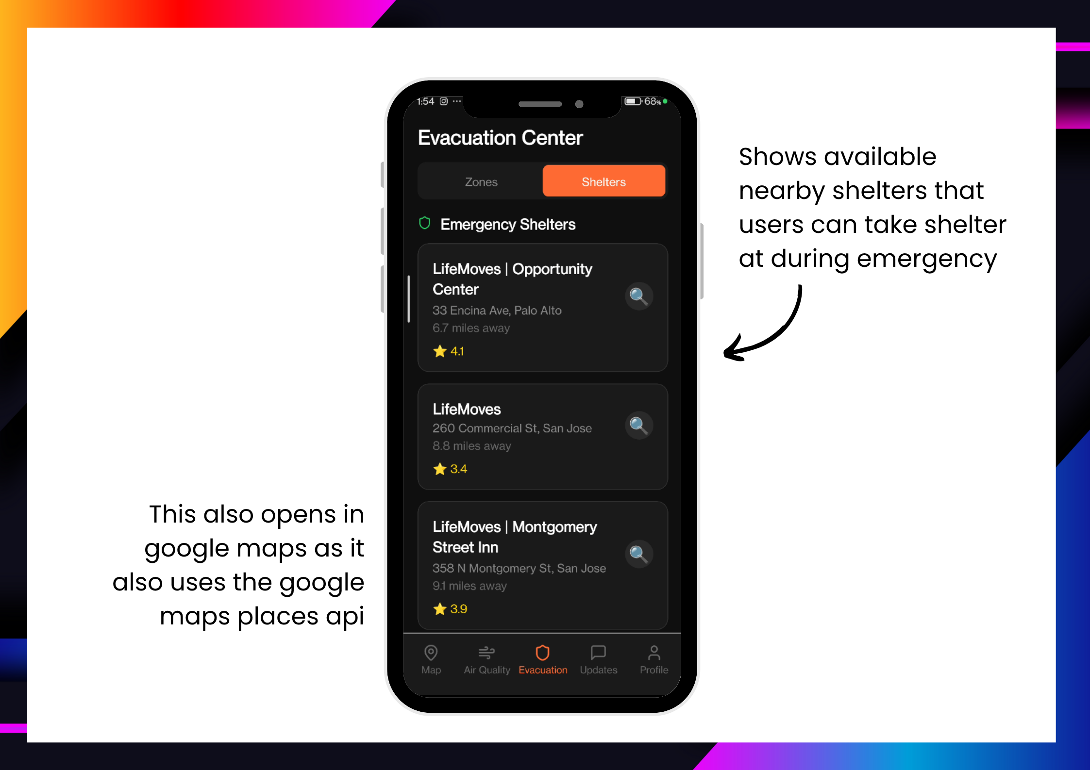
Show nearby shelters, fire stations, and environmental NGOs
Provide a updates section for road closures and local hazards reported by users or authorities
How we built it
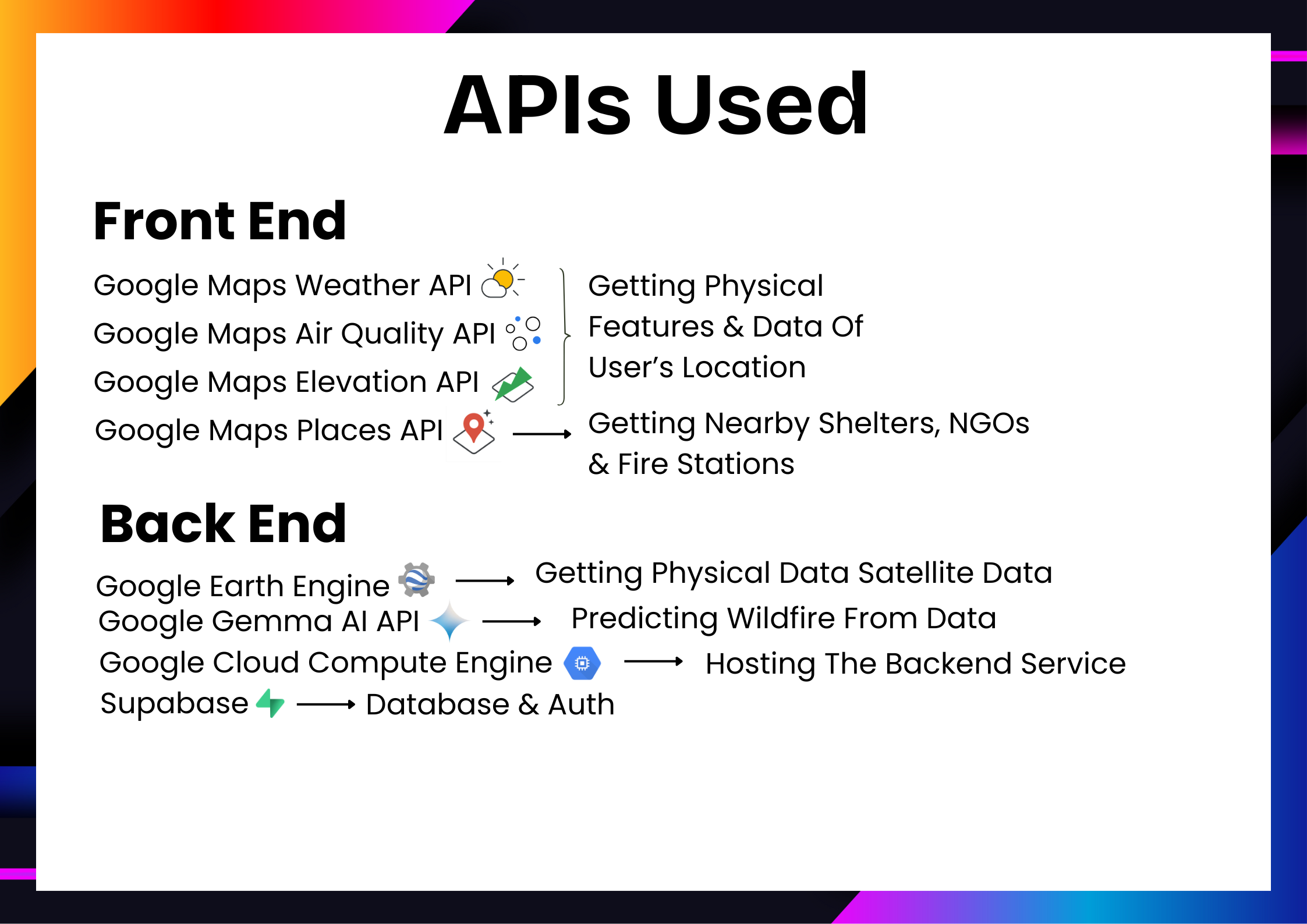
Google Maps API for real-time location, nearby places (e.g., shelters, fire stations), and geospatial visualization
Google Earth Engine to extract vegetation cover and historical burn counts
Gemma 2B via OpenRouter to generate wildfire risk assessments from environmental inputs
Flask backend to manage API communication and risk model integration
Push notification system to alert users when wildfire threat reaches high
Frontend built in React Native for cross-platform mobile compatibility
Challenges we ran into
Integrating multiple APIs and synchronizing their data formats
Extracting accurate vegetation/burn data from Earth Engine
Managing prompt stability and context for Gemma’s risk evaluation
Ensuring low-latency real-time alerts without draining battery or bandwidth
Crafting a UI that’s simple yet informative during emergencies
And choosing a category for this project as it is not a pure AI project but it has a pure sustainablity backgrounnd with AI sprinkled on it
Accomplishments that we're proud of
Building a complete end-to-end wildfire prediction and alerting tool in limited time
Seamlessly connecting Google Earth Engine, Maps APIs, and an LLM to drive intelligent insights
Creating an educational tool that not only alerts, but informs and empowers users
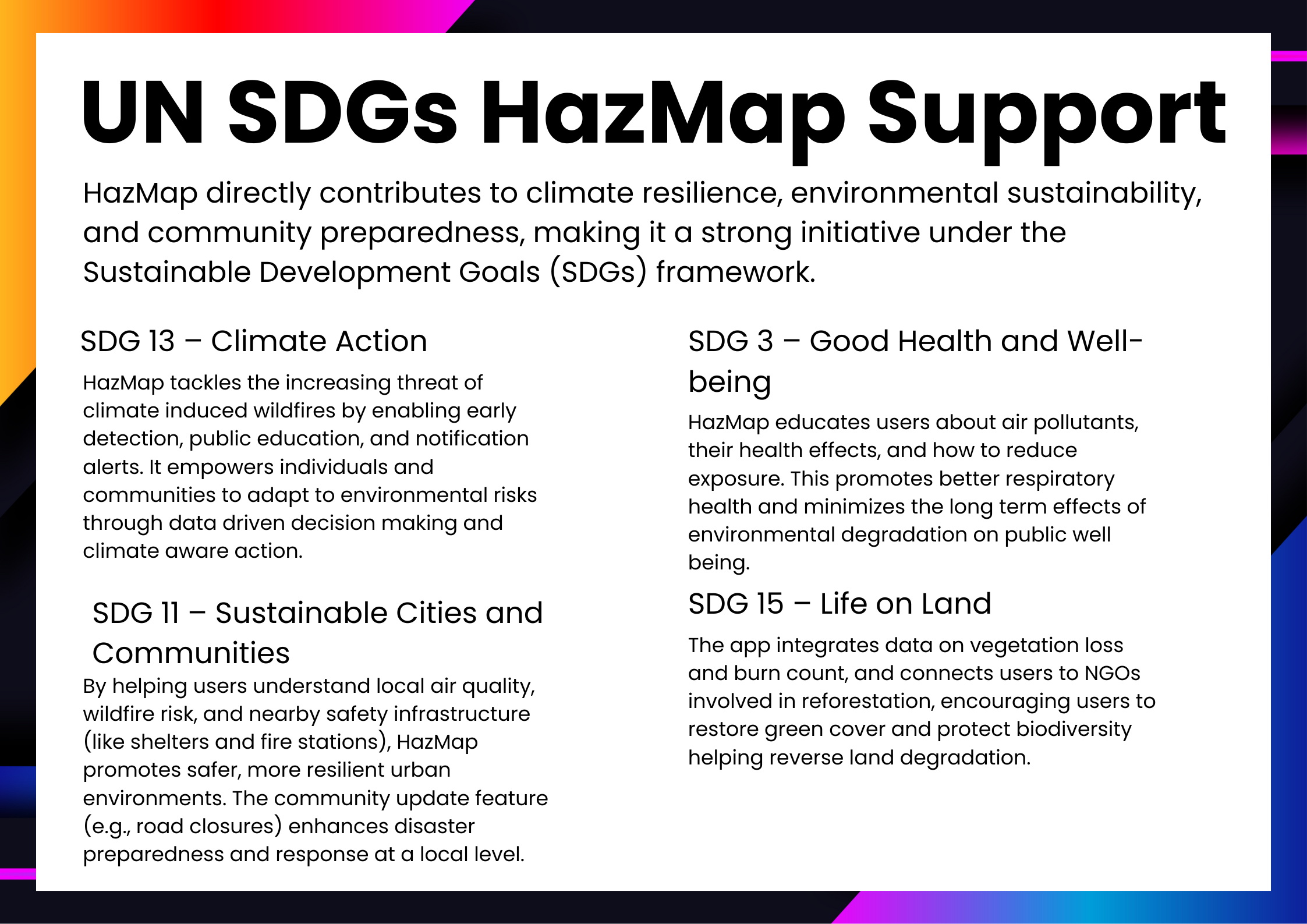
Designing HazMap to align with multiple Sustainable Development Goals (SDGs 3, 11, 13, and 15)
What we learned
How to use geospatial data from Earth Engine in practical, real-world applications
How small design choices can impact user behavior in high-risk situations
The power of combining environmental data with LLMs for meaningful AI applications
Importance of climate-tech and civic-tech collaboration for sustainable innovation
What's next for HazMap
Partner with environmental NGOs and local governments for real-world deployment
Implement multilingual support for broader accessibility
Launch HazMap as a public safety platform in wildfire-prone regions officially
Start prediction for more natural disasters, wildfires are just the begining
Log in or sign up for Devpost to join the conversation.