-
-
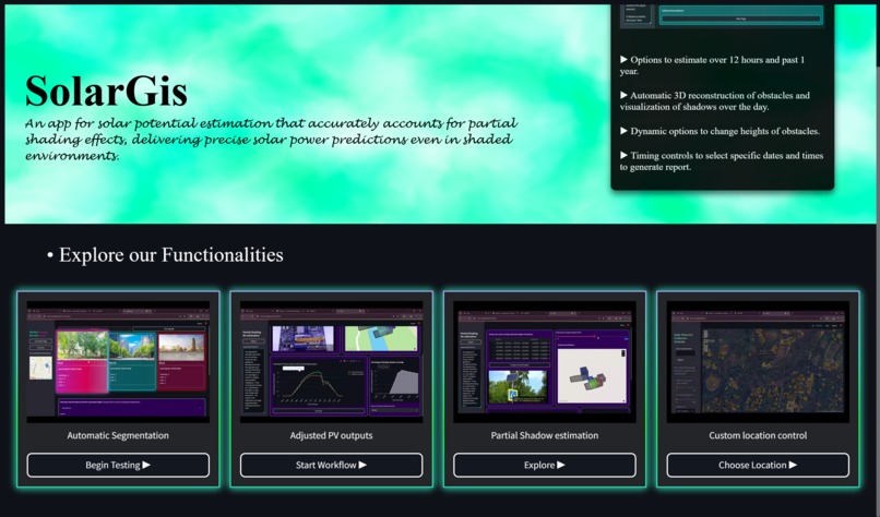
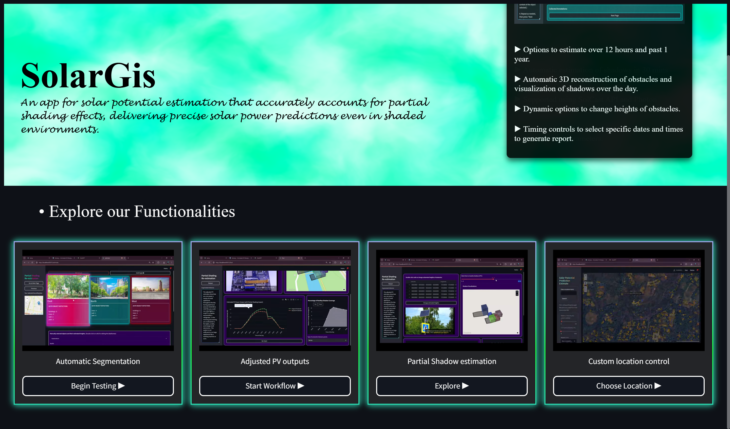
Landing page
-
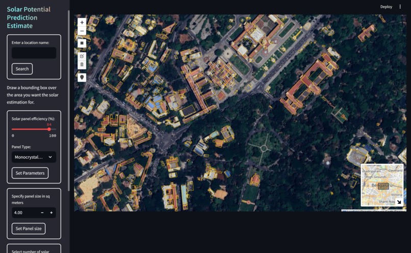
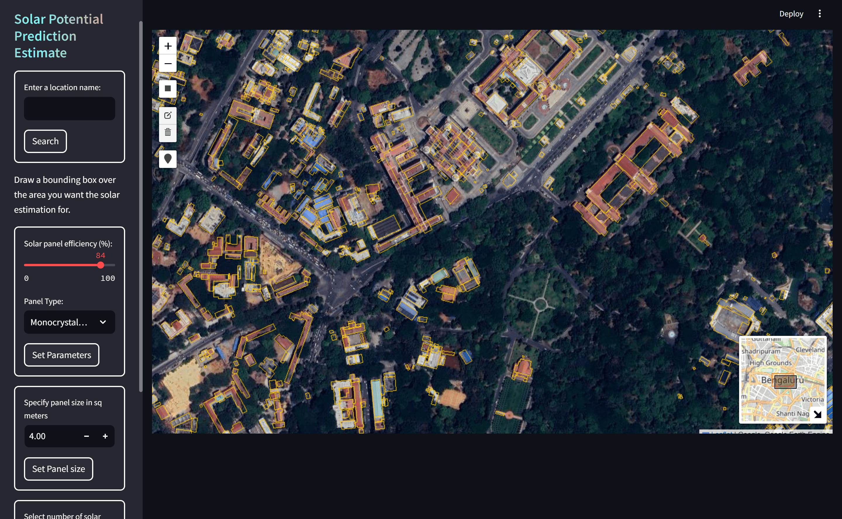
Users select setup site
-

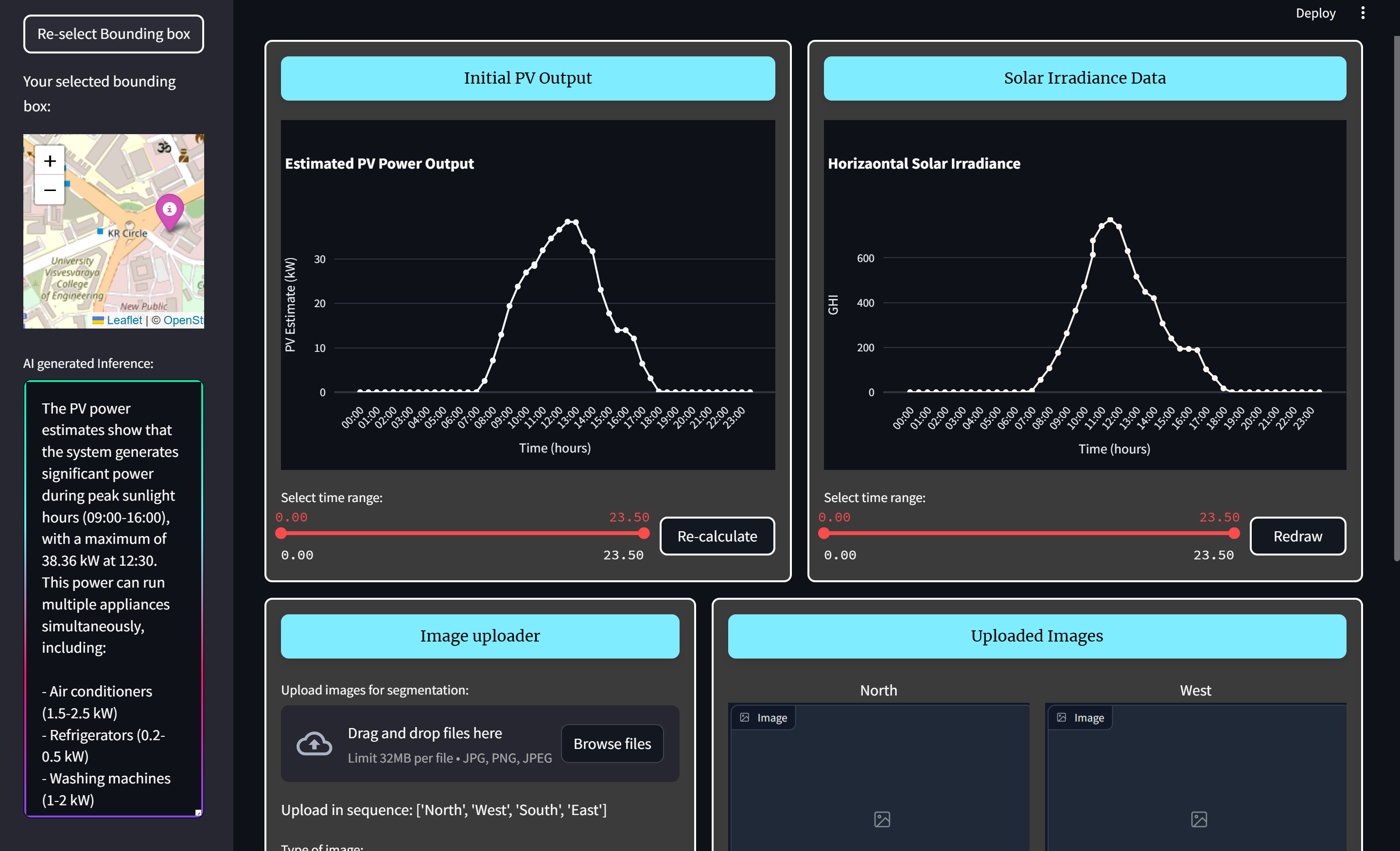
Detailed analysis of solar energy with data insights (using LLM)
-
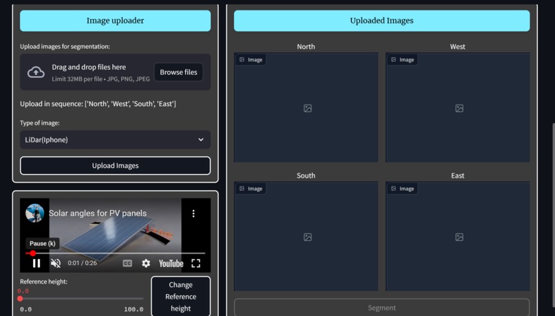
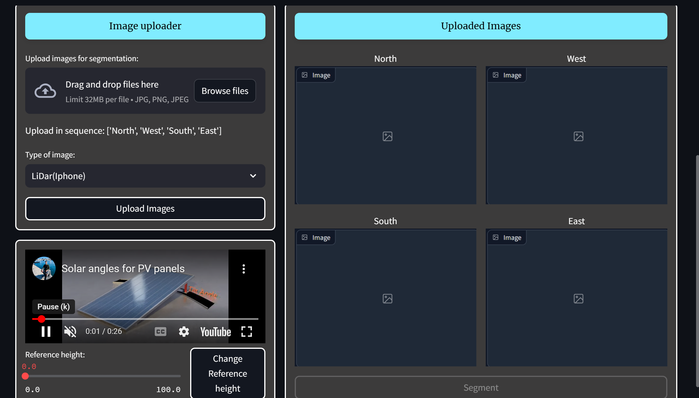
Advanced auto segmentation options
-
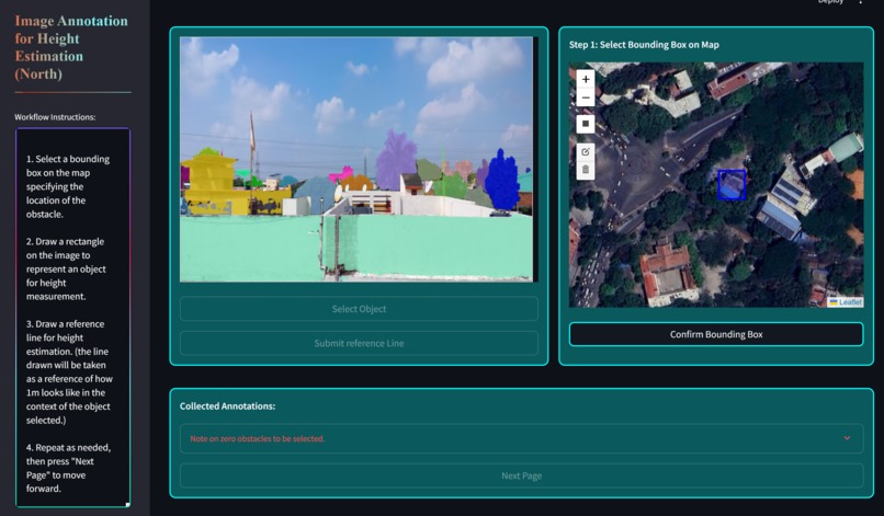
Automatic dimension estimation
-
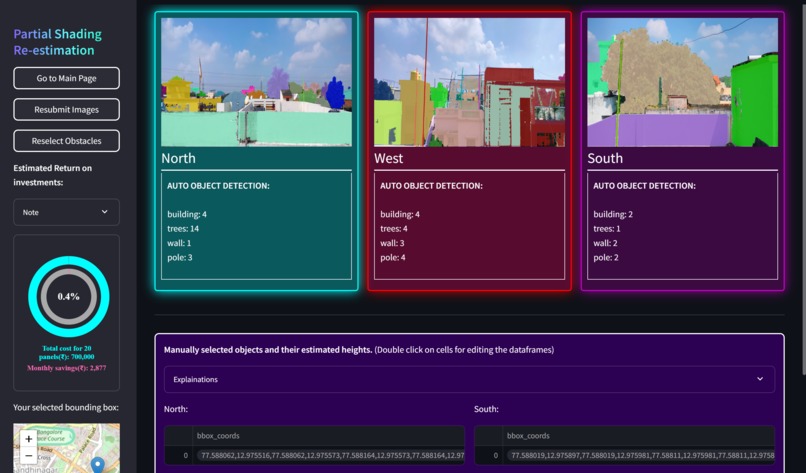
Dashboard for identified obstacles and shadows
-
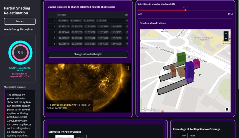
Advanced 3D reconstruction and ray tracing.
-
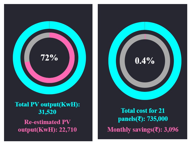
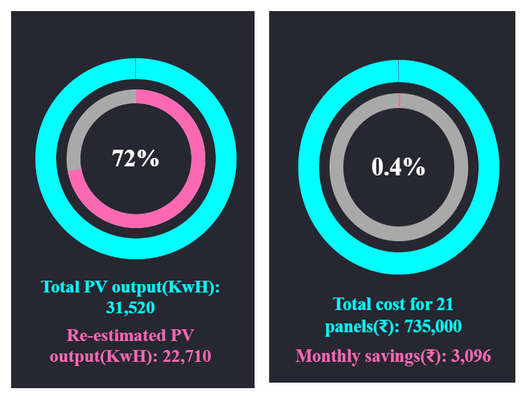
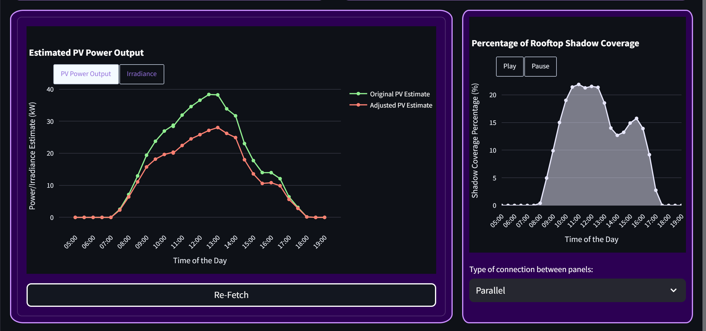
ROI estimates generated using live data.
-

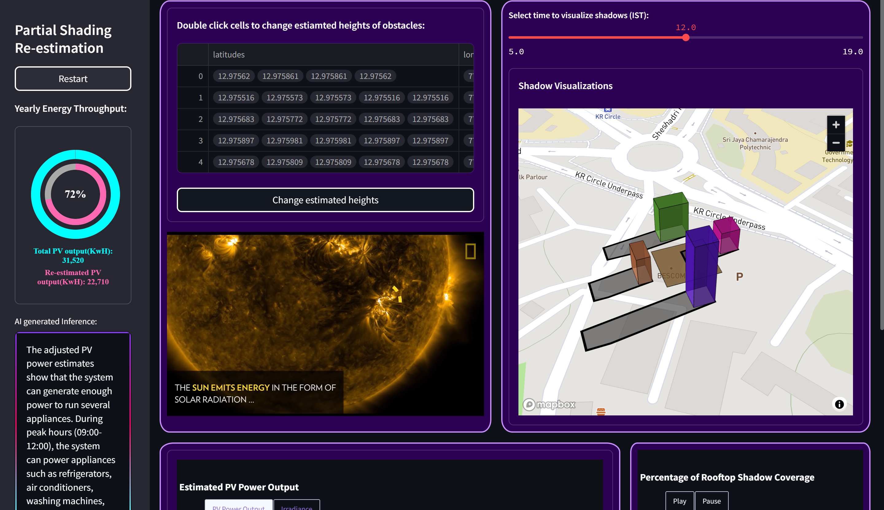
Re-estimated precise solar outputs for shaded environments
-
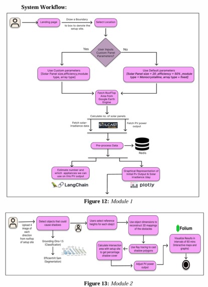
System workflow


Inspiration
With the increasing urgency to combat climate change, solar energy is a pivotal renewable energy source. However, accurately predicting solar power potential remains challenging, especially in environments with partial shading. This project was inspired by the need to bridge the gap between current solar energy estimation tools and the complexities of real-world scenarios, empowering users with a system that combines precision, innovation, and accessibility.
What It Does
Our system predicts solar energy potential, factoring in partial shading and dynamic environmental conditions. Using advanced ray tracing, 3D reconstruction, and automated image segmentation, it simulates shadow dynamics and calculates accurate solar power outputs. The tool is interactive, allowing users to input specific solar parameters, upload images for obstacle detection, and visualize shadow projections and solar potential on 3D maps.
How We Built It
The system integrates multiple technologies:
- Ray Tracing: Simulates shadow dynamics using solar azimuth and zenith angles.
- 3D Reconstruction: Builds models of urban environments for precise shadow mapping.
- Image Segmentation: Utilizes Grounding-DINO for obstacle detection and dimension estimation.
- APIs: Solcast API for solar radiation data.
- Tools: Pvlib for solar calculations, Streamlit for UI, and Redis for caching large datasets.
- Deployment: Dockerized app deployed on AWS EC2.
Challenges We Ran Into
- Accurate modeling of partial shading effects on energy output.
- Integrating diverse datasets and ensuring real-time responsiveness.
- Optimizing segmentation for varied urban environments and object densities.
- Deploying a scalable and persistent app with advanced features.
Accomplishments That We're Proud Of
- Comprehensive Solar Potential Prediction: Successfully developed a robust system that accounts for partial shading, offering precise and reliable solar potential estimates in diverse environments.
- Integration of Cutting-Edge Technologies: Incorporated advanced ray tracing for accurate light transport simulation, 3D reconstruction for urban modeling, and automated image segmentation for obstacle detection and analysis.
- Enhanced Accuracy and Transparency: Achieved performance metrics closely matching proprietary platforms like Google Solar API, while maintaining transparency in calculations and providing users with full control over inputs and assumptions.
- User-Centric Design: Created an intuitive, interactive interface that simplifies complex solar calculations, enabling users to visualize shadow projections, customize solar parameters, and make informed decisions without technical expertise.
- Scalable and Efficient Deployment: Implemented cloud-based solutions using Docker and AWS EC2, ensuring real-time responsiveness, persistent data handling, and efficient processing of large datasets.
- Advanced Shadow Modeling: Developed a sophisticated shadow mapping system that dynamically adjusts for changing solar positions and accounts for varying obstacle dimensions and orientations.
- Accessibility for Diverse Users: Designed the system as an open-source platform, making accurate solar energy estimation tools accessible to researchers, policymakers, renewable energy developers, and individual users alike.
- Sustainability and Impact: Contributed to the global transition toward renewable energy by providing actionable insights that promote optimized solar installations and reduce dependency on fossil fuels.
What We Learned
We deepened our understanding of:
- Solar Physics: The interplay of solar azimuth, zenith angles, and their influence on energy generation in partially shaded environments.
- Photovoltaic Behavior: The nonlinear effects of shading on different panel configurations and their implications on series and parallel connections.
- Light Transport Modeling: Advanced ray tracing techniques to simulate solar irradiance and dynamic shadowing across varying urban geometries.
- Energy Optimization: Strategies to maximize solar potential by integrating 3D reconstruction, shadow mapping, and obstacle segmentation.
What's Next for SolarGIS
- Incorporating real-time weather updates for even more accurate predictions.
- Expanding compatibility with additional satellite and ground-based data sources.
- Enhancing user interactivity by integrating AR/VR visualizations.
- Scaling the system for global use and making it fully open-source to democratize solar energy estimation.
Built With
- amazon-web-services
- gemini
- google-earth
- google-geocoding
- langchain
- pvlib
- redis
- streamlit
- tensorflow


Log in or sign up for Devpost to join the conversation.