-
-
AI+IOT for greener tomorrow
-
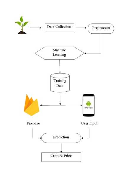
This is how work flow of the harvest lens
-

Smart farming powdered by IOT and satellite data
-
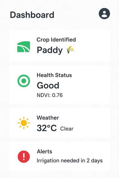
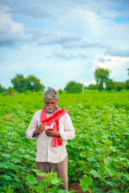
Your farm's health, right in your pocket


Inspiration
My father is a farmer, and when he’s busy or away from the field, it’s hard for him to monitor crop health. This inspired me to create a solution to help farmers check their fields remotely using satellite data and AI.
What it does
Our project, Harvest lens, uses satellite imagery to identify crop types and monitor their health. It provides real-time insights to help farmers make better decisions on irrigation, fertilization, and pest control. To analyze which types of crops is suitable for irrigation by using satellite
How we built it
Collected satellite data from platforms like Google Earth Engine. Processed vegetation indices such as NDVI to detect crop health. Trained an AI model for crop identification. Created a simple dashboard for easy access to field information.
Challenges we ran into
Handling large and complex satellite datasets. Achieving high accuracy across different soil and weather conditions. Making the interface simple and understandable for farmers.
Accomplishments that we're proud of
Building a functional prototype within the hackathon timeline. Successfully integrating AI with real satellite data. Designing an interface that farmers can easily understand.
What we learned
Basics of geospatial data processing and AI/ML techniques. Importance of user-friendly designs for real-world users. How technology can make agriculture more efficient and sustainable.
Built With
- c
- firebase
- google-earth
- java
- keras
- openweathermap
- python
- streamlit
- tensorflow

Log in or sign up for Devpost to join the conversation.