Inspiration
The inspiration for this project came from the pressing need to modernize property tax collection in Anambra State, Nigeria. Traditionally, tax assessment and property records were manually managed, resulting in data inconsistencies, revenue loss, and limited transparency. As urban areas expanded rapidly, the state required a smarter, scalable solution to identify, map, and manage thousands of properties efficiently.
Leveraging Google Maps Platform, I set out to build a digital system that could accurately geo-tag every property, classify them by usage (residential, commercial, industrial), and provide real-time data access to both government authorities and field agents. The goal was simple: use technology to unlock untapped revenue, reduce fraud, and lay the foundation for smart governance in property management.
This project was driven by the belief that location intelligence—when applied correctly—could transform traditional public administration systems and improve accountability, especially in developing regions.
What it does
This project is a GIS-powered property enumeration and tax management platform designed for Anambra State, Nigeria. It enables the government to accurately map, categorize, and monitor thousands of properties across the state using Google Maps Platform.
Key features include:
🗺️ Interactive Property Map: Displays each property on Google Maps with detailed metadata such as location, usage type (residential, commercial, industrial), images, and GIS Plus Codes.
🏢 Property Classification: Automatically categorizes properties based on their function—homes, shops, hotels, supermarkets, factories, etc.
📷 Photo Integration: Each property is linked to real images captured during field enumeration.
📍 Geolocation Accuracy: Utilizes Google Maps Geocoding and Plus Codes APIs to pinpoint exact property locations even in remote or unmapped areas.
🧾 Tax Tracking & History: Helps tax authorities manage billing, collection status, and historical records for each property.
📊 Data Dashboard: Offers analytics and visual insights on property distribution, taxable revenue, and collection performance.
The platform simplifies the entire property tax workflow—from field data collection to map-based analytics—enabling transparency, traceability, and better decision-making for government revenue authorities.
How we built it
We developed the platform by combining the power of Google Maps Platform, Google Earth Engine, and modern web/GIS technologies to create a robust, scalable property enumeration and tax intelligence system tailored for Anambra State.
🔧 Core Technologies 🌍 Google Maps Platform APIs Maps JavaScript API – For rendering interactive maps with property overlays.
Geocoding API – To convert field coordinates and addresses into accurate map locations.
Plus Codes API – To assign digital location codes for precise geolocation, especially in areas without formal addresses.
🌐 Google Earth Engine Used for analyzing satellite imagery, identifying settlement patterns, and validating property boundaries and land cover changes over time.
Enabled land use classification to distinguish between residential, commercial, agricultural, and undeveloped parcels.
Supported temporal monitoring for urban sprawl detection and planning infrastructure improvements.
💻 Frontend Developed using React and Tailwind CSS for a responsive and modern user experience.
🖥️ Backend Built with Node.js and Express to manage APIs and system logic.
Used PostgreSQL with PostGIS for spatial database operations and geolocation queries.
☁️ Cloud & Storage Hosted on AWS for high availability and scalability.
Amazon S3 stores property images and field data files securely.
🛰️ GIS Tools Integrated with desktop GIS software for shapefile processing, zoning, and exporting layers.
Used in tandem with Google Earth Engine for visualizing land use transformation and creating tax zones.
Challenges we ran into
🛰️ Limited Mapping Coverage in Remote Areas Some rural or informal settlements in Anambra State lacked detailed road networks or address data. This made accurate geolocation challenging, especially during field enumeration. We overcame this by using Google Plus Codes and Google Earth Engine to supplement missing map data.
📶 Unstable Internet Connectivity Field agents often worked in areas with poor mobile network coverage, which made real-time data syncing difficult. We had to implement offline data capture features and ensure that data uploads resumed automatically when connectivity was restored.
🧩 Integration Complexity Integrating Google Maps Platform, Google Earth Engine, and PostGIS into a seamless system required deep knowledge of spatial data handling. Coordinating data flow across APIs and databases was complex and required custom middleware and validation layers.
🔐 Data Privacy and Security Handling sensitive property and ownership data meant we had to prioritize security. We implemented authentication, role-based access controls, and encrypted cloud storage to ensure compliance with data protection best practices.
📸 Photo Management at Scale Managing and linking thousands of property images to mapped entries posed performance and organization challenges. We optimized storage using AWS S3 and implemented dynamic loading on the frontend to ensure fast map interaction.
🏛️ Bureaucratic Delays Engaging with government stakeholders involved in tax administration came with bureaucratic hurdles and delays. Aligning expectations, securing cooperation, and maintaining momentum required strong communication and persistent advocacy.
Accomplishments that we're proud of
🗺️ Mapped and Digitized Thousands of Properties Successfully digitized thousands of properties across Anambra State using Google Maps Platform, each with precise location data, property images, and classification tags. This has laid the groundwork for transparent and efficient tax administration.
📍 Introduced Location Intelligence to Tax Governance For the first time in the region, tax officials and policymakers now have access to a live, interactive map-based view of properties, helping them make smarter, data-driven decisions.
🌐 Integrated Google Maps with Google Earth Engine We combined satellite analysis with interactive mapping—enabling not just visualization but insight into land use patterns, urban sprawl, and property development trends.
🏘️ Improved Revenue Potential for the Government By exposing previously unrecorded properties and standardizing data collection, the platform unlocked significant revenue potential for the local government, ensuring more properties are included in the tax base.
🧑🤝🧑 Empowered Field Agents with Digital Tools Trained and equipped local field agents with digital tools to collect accurate data and operate efficiently, reducing manual paperwork and human errors.
🔒 Ensured Data Security and Accessibility Built a secure and scalable backend with cloud storage and access controls, ensuring that property data is protected and reliably available across multiple user roles.
🧩 Built a Scalable, Replicable System Designed the platform architecture to be scalable and replicable across other local governments or regions facing similar property mapping and taxation challenges.
What we learned
🧭 Geospatial Technology is Transformative for Governance We learned that integrating geospatial tools like Google Maps Platform and Google Earth Engine can fundamentally transform how governments manage public assets and collect revenue. These tools bring visibility, precision, and accountability to systems that were previously opaque and manual.
🏗️ Building at Scale Requires Simplicity and Structure Handling data for over 65,000 properties taught us the importance of designing with scalability in mind—from database optimization to user-friendly interfaces for both field agents and administrators.
🌍 Offline Access is Crucial in Developing Areas Inconsistent network access in rural communities emphasized the need for robust offline-first data collection, sync capabilities, and redundancy in the data pipeline.
🔄 Cross-Platform Integration is Powerful but Demands Planning Bringing together Google Maps, Google Earth Engine, PostGIS, and AWS taught us that while cross-platform solutions are powerful, they also require deep integration planning, well-structured APIs, and tight data validation to avoid mismatches and redundancy.
🧑💼 End Users Are Just as Important as the Code Training field staff and understanding their needs helped us improve UX and workflows. We learned that real-world success depends as much on human usability as it does on technical correctness.
📊 Location Data Is More Than a Map—It’s a Decision Engine Beyond visualization, location data enabled strategic decisions in tax enforcement, land use policy, and urban planning. We now see maps not just as interfaces, but as operational dashboards for public governance.
What's next for Digitizing Property Tax Systems with Google Maps
🌍 Expand Coverage Across All LGAs in Anambra State With 65,876 properties already mapped, we are actively expanding to cover all 21 Local Government Areas (LGAs) in Anambra State. This will ensure every taxable property is accounted for, boosting accuracy and government revenue.
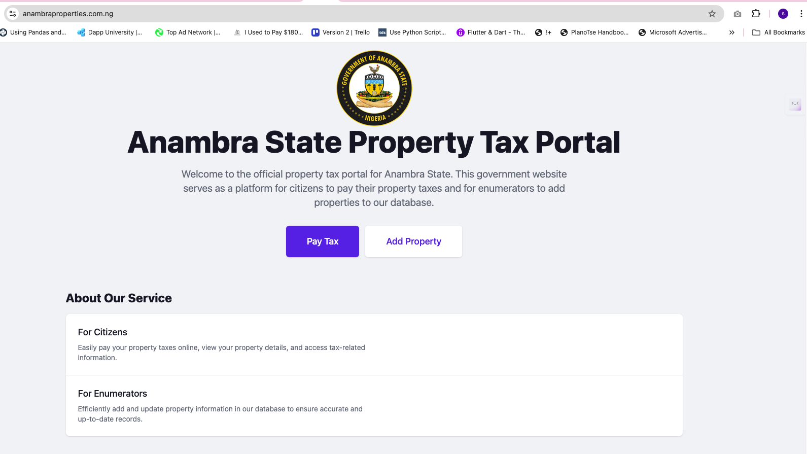
📱 Public Portal and Mobile App – Already Live We have successfully launched a citizen-facing web portal and mobile app, enabling property owners to:
Search and verify their property details
View tax assessments and payment history
Report inaccuracies or ownership disputes
Receive real-time notifications and tax updates
This promotes transparency, ease of access, and direct public engagement with property records.
💳 Payment Gateway – Fully Integrated The platform is fully integrated with a secure online payment gateway, allowing property owners to pay taxes directly from the portal or app—simplifying revenue collection and reducing reliance on cash-based systems.
🧠 Upcoming: AI-Driven Property Classification and Valuation We plan to introduce machine learning models to assist in property classification, automatic valuation, and fraud detection. This will support more consistent and data-driven taxation policies.
🛰️ Enhanced Satellite Intelligence with Google Earth Engine We will continue leveraging Google Earth Engine to analyze settlement growth, detect unauthorized developments, and support evidence-based land management decisions.
🌐 Expansion to Other States The system is fully modular and ready for scaling nationwide. We aim to collaborate with other Nigerian states and local governments to modernize their property tax systems using this proven model.
📊 Policy Dashboards and Predictive Analytics Next, we are building advanced dashboards and planning tools to provide real-time insights for government stakeholders, enabling data-informed decisions in urban planning and taxation policy.
Built With
- amazon-web-services
- express.js
- google-earth
- google-maps
- node.js
- postgresql
- prisma-orm
- react
- tailwind-css


Log in or sign up for Devpost to join the conversation.