Devpost
Participate in our public hackathons
Devpost for Teams
Access your company's private hackathons
Grow your developer ecosystem and promote your platform
Drive innovation, collaboration, and retention within your organization
By use case
Blog
Insights into hackathon planning and participation
Customer stories
Inspiration from peers and other industry leaders
Planning guides
Best practices for planning online and in-person hackathons
Webinars & events
Upcoming events and on-demand recordings
Help desk
Common questions and support documentation
Sort by:
Your reliable-access transit app.
Ontario is tearing out bike lanes without data. 4sight gives cyclists eyes in the back of their head, warning drivers before a car passes too close, and turning every close call into open evidence.
placeholder text
Sunspot helps you discover new viewpoints with photos, sun direction, cloud forecasts, walking budgets, and practical visit details. Less searching, more time outside.
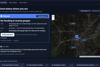
Is my street safe to drive? Street-level flood warnings backed by live NOAA and NWS data, telling every resident if their road is safe and what to do, in their own language, by text and voice.
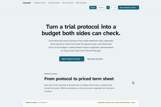
Turn a clinical trial protocol into a site budget both sides can check: procedures priced from public Medicare rates, with a source on every line.
Monthly averages hide the patient who waited 20 minutes. ERGent shows Ithaca’s 911 center which zone is slow, which stage causes it, since when, and whether the fix worked.
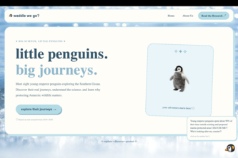
Making Antarctic research accessible and personal, transforming real penguin journeys into interactive experiences that inspire ocean conservation.
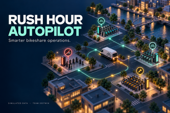
Rush Hour Autopilot helps bikeshare dispatchers spot empty or full stations, prioritize action, and compare rebalancing strategies using simulated data.
Get lost, explore more! Our maps app creates safe, unique routes to your destination, revealing hidden gems, landmarks and local hotspots. Track your footprint and discover more of your city!
Track a runaway pelican on a red bicycle, explore its improbable adventures, and nominate its next stop.
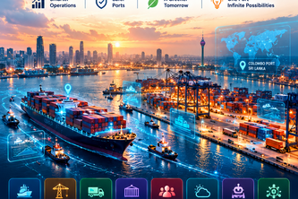
PortMind AI Colombo — Smarter Ports. Intelligent Decisions.
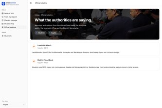
Every SOS in one trusted queue. CrisisConnect merges crisis messages from every channel into verified household cases, ranks who to call first, and tracks help until it’s delivered.
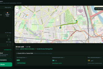
Find a little joy along the way. JoyWalk turns an everyday route into a chance to slow down, breathe, and notice what’s around you.
Turn everyday nature into characters to collect and share. Discover plants and animals on a map, keep a personal Journal, and find a new reason to connect with friends.
Your parent needs care? ElderCare turns Taiwan's long-term care rules and 11,722 government providers into an exact 2-minute plan: costs, deadlines, and who to call first.
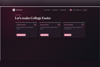
A 3-in-1 project to help De Anza students plan their courses, schedule their events, and ask all questions about De Anza.
Elevate your experience with nature, share your sightings and see what's near you!
Help that understands you. VoiceFlare calls every home in a danger zone in its own language, holds the alert until four neighbours confirm it, and tells the city who needs a person.
WildPass bridges the gap between modern life and natural life, both literally and figuratively. It maps where highways split California's habitats and designs crossings so wildlife and people coexist.
BOSCO: Bushfire Observation, Simulation and Coordination OperationsEyes above the fire for people who can't ask for help.A drone fleet that maps wildfires and finds the people in its path.
QuietCheck: When batteries go silent, we tell you why—and what to do next
Plan the tour where a band's listeners already are
Meshed Relays In All Deadzones: A Decentralized Thru-Hiking Bulletin, Safety, and Communication App