Devpost
Participate in our public hackathons
Devpost for Teams
Access your company's private hackathons
Grow your developer ecosystem and promote your platform
Drive innovation, collaboration, and retention within your organization
By use case
Blog
Insights into hackathon planning and participation
Customer stories
Inspiration from peers and other industry leaders
Planning guides
Best practices for planning online and in-person hackathons
Webinars & events
Upcoming events and on-demand recordings
Help desk
Common questions and support documentation
Sort by:
AI for drought prevention, water conservation, and community engagement. Discover map, resources, search, social media, and graphics. Helping create a better future for all.
Citizens deliver live updates on local safety, businesses, and other changes to highlight pressing issues and facilitate communication, thereby promoting human connection in urban areas.
To open up unused land and offices and housing used as speculative properties, we want to showcase how a land value tax could impact the housing landscape.
We have produced a 3d model of Syracuse.
Your window to trans-safety across the 50 states of the USA!
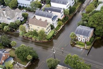
The World is Flooding! Visualize a realistic flooding view of your neighbourhood.
Ever wonder which county is more dangerous in NJ? No? Why not? Here's some information on how public transport may be your last trip destination (Results may vary).
Blazing fast AI for your rail yard (Siemens challenge)
We're creating a more accessible Duke by helping students with disabilities navigate the campus conveniently. Empowering students to fully engage and get the most out of their college experience.
Viaja Seguro, Viaja Feliz
u
Identifies the most suitable roofs which can produce the highest amounts of solar energy, rank them in priority categories, and provides additional data, like how much they can produce and their ROI.
An app that allows travelers to seamlessly see what parts of town offer food at the best prices. With our app, travelers can avoid scams and eat safely when getting their next meal!
Reducing the impact of natural disasters in the Bahamas one grain of soil at a time.
Join us in revolutionizing the way UMD students navigate campus construction. Detouree combines crowd sourced data with optimized routing algorithms to find you the fastest path to your destination.
Discover the proximity of Kosice city buildings to essential living amenities like stores and groceries with our 3D map.
Discover and support with the 400 million local businesses around the world for both a healthy economy and a healthy planet - hyper personalized to every user, while getting rewarded for it! 💹🌎
An interactive map website that allows users to see various environmentally unfriendly projects or legislation throughout the United States and access petitions to move against them.
Drive Smarter, Not Harder with Rider Hot Spot Insights
A fully-functional web application designed to diminish the prevalence of food insecurity around the world through food redistribution.
UBC Botanical Garden is otherworldly terrain. Here are some teasers that don't give away too much: chloropleth maps and species.
The ultimate navigation app for indoor tunnels at the university of Waterloo campus.
Farm Tech is a tool that aims to help the Indian farming community, optimize crop production. Provides desirability, feasibility, and viability for the farming community.
We help local municipalities aid communities vulnerable to the effects of urban heat islands.