Devpost
Participate in our public hackathons
Devpost for Teams
Access your company's private hackathons
Grow your developer ecosystem and promote your platform
Drive innovation, collaboration, and retention within your organization
By use case
Blog
Insights into hackathon planning and participation
Customer stories
Inspiration from peers and other industry leaders
Planning guides
Best practices for planning online and in-person hackathons
Webinars & events
Upcoming events and on-demand recordings
Help desk
Common questions and support documentation
Sort by:
na
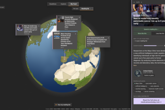
EyeOfHorus is an interactive 3D globe that shows significant events and news happening on Earth right now: earthquakes, wildfires, floods, alongside news on politics, conflict, society and more.
Not just the fastest route — the safest one
A Smarter Way To Cater
Click it! Scrap it! Collage it! Explore with your crew, leave your thoughts, and watch the city glow with your gleaming (or not) reviews! As if you are your friend's ultimate tour guide..
Upload place datasets, inspect and capture map snapshots, and analyze temporal changes like construction, accidents, nature events, or tree cutting with Google Map.
Your flight just emitted 2 tons of CO₂; did your travel app tell you that? GreenRoute plans your flights and drives, using Arize on Google Cloud to budget, track, and break down every mile's CO₂.
SafeRoute is a navigation app designed to help people get to their destination safer, not just faster. While traditional map apps focus only on the quickest route, SafeRoute priortizes your safety.
Rent is only part of the story. RealRoot reveals hidden costs -- commute, gentrification risk, and time lost -- in one unified score powered by real data. The real cost of where you root yourself.
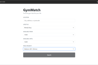
Find your best-fit gym based on how you actually live.
Feeling restless? Touch grass!
Safara is a safety-first travel app that helps people find safer locations, compare safer routes, and plan trips with real-time and future risk insights.
Mekong Delta Flood Risk Intelligence Turning satellite imagery into clear, local insights for faster preparedness and smarter response.
SightLine is like your Life Line — Your AI Vision Assistant for the Visually Impaired. Real-time scene description, navigation & reading powered by Gemini. See the world. Live your life.
Using ai to keep you in line with your fitness and nutrition goals!
AI-powered route planner for exploration, not navigation
Scan Landmarks, Instantly Understand the World Around You. AI identifies places from camera or photos, reveals history, culture, fun facts, nearby events, and turns your trips into a shareable wrap.
Freshfront is your AI-powered creative co-founder. It unifies your data with deep research, multi-modal content generation and full marketing automation in a single workspace to help maximize output.
Online food tour optimizer
Odyssey: Modern cities. Epic journeys.
This app lets drivers change routes by voice without typing, using Gemini 3 to parse intent, validate addresses and POIs, and update multi-stop routes with coffee picks and a one-tap Google Maps link.
A personal map to guide you away from any hazards!!
HolyShift is a marketplace that connects buyers with sellers, making it easy to find or list the perfect car, even with unique needs or limited options.
Emergency response platform providing instant access to weather data, air quality levels, nearby shelters, and evacuation routes. Auto-location detection. Built with React, Google Maps, Open-Meteo.