-
-
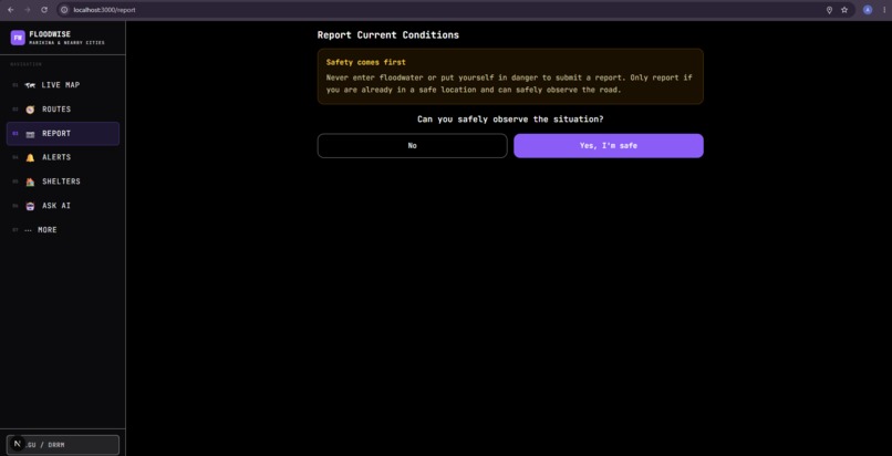
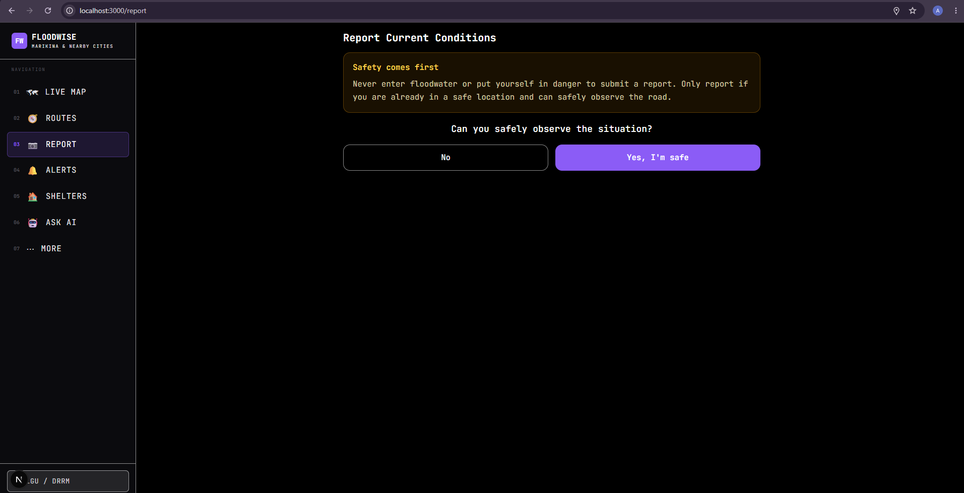
Report — Safety Check — Ensures users confirm they can safely observe the situation before reporting.
-
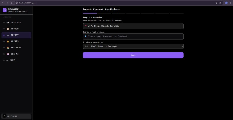
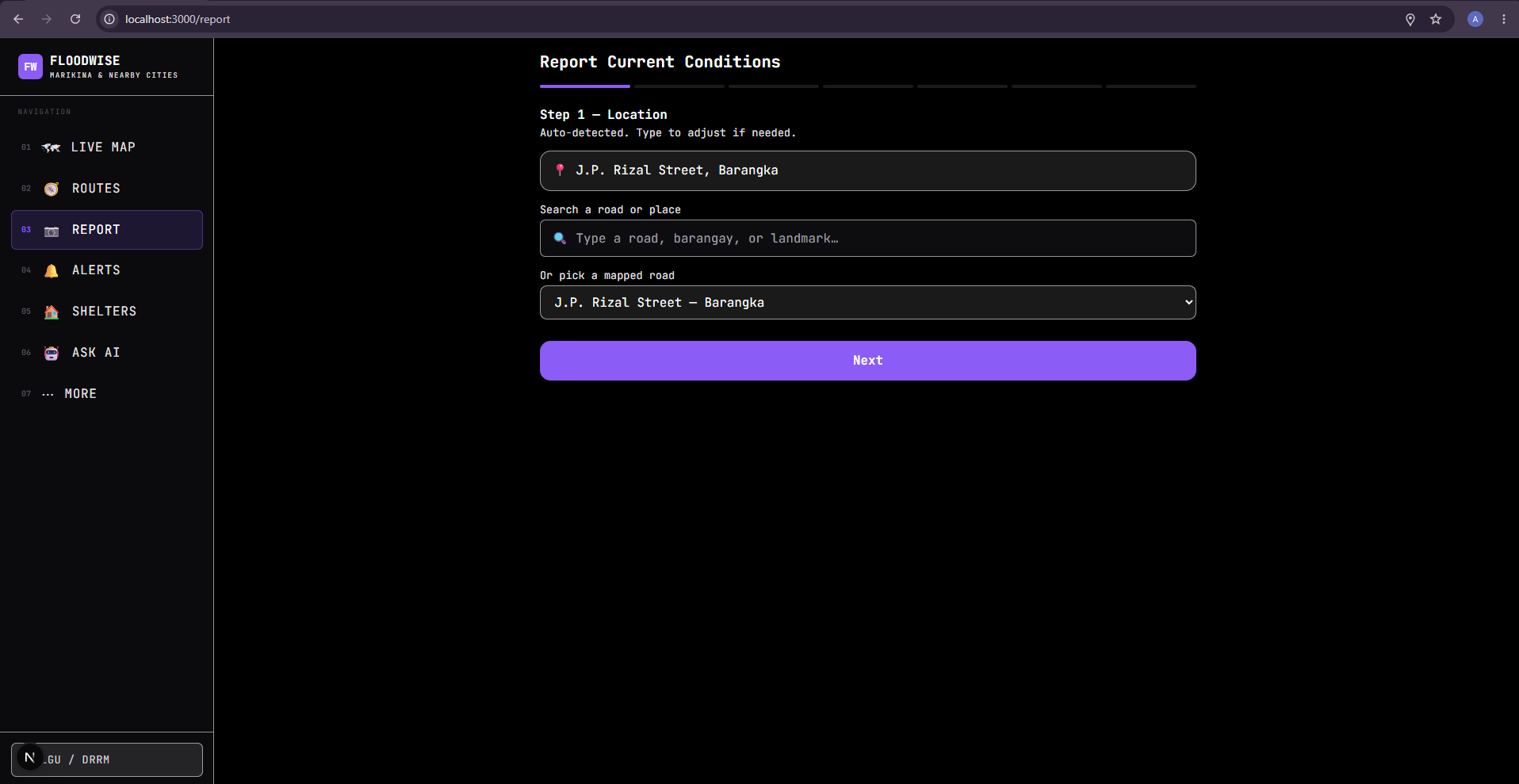
Report — Location — Detects the user's location and allows them to search or manually select the affected road/location.
-
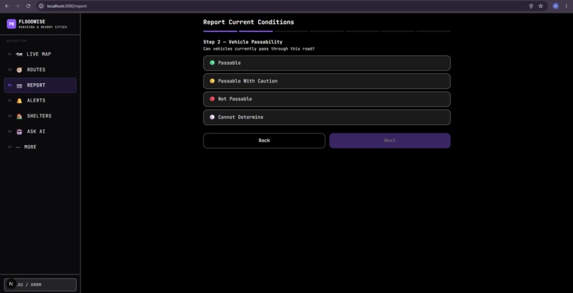
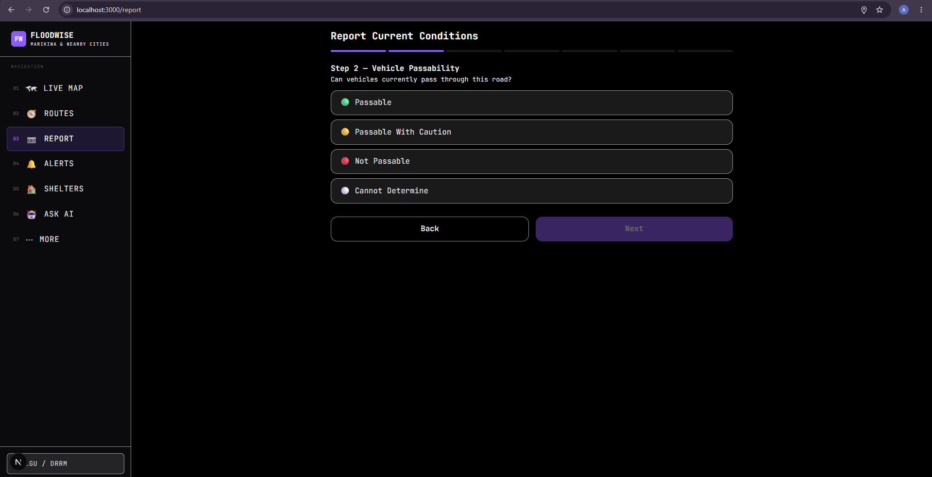
Report — Vehicle Passability — Lets users indicate whether vehicles can pass, can pass cautiously, cannot pass, or cannot be determined.
-
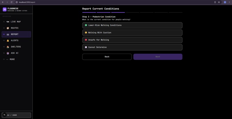
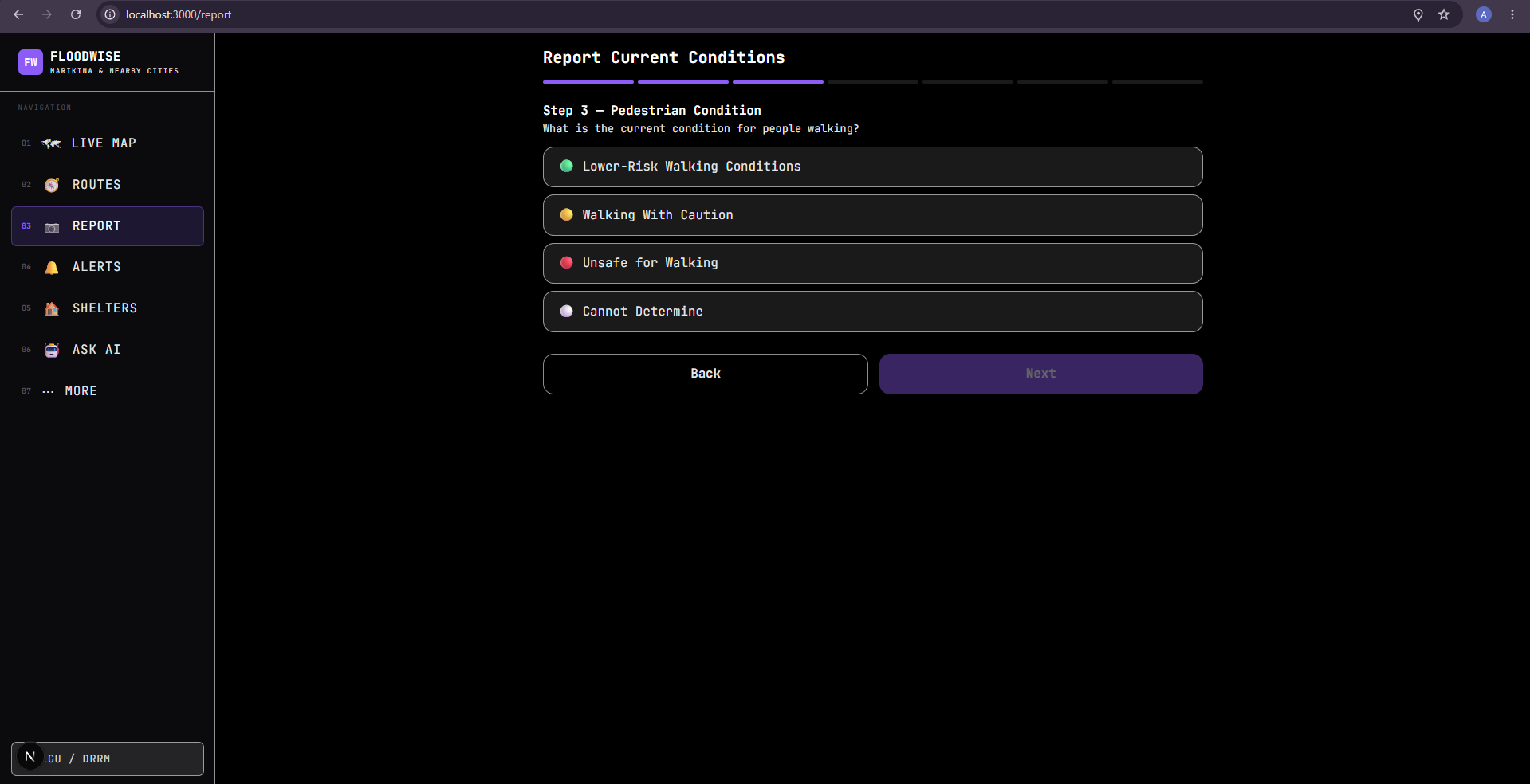
Report — Pedestrian Condition — Separately records whether the location is lower-risk, cautionary, unsafe, or unknown for pedestrians.
-
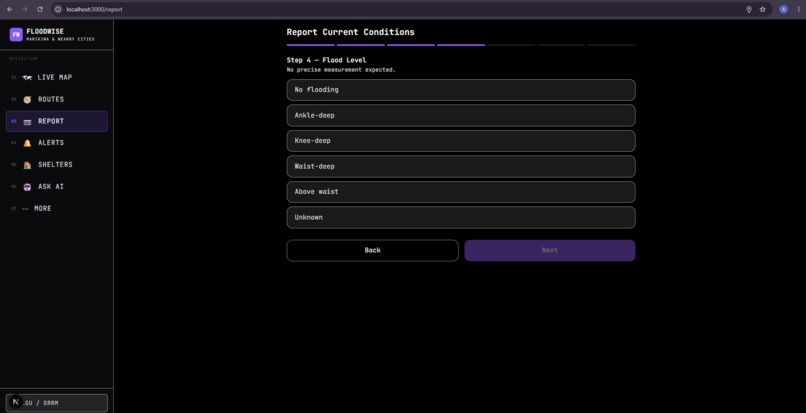
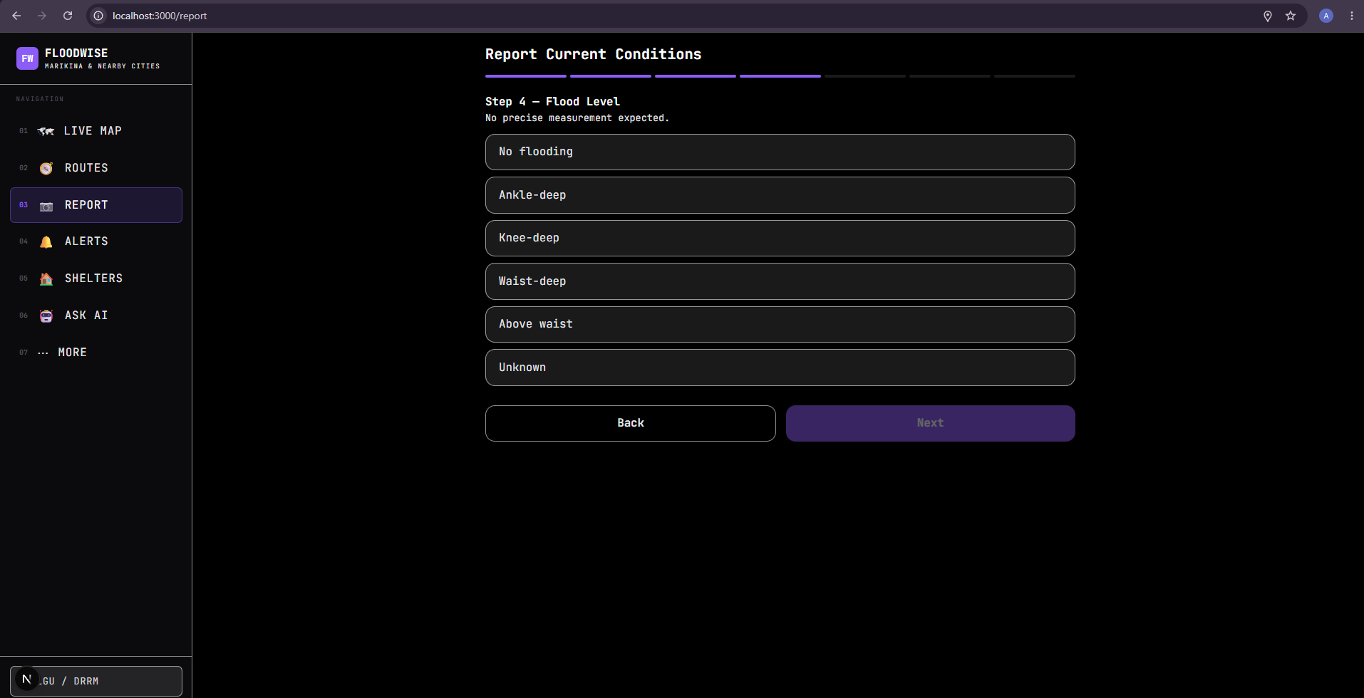
Report — Flood Level — Records the observed flood depth, from no flooding to above waist level, including an unknown option.
-
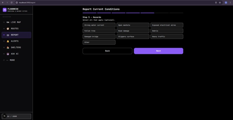
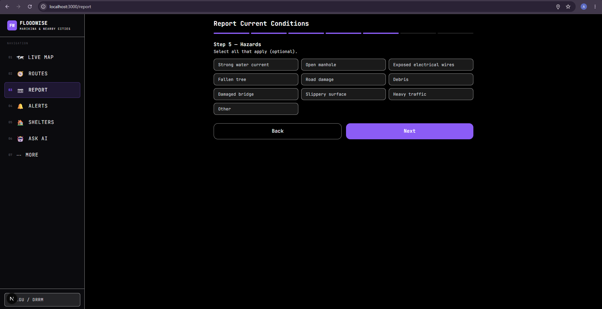
Report Hazards - Allows users to identify additional hazards such as strong currents, open manholes, wires, trees, debris, and road damage.
-
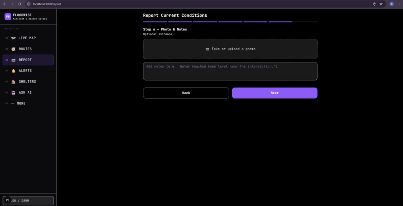
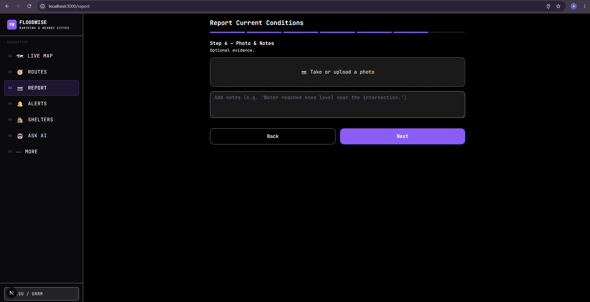
Report — Photo & Notes — Allows users to attach an optional photo and provide additional details about the situation.
-
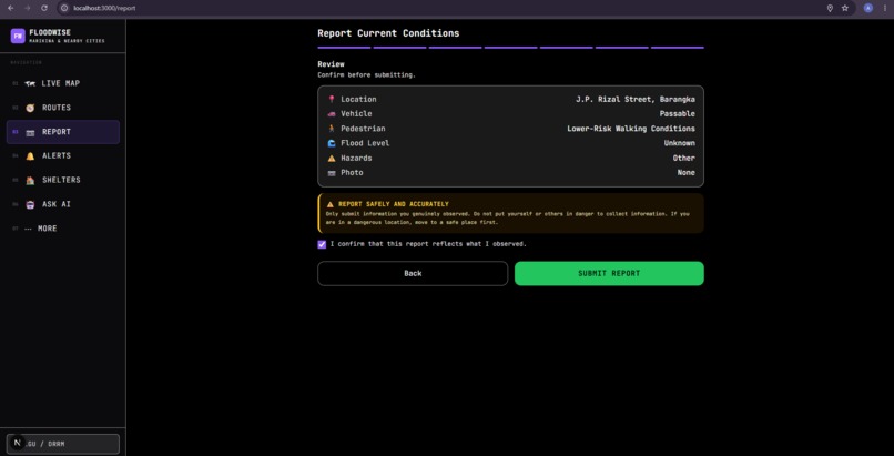
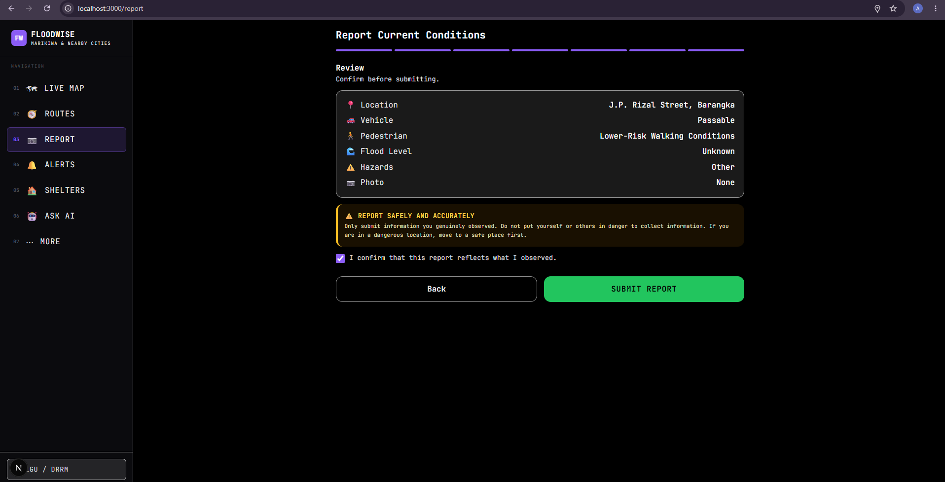
Report — Review — Shows the complete report for review and requires the user to confirm its accuracy and safety before submitting.
-
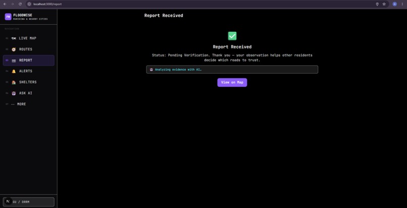
Report — Review — Shows the complete report for review and requires the user to confirm its accuracy and safety before submitting.
-
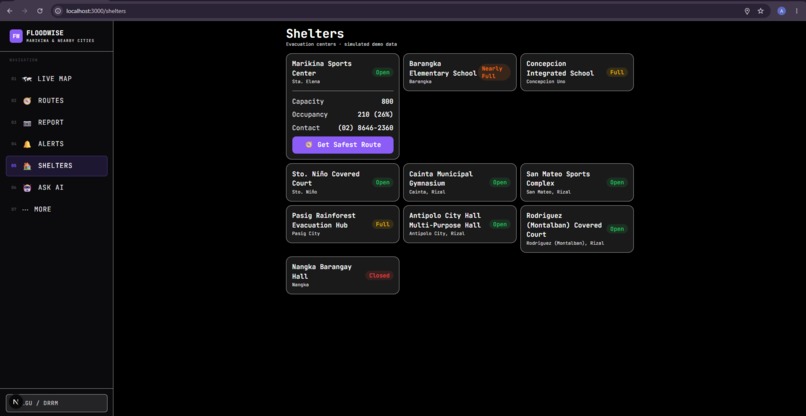
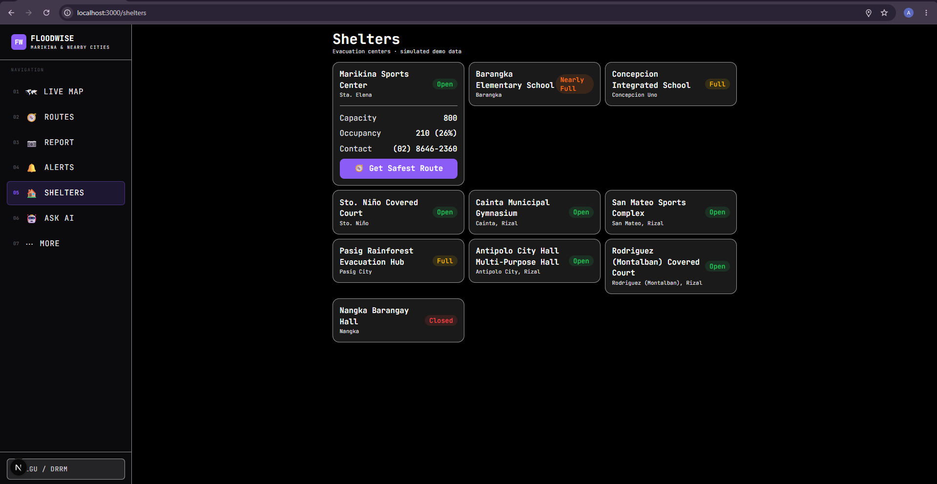
Shelters — Displays nearby evacuation centers with their availability, capacity, occupancy, and safest-route option.
-
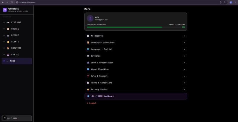
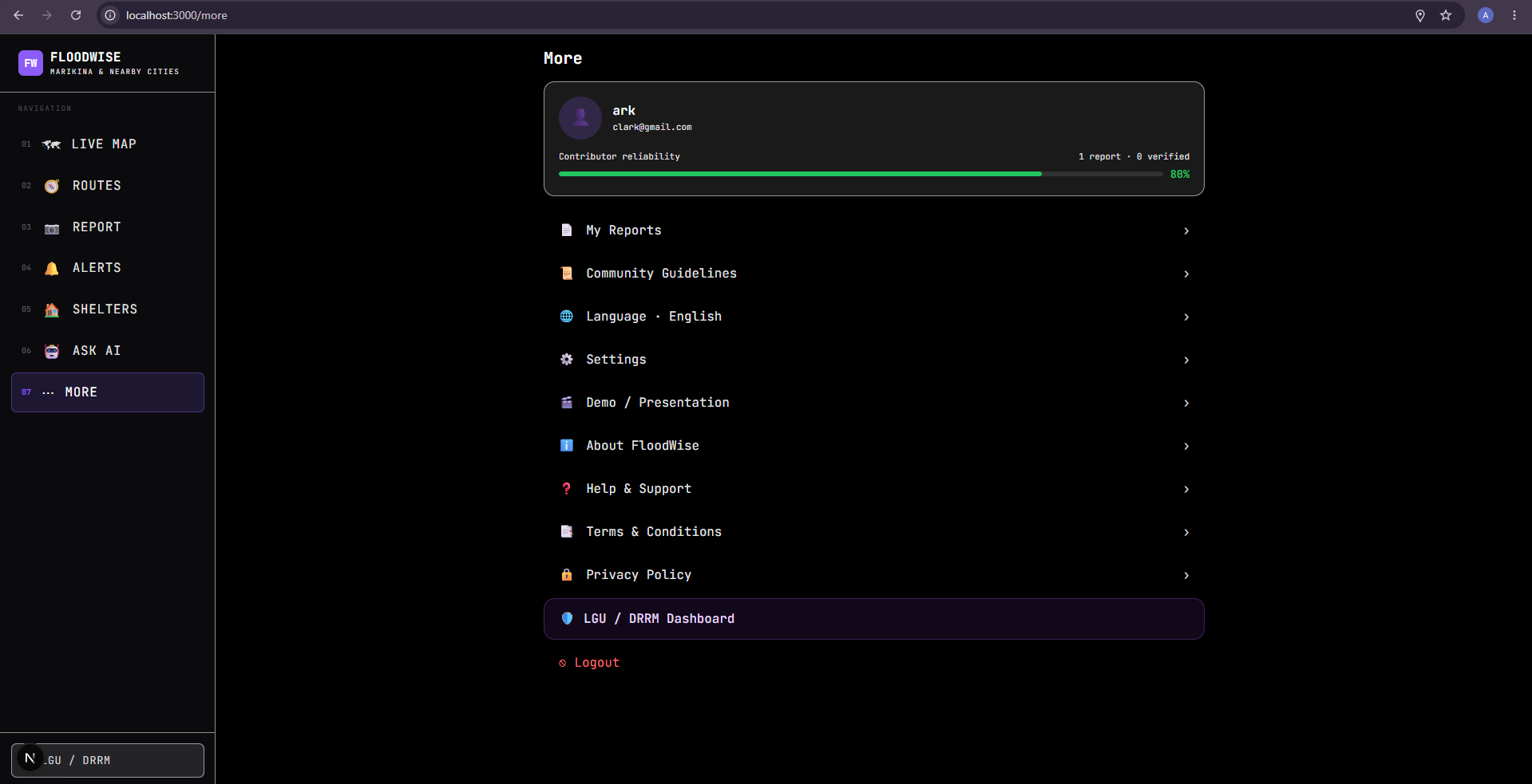
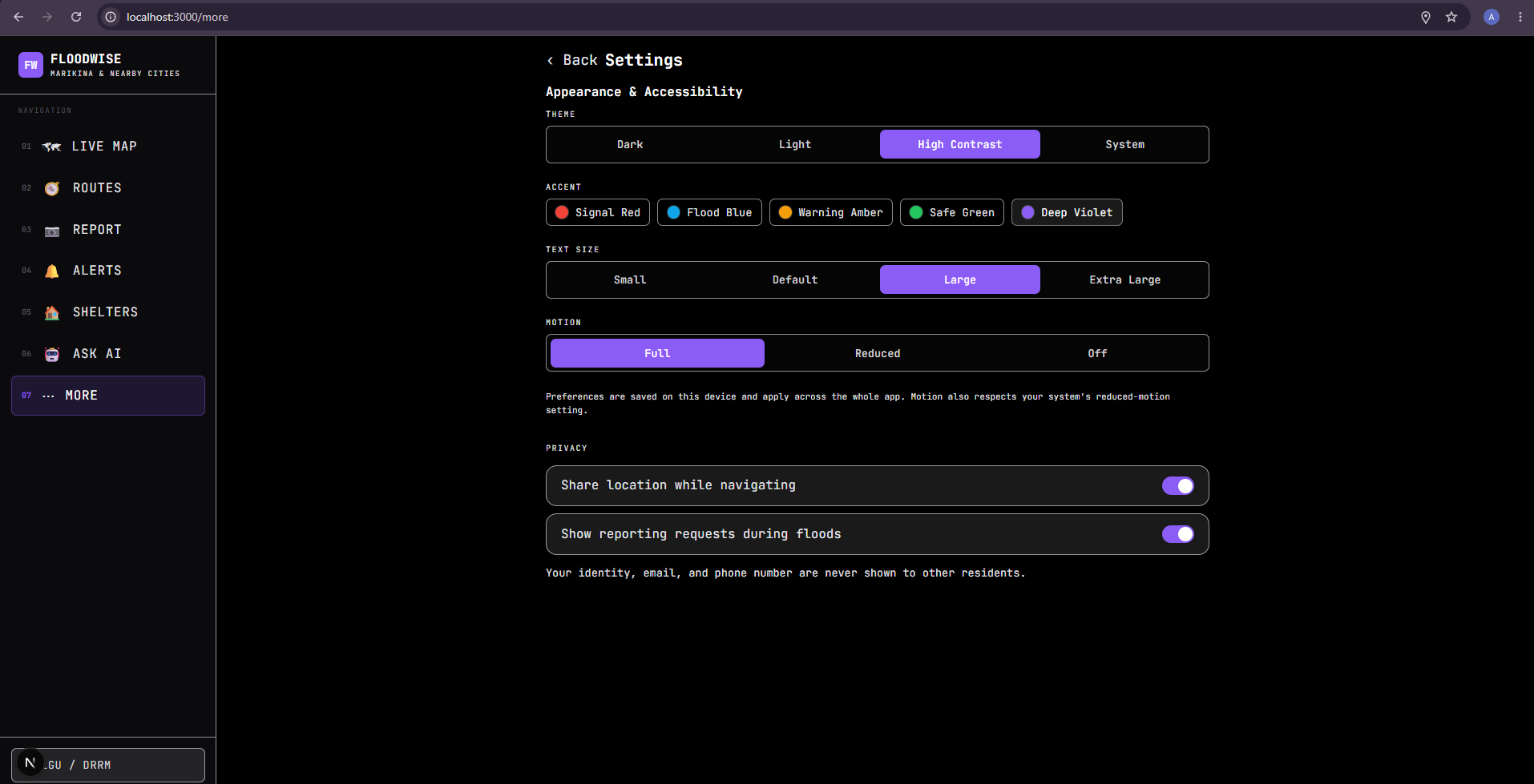
Settings — Allows users to customize theme, colors, text size, motion, and location/privacy settings.
-
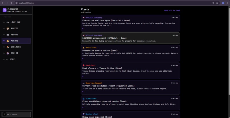
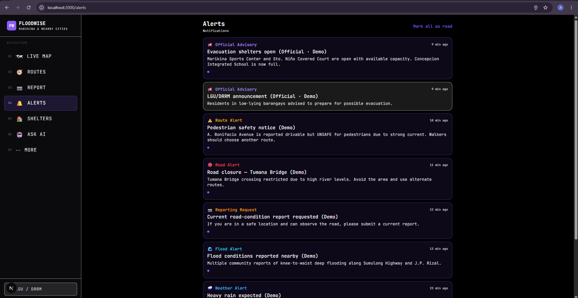
Alerts — Shows official LGU/DRRM alerts and community reports about flooding, road hazards, closures, and evacuations.
-
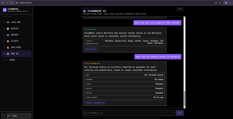
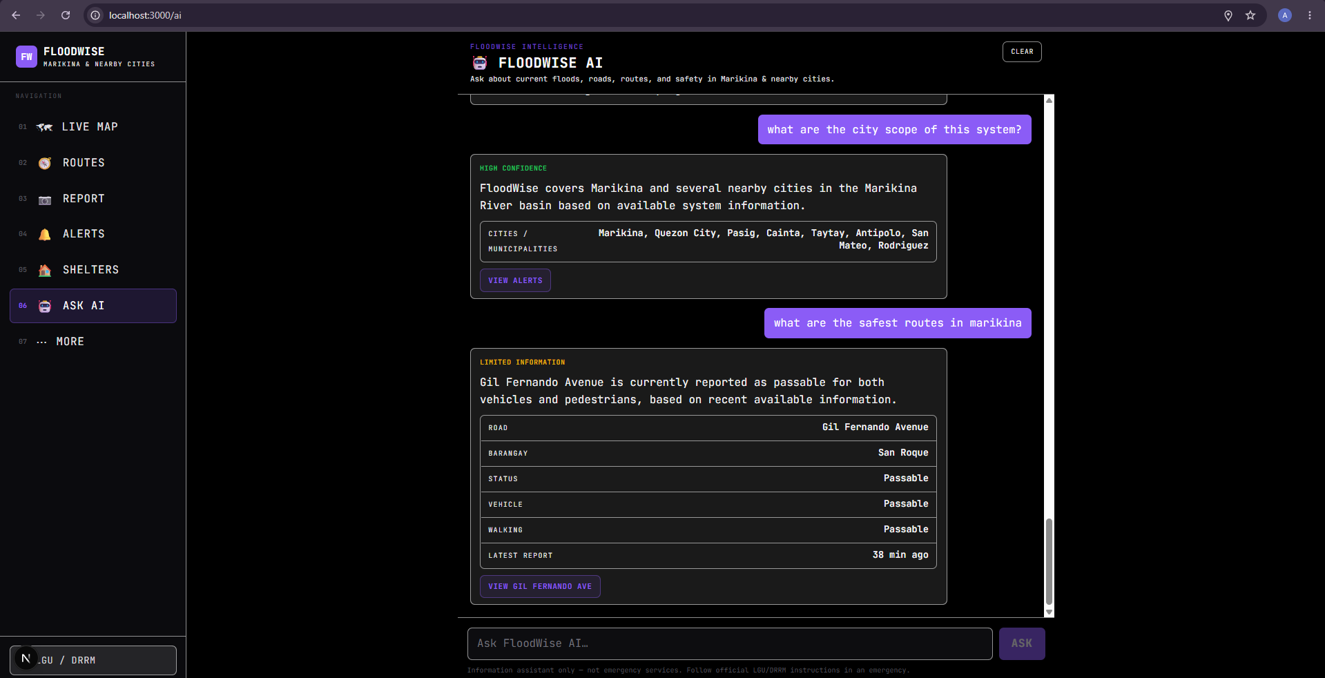
Ask AI — AI assistant answers questions about floods and routes using current FloodWise report data.
-
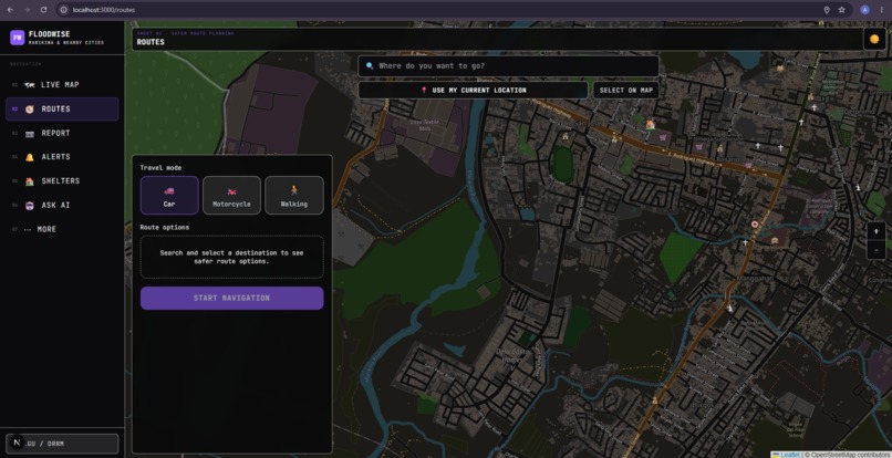
Routes — Allows users to choose travel mode, starting location, destination, and start navigation.
-
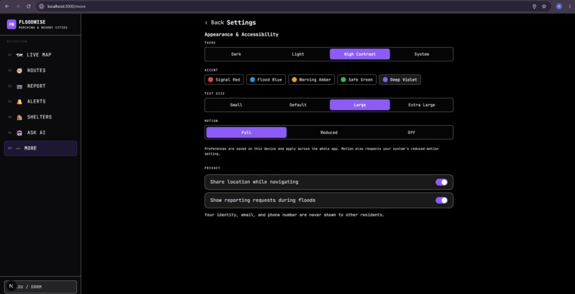
Settings — Allows users to customize theme, colors, text size, motion, and location/privacy settings.

FloodWise — Know the Road Before You Go
Flooding can change a road from passable to dangerous in a matter of minutes.
For people living in flood-prone communities, the question is often not simply "Is it raining?" but:
"Can I actually get through this road right now?"
This is the problem we wanted to solve with FloodWise, a community-powered flood intelligence and safer route navigation system designed specifically for Marikina City, Philippines.
💡 Inspiration
We were inspired by a simple observation: during heavy rain and flooding, information becomes just as important as infrastructure.
Weather applications can tell us that heavy rain is coming, but they usually cannot tell us what is happening on a specific street right now.
A road might be:
- passable by car but unsafe for pedestrians;
- flooded a few minutes ago but already clearing;
- blocked by debris;
- affected by an open manhole or strong current;
- officially closed by authorities; or
- simply unknown because there is no recent information.
We wanted to build something that connects these small, local observations into a bigger picture that can help an entire community.
That led us to one core idea:
If people can safely report what they are seeing, their observations can help other people make better decisions.
🌊 What is FloodWise?
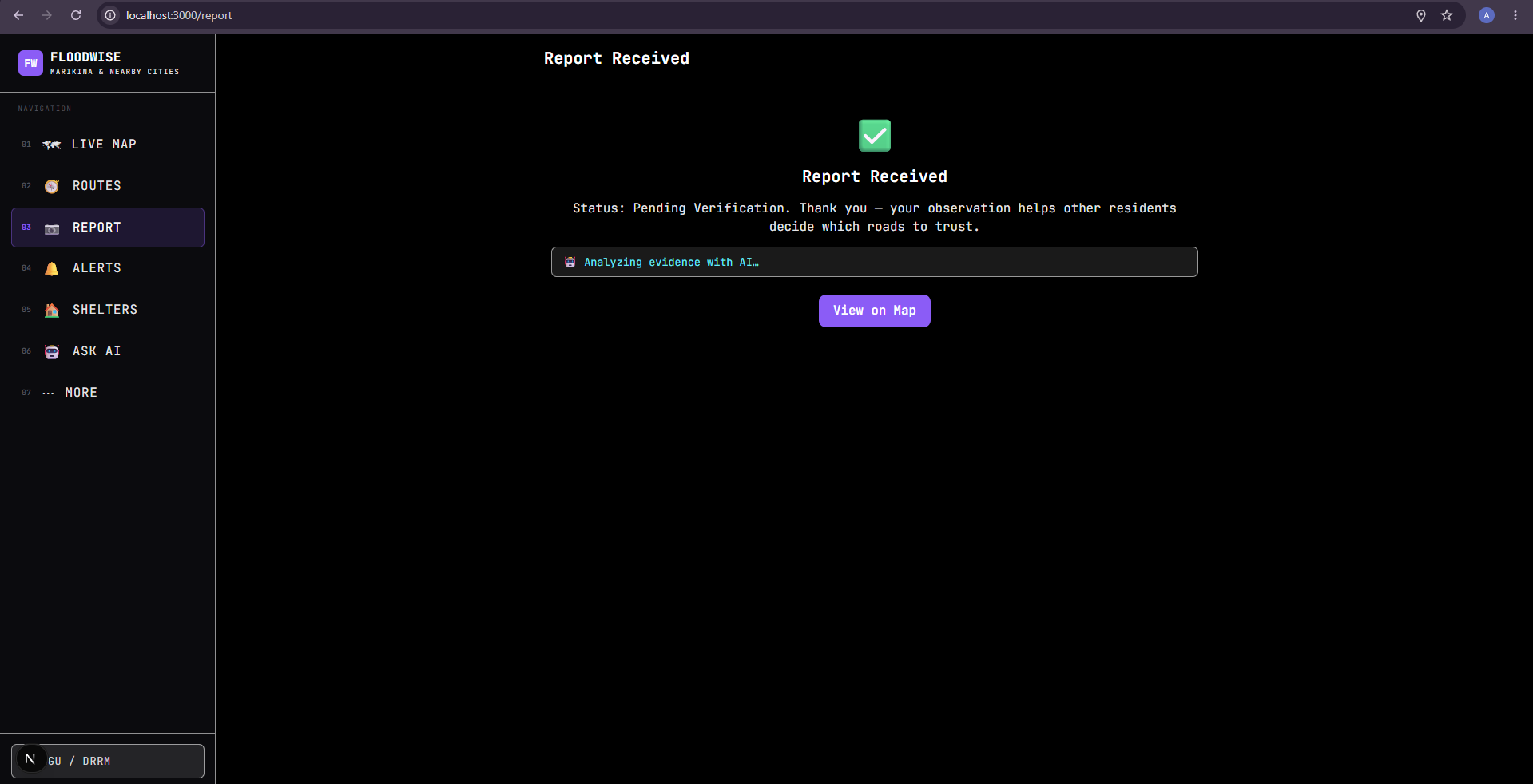
FloodWise combines community reporting, maps, AI-assisted verification, weather information, and flood-aware routing into one system.
Instead of simply showing a flood map, FloodWise creates a continuously changing picture of road conditions based on the most recent available evidence.
The core workflow is:
Observe → Report → Verify → Understand → Route
When flooding is active, users can be asked to provide a current road-condition report.
However, safety comes first.
FloodWise does not ask users to enter floodwater or put themselves in danger just to submit a report. Users are encouraged to report only when they are already in a safe location and can safely observe the surrounding conditions.
A report can include:
- 📍 Current location
- 🚗 Vehicle passability
- 🚶 Pedestrian/walking passability
- 🌊 Flood depth
- ⚠️ Hazards such as debris, strong currents, open manholes, electrical hazards, or damaged roads
- 📷 Optional photo evidence
- 📝 Additional observations
- 🕐 Timestamp
This allows FloodWise to distinguish something that traditional road information often misses:
A road being passable for vehicles does not necessarily mean it is safe for pedestrians.
🗺️ From Reports to Road Intelligence
A single report should not automatically determine whether an entire road is safe.
FloodWise therefore uses multiple layers of evidence:
GPS + timestamp + photo evidence + AI assessment + community confirmation + report freshness + official information
Reports can be:
- Pending
- Verified
- Disputed
- Expired
- Rejected
We also designed a Road Reliability Index (RRI) to communicate how strong and current the available evidence is for a road.
Importantly, the RRI is not a guarantee of physical safety.
Instead, it answers a more responsible question:
"How reliable is the information we currently have about this road?"
Older reports gradually become less influential because flood conditions can change quickly.
🤖 How AI Helps
AI is used as an assistant, not as the final authority.
For example, when a user submits a photo, AI can help determine whether the image appears relevant to the report and identify visible indicators such as:
- flooding
- possible debris
- potential hazards
- image-quality problems
- possible inconsistencies between the report and evidence
The AI produces an assessment with uncertainty rather than simply declaring:
"This road is safe."
This distinction is important to us because an AI model should not be trusted to make a life-or-death decision by itself.
Official LGU/DRRM information and human verification remain authoritative.
🚶 Safer Route Decisions
The information collected by FloodWise becomes useful beyond the map.
Users can enter a destination and select a travel mode:
- 🚗 Car
- 🏍️ Motorcycle
- 🚶 Walking
FloodWise considers current road conditions when evaluating available routes.
For example, if a road has recent evidence indicating that it is not passable, the routing system can avoid it.
For pedestrians, the system uses pedestrian-specific conditions rather than assuming that a vehicle-passable road is also walkable.
Users can compare route options such as:
- Safest — prioritizes roads with stronger/current evidence
- Balanced — balances route condition and travel time
- Fastest — prioritizes travel time while respecting important road restrictions
The system can also explain why a route was recommended.
For example:
"This route avoids a recently reported flooded road and an official road closure."
The goal is not to tell people that a route is guaranteed safe.
Instead, FloodWise helps people make a better-informed decision using the best available current information.
🏛️ Connecting the Community and LGU
FloodWise also includes an LGU/DRRM dashboard.
Authorized personnel can:
- monitor current reports;
- review submitted evidence;
- verify or reject reports;
- identify affected roads and barangays;
- publish official road closures;
- publish official advisories;
- manage evacuation-center information; and
- monitor the overall flood situation.
An official road closure can directly affect the public map and routing system.
This creates a two-way information system:
Community → LGU
Current observations can help authorities understand what is happening on the ground.
LGU → Community
Official closures and advisories can immediately reach residents using FloodWise.
🔐 Fighting Misinformation
One of the biggest challenges we identified was misinformation.
A crowdsourced flood system could become dangerous if anyone could submit false information without consequences.
Instead of relying on a single "true/false" mechanism, FloodWise uses layered verification.
Reports can be supported or challenged by other users, evaluated for freshness, assessed with optional AI assistance, and reviewed by authorized LGU/DRRM personnel when necessary.
We also designed the system so that users are asked to agree to reporting guidelines before contributing.
The goal isn't to create a system that claims to know everything.
The goal is to make uncertainty visible.
Instead of saying:
"This road is definitely safe."
FloodWise can say:
"No recent reliable report is available."
or:
"This road has conflicting recent reports."
We believe communicating uncertainty is much safer than creating false confidence.
🛠️ How We Built It
FloodWise is designed as a location-aware web/mobile system with several interconnected components.
Frontend
The interface provides:
- interactive flood maps;
- road-condition overlays;
- report submission;
- route selection;
- alerts;
- evacuation-center information; and
- an LGU/DRRM monitoring dashboard.
Mapping
We designed the system around open geographic data and interactive map technologies so that the project can display:
- roads;
- flood reports;
- hazards;
- road conditions;
- shelters; and
- closures.
Backend
The backend manages:
- user accounts;
- reports;
- road conditions;
- verification;
- alerts;
- shelters;
- official closures;
- advisories; and
- routing logic.
AI
The AI layer assists with evidence assessment and report analysis while keeping final decisions outside of the model.
Routing
A routing engine generates candidate routes, after which FloodWise evaluates those routes using its own flood-condition and road-reliability information.
This separation allows ordinary navigation logic and flood-specific intelligence to work together.
🧠 What We Learned
One of the biggest things we learned was that building a disaster-response application is very different from building an ordinary application.
Normally, an application can tolerate a little uncertainty.
In a flood-response system, incorrect information can have real consequences.
That changed how we approached the entire design.
We learned to think about:
- data freshness;
- uncertainty;
- misinformation;
- human verification;
- privacy;
- location accuracy;
- pedestrian safety;
- official authority;
- AI limitations; and
- failure scenarios.
We also learned that "unknown" is an important state.
If we do not have enough reliable information about a road, the system should not automatically assume that the road is safe.
🚧 Challenges
1. Keeping community reports trustworthy
Crowdsourcing creates a difficult balance: more reports provide more information, but false or outdated reports can also cause harm.
We addressed this through timestamps, report freshness, community confirmation, evidence, AI-assisted assessment, and LGU review.
2. Designing AI responsibly
It was tempting to make AI the "judge" of whether a report was real.
But that would create a dangerous single point of failure.
Instead, we designed AI as an evidence-assistance layer that communicates uncertainty and can flag reports for further review.
3. Routing during rapidly changing conditions
Traditional navigation focuses primarily on roads and travel time.
FloodWise needs to consider another dimension:
current road condition.
This required us to think about how community observations can be connected to actual road segments and then incorporated into route selection.
4. Pedestrian safety
We realized that simply saying "passable" was not enough.
A road might still allow vehicles through while being extremely difficult or dangerous for someone walking.
That is why FloodWise treats vehicle passability and pedestrian passability as separate pieces of information.
5. Balancing ambition with a realistic MVP
There are countless features that could be added to a disaster-response platform.
We decided to focus our MVP around one complete loop:
Report → Verify → Update Road → Change Route
If we can make that loop reliable, the foundation can eventually support much larger capabilities.
❤️ Why FloodWise Matters
FloodWise is more than a flood map. It is an attempt to turn local observations into community intelligence.
One person's observation can help another person avoid a flooded road.
Multiple observations can reveal a developing situation.
Official information can validate or override community information.
And the resulting road intelligence can help someone choose a better route.
Our vision is simple:
Know what is happening. Know how reliable the information is. Know which roads are affected. Then make a better decision.
For our first deployment, we are focusing on Marikina City.
But the long-term vision is to create a model that could eventually help other flood-prone communities make better-informed decisions when conditions change faster than traditional maps can.
Built With
- ai
- api
- artificial
- computer
- geojson
- gps
- intelligence
- javascript
- leaflet.js
- next.js
- node.js
- openstreetmap
- postgis
- postgresql
- react
- responsive
- rest
- routing
- typescript
- vision
- weather
- web


Log in or sign up for Devpost to join the conversation.