-
-
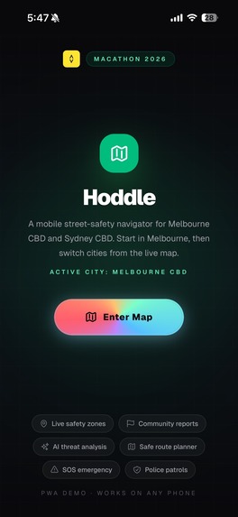
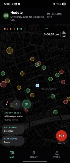
Landing Page
-
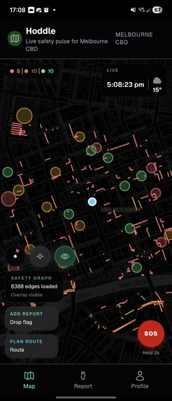
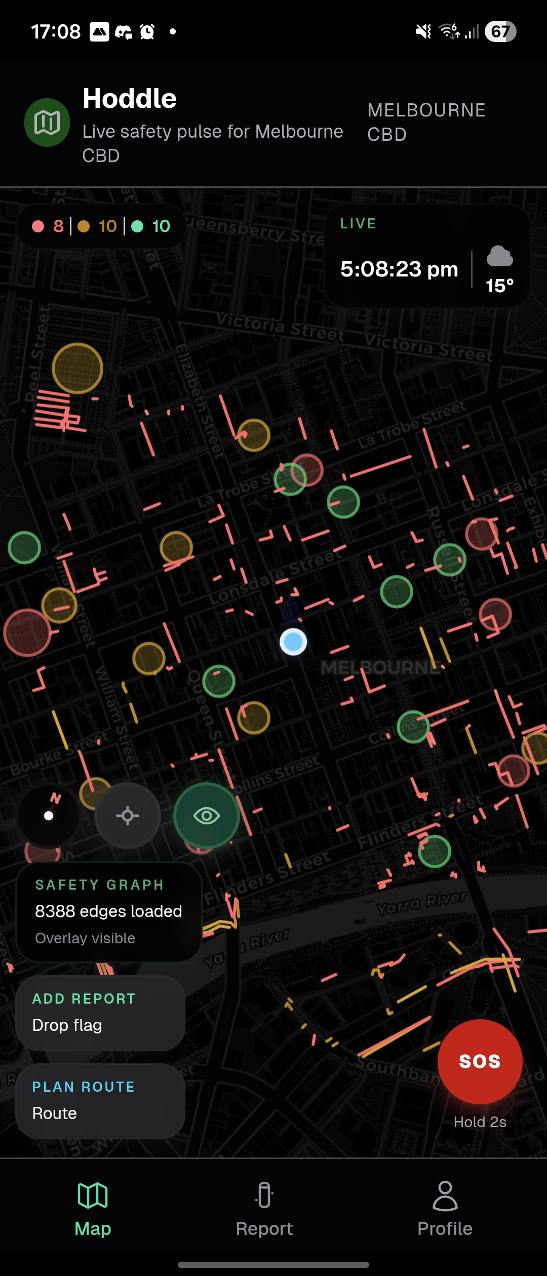
Map Zoomed Out
-
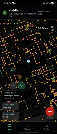
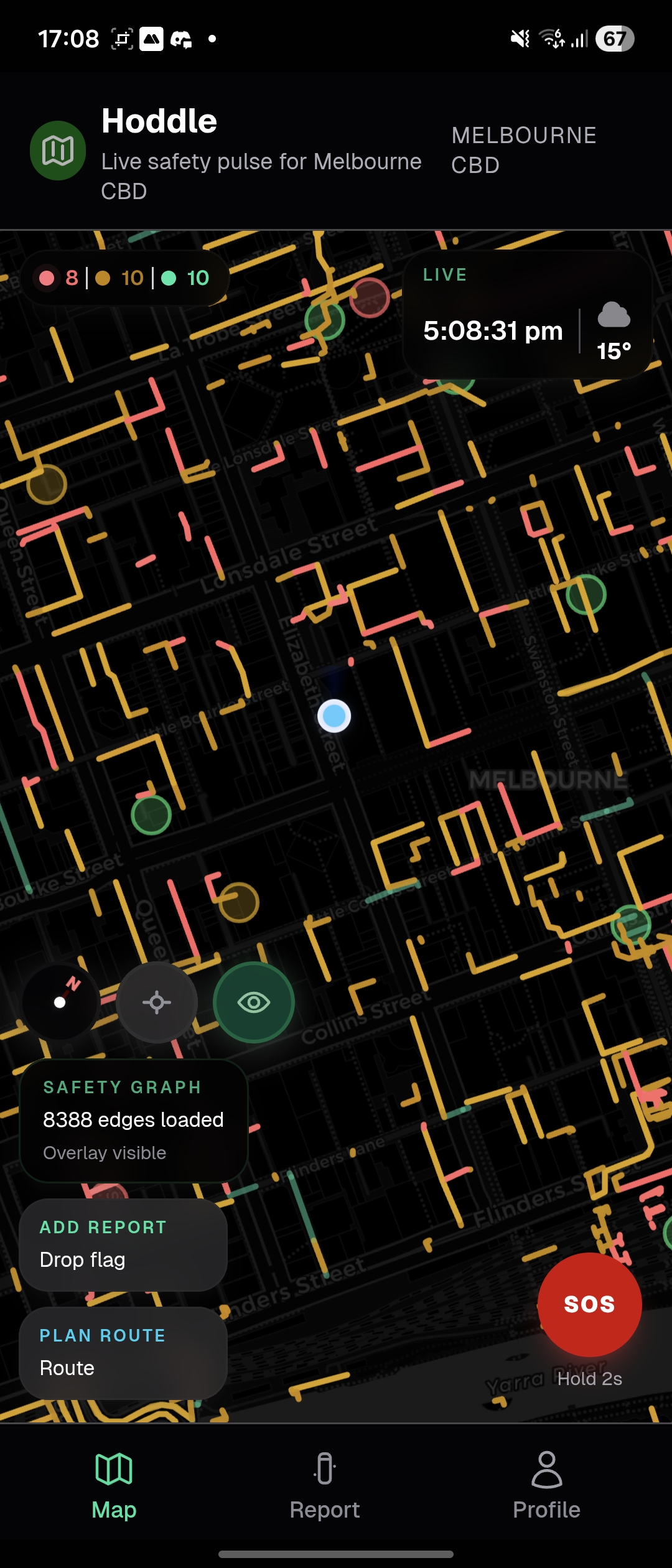
Map Intermediate Zoom
-
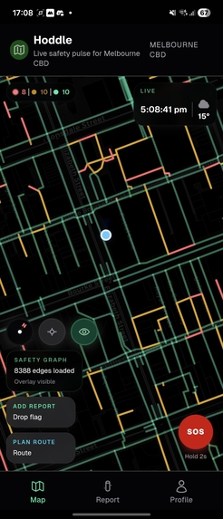
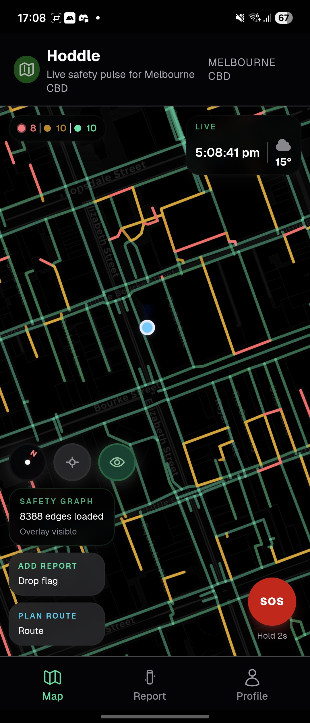
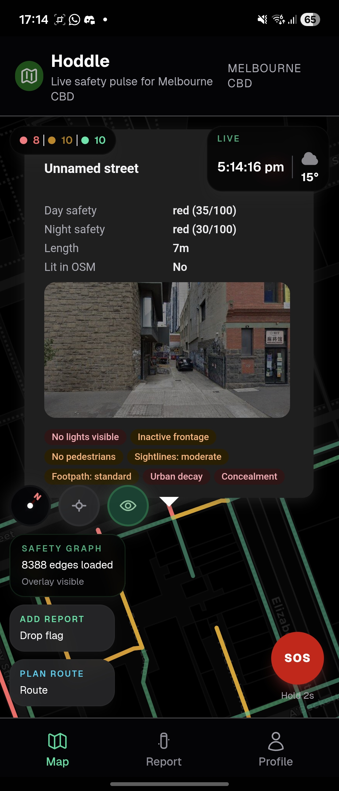
Map Close Zoom
-
Map Landmarks Only
-
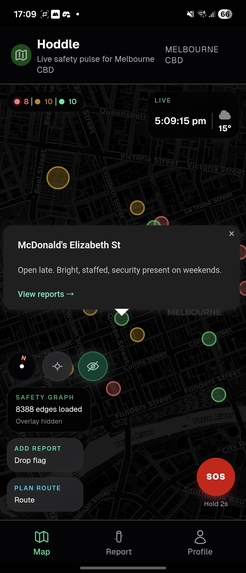
Safe Zone on Map
-
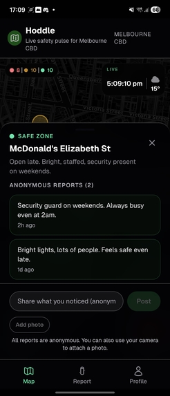
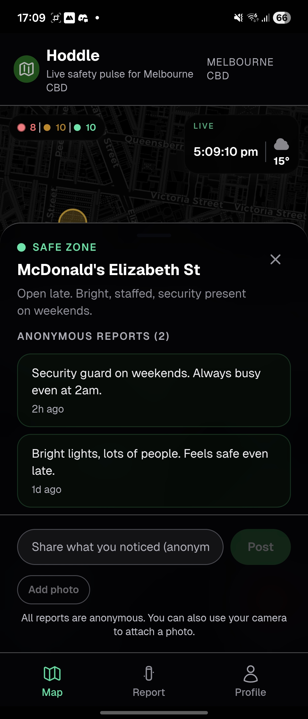
Safe Zone Description
-
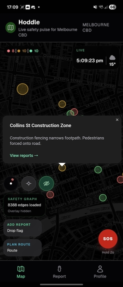
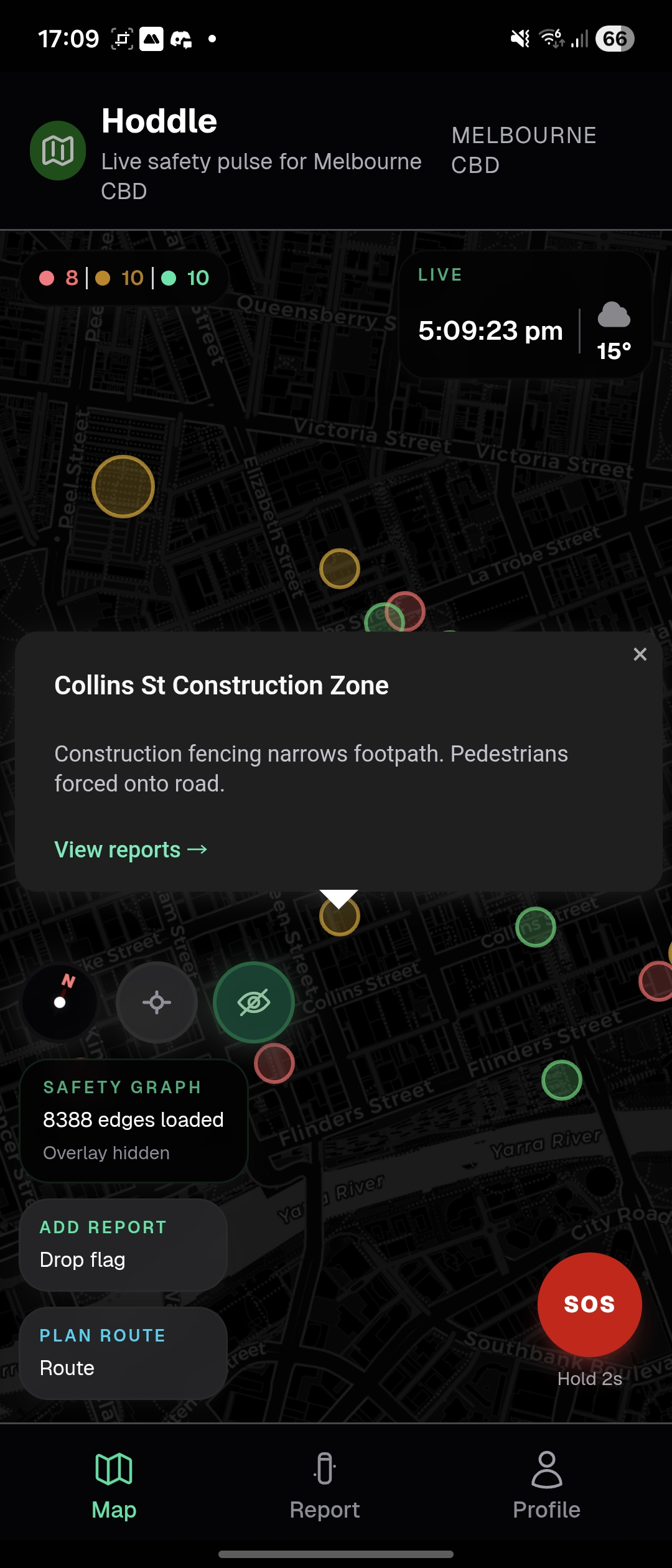
Caution Zone on Map
-
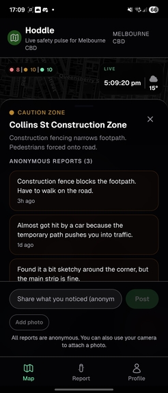
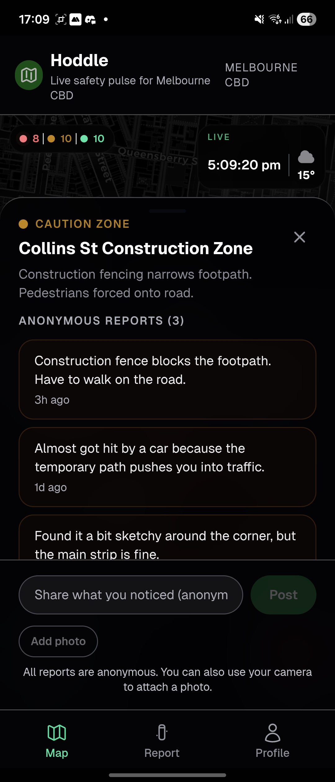
Caution Zone Description
-

Danger Zone on Map
-
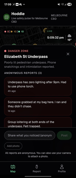
Danger Zone Description
-
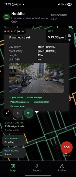
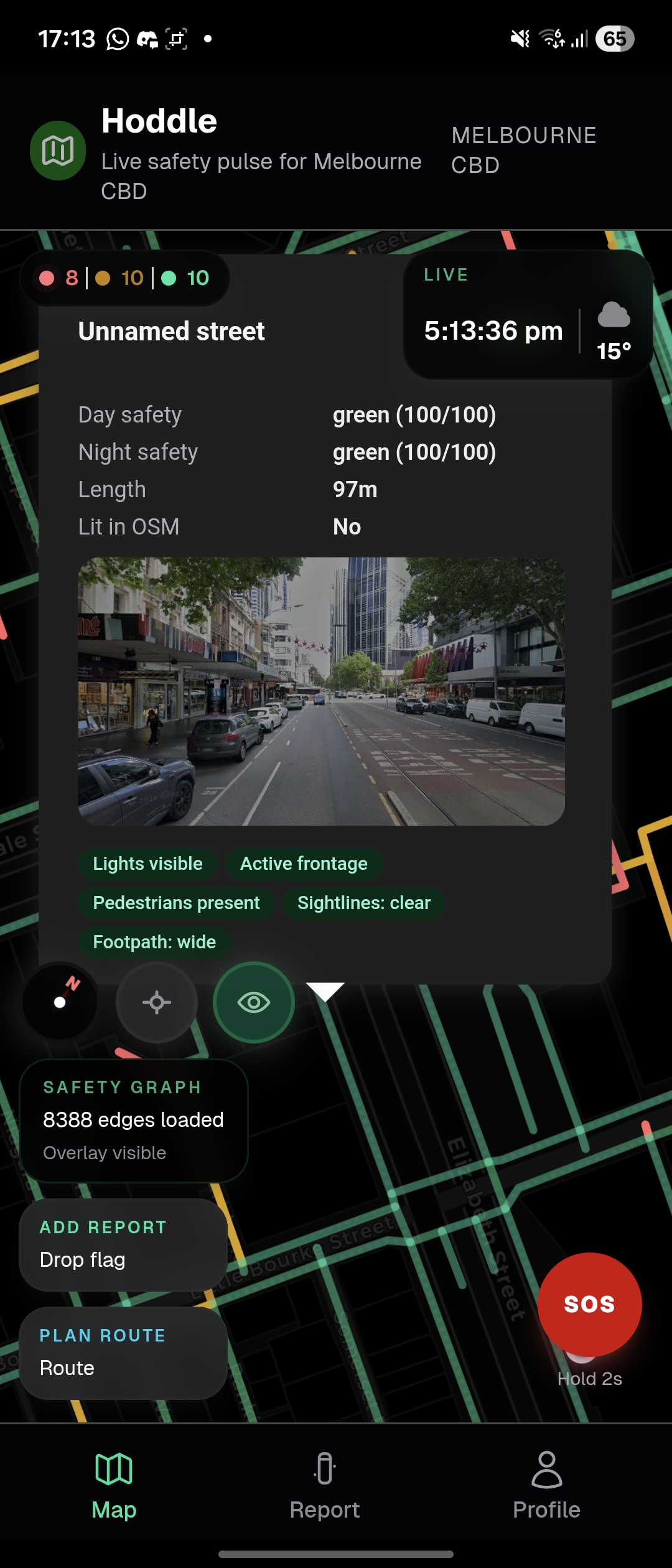
Safe Zone Street View
-

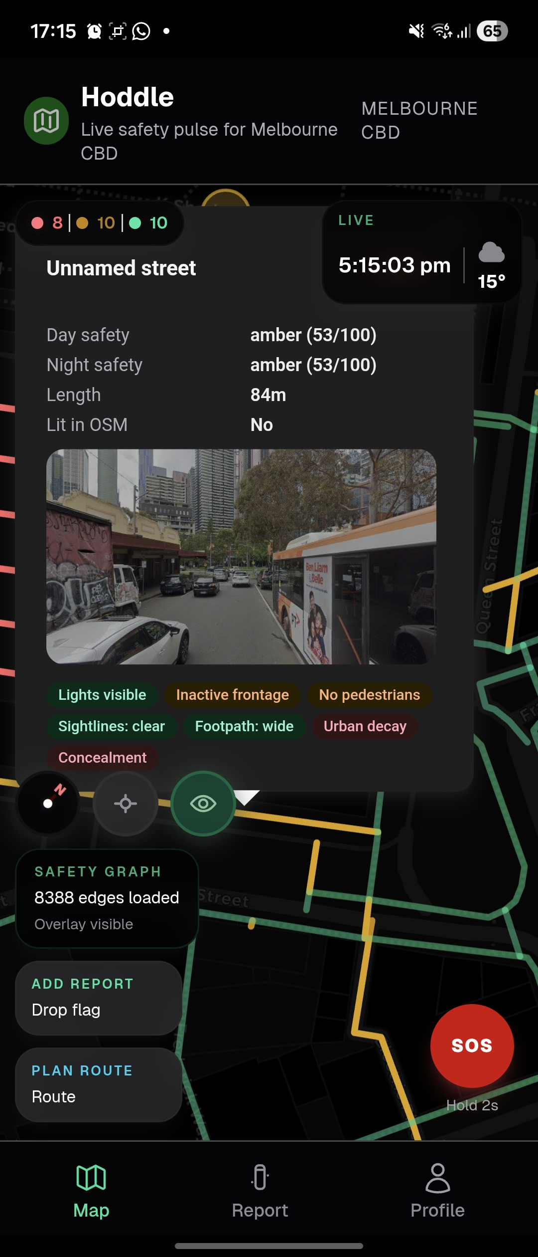
Caution Zone Street View
-
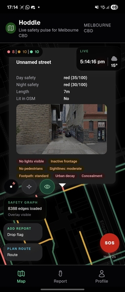
Danger Zone Street View
-
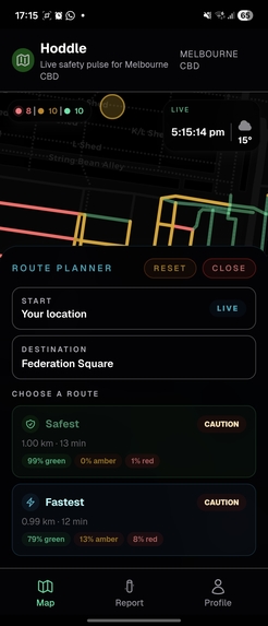
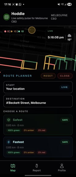
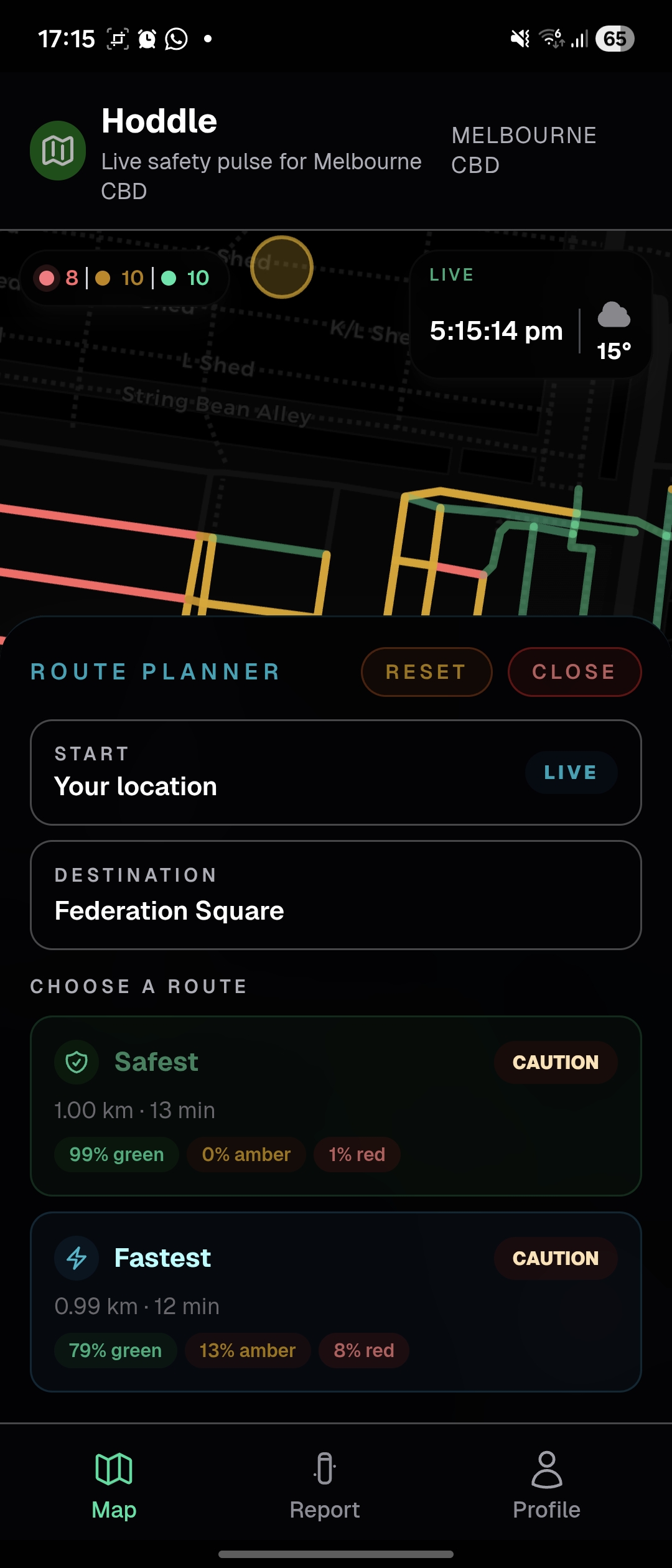
Route Options, Safest vs Fastest
-
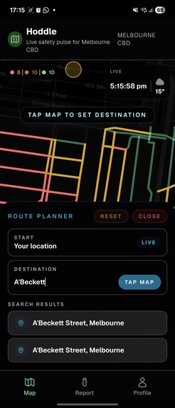
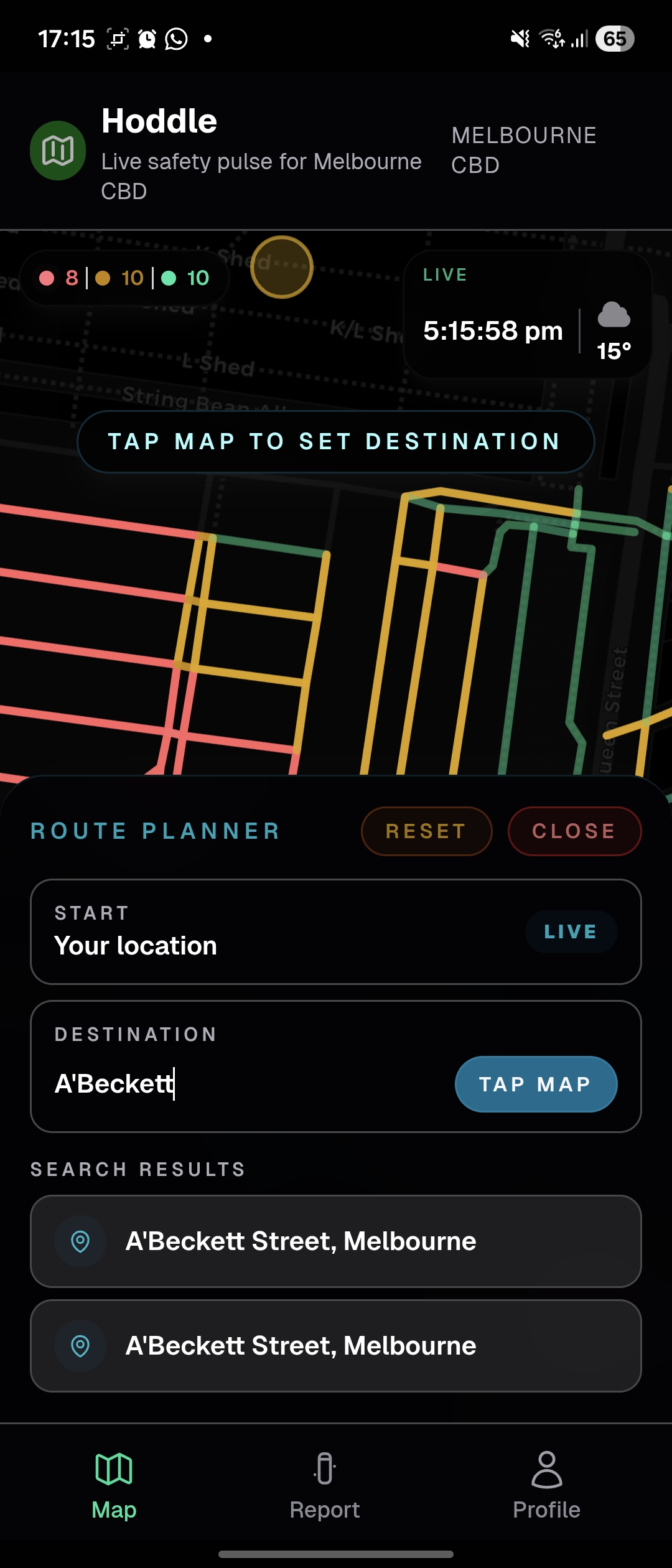
Route Search
-
Route Search Options
-
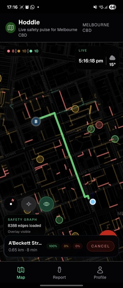
Final Map Route


Inspiration
Reports of theft and public safety are at a 20-year peak in Victoria - only 32% of people feel safe using public transport at night. Stopping crime takes increased security, better public lighting and other programs. These solutions are cost both money and time. But criminal or unsafe areas could be avoided, if people had access to maps that prioritised safety over time.
What it does
Our app, Hoddle, is a navigation layer prioritising environmental safety for pedestrians and transit users in Melbourne's CBD. Instead of routing users down unlit alleyways to save time, Hoddle analyses street-level safety to find the brightest or safest path. If a walking route becomes too isolated at night, our system dynamically routes users to the places that are well-lit or known to be popular.
How we built it
We generated a street network graph of the walkways in Melbourne CBD using OpenStreetMap. For each street segment, our pipeline pulls Google Street View images and feeds them into a Vision Language Model. The VLM assigns a "Safety Score" based on common safety factors such as lighting, sightlines and others. We also layered ambient activity data, looking at nearby amenities and common active hours. Our engine then finally calculates the safer routes using safety-weighted costs.
Challenges we ran into
In our planning phase, we ran into challenges considering the ethical aspects of the project - should unverified people be allowed to post safe zones? How would an identification of a danger zone affect businesses or community events nearby? Our next challenge was getting relevant images of the street from Google Street View. Certain Images have low relevance but add detail to the area. The final challenge was trying to sync and scrape real life news incidents to add as a further layer to our safe zones. However, we received news articles and events that were either outdated or not relevant to our project. Hence we decided to scrap this feature.
Accomplishments that we're proud of
Real time tracking and location services - we actually used our app to navigate from X to Y in the CBD. We avoided a secluded alleyway that google maps showed, and took a slightly longer but more crowded and popular roads. Our UI is modern, clean and informative, allowing not only pedestrians and travelers to feel safe but also gives authorities the option to prioritise their monitoring to certain areas.
What we learned
We learned how to use complex geospatial data and bridge the gap between qualitative AI image analysis and quantitative routing algorithms. Most importantly, we discovered that historical crime statistics are lagging indicators. We think that environmental design—like lighting and sightlines—is a much faster, accurate predictor of a pedestrian's actual vulnerability.
What's next for Hoddle
We would like to implement a dynamic SOS feature - if users are stationary in an unsafe area or deviate extremely from the path, the app notifies their Emergency Contact with their location data in order to ensure a quick response. We would also like to sync a pedestrian's walking ETA with live PTV timetables to minimize stationary wait times in dark areas - a major concern for public safety at night.


Log in or sign up for Devpost to join the conversation.