-
-
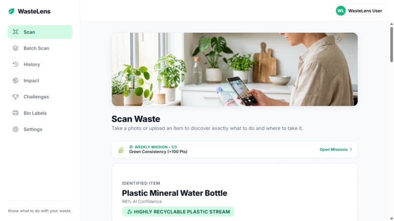
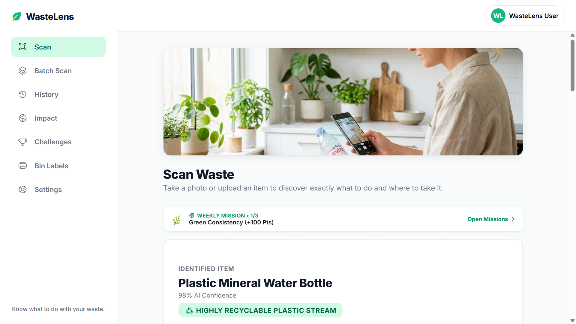
Scan Waste
-
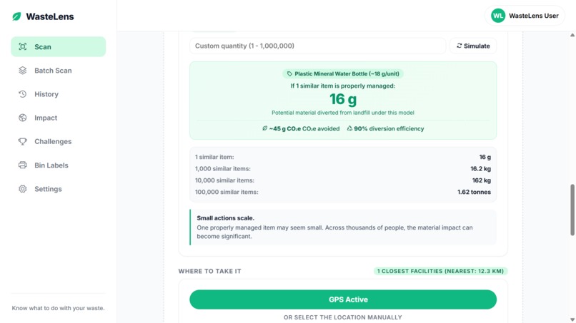
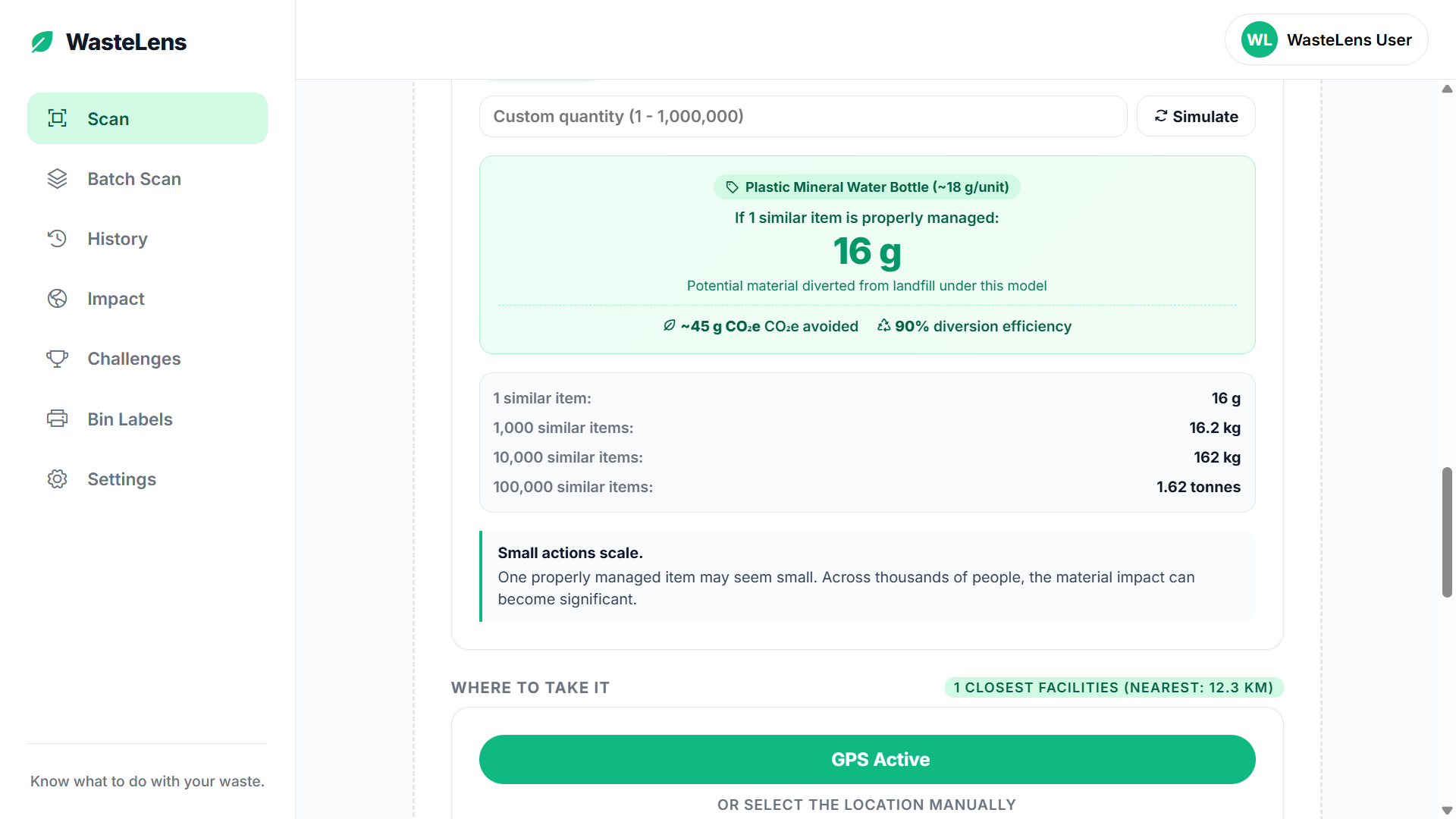
Impact Simulator
-
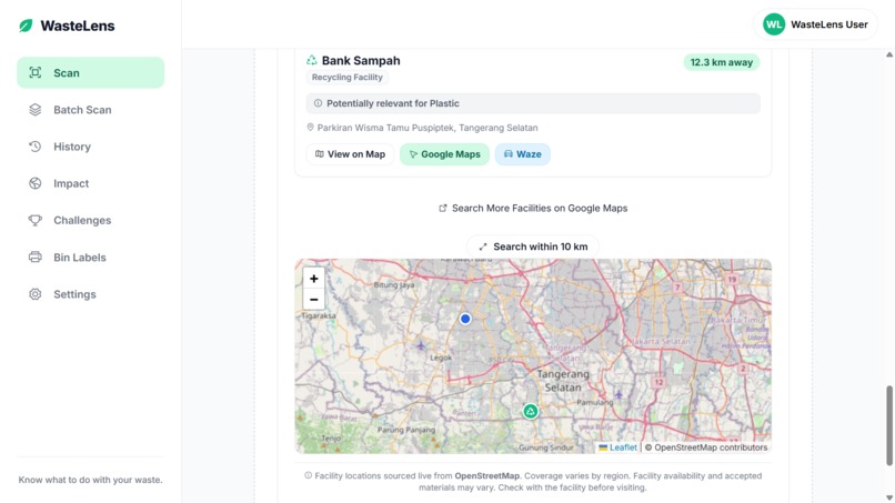
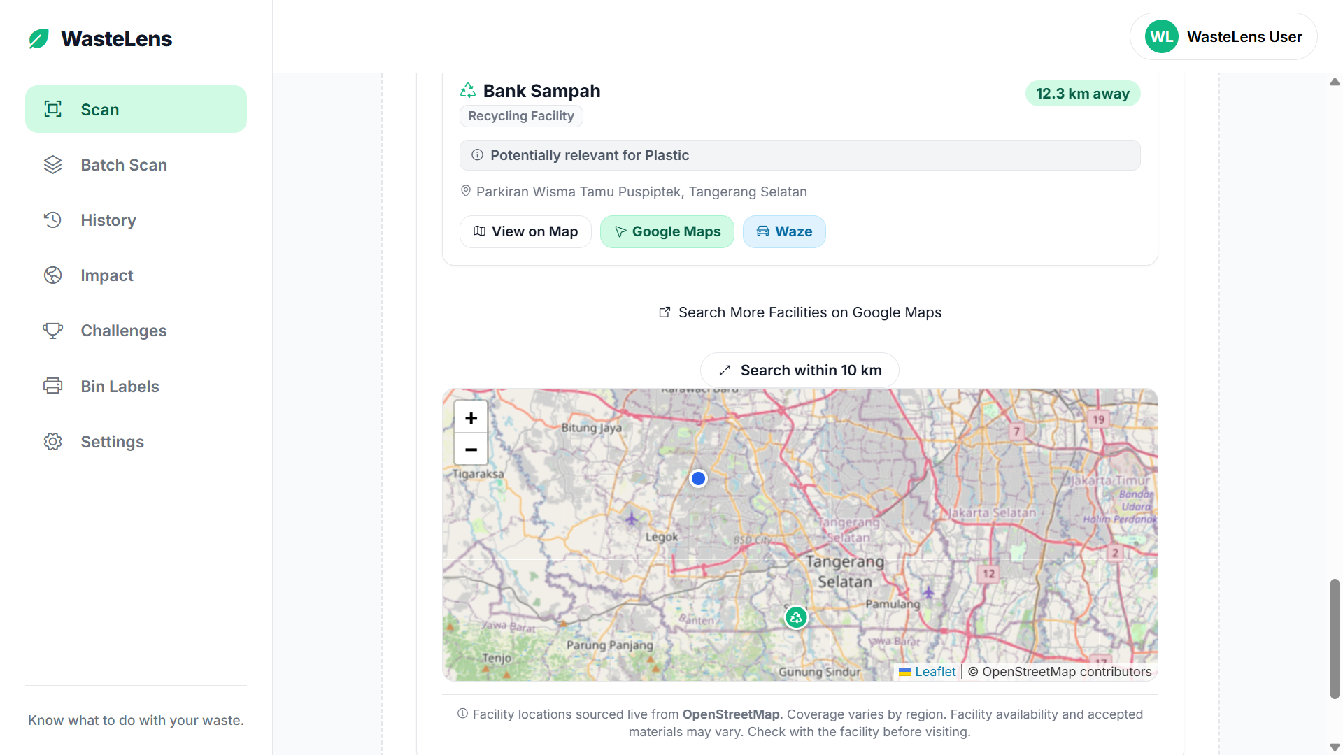
Find Waste Banks
-
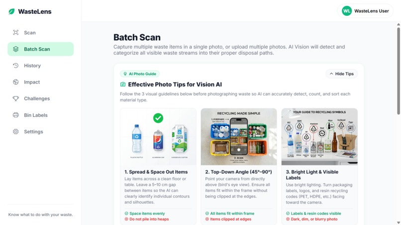
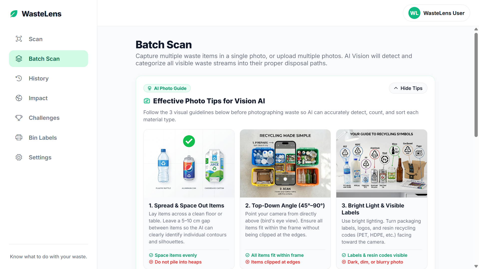
Batch Scan
-
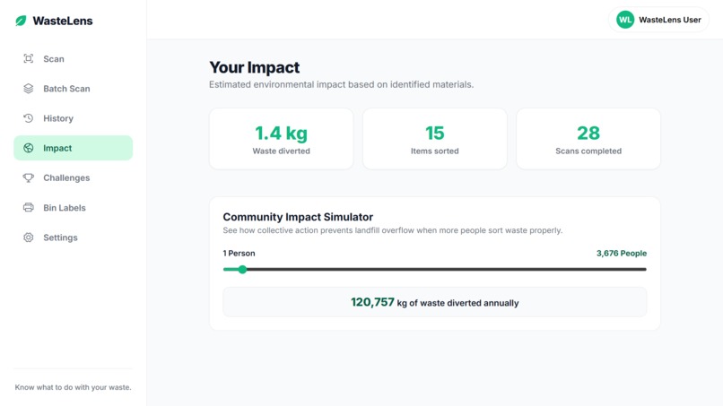
Your Impact
-
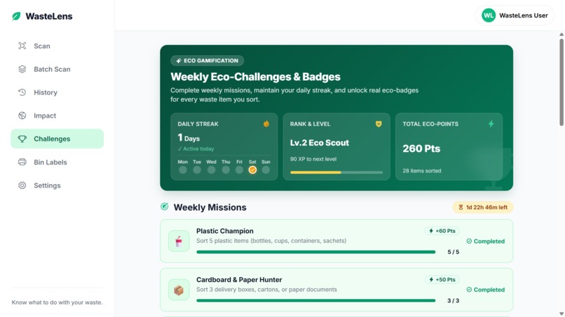
Weekly Eco-Challenges & Badges
-
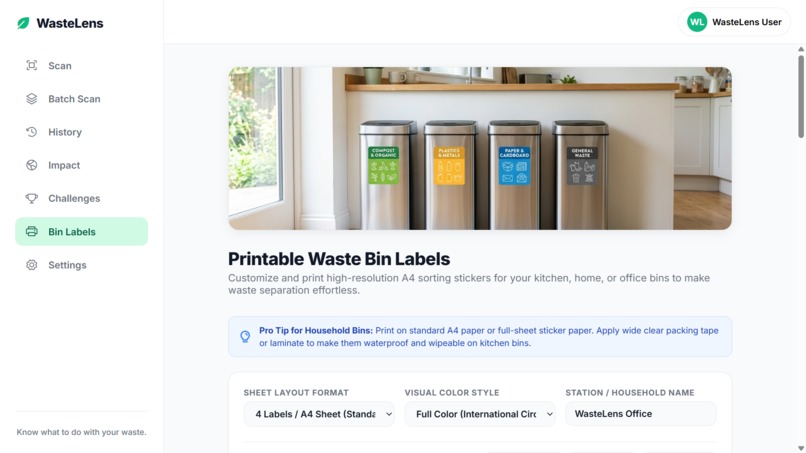
Printable Waste Bin Labels
-
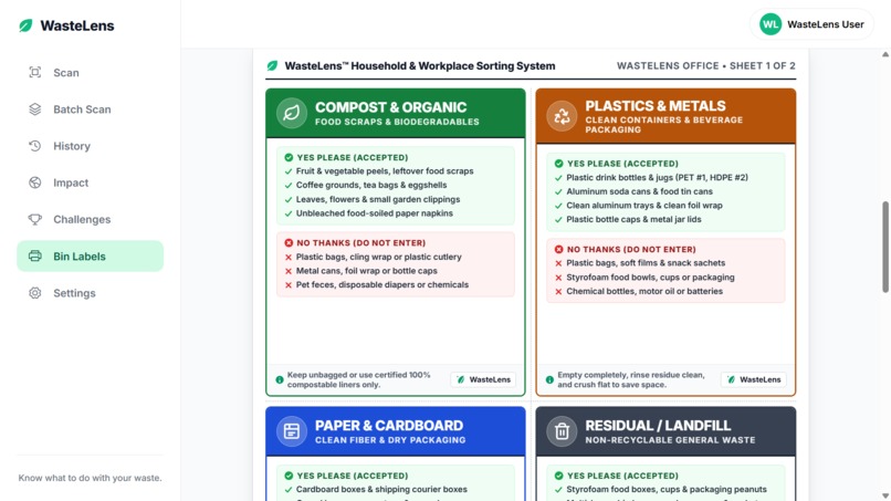
The Resulting Label
Inspiration
“The world doesn’t have a recycling problem — it has a sorting problem.”
Every day, recyclable materials and harmful waste end up in landfills because people simply don't know what to do with them.
People often ask:
- “Can I recycle this?” - “How should I prepare it?” - “Where should I take it?”
This becomes even harder for items like e-waste, batteries, expired medicine, and used cooking oil, which often need special drop-off points.
We wanted to make this process much easier.
That's why we created WasteLens — a tool that helps people identify their waste, prepare it correctly, find the right place to take it, and understand their impact.
Our goal is simple: turn recycling from a confusing task into an easy everyday action.
What it does
WasteLens connects AI, recycling locations, and community action in one platform.
AI Waste Scanner
Users can take a photo or upload an image of their waste.
In seconds, WasteLens identifies the material, checks if it can be recycled, and gives simple preparation instructions — such as rinsing, removing parts, or keeping materials separate.
Find the Right Drop-Off Location
WasteLens uses GPS and OpenStreetMap to find nearby waste banks, recycling centers, and other collection points.
To display more complete and nearby waste banks registered on Google Maps, you can press Search More Facilities on Google Maps so users can see many more nearby waste banks from their location.
Batch Scan
Users can scan multiple items in one session.
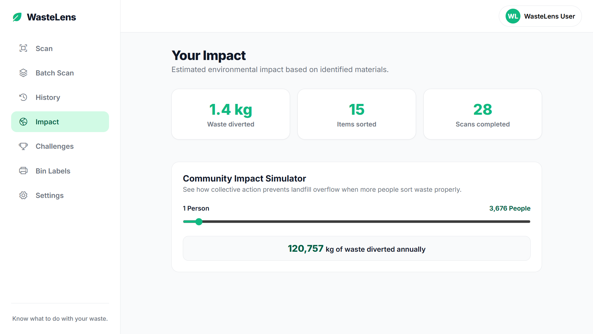
This is useful for homes, offices, schools, and community cleanups, while also showing the total amount of waste that could be diverted from landfills.
Impact Simulator
WasteLens tracks how much waste each user diverts.
The Community Impact Simulator then shows how small actions can grow into a much bigger impact when hundreds or thousands of people participate.
Printable Bin Labels
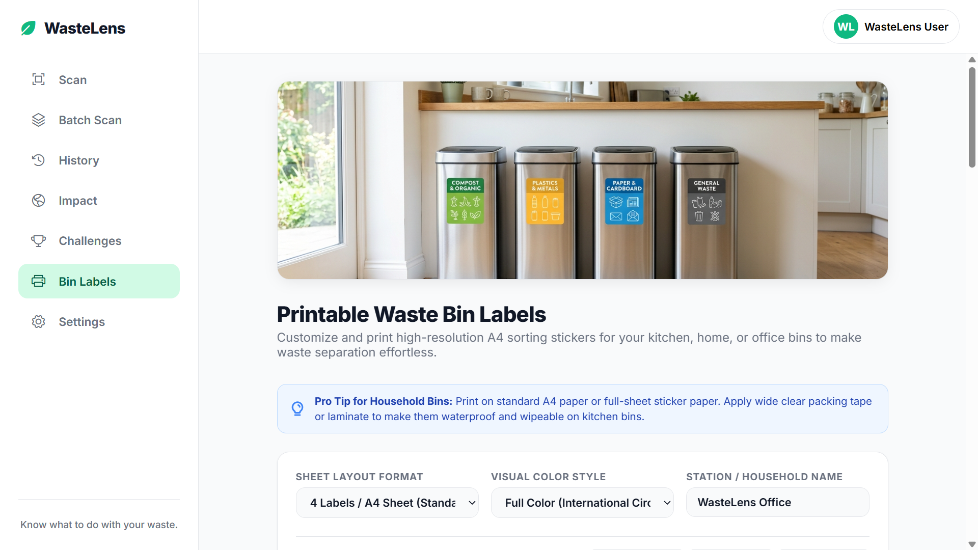
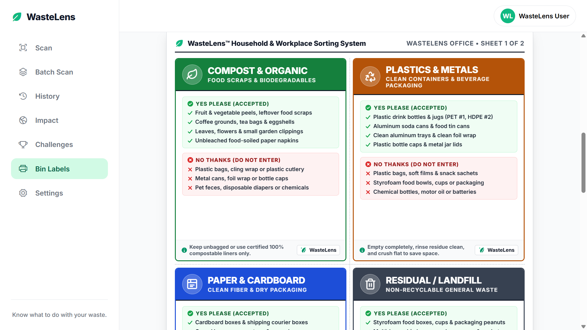
WasteLens can create clear labels for Organic, Recyclable, Hazardous, and Residual waste.
Users can download and print them for schools, offices, cafes, and communities, helping people sort waste correctly at the source.
Challenges & History
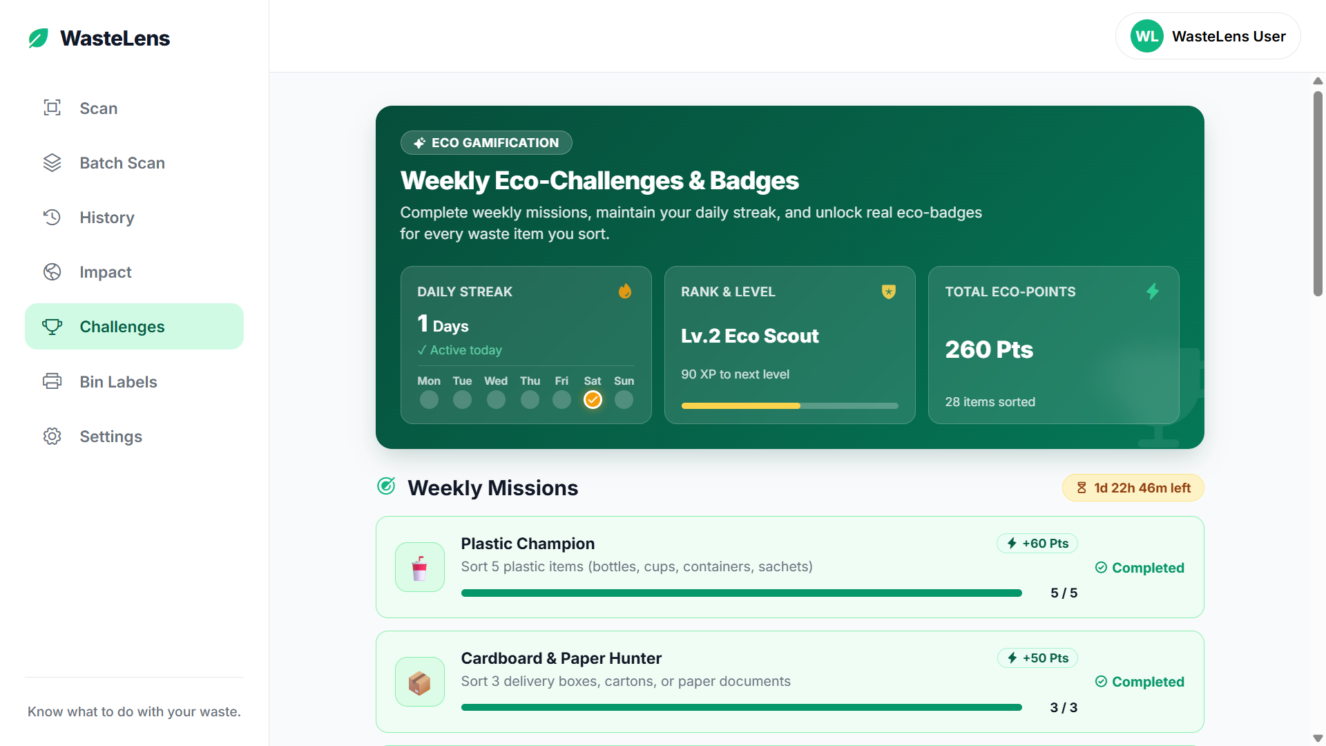
Users can earn XP, badges, and streaks to build better habits.
The History section keeps track of their previous scans and environmental progress.
How i built it
WasteLens combines AI, web technology, and open-source mapping.
- Groq Cloud + Qwen power the AI image analysis. - TypeScript/JavaScript and responsive CSS power the web interface. - Leaflet, OpenStreetMap, Nominatim, and Overpass API provide location and map data. - HTML5 Geolocation finds the user's location. - A Vercel Serverless Function securely handles AI requests and protects the API key.
- The application is deployed on Vercel for both mobile and desktop use.
Challenges i ran into
- Making AI Fast Enough
People won't want to wait several seconds while standing next to a trash bin.
My first approach took more than 6 seconds to process an image. I optimized the AI pipeline and used Groq's fast inference to bring the response time down to around 3 seconds.
- Finding the Right Local Information
Recycling systems are different from one city to another.
Instead of hardcoding locations, I built a system that uses the user's GPS location to understand their city and find more relevant recycling options.
- Bringing WasteLens Into the Real World
I didn't want WasteLens to be just another app on a phone.
This led to the Printable Bin Labels feature, allowing users to take what they create in the app and use it directly on real trash bins.
Accomplishments that i'm proud of
- ✨ A Real Working System
WasteLens is more than a UI prototype.
It uses real AI image analysis, real GPS data, real OpenStreetMap data, and real facility searches in one working system.
- 🌍 Showing the Power of Collective Action
The Community Impact Simulator helps users understand how a small personal action can become a much bigger community impact.
- 🎯 Simple User Experience
I focused on making WasteLens easy to understand.
I designed a UI/UX layout that is simple and intuitive for everyday users, making the website easy to use both on mobile and desktop.
What i learned
- Working with AI Vision
I learned how to design prompts and structure AI responses so that image analysis can return useful and consistent waste information.
- ♻️ Understanding Waste Contamination
I learned that small mistakes, such as leaving food or grease inside a container, can affect the recycling process.
This showed me why telling people how to prepare waste can be just as important as identifying the item.
- 🗺️ Using Open Mapping Data
I learned how tools like OpenStreetMap can be used to build useful location-based applications without relying completely on expensive mapping services.
What's next for WasteLens
- 💰 Waste-to-Cash
Add local recycling prices so users can see the potential value of materials like PET, cardboard, and aluminum at nearby waste banks.
- 🚛 Smart Collection Schedules
Connect WasteLens with local waste management services so users can see when different types of waste will be collected in their area.
- 🗣️ Voice Guidance
Add voice instructions in multiple languages to make WasteLens easier to use for children, seniors, and workers who may have difficulty reading.
- 🏫 Community Leaderboards
Allow schools, campuses, and neighborhoods to track their collective waste diversion and compete in friendly zero-waste challenges.
- 🧹 Community Cleanup Event
Organizing cleanup events in local neighborhoods by inviting residents, universities, and youth to participate in location-based community cleanup activities.
The long-term goal is simple: make waste easier to understand, easier to sort, and easier to turn into a resource.
Built With
- css3
- groq
- html5-geolocation
- javascript
- leaflet.js
- openstreetmap
- overpass-openstreetmap
- qwen
- serverless
- svg-canvas
- typescript
- vercel

Log in or sign up for Devpost to join the conversation.