Inspiration
Coming from UCF to Shellhacks, one wrong turn sparked disaster. When we unknowingly took the ramp onto the Florida turnpike in the wrong lane, we found an entire hour tacked onto our already four-hour long commute time, needing to drive 40 miles in both directions to get back on track. We wanted to build a system to avoid problems like this in the future.
What it does
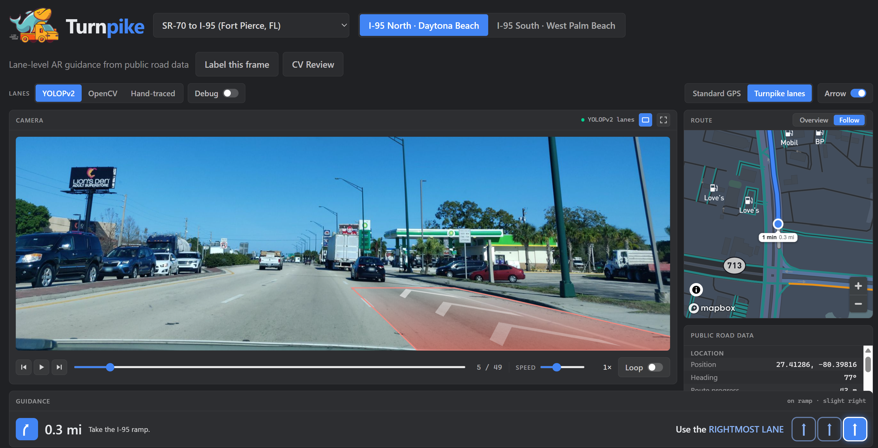
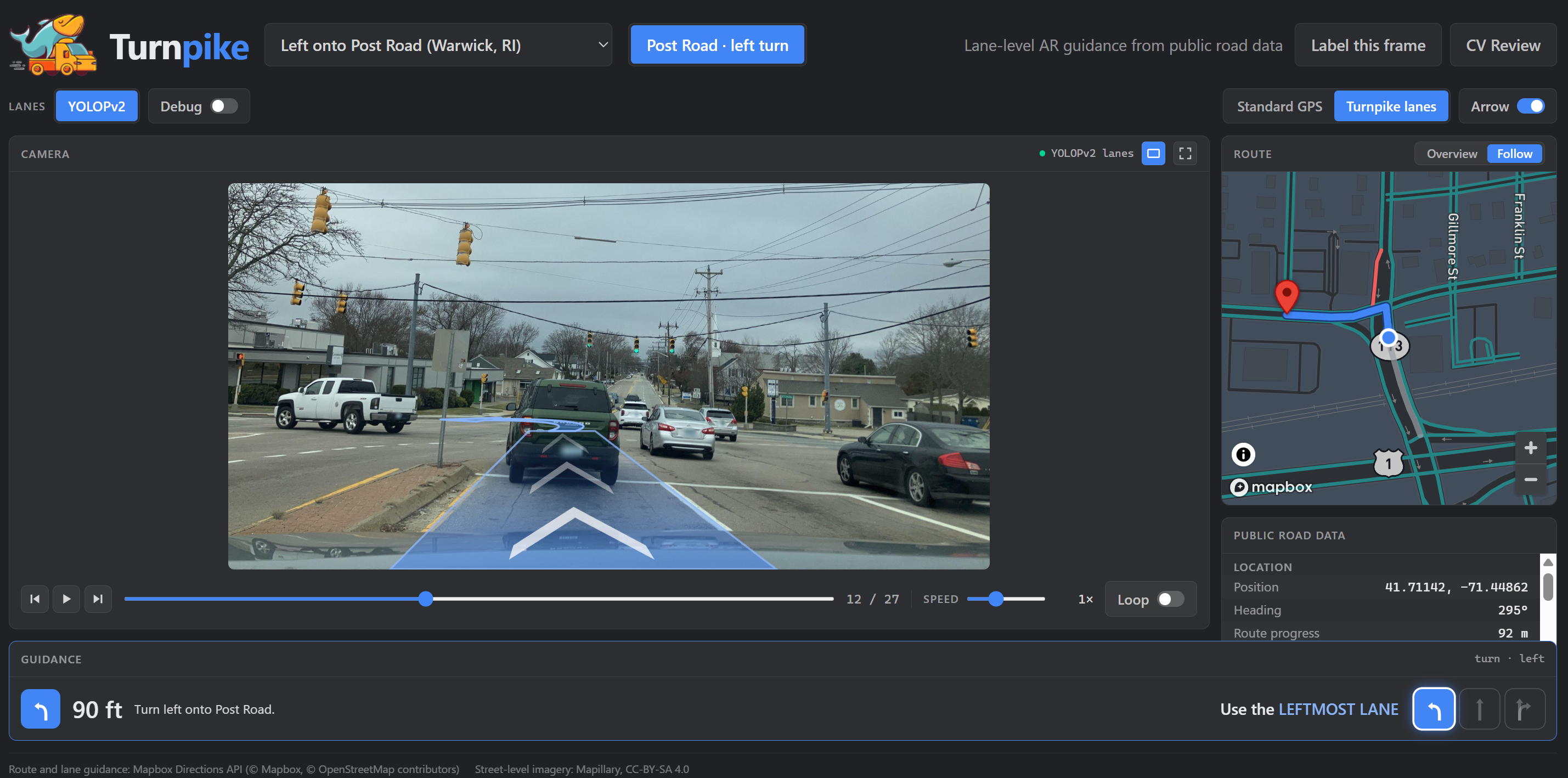
Turnpike simulates what a car dash cam would see Google Earth-style and calculates the best lane to travel in based on the plugged-in travel route.
How we built it
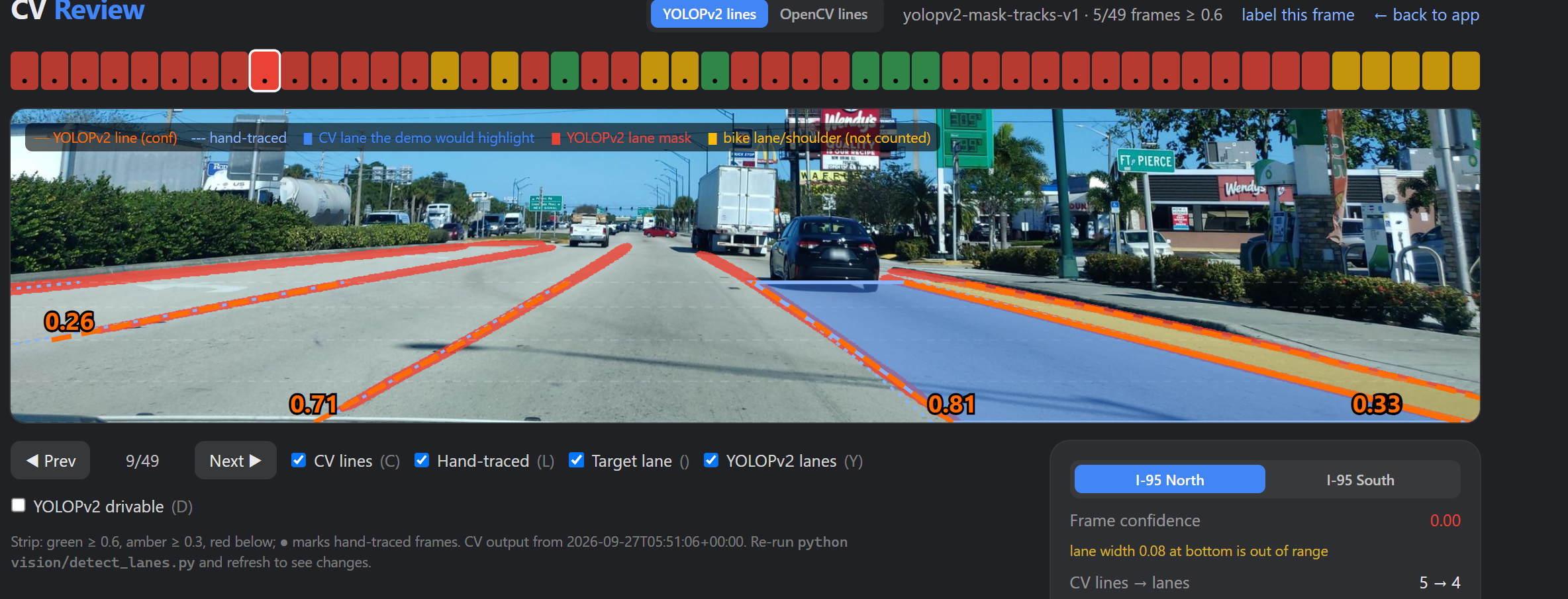
We used the Mapillary and Mapbox APIs and synchronized by latitude and longitude to simulate a real functioning navigation system. To calculate and predict lane boundaries, we used the YOLOPv2 neural network trained on the BDD100K dataset. For our user interface, debug dashboards, and lane overlays, we used React and Typescript. We also utilized Claude Code and Codex to rapidly prototype and develop.
Challenges we ran into
The most significant hurdle of this project was lane detection. We initially tried a more simple approach using OpenCV and Hough Lines, but inconsistent results drove us to search for more robust solutions. Even after discovering the YOLOPv2 repository, we continued to encounter issues with lane detection. Tuning the logic to accommodate edge cases like bike lanes and turn lanes took significant experimentation.
Accomplishments that we're proud of
We are incredibly proud to have a functional, robust MVP. We were excited to see that the logic we wrote for our initial test case was scalable, working with little tuning required for different routes.
What we learned
We learned to find consistency in messy data sources through the use of neural networks.
What's next for Turnpike
We would love to incorporate our software into an actual dashcam and test it with live navigation data.
Built With
- api
- directions
- gl
- javascript
- mapillary
- opencv
- openstreetmap
- react
- typescript
- yolopv2


Log in or sign up for Devpost to join the conversation.