-
-

-
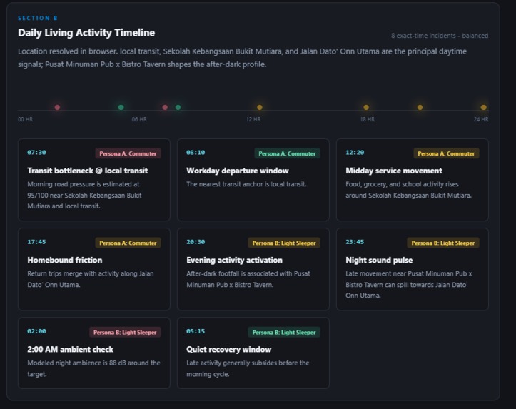
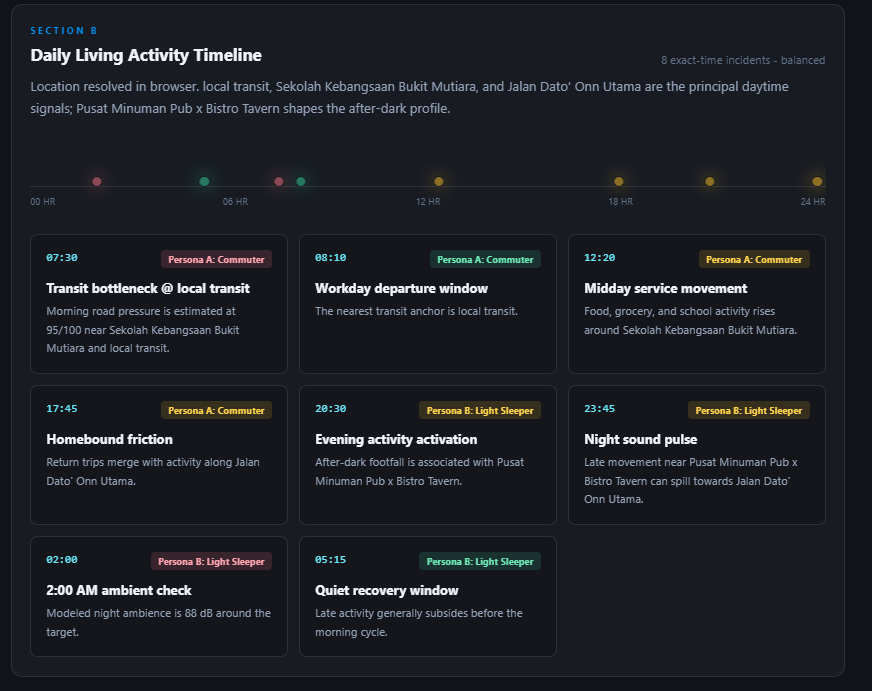
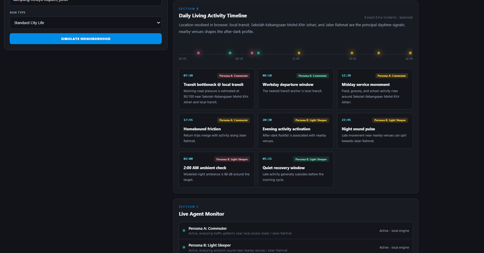
24 hours activity timeline target location
-
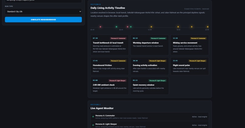
24 hours activity timeline target location
-
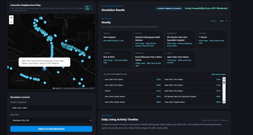
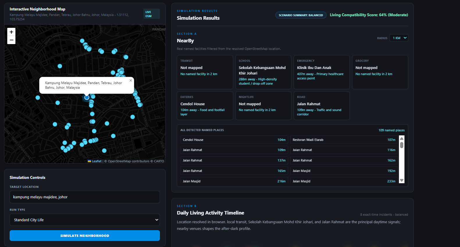
result of target location
-
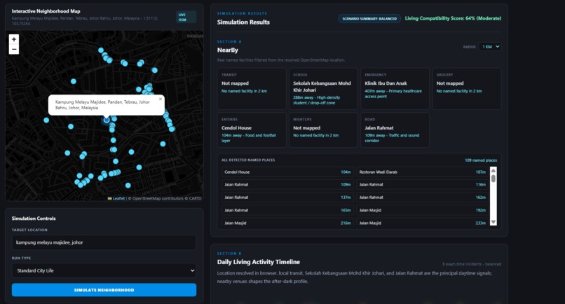
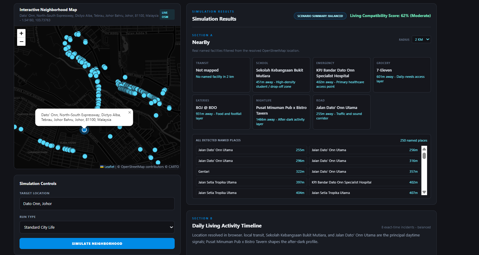
nearby target location
-
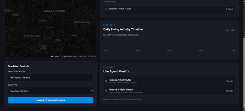
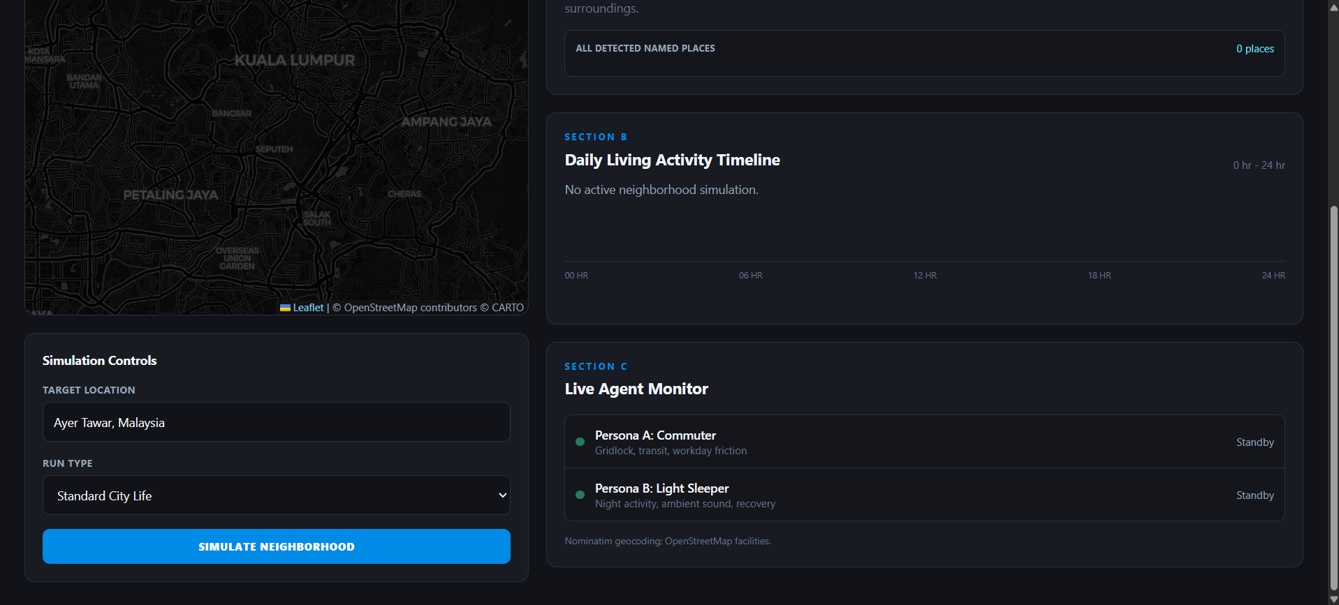
Target Location
-
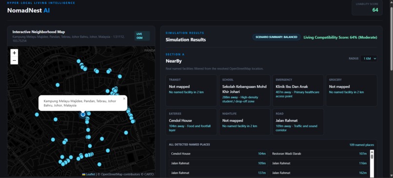
Result target location
-
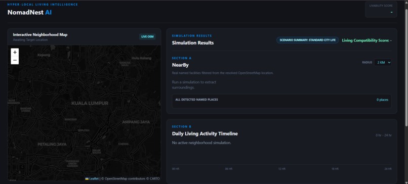
Main Interface

Inspiration
Traditional property search engines and real estate websites leave relocators, students, and digital nomads completely blind to the true character of a location. They present a static map with flat, motionless pins representing nearby locations. They hide the operational friction of real-life environments—failing to capture the intense 7:30 AM morning drop-off congestion outside a local school, or the 11:30 PM ambient sound profiles of commercial entertainment districts. I were inspired to eliminate this logistical anxiety. I set out to build NomadNest AI: an autonomous "digital twin" engine that transforms cold, raw geographic coordinates into an active, readable behavioral forecast of daily living.
What it does
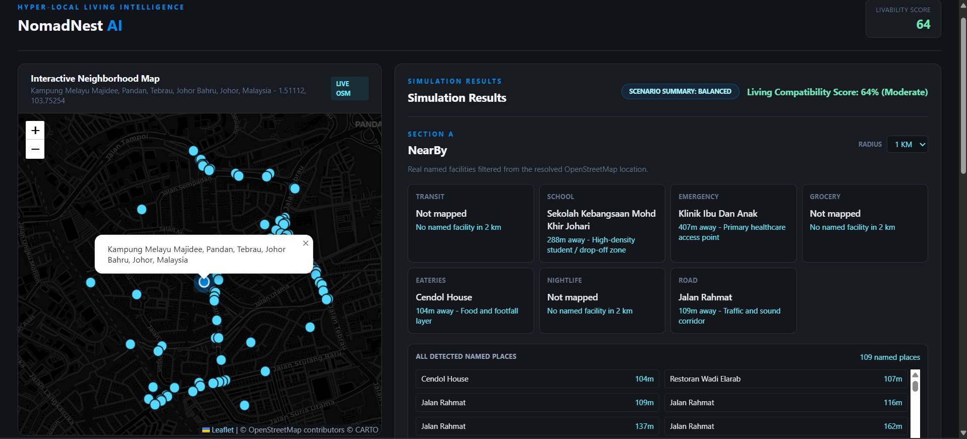
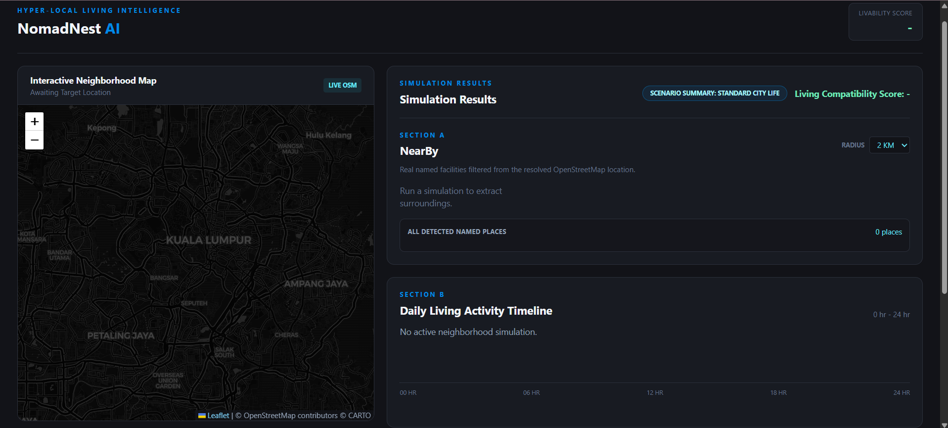
NomadNest AI allows a user to input any natural text location—such as a specific address or neighborhood hub like Bandar Dato’ Onn, Johor Bahru—and instantly observe a dynamic simulation of a 24-hour cycle in that area. The application extracts local architectural and infrastructure assets (Transit anchors, Schools, Emergencies, and Eateries) and passes them to a multi-agent AI framework. The application computes a unified Living Compatibility Score based on selected tracks (e.g., Standard City Life, Balanced) and maps localized friction points onto an interactive, 24-hour horizontal timeline visualization embedded with glowing, animated CSS pulse notifications.
How I built it
The core software architecture relies on a lightweight, high-performance Python FastAPI backend coupled with a local SQLite database layer managed via SQLAlchemy.
- Spatial Resolving Engine: Text queries are translated into high-fidelity coordinate payloads via the free, open-source Nominatim OpenStreetMap API integrated into an interactive, dark-themed Leaflet.js map canvas.
- Proximity Feature Extraction: The geocoded coordinate variables feed a backend spatial script that computes proximity parameters. We filter nearby infrastructure nodes dynamically using a tailored geospatial radius configuration.
- Twin-Agent Swarm Logic: The backend packages the discovered infrastructure nodes into specialized prompt schemas, dispatching them concurrently to two separate GPT-5.6 Sol processes utilizing the advanced Ultra reasoning mode.
- Timeline Mapping: Python’s asynchronous libraries process the structured JSON tracks from both agents, absolute-positioning the resulting friction alerts along the web frontend’s horizontal timeline vector based on their exact timestamps.
Challenges I ran into
Our primary technical challenge was overcoming standard sequential API request blocking. Running multiple complex system prompts against the OpenAI SDK sequentially caused the FastAPI response cycle to stall, resulting in unacceptable loading latency for an interactive web dashboard.
Additionally, I faced spatial mapping hurdles when querying raw OpenStreetMap node dumps, which returned unstructured lists of hundreds of unmapped streets and minor landmarks. I solved this by implementing a rigorous geospatial distance filter that groups, evaluates, and ranks named facilities based on true proximity boundaries before packaging the context payload for the LLM inference matrix.
Accomplishments that I proud of
I are immensely proud of building a 100% vendor-independent, open-source mapping architecture. By combining Leaflet.js with CartoDB Dark Matter tile assets, we avoided closed, high-cost, metered third-party GIS APIs, meaning our software scales infinitely without incurring external credit costs.
I are also proud of the high-fidelity, responsive frontend visual synchronization. When a new address query is committed, the Leaflet map pans dynamically while Sections A, B, and C update concurrently with seamless animated pulse effects, matching the exact spatial profile of the real-world location.
What I learned
This challenge deepened our mastery of asynchronous task coordination in Python. I learned how to successfully employ asyncio.gather() to manage parallel multi-agent logic gates safely without blocking the web framework's network boundaries I also discovered that providing highly structured, locally scoped text parameters (from real OpenStreetMap node lists) into the GPT-5.6 Sol context parameters completely eliminates factual hallucinations, forcing the model to output accurate lifestyle events grounded in true physical infrastructure.
What's next for NomadNest AI
The next milestone for NomadNest AI is the integration of crowd-sourced sensory telemetry, allowing historical noise level and traffic congestion data to reinforce the agentic simulation. I also plan to introduce an automated "Cross-Agent Negotiation Mode," where a user can spin up a specific family swarm (e.g., Parent Persona interacting with Student Persona) to co-evaluate multi-generational relocation compatibility across city borders automatically.
Built With
- cartodb-dark-matter
- fastapi
- html5
- javascript
- leaflet.js
- nominatim-openstreetmap-api
- openai-python-sdk
- openstreetmap
- overpass-openstreetmap
- sqlalchemy
- sqlite
- tailwind
- uvicorn


Log in or sign up for Devpost to join the conversation.