HeatRoute
Inspiration
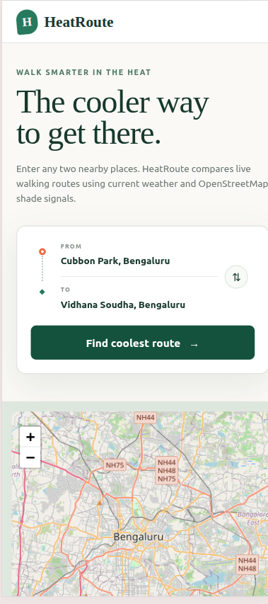
Most navigation apps optimize for the shortest or fastest route, but walking a few minutes under direct sunlight can be exhausting or unsafe during extreme heat. We built HeatRoute to answer a different question:
What is the coolest and most comfortable way to walk to a destination?
Our goal was to combine routing, weather, environmental data, and AI to help pedestrians make better decisions in increasingly hot cities.
What It Does
HeatRoute compares multiple pedestrian routes using:
- Live temperature and “feels-like” temperature
- Humidity and UV levels
- Estimated shade from trees, parks, forests, and covered paths
- Walking distance and journey duration
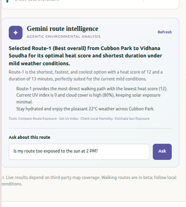
- AI-powered route recommendations and safety advice
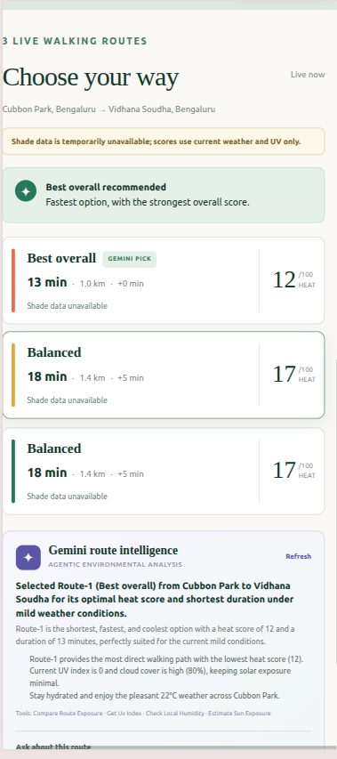
Each route receives an estimated heat-exposure score from 0 to 100. HeatRoute then recommends the route that offers the best balance between lower heat exposure and reasonable travel time.
How We Built It
We developed HeatRoute using:
- React, TypeScript, and Next.js
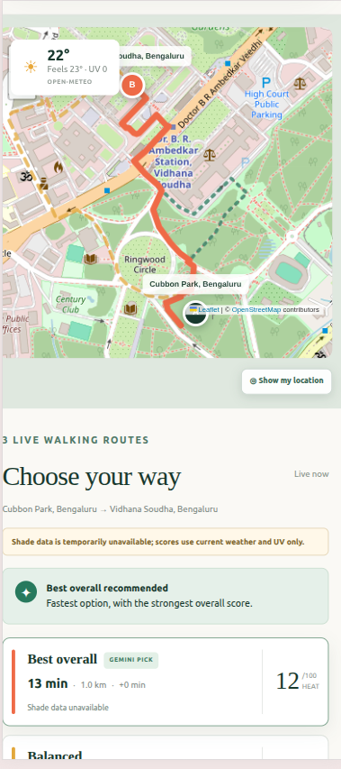
- Leaflet for the interactive map
- Valhalla for pedestrian routing
- Open-Meteo and MET Norway for weather information
- OpenStreetMap and Overpass for environmental features
- Photon and Nominatim for place search and geocoding
- Gemini for intelligent recommendations and route questions
The simplified heat score is calculated as:
$$
\text{Weather Risk}
0.45(\text{Heat Risk}) + 0.25(\text{UV Risk}) $$
When shade information is available:
$$
\text{Exposure Intensity}
\text{Weather Risk} + 0.30(100-\text{Shade Potential}) $$
We also apply a duration factor because longer walks create greater exposure:
$$
\text{Heat Score}
\operatorname{clamp} \left( \text{Exposure Intensity} \times \text{Duration Factor}, 0, 100 \right) $$
Finally, routes are ranked by balancing estimated heat exposure with additional travel time.
Challenges We Faced
One major challenge was estimating shade without access to physical shadow simulation. We solved this by creating a transparent proxy based on nearby trees, green spaces, and covered paths from OpenStreetMap.
We also faced inconsistent environmental data between locations. HeatRoute handles missing information gracefully and clearly tells users when shade data is unavailable.
Another challenge was generating genuinely different walking routes. We filtered highly similar alternatives and introduced controlled waypoint detours when necessary.
Finally, combining several third-party services required careful handling of timeouts, fallbacks, incomplete responses, and changing data coverage.
What We Learned
We learned that the fastest route is not always the most useful route. Environmental context can significantly improve everyday navigation.
We also learned how to:
- Combine routing, weather, geospatial, and AI services
- Decode and display route geometry
- Design an explainable scoring system
- Work with incomplete open-source geographic data
- Build graceful fallbacks for external APIs
- Use Gemini to turn raw route data into practical guidance
Accomplishments
We are proud that HeatRoute transforms complex environmental information into a simple recommendation that users can understand immediately. Instead of showing only distance and time, it explains which route may be cooler and why.
What’s Next
Future versions could include:
- Time-based physical shadow simulation
- Weather forecasts for planned journeys
- Turn-by-turn navigation
- Accessibility and personal heat-sensitivity settings
- Air-quality and hydration-station data
- Crowdsourced shade verification
- Support for more cities and languages
HeatRoute demonstrates how navigation can move beyond speed and become more climate-aware, comfortable, and human-centered.
Built With
- cloudflare
- eslint
- gemini
- git
- gps
- leaflet.js
- met
- next.js
- node.js
- nominatim
- npm
- open-meteo
- openstreetmap
- overpass
- photon
- polyline6
- react
- tailwind
- typescript
- valhalla

Log in or sign up for Devpost to join the conversation.