-
-
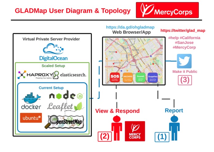
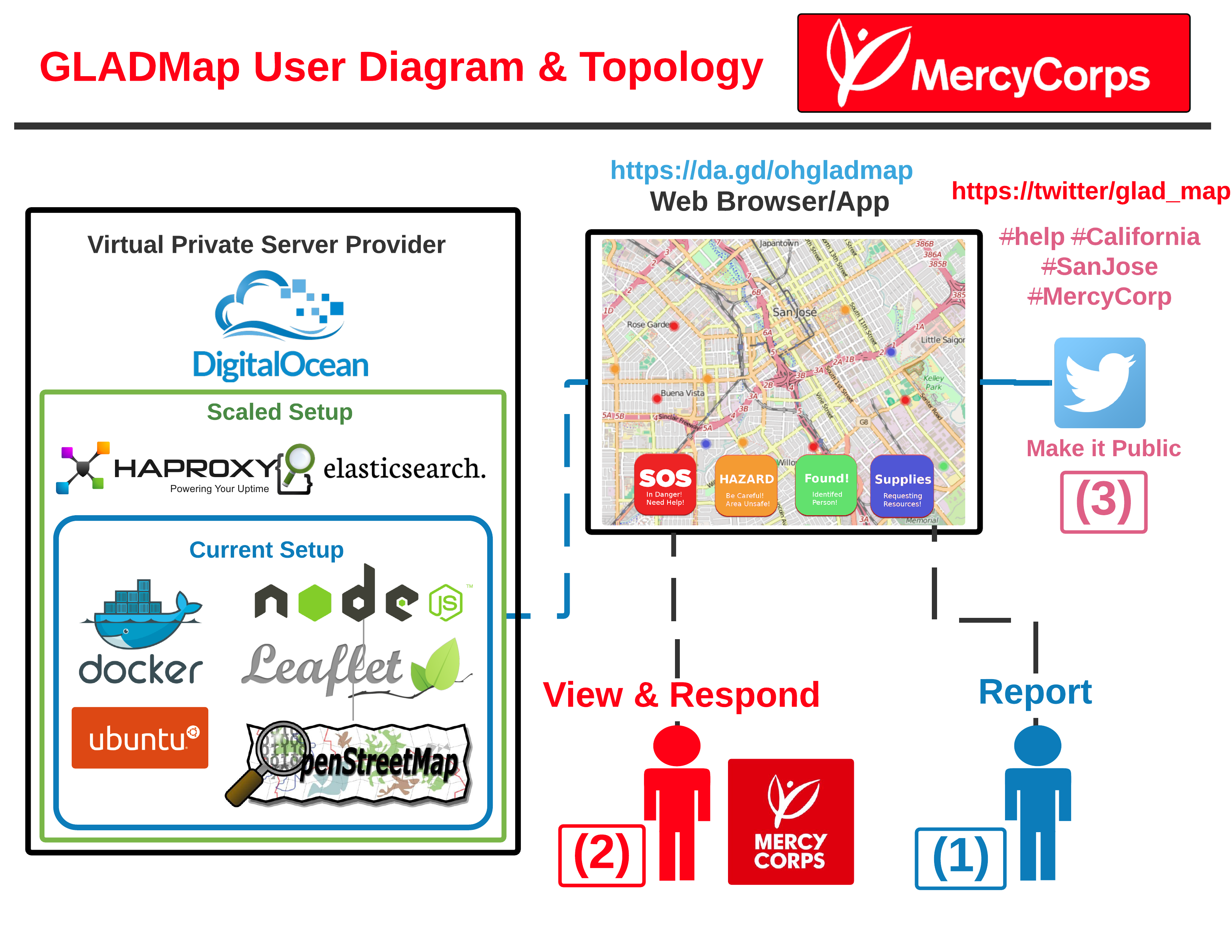
UML Topology
Inspiration
There are many situations that involve a natural disaster/event that require Emergency Response Organizations to help people in danger and find out what is happening in the location. We wanted to create simple way for people to report that data as fast and as accurately as possible.
What it does
A web application similar to Uber + Waze, with the main feature to support the ability to report Hazards, a person in danger, etc. to a centralized location that people can contribute to as allow Emergency Response Organizations to make decisions on how they will handle the area.
How WE built it
Server:
- Ubuntu 14.04 Server
Services:
- Nodejs
APIs:
- Openstreetmap.org
- LeafletJS
Other Resources:
- Docker
Challenges WE ran into
Trouble trying to find open-source map api solutions to integrate with LeafletJS.
Mainstream solutions had free limited use such as Google Maps & MapBox and would not scale globally so we had to find an proper open source solution and hack it!
Accomplishments that We're proud of
Found the open sourced map data API solution to integrate with LeafletJS! API
What We learned
Everyone can contribute, Collaboration and Communication is Key to a successful project
What's next for GLADMap
Make it scale and available to the public to contribute their data on hazards in real-time.
Add more features to make it look modern.
Built With
- docker
- elasticsearch
- geojson
- haproxy
- html
- leafletjs
- node.js
- openstreetmap
- ubuntu
Log in or sign up for Devpost to join the conversation.