-
-
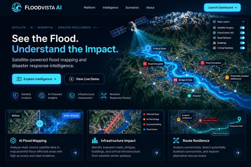
landing page
-
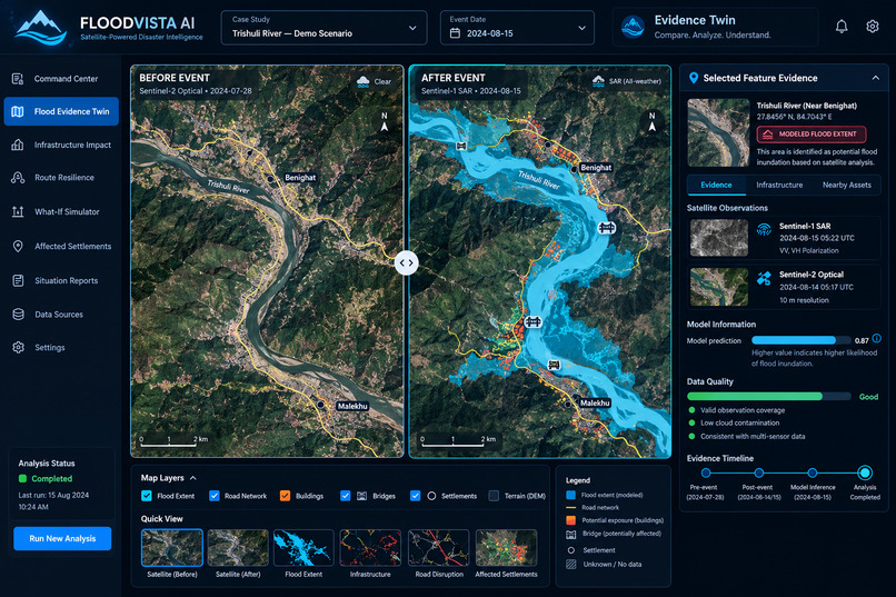
dashboard
-
flood evidence twin
-
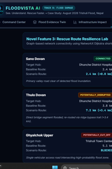
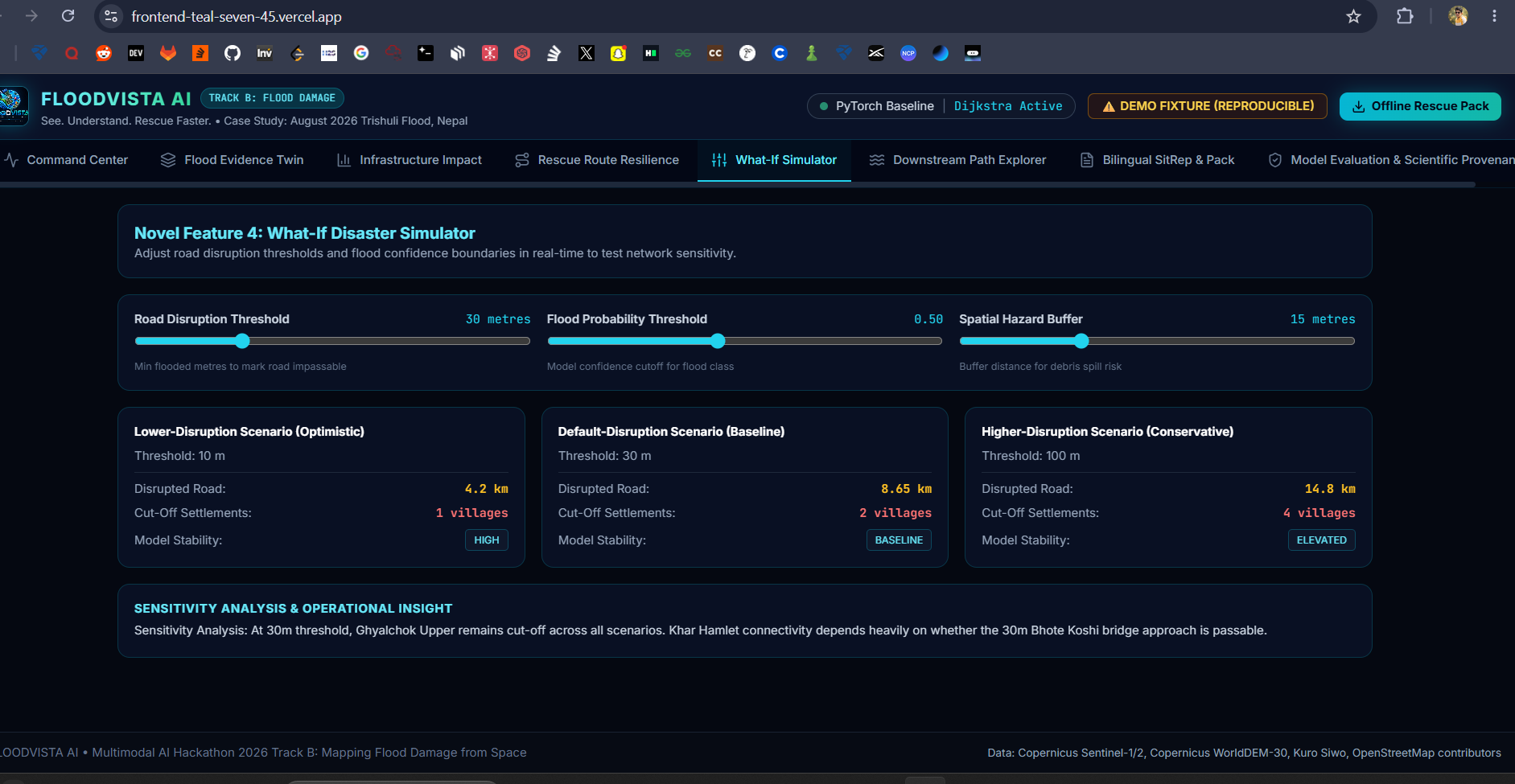
what if simulator
-
downstream path
-
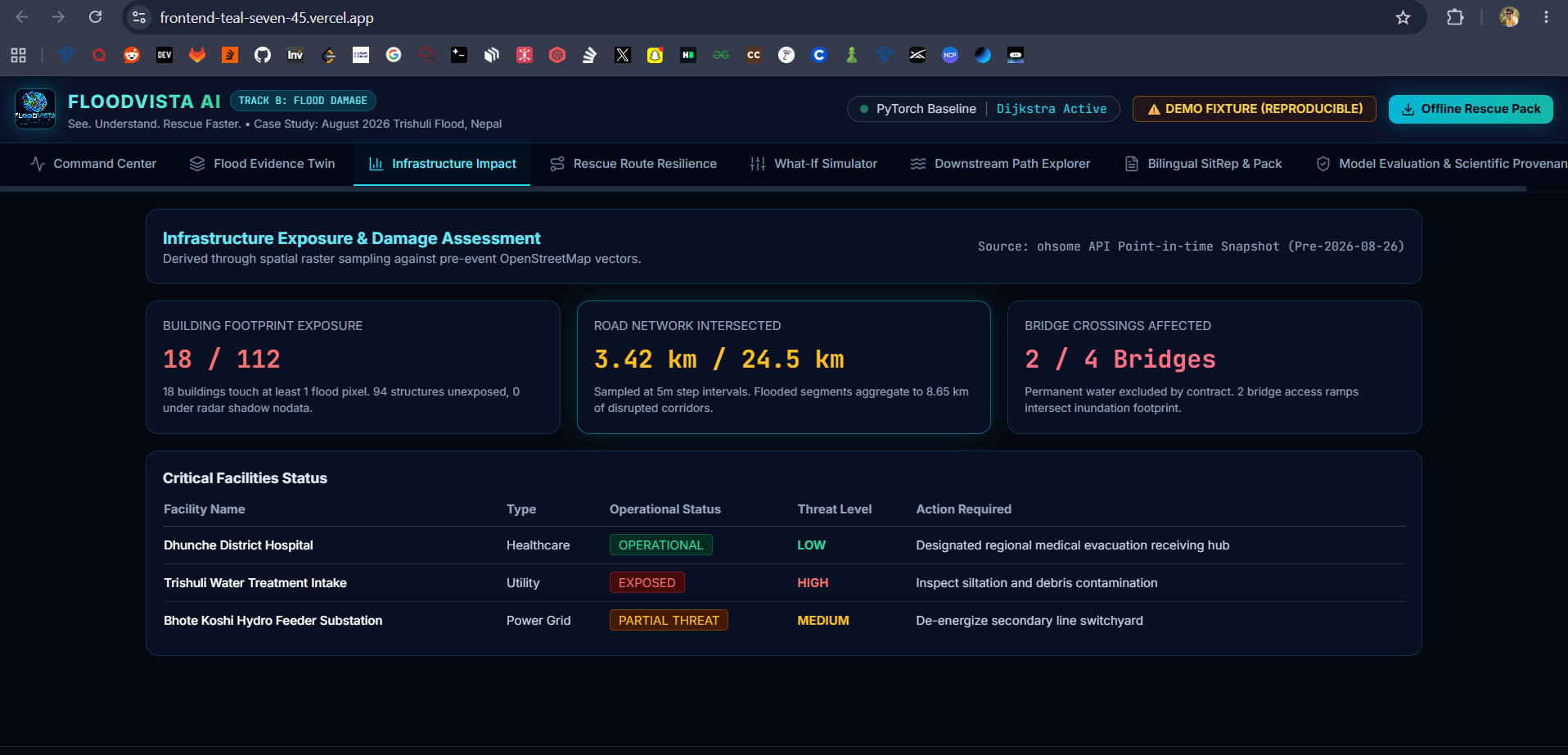
infrastructure impact
-
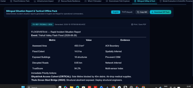
command centre
🌊 Inspiration
When floods strike, roads become inaccessible, bridges may be damaged, and entire communities can become isolated. Rescue teams often struggle to understand the full extent of the damage, especially when ground communication and transportation infrastructure fail.
We asked ourselves a critical question: What if satellites could help rescue teams understand where the damage is, which communities may be cut off, and how to reach them faster?
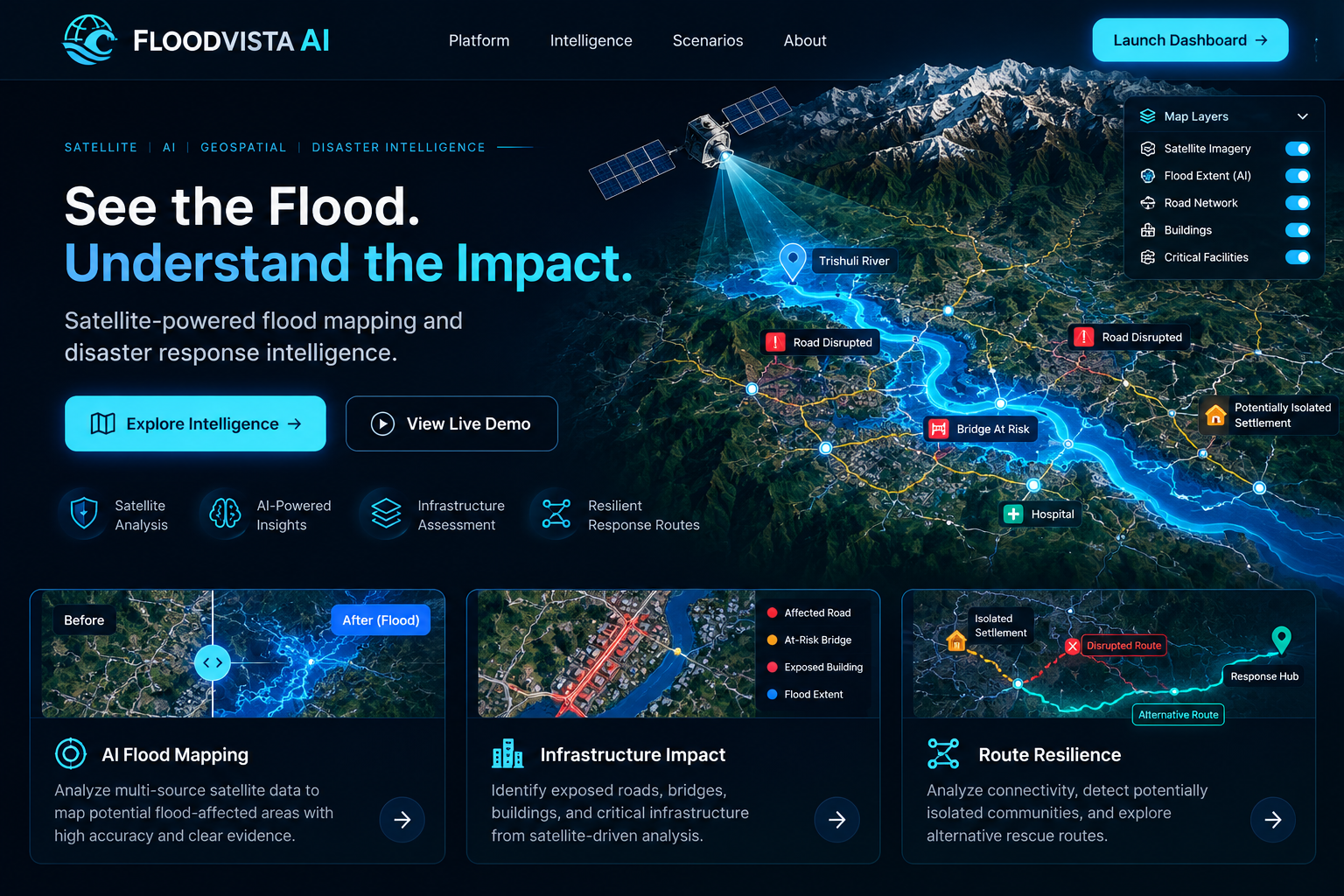
That question inspired FLOODVISTA AI — Satellite-Powered Flood Damage Assessment and Disaster Intelligence, a project designed to transform satellite observations into actionable information for disaster response.
Our vision is simple: make critical disaster intelligence faster to understand, easier to verify, and more accessible to the people who need it most.
💡 What Makes FLOODVISTA AI Different?
FLOODVISTA AI goes beyond conventional flood visualization. It aims to connect satellite-based flood detection with infrastructure analysis and road-network intelligence in one integrated platform.
Our key innovations include:
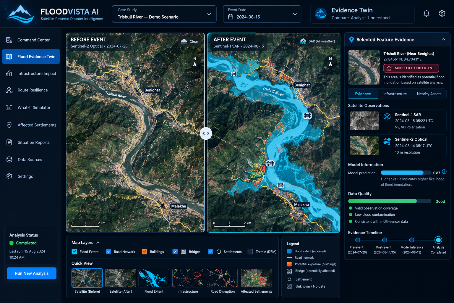
- Flood Evidence Twin: An interactive before-and-after satellite viewer that helps users explore flood extent, geographical changes, and the evidence behind AI predictions.
- AI-Powered Flood Mapping: A machine-learning pipeline designed to identify potential flood-affected areas from suitable satellite observations.
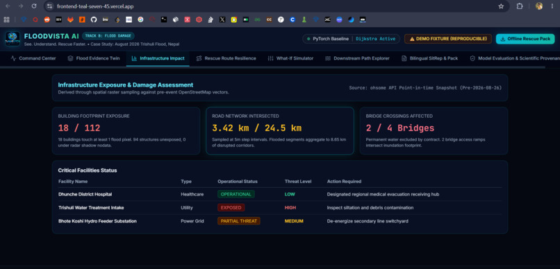
- Infrastructure Impact Analysis: Geospatial analysis to identify buildings, roads, bridges, and critical facilities exposed to modeled flood extent.
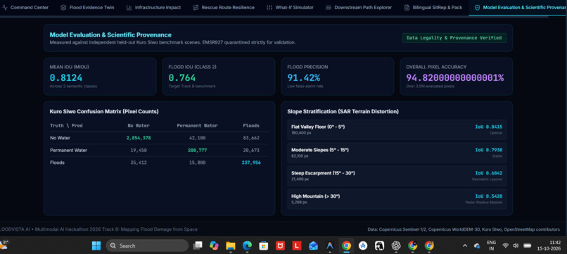
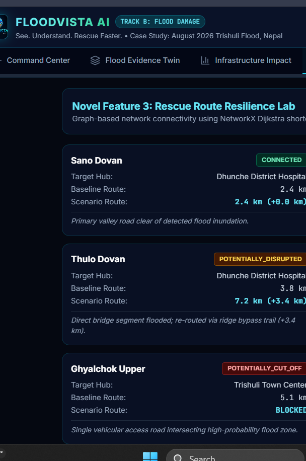
- Rescue Route Resilience Lab: A graph-based system that evaluates road connectivity, explores alternative routes, and identifies settlements that may lose access to designated response hubs.
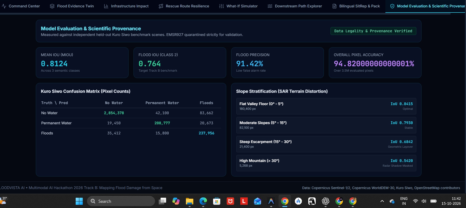
- TrustScore and Explainable Intelligence: An evidence-quality and uncertainty layer that distinguishes direct observations from model predictions and network-based inferences.
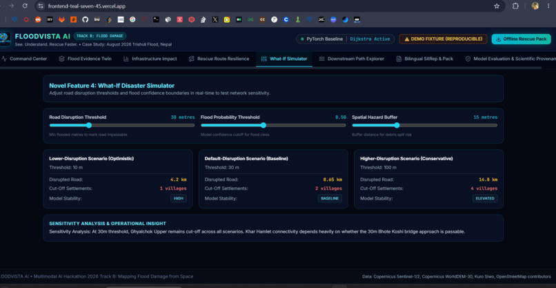
- What-If Disaster Simulator: An interactive environment for testing how different road-disruption assumptions affect route availability and community connectivity.
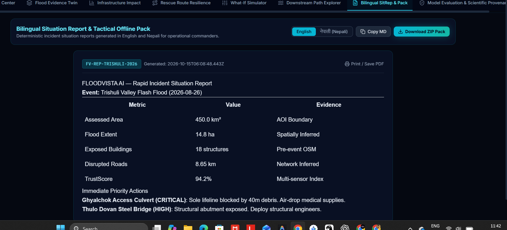
- Offline Rescue Reports: A planned export workflow for incident summaries, map layers, and route information to support users working with limited connectivity.
These capabilities are intended to help emergency teams move from seeing a flood to understanding its potential consequences.
⚙️ How We Are Building It
The project combines remote sensing, geospatial analysis, machine learning, and interactive visualization.
Our intended workflow begins with suitable pre-event and post-event satellite observations, including Sentinel-1 synthetic aperture radar imagery and Sentinel-2 optical imagery where available. The data is preprocessed and aligned before being passed to a flood-segmentation pipeline.
The resulting predictions are georeferenced and combined with terrain information and infrastructure datasets. Spatial analysis identifies potentially exposed assets, while graph algorithms evaluate changes in road connectivity and alternative access routes.
An interactive dashboard brings these outputs together through map layers, evidence inspection, scenario analysis, and situation-report generation.
We are using permitted flood-mapping datasets, reproducible preprocessing, and measurable model-evaluation methods to make the approach testable rather than relying solely on visual demonstrations.
🚧 Challenges We Are Tackling
Flood mapping from space is not as simple as identifying blue pixels on a map.
Cloud contamination, difficult terrain, SAR interpretation, incomplete infrastructure records, inconsistent spatial resolution, and the absence of timely observations can all affect the reliability of an assessment.
Another significant challenge is distinguishing a road that is potentially exposed to flooding from one that has actually become impassable. Similarly, losing modeled connectivity does not automatically mean that every person in a settlement is stranded.
We address these challenges through geospatial validation, explicit scenario assumptions, source provenance, uncertainty indicators, and clear distinctions between observed evidence and inferred impacts.
When data is missing, the system should communicate the limitation instead of inventing an answer.
📚 What We Are Learning
FLOODVISTA AI brings together several disciplines: satellite remote sensing, AI-based segmentation, geographic information systems, graph theory, explainable AI, and disaster-response visualization.
The project is teaching us that a useful AI system is not defined only by its predictive model. Its outputs must be traceable, its limitations must be visible, and its findings must be presented in a form that supports real decisions.
We are also learning how to turn individual technical components into a reproducible end-to-end workflow that can be tested and demonstrated.
🚀 Our Vision
We envision FLOODVISTA AI becoming a practical disaster-intelligence platform that helps emergency responders, humanitarian organizations, local authorities, and researchers better understand flood impacts.
By connecting satellite evidence, infrastructure exposure, and road-network resilience, we aim to help response teams identify locations that require verification, evaluate potential access constraints, and make better-informed decisions under pressure.
FLOODVISTA AI — See. Understand. Rescue Faster.
Because when every minute matters, better information can make a meaningful difference.
Built With
- api
- copernicus
- css
- fastapi
- geojson
- geopandas
- gl
- javascript
- maplibre
- networkx
- numpy
- openstreetmap
- pandas
- python
- pytorch
- rasterio
- react
- recharts
- rest
- scikit-learn
- sentinel-1
- shapely
- tailwind
- typescript
- vite

Log in or sign up for Devpost to join the conversation.