-
-
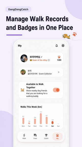
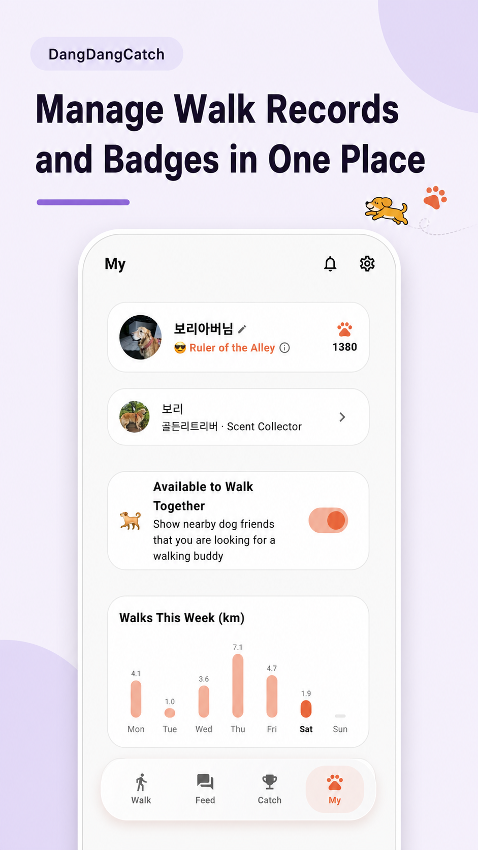
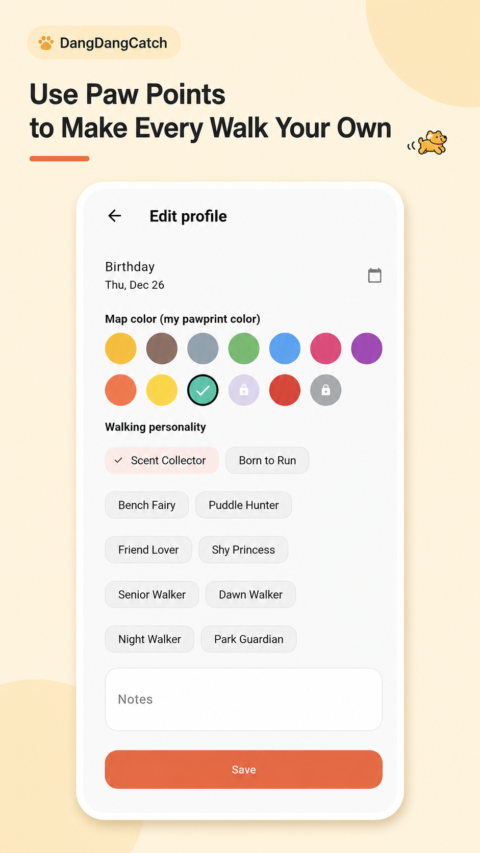
Track weekly progress, manage your dog’s profile, and celebrate achievements.
-
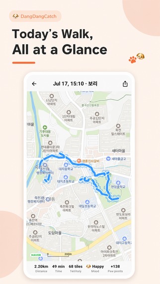
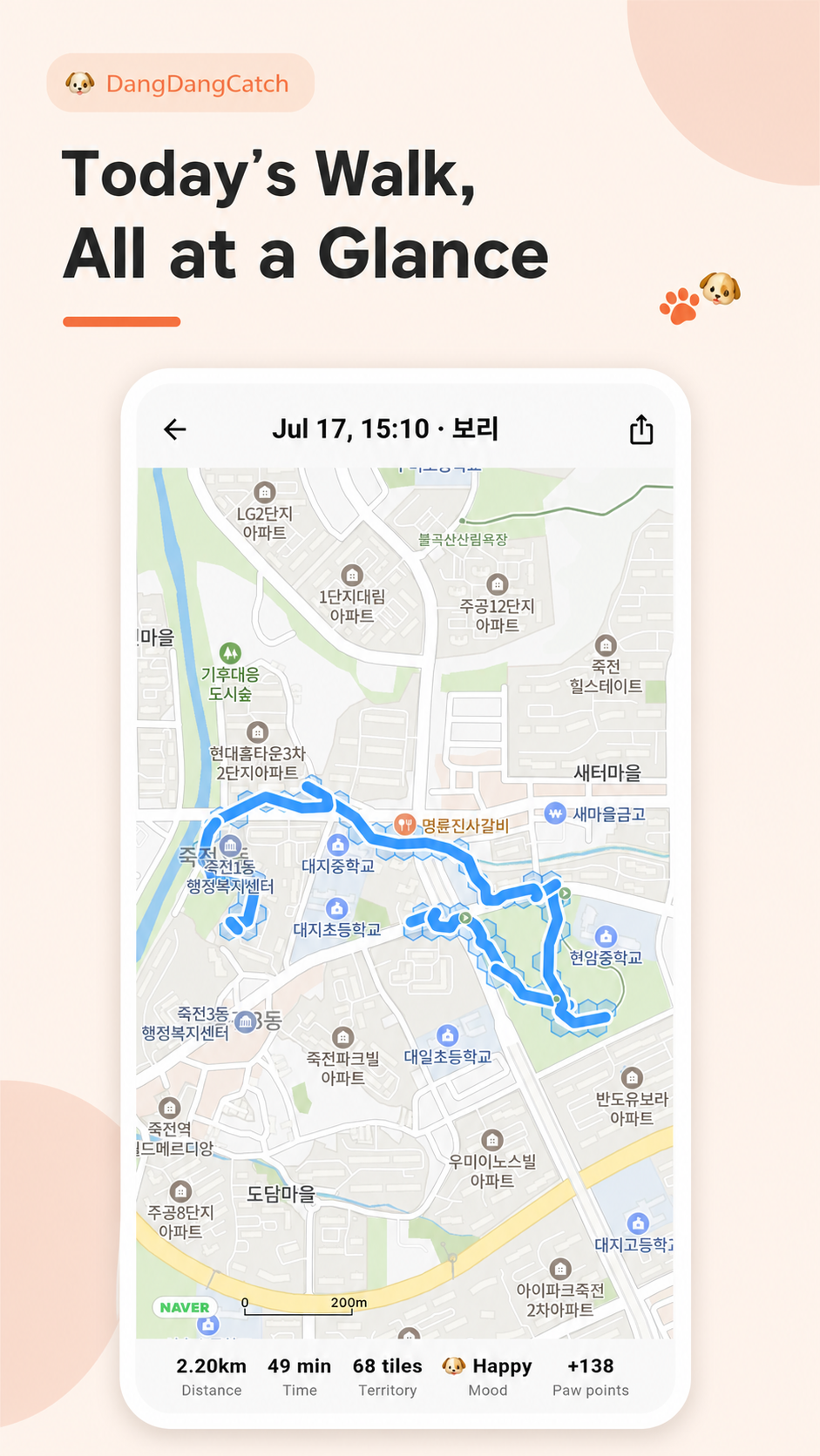
Review your route, distance, time, territory, mood, and Paw Points.
-
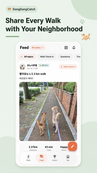
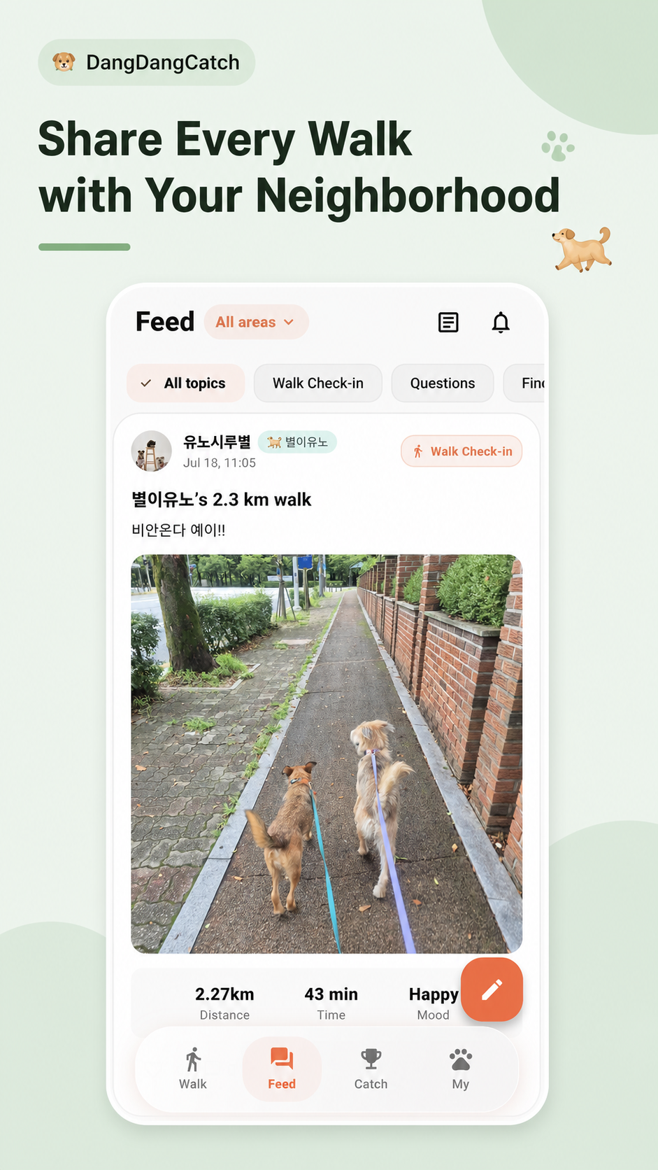
Post memorable moments and connect with fellow dog lovers nearby.
-
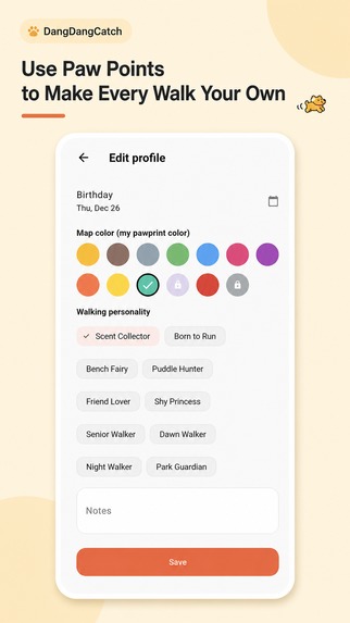
Use Paw Points to unlock colors and personalize your walking style.
-
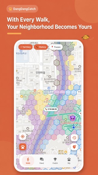
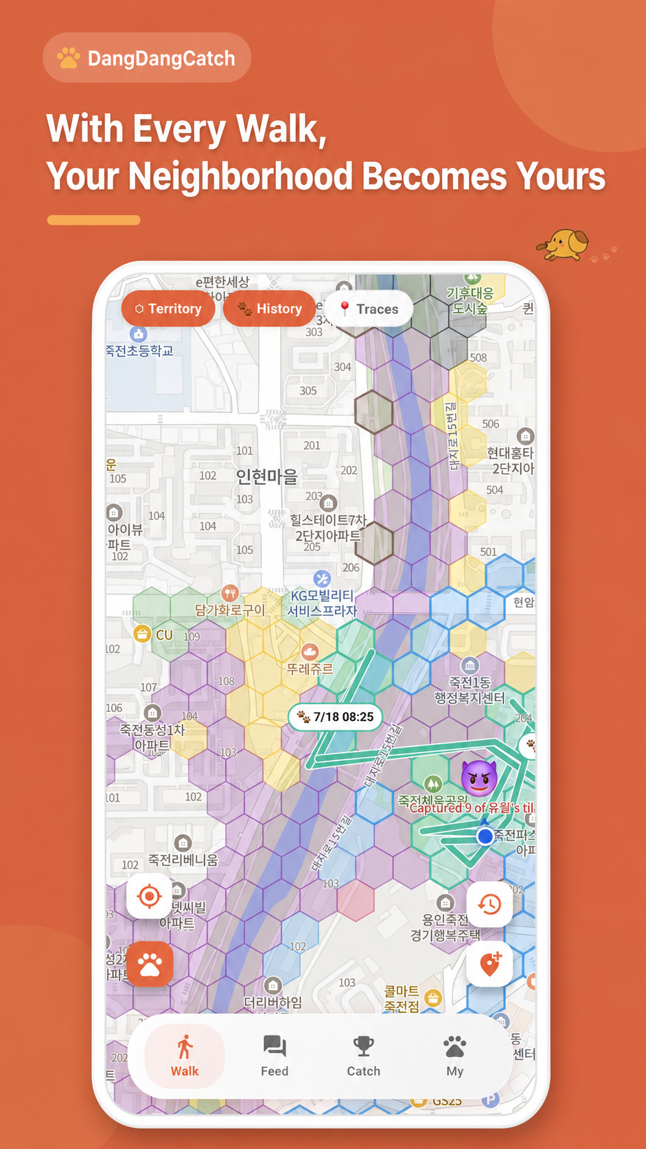
Walk more, explore your neighborhood, and claim new territory.
DangDangCatch: Turn Every Walk into a Territory Adventure
Inspiration
DangDangCatch began with a simple question inspired by Simon Sinek’s Golden Circle:
Why should a dog walk feel like a routine when it can become a shared adventure?
I live with Bori, a Golden Retriever who needs to go outside three times a day. During those daily walks, we kept meeting the same neighborhood dogs and their owners. Those repeated encounters gradually became friendships, conversations, and a small local community.
Many apps already record walking distance, duration, and routes. But I wanted to create something that gave people a stronger reason to look forward to the next walk.
The Why behind DangDangCatch is to make everyday dog walks more meaningful, playful, and socially connected.
The How is to transform real walking routes into a location-based territory game. Dogs can claim areas, take territory from one another, compete in weekly rankings, leave traces, and playfully challenge nearby walkers.
The What is a dog-walking platform that combines GPS walk tracking, territory battles, community feeds, rewards, missions, and privacy controls.
Location and walking data can be sensitive, so sharing is always based on the user’s choice. A user can enjoy DangDangCatch alone, connect with neighborhood friends, share selected records, or participate in playful territory challenges without being forced to expose personal information.
That balance between competition, community, privacy, and real-world movement became the foundation of DangDangCatch.
What it does
DangDangCatch turns everyday dog walks into a location-based game and community experience.
Users can:
- Record walking routes, distance, duration, mood, rewards, and territory.
- Claim hexagonal territory by physically walking through an area.
- Take territory from other walkers and compete in weekly neighborhood rankings.
- Review previous walks and see routes, timestamps, statistics, and territory directly on the map.
- Leave traces and interact with nearby dog owners.
- Share walk verification posts, questions, local news, and friend-recruitment posts through the community feed.
- Decide whether walking records and location-related information are private or shared.
- Send playful challenges after territory changes.
- Complete daily missions, walking bingo, streaks, and reward activities.
- Collect paw points and use them for map colors, titles, and other shop items.
- Receive comments, territory updates, announcements, ranking rewards, and community notifications.
- Use the app in Korean, English, Spanish, Portuguese, Japanese, or German.
- Choose between light and dark themes.
DangDangCatch can be enjoyed as a solo walking companion, a neighborhood social platform, or a competitive territory game.
How we built it
DangDangCatch was built with Flutter so that one codebase could support both Android and iOS.
Firebase powers the backend infrastructure:
- Firebase Authentication manages user accounts.
- Cloud Firestore stores users, walks, territories, posts, comments, rankings, rewards, and notifications.
- Cloud Functions processes scheduled rankings, rewards, notifications, and server-side game logic.
- Firebase Storage stores profile images, feed images, and announcement images.
- Firebase Cloud Messaging delivers community and territory notifications.
- Firebase Analytics helps us understand screen flows, feature usage, and user engagement.
The current map experience is built with Naver Maps. Walking coordinates are converted into map routes and polygon-based territory cells. The app loads only the records and territory needed for the visible map area.
To keep the map fast, we implemented:
- Viewport-based data loading.
- Incremental tile queries.
- Territory and walk-record caching.
- Marker clustering based on zoom level.
- Reuse of already loaded territory cells.
- Debounced camera updates.
- Reduced GPS update frequency to control battery use and device temperature.
- In-memory walk recording with a consolidated upload at the end of a walk.
- Firestore pagination and read minimization.
- Cached feed images and reusable image viewers.
We also used Codex with 5.6 Sol Ultra mode as a development partner. Multiple agents helped inspect map rendering, Firestore usage, UI behavior, localization, and server logic from different perspectives. This made it possible to investigate several connected problems while maintaining a consistent product direction.
Challenges we ran into
The greatest challenge was map performance.
A territory game can create thousands of polygons, walking paths, markers, timestamps, and nearby records. Loading or redrawing everything whenever the camera moved caused delays, unnecessary Firestore reads, and visual flickering.
We had to carefully decide:
- Which territory cells should be queried.
- When cached cells could be reused.
- How long map data should remain cached.
- At which zoom levels records and clusters should appear.
- How to prevent already loaded territory from disappearing.
- How to keep map interactions smooth while data was being processed.
- How to minimize Firestore costs without removing live gameplay.
Another challenge was keeping territory ownership consistent when multiple users walked through the same areas. Client state, server state, weekly ranking data, family accounts, and notifications all needed to agree.
Privacy was equally important. Walking routes can reveal where someone lives or when they usually go outside. We designed the experience so users remain in control of what they share and can still enjoy the game privately.
Supporting six languages, light and dark themes, multiple device sizes, image-heavy feeds, moderation, reporting, announcements, and notifications also required consistent design and careful testing.
Accomplishments that we're proud of
DangDangCatch was not created by one person working in isolation.
Every day, I showed new versions to dog owners in my neighborhood, listened to their reactions, and updated the product based on real walking experiences. During one week, we released seven updates.
That rapid feedback loop helped us remove unnecessary complexity and build an experience that feels focused and natural.
We are especially proud that DangDangCatch now combines:
- A responsive territory map.
- Detailed GPS walk records.
- Weekly territory competitions and rewards.
- A community feed with images, comments, reactions, and moderation.
- User-controlled privacy settings.
- Family account support.
- Missions, bingo, streaks, badges, titles, and paw-point rewards.
- Announcements, reports, notifications, and administrative tools.
- Six-language localization.
- Light and dark themes.
- Firestore caching, pagination, and query optimization.
What began as a simple map with place markers evolved into a living territory game, a walking journal, and a neighborhood dog community.
We are also beginning to see strong growth in user interest and engagement through traffic and advertising metrics. The most rewarding signal is that people are not only downloading the app—they are using it during their real walks and sharing feedback for the next update.
What we learned
We learned that users do not simply want more features. They want a clear reason to return.
A walking history is useful, but a territory that can be protected, challenged, or expanded gives the next walk a purpose.
We also learned that privacy should not be treated as a single on-or-off decision. Different users want different experiences. Some want competition and neighborhood friendships, while others want a private walking journal. A strong product should support both.
Daily conversations with real users were more valuable than assumptions. Small details—when a marker appears, whether territory remains visible, how quickly an image loads, or how a reward is explained—had a major effect on the overall experience.
Finally, we learned how powerful multi-agent AI-assisted development can be when it is paired with a clear product vision. AI helped us inspect performance, data structures, localization, UI consistency, and edge cases, but the product direction continued to come from real people walking real dogs.
What's next for DangDangCatch
The next stage is to expand DangDangCatch from a daily territory game into a deeper, persistent world.
We are exploring:
- Persistent territories that can be defended and strengthened over time.
- A territory lord system where users can build homes, landmarks, or castles.
- Rewards for maintaining and protecting an area.
- Cooperative groups and larger regional territory battles.
- A richer paw-point economy and expanded shop.
- Seasonal challenges, special missions, and community events.
- Improved fraud prevention and server-side reward validation.
- More detailed analytics for understanding user journeys.
- Additional accessibility and localization improvements.
DangDangCatch currently uses Naver Maps for its primary map experience in Korea. For international expansion, we plan to introduce Google Maps and select the appropriate map provider by region.
Our goal is not simply to create another dog-walking tracker.
Our goal is to build a world where every walk creates a story, every pawprint leaves a mark, and every neighborhood can become a community.


Log in or sign up for Devpost to join the conversation.