Inspiration
During catastrophic flash floods, severe earthquakes, cyclones, and grid collapses, telecommunication infrastructure is almost always the first casualty. Cellular towers lose backhaul power, broadband lines sever, and centralized cloud servers become completely unreachable. In emergency medicine and disaster management, the first 60 minutes following a disaster are known as the "Golden Hour"-the critical window where rapid triage and immediate routing mean the difference between life and death.
Tragically, existing crisis coordination platforms depend entirely on continuous high-speed internet, proprietary map backends, and costly cloud AI APIs. When cell towers fail in a rural town or a submerged metropolitan sector, citizens are left stranded with no way to assess injuries or find rescue hubs, while emergency responders deploy blind.
We asked a fundamental question: What if an emergency response system required zero external server dependencies, incurred zero API costs, and could autonomously triage casualties, locate specialized trauma facilities worldwide, and compute life-saving routes even in complete airplane mode?
That imperative inspired the creation of CrisisConnect.
What It Does
CrisisConnect is a decentralized, offline-first disaster response and emergency routing platform that turns any smartphone into an autonomous dispatch terminal during infrastructure blackouts. Operating with zero server dependency and zero API costs, it delivers five core capabilities:
On-Device AI Emergency Triage: Users describe crises in plain text (e.g., "Flash flood rising fast, 3 people trapped on roof, elderly diabetic in shock"). Running entirely on-device, the NLP engine instantly classifies urgency from Critical $$P_1$$ to Informational $$P_4$$, estimates casualty counts, flags acute physiological threats, and tags required response equipment without transmitting data over the cloud.
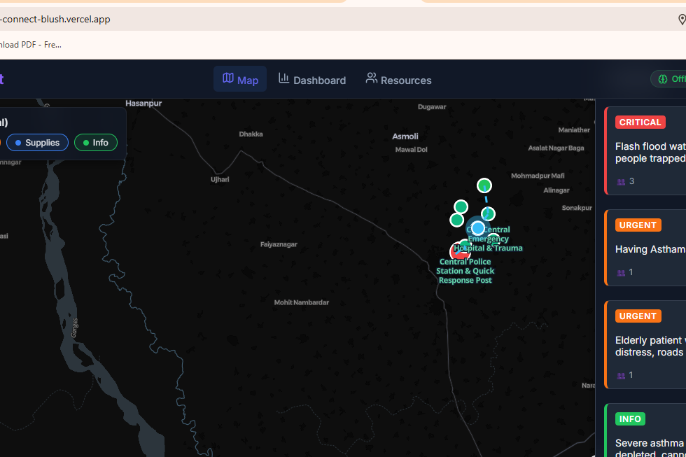
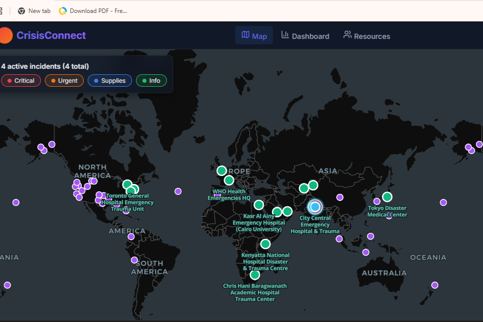
Global Open-Source Facility Discovery: Combining live OpenStreetMap (OSM) Overpass queries with an indexed international network of major trauma centres, the platform dynamically maps hospitals, clinics, nursing homes, fire rescue stations, and relief shelters across Asia, Africa, Central Asia, the Middle East, Europe, and the Americas.
"What to Use This For" Clinical Guidance: Touching any facility on the map reveals its exact capabilities-clarifying whether it handles Level 1 polytrauma surgery, acute burns, hyperbaric oxygen, geriatric stabilization, or debris extrication. Each card includes live Haversine distance tracking and 1-tap direct native emergency dialling.
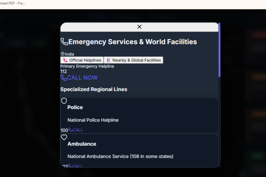
Full Offline Persistence & Manual Coordinate Parity: Users can toggle seamlessly between live GPS tracking and manual latitude/longitude input for remote coordinate rescue. All reported incidents, facilities, dispatch links, and regional helplines are stored client-side in IndexedDB, guaranteeing uninterrupted functionality even through complete network blackouts and browser reloads.
How we built it
CrisisConnect is engineered as an offline-first Single Page Application with strict modularity, high rendering performance, and zero proprietary lock-in:
Technology Stack: Frontend Architecture: React 18, TypeScript, Tailwind CSS, Lucide Icons. Cartographic Engine: MapLibre GL (Open-source vector tile renderer with zero Mapbox/Google token requirement). Storage & Offline Sync: Dexie.js (IndexedDB wrapper for local database persistence). Geospatial & Geocoding Pipeline: OpenStreetMap Overpass API, Nominatim Reverse Geocoding, and Geodesic Radial Generators. Emergency AI Knowledge Core: Client-side heuristic triage classifier with zero external network dependencies.
Challenges we ran into
Eliminating Network-Blocking Race Conditions: Problem: Initial builds waited on remote OpenStreetMap network responses before committing submitted incidents to local state, causing the UI to freeze on high-latency 2G networks. Solution: We decoupled the state lifecycle: incidents and local fallback facilities commit immediately to IndexedDB and UI state in $$< 15\text{ ms}$$, while external OSM queries stream in asynchronously in the background.
Preventing GPS Location Leaks in Manual Coordinate Entry: Problem: Entering manual coordinates for distant areas (e.g., Manhattan, NYC) initially caused the system to leak the user's local GPS cache, incorrectly routing incidents across continents. Solution: We designed an isolated coordinate resolver with an explicit priority hierarchy that bypasses the GPS cache when manual inputs are provided, triggering background facility fetches scoped specifically to the manual coordinates.
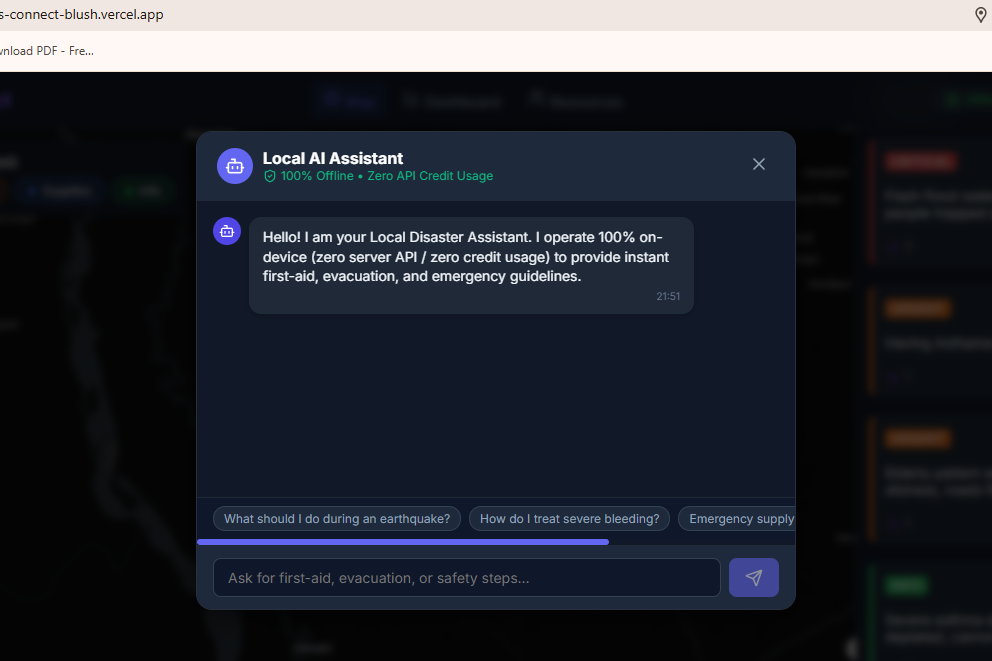
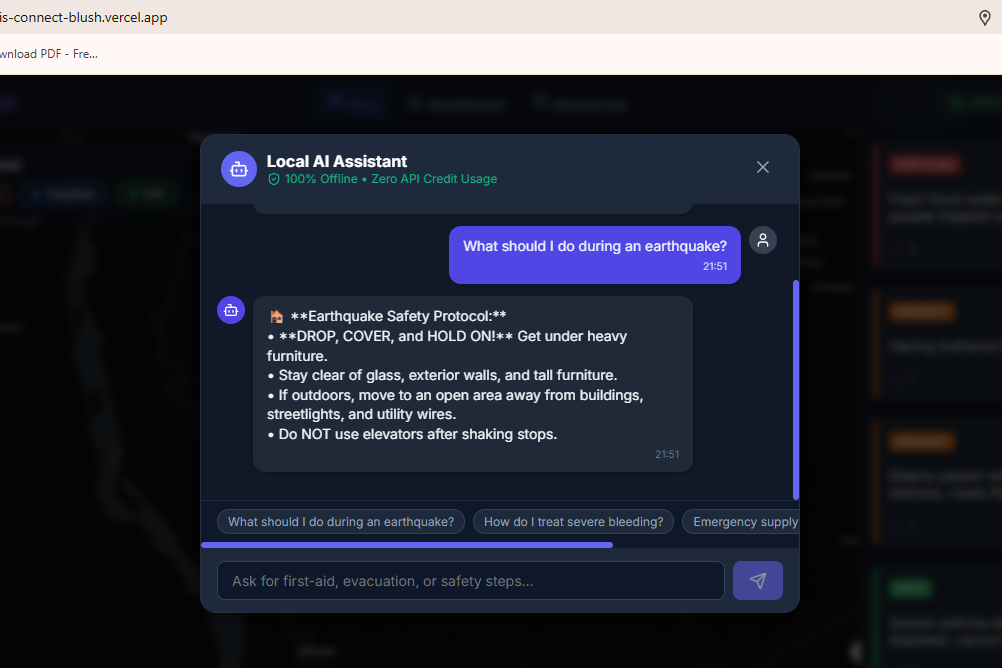
Zero-Credit Intelligent Local AI: Problem: External LLM API calls exhaust API tokens rapidly during general chat and fail completely during network loss. Solution: We developed an on-device emergency knowledge base with keyword triage heuristics, providing instant guidance on CPR, bleed control, flood evacuation, and earthquake protocols with zero API usage.
Dynamic Multi-Point Viewport Framing (fitBounds): Problem: Framing both an incident and its matched emergency station on dynamic mobile viewports resulted in markers clipping beneath UI sidebars and floating buttons. Solution: We engineered custom coordinate bounding calculations with directional padding offsets ({ top: 90, bottom: 90, left: 90, right: 380 }), ensuring both nodes remain fully visible during selection transitions.
Accomplishments that we're proud of
True Offline Autonomy: CrisisConnect can be loaded once, disconnected from the internet (Airplane Mode), and will continue to perform AI triage, compute distances, render vector maps, and provide first-aid protocols.
100% Free & Open-Source (FOSS) Ecosystem: Built entirely with open-source technologies-MapLibre GL, OpenStreetMap, Nominatim, and Overpass API-with zero proprietary API keys or hidden costs.
Worldwide Emergency Coverage: Includes pre-indexed major trauma centers across underserved and disaster-prone regions across Africa, Central Asia, the Gulf, South Asia, Europe, and the Americas.
High-Contrast, Low-Cognitive-Load UX: Designed for high-stress disaster scenarios, featuring clear priority color codes ($$P_1$$-$$P_4$$), oversized interactive targets, and direct native calling.
What we learned
Local-First Architecture: Building dependable crisis software requires treating client-side storage (IndexedDB) as the primary source of truth rather than a temporary cache.
Geospatial Query Optimization: Structuring concise Overpass QL queries taught us how to query complex municipal amenity sets across wide geographic radiuses in a single payload.
Human-Centred Disaster UX: In life-threatening emergencies, clarity is paramount. Complex dropdowns and dense configurations must be replaced with automated triage, clear status badges, and 1-tap emergency actions.
What's next for CrisisConnect
Browser-to-Browser WebRTC / BLE Mesh Sync: Enabling neighboring smartphones to gossip emergency reports across an ad-hoc local mesh network until one node reaches an active internet connection.
Quantized WebAssembly SLM Integration: Compiling on-device Small Language Models via Transformers.js / ONNX Web Runtime for multilingual, voice-to-text offline triage directly in the browser.
LoRaWAN Hardware Beacon Bridge: Connecting CrisisConnect to low-power, long-range LoRa hardware nodes (e.g., ESP32 / Meshtastic) to broadcast SOS coordinates across 15+ kilometers without cellular coverage.
Built With
- css3
- dexie.js
- disaster-management
- edge-ai
- emergency-response
- geojson
- geolocation-api
- haversine-algorithm
- html5
- indexeddb
- javascript
- local-storage
- lucide-react
- maplibre-gl
- natural-language-processing
- nominatim
- offline-first
- openstreetmap
- overpass-api
- pwa
- react
- spatial-computing
- tailwind-css
- typescript
- vite

Log in or sign up for Devpost to join the conversation.