-
-
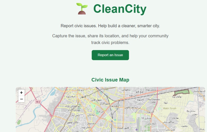
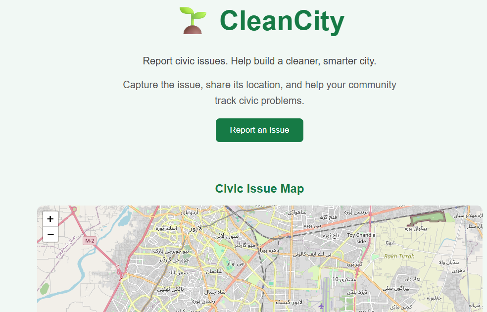
CleanCity Interactive Landing Page with Live GPS Civic Issue Map for Real-Time Location Tracking.
-
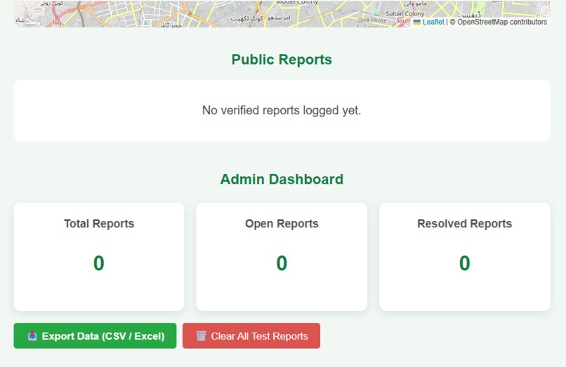
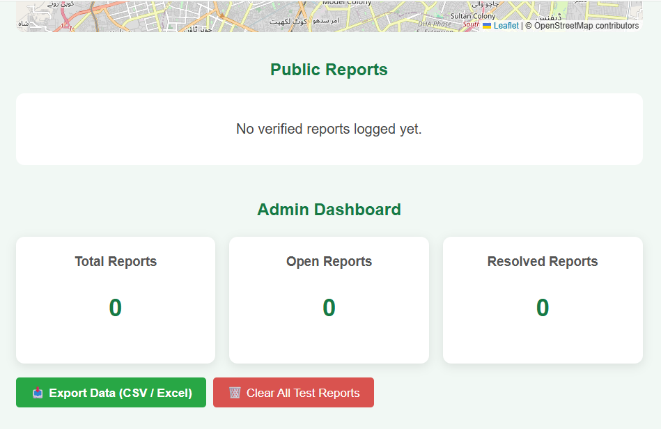
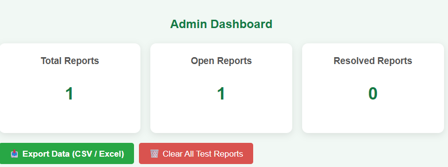
Admin Dashboard with real-time analytics counters and one-click CSV data export.
-
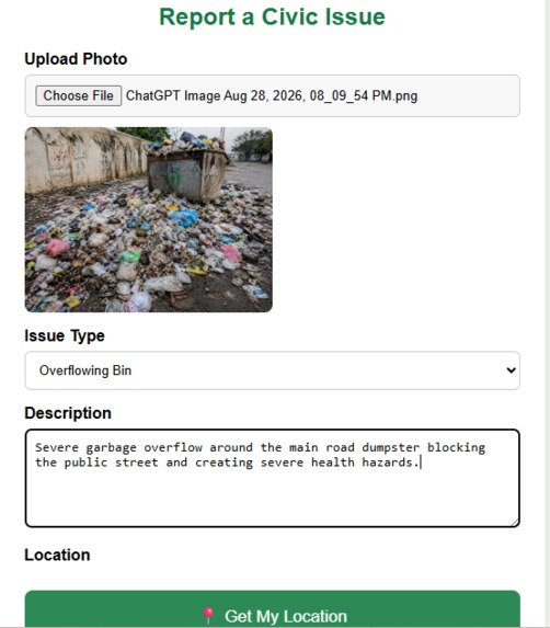
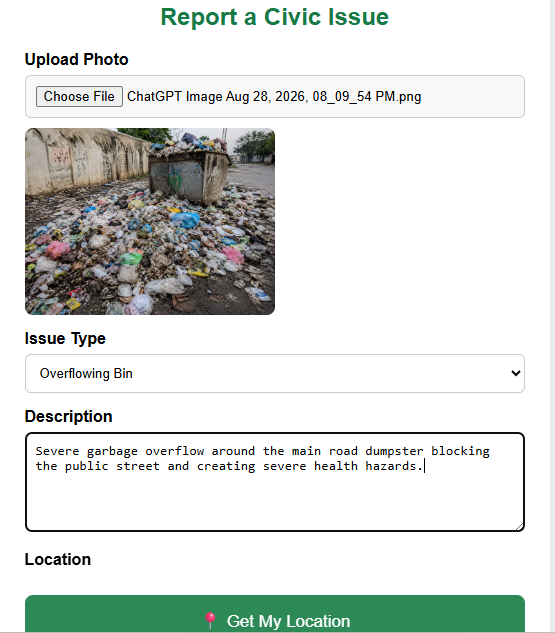
Civic Issue Reporting Form with geo-location capture and image upload capabilities.
-
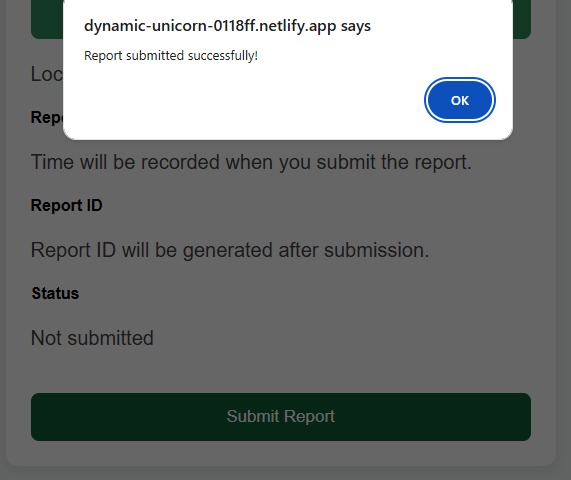
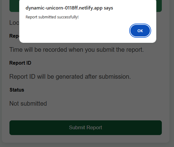
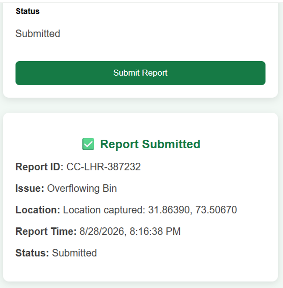
Instant user feedback and automated report submission confirmation prompt.
-
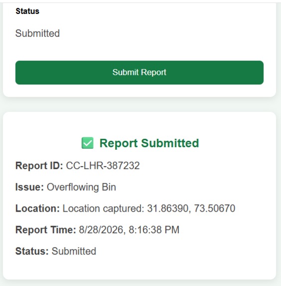
Instant report confirmation screen with auto-generated Report ID, exact GPS coordinates, and timestamp.
-
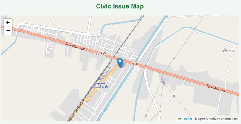
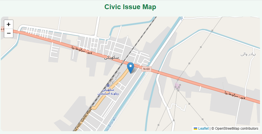
Interactive map view showing pin location of reported civic issue.
-
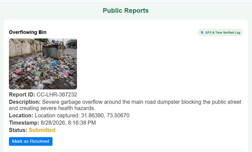
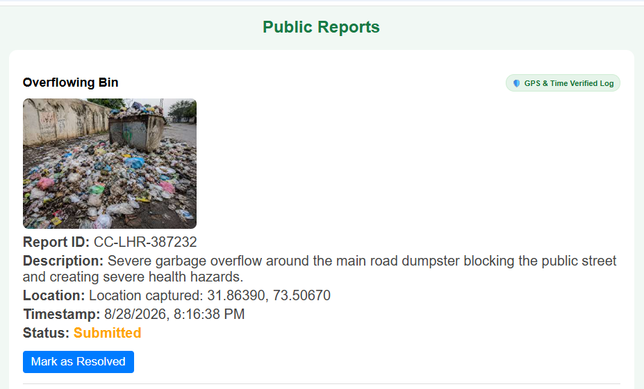
Public feed display showing verified civic report details with real-time status update functionality.
-
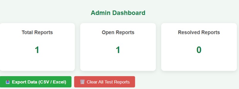
Live Admin Dashboard displaying active report analytics, CSV data export, and test management tools.
-
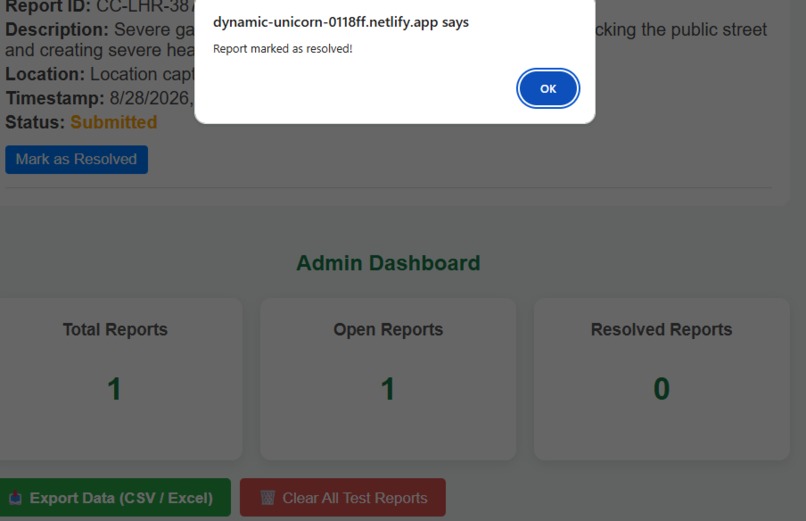
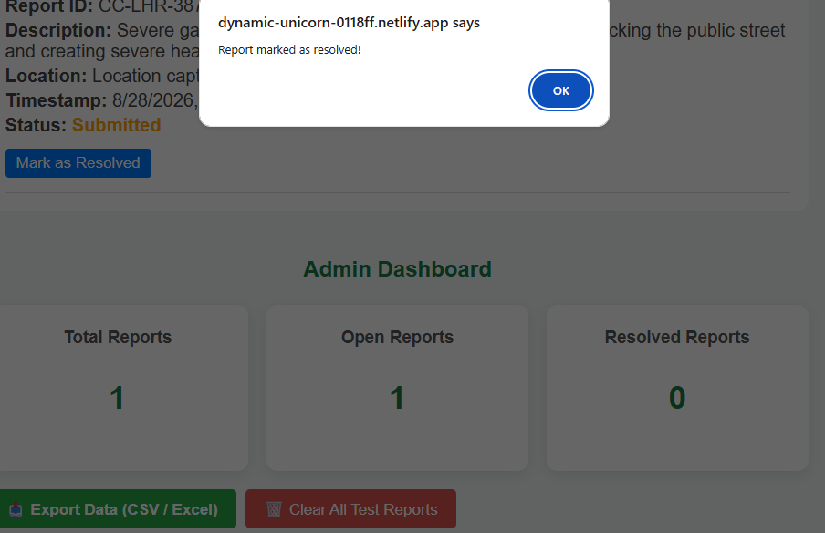
Interactive notification confirming real-time issue resolution status update.
-
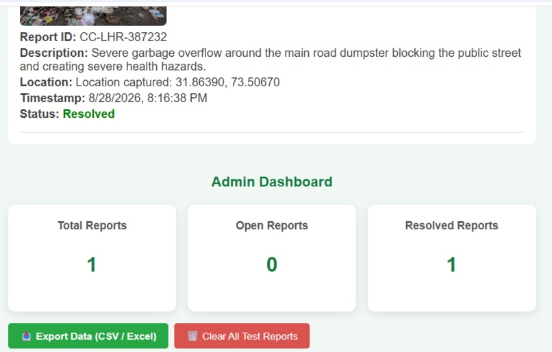
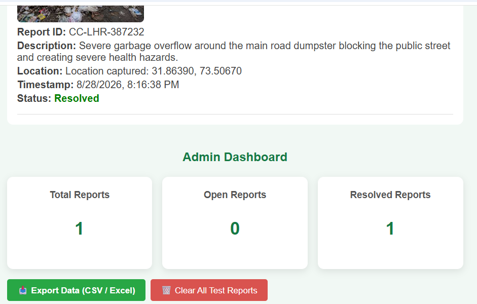
Updated report status showing resolved civic issue synced live with the admin analytics dashboard.
-
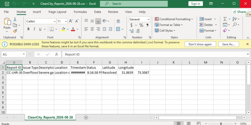
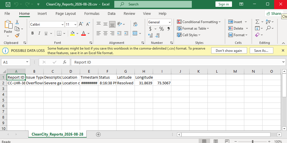
Exported CSV spreadsheet showing complete civic issue records, including GPS coordinates, timestamp, and status.
-
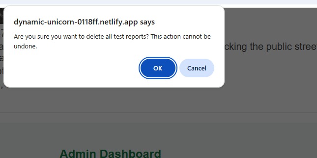
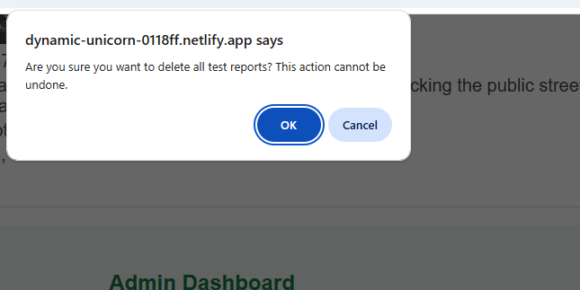
Admin confirmation dialog for safely resetting and clearing test report data.
Inspiration: Cities face many everyday civic problems such as garbage accumulation, overflowing waste bins, and unclean public spaces. Citizens often notice these problems first, but existing complaint systems may not provide a reliable way to verify reports, track their progress, or build a trustworthy public record.
This inspired us to build CleanCity, a citizen reporting platform that turns ordinary residents into verified sensors for their communities. The idea is based on a simple principle: if a report is supported by a photo, precise location, and timestamp, it can become more useful and accountable.
What it does: CleanCity allows citizens to report civic issues by uploading a photo and providing the issue details. The system captures the report's location and timestamp, helping create a verifiable record of the problem.
Each report can be displayed on an interactive map using OpenStreetMap, allowing citizens and authorities to understand where issues are occurring. A public feed can show reported issues and their current status, such as:
Submitted Under Review In Progress Resolved
The platform also aims to identify duplicate reports so that multiple submissions about the same issue can be combined instead of counting the same problem repeatedly.
How we built it: We designed the project as a software-based civic reporting platform with a focus on verification, location-based reporting, and transparent issue tracking.
The main workflow is:
Citizen → Photo + Location + Timestamp → Verification → Public Record → Status Tracking
OpenStreetMap is used as the basemap for location-based reporting and visualization.
Challenges we ran into: One of the main challenges was designing a reporting system that remains simple enough for citizens while still collecting enough information to make reports useful and verifiable.
Another challenge was considering duplicate reports. Multiple citizens may report the same issue, so the system needs a way to recognize similar reports and represent the problem accurately.
We also had to think about how to present civic issues clearly on a map and how to make the reporting process accessible to ordinary citizens.
Accomplishments that we're proud of: We are proud of creating a solution that focuses not only on reporting civic problems but also on making those reports more verifiable and useful.
Our key accomplishments include:
Building a citizen-focused reporting concept based on photo, location, and timestamp. Designing a workflow that turns individual reports into a verifiable public record. Integrating the idea of map-based issue visualization using OpenStreetMap. Including a concept for duplicate detection, so repeated reports about the same issue can be grouped together. Designing a transparent status-tracking system from Submitted to Resolved. Creating a solution that can generate its own civic data without depending on closed government datasets.
Most importantly, we are proud that CleanCity gives ordinary citizens a more active role in identifying and documenting problems in their communities.
What we learned: Through this project, we learned that a useful civic technology solution is not only about collecting complaints. Trust and verification are equally important.
We learned how location data, timestamps, photographs, mapping, and structured reports can work together to create more reliable civic information.
What's next for CleanCity – Smart Waste Reporting: CleanCity can be expanded beyond the initial prototype to become a more complete civic reporting and accountability platform.
Our next steps include:
AI-assisted verification: Use image analysis to help identify whether an uploaded image actually contains a relevant civic issue. Improved duplicate detection: Automatically identify reports that refer to the same location and problem. Real-time notifications: Notify users when the status of their reported issue changes. Area-based analytics: Show which areas have the highest number of reported or unresolved issues. Authority dashboard: Provide an organized dashboard for reviewing, prioritizing, and resolving reports. Resolution verification: Allow a resolved issue to be supported by a new photograph as evidence of completion. Public transparency: Provide citizens with a clearer view of open, ongoing, and resolved issues.
Our long-term goal is to expand CleanCity from a waste-reporting tool into a broader verified civic reporting platform, where citizens can help create reliable, location-based data about problems in their communities.
Built With
- application
- css
- gps
- html
- javascript
- openstreetmap
- web

Log in or sign up for Devpost to join the conversation.