Inspiration
During emergencies, every moment matters. Yet incident reports, location information, risk assessments, and responder coordination can become fragmented across different systems and communication channels.
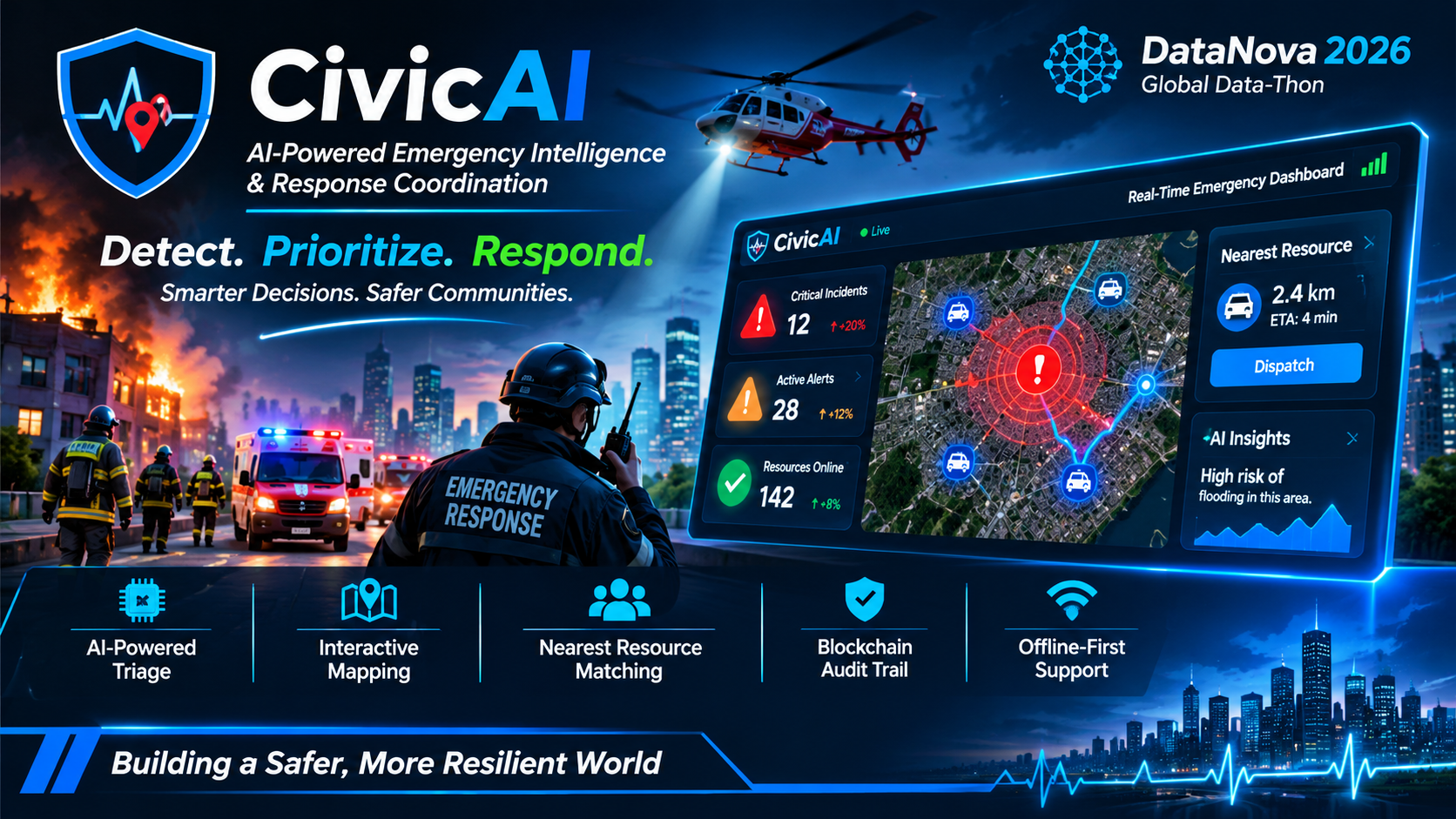
We created CivicAI to address this challenge by bringing emergency intelligence and response coordination into one platform. Our vision is to transform scattered incident information into a shared operational picture that helps emergency teams prioritize incidents, identify nearby resources, and make better-informed decisions.
Our mission is simple: Detect. Prioritize. Respond. We want to help build safer, more resilient communities through responsible AI and accessible technology.
What it does
CivicAI is an AI-assisted emergency intelligence and response coordination platform designed for emergency teams, public agencies, and local responders.
Key features include:
- AI-Assisted Incident Triage: Supports incident classification, severity assessment, and emergency guidance.
- Interactive Geospatial Mapping: Visualizes reported incidents and their locations through an interactive map powered by Leaflet and OpenStreetMap.
- Responder and Resource Matching: Identifies nearby emergency resources and estimates travel times to support response planning.
- Emergency Intelligence Dashboard: Provides an overview of incidents, alerts, and operational activity.
- Risk and Prediction Insights: Offers a foundation for identifying potential risks and understanding incident patterns.
- Transparent Event Tracking: Supports traceability of operational events and incident updates.
- Offline-Ready Experience: Uses client-side persistence to help users maintain workflows when internet connectivity is unreliable.
CivicAI is designed to support human decision-making rather than replace emergency professionals. Recommendations should be reviewed by authorized personnel before operational action is taken.
How we built it
CivicAI combines a modern web interface, a Python backend, geospatial visualization, and AI-assisted analysis.
Frontend: React, Vite, Tailwind CSS, Leaflet, and React Leaflet provide the user interface, dashboards, and interactive incident maps.
Backend: FastAPI, Python, and Uvicorn power the backend API, incident management, routing logic, and application orchestration.
AI and Analysis: AI-assisted reasoning and structured incident intelligence support triage, incident interpretation, and decision support.
Mapping and Routing: Leaflet and OpenStreetMap provide geographic visualization, while GPS-based resource matching supports nearest-resource identification and estimated arrival times.
Offline Support: IndexedDB provides client-side persistence for an offline-ready user experience.
Integration Architecture: The project includes service modules for capabilities such as AI interaction, notifications, search, vision, storage, and event tracking. The extent to which external services are operational depends on their configuration and deployment.
We organized the platform into modular frontend and backend components to make the application easier to develop, test, maintain, and extend.
Challenges we ran into
One of our main challenges was bringing different emergency-response capabilities into a coherent workflow rather than building disconnected features.
We needed to consider how incident information moves from submission to assessment, mapping, resource matching, and operational review.
Other challenges included:
- Designing incident information structures that support prioritization and coordination.
- Connecting geographic information with responder and resource matching.
- Making AI-assisted recommendations useful without treating them as unquestionable decisions.
- Designing for unreliable connectivity and the need to preserve information locally.
- Creating a modular architecture that can accommodate additional data sources and integrations.
- Distinguishing prototype capabilities from features that require further testing, live integrations, or deployment.
These challenges reinforced the importance of building emergency technology around reliability, transparency, usability, and human oversight.
Accomplishments that we're proud of
We are proud to have developed the foundation of an integrated emergency intelligence platform that brings several important capabilities together.
Our key accomplishments include:
- Establishing a full-stack architecture using React and FastAPI.
- Designing a centralized emergency dashboard and incident management workflow.
- Incorporating interactive geospatial visualization for incident awareness.
- Developing a foundation for AI-assisted triage and emergency decision support.
- Building resource-matching and route-estimation capabilities into the proposed workflow.
- Incorporating offline-ready client-side persistence.
- Structuring the backend into modular services and API routes.
- Creating a platform that can be extended toward richer analytics, integrations, and multi-agency coordination.
Most importantly, CivicAI is built around a practical problem: helping people turn incident information into coordinated action.
What we learned
Building CivicAI strengthened our understanding of how AI, geospatial data, backend engineering, and user experience can work together to address real-world challenges.
We learned that an effective emergency intelligence platform requires more than an AI model or a map. It needs a complete workflow connecting information collection, assessment, resource identification, communication, and review.
We also learned the importance of responsible AI design. In emergency scenarios, recommendations should communicate uncertainty, support human judgment, and remain open to verification and correction.
Finally, we recognized that impact must be measured rather than assumed. Meaningful evaluation requires realistic scenarios, baseline comparisons, data-quality checks, and feedback from intended users.
What's next for CivicAI: AI-Powered Emergency Response
Our next goal is to move CivicAI toward a more thoroughly validated and deployment-ready emergency response platform.
Our roadmap includes:
1. Stronger Incident Intelligence: Improve incident classification, contextual analysis, severity scoring, and risk assessment.
2. Real Road-Network Routing: Integrate reliable road-network data and navigation services to improve route selection and estimated arrival times.
3. Predictive Analytics: Develop and evaluate models for identifying incident patterns and potentially high-risk areas using suitable historical data.
4. Multi-Agency Coordination: Expand alerting, communication, and coordination workflows for authorized emergency teams and public agencies.
5. Improved Offline Resilience: Strengthen local persistence, synchronization, and recovery when connectivity returns.
6. Responsible AI and Security: Improve access controls, auditability, data protection, explainability, and human review of AI-generated recommendations.
7. Pilot Testing and Impact Measurement: Evaluate the platform using simulated emergency scenarios and, where appropriate, controlled pilots with qualified reviewers. We aim to measure triage time, resource-matching quality, route-estimation accuracy, data completeness, and system reliability.
Our long-term vision is to make emergency intelligence more accessible, coordinated, and transparent—helping communities and response teams make better-informed decisions when they matter most.
**CivicAI: Detect. Prioritize. Respond. Building a safer, more resilient
Built With
- ai-assisted-analysis
- azure-blob-storage
- azure-cosmos-db
- fastapi
- geospatial-mapping
- gps
- gpt-style-reasoning
- hedera
- indexeddb
- javascript
- leaflet.js
- mcp
- notification-services
- openstreetmap
- python
- react
- react-leaflet
- rest-api
- routing-engine
- severity-scoring
- tailwind-css
- uvicorn
- vite
- yolo

