Inspiration (the problem)
Some satellites were declared dead decades ago and are still in orbit. A few of them are still transmitting, and almost every one of those was found again by an amateur with an antenna, not by the agency that built it.
In January 2018 a Canadian radio amateur, Scott Tilley (VE7TIL), was searching his backyard sky for a missing secret satellite. He found an unknown signal instead, matched its Doppler curve against the public orbit catalog, and identified NASA's IMAGE spacecraft, silent since 2005.
Anyone who wants to follow a satellite like that needs three things at once: when it passes, where in the sky to point, and how far the frequency has shifted. The tools that give those three answers are either desktop programs for experienced operators or a ground station that you build yourself. A newcomer cannot get past the first step: the satellite is overhead and there is no easy way to know where to look.
What it does
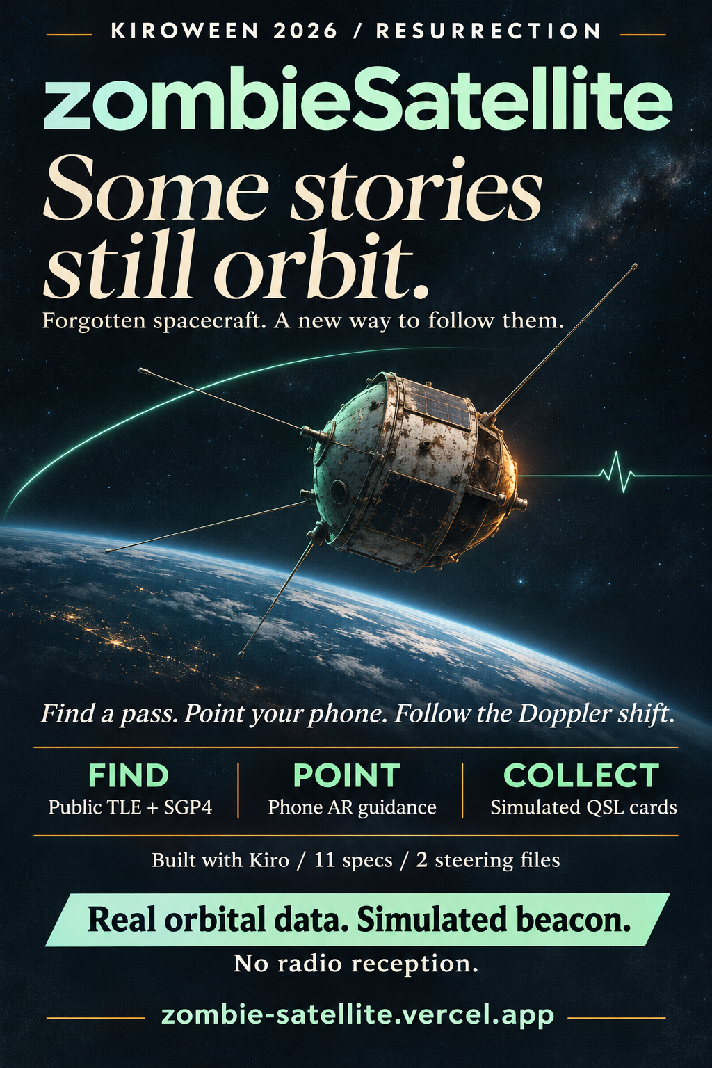
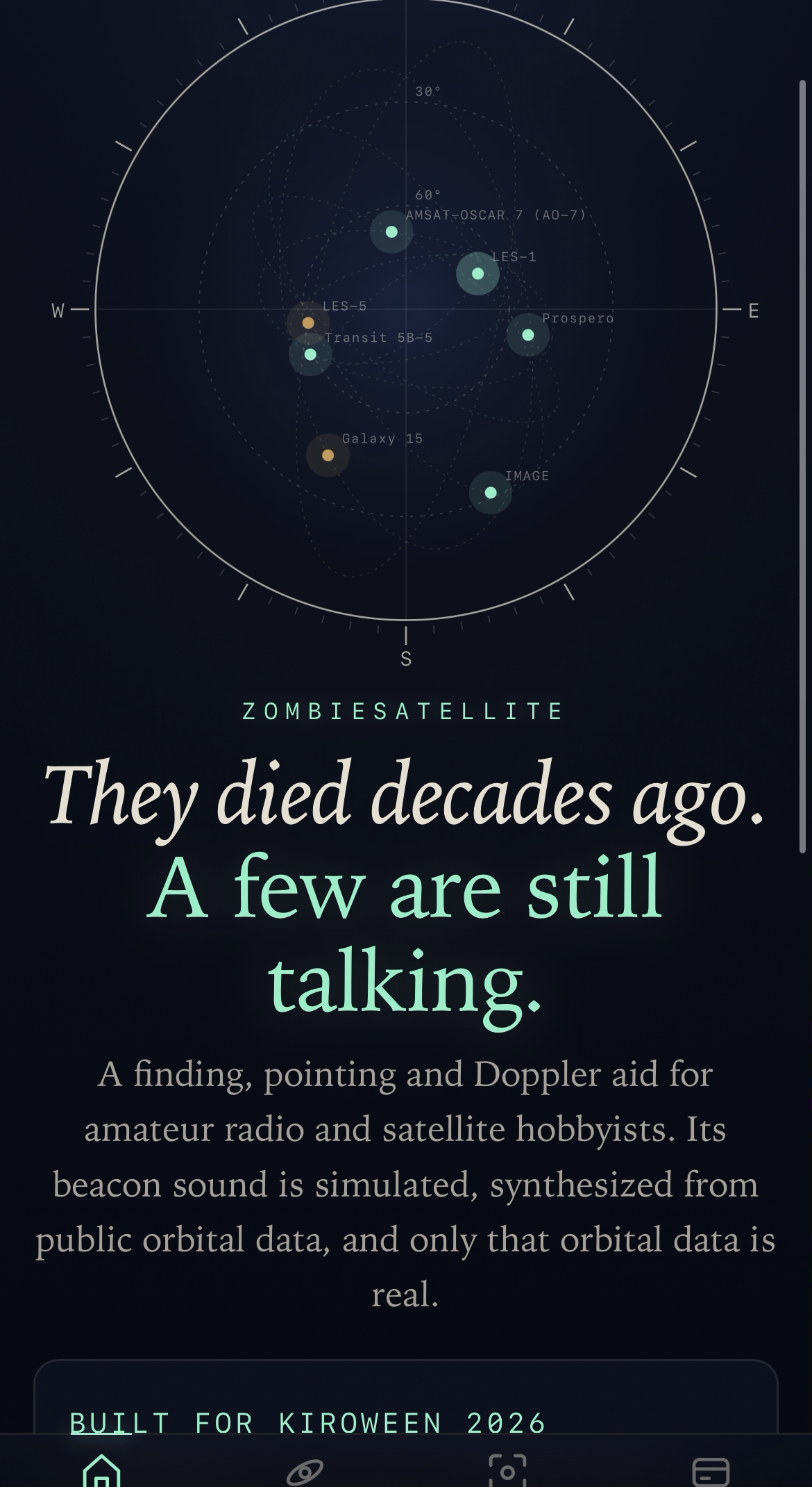
zombieSatellite is a finding, pointing and Doppler aid for amateur radio and satellite hobbyists, built around a fixed catalog of seven zombie satellites.
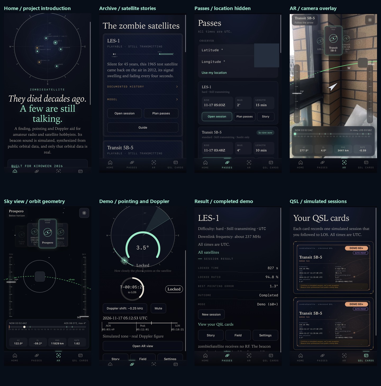
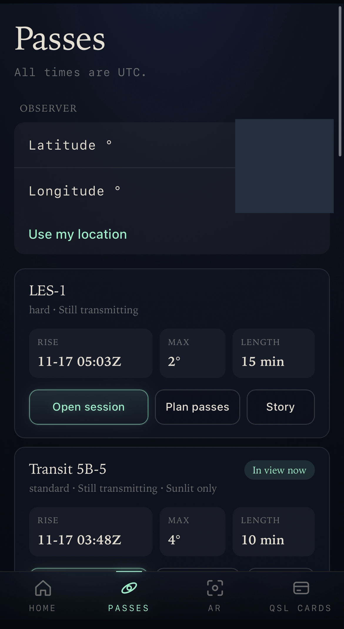
- Find. It predicts the next pass over your position (browser geolocation, or typed coordinates) from public CelesTrak TLE data with SGP4. All times are UTC, with a local start time next to each prediction.
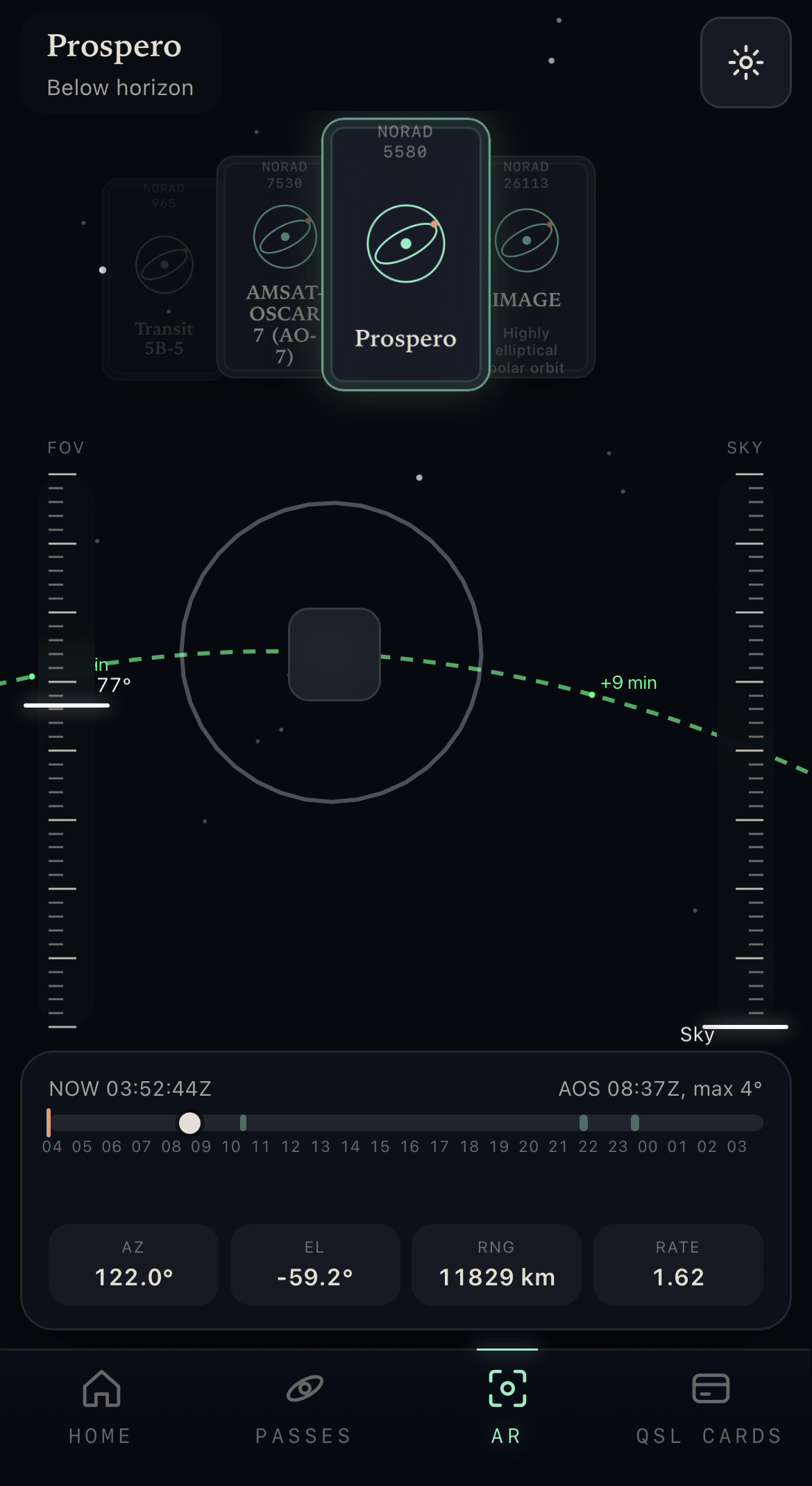
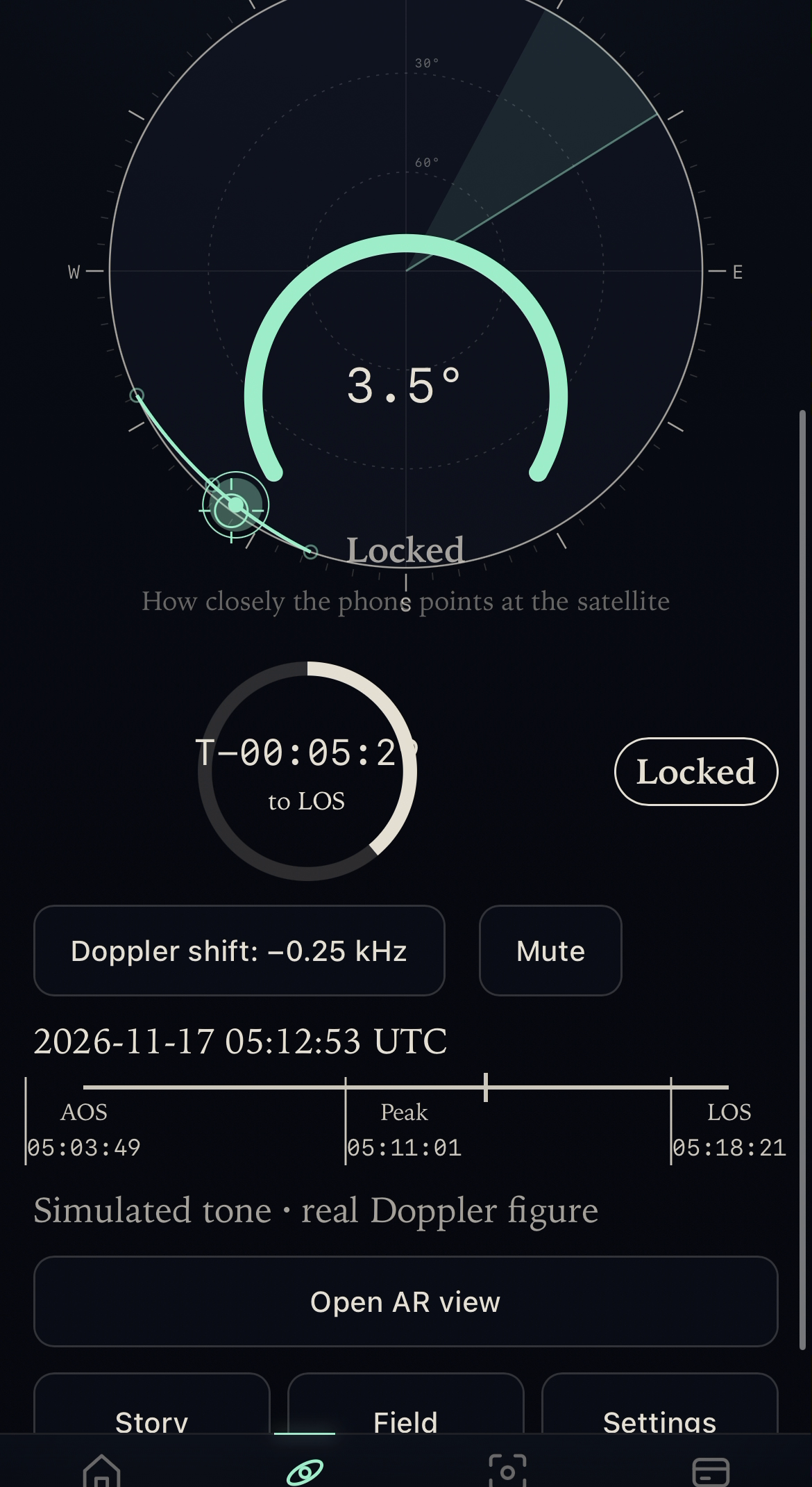
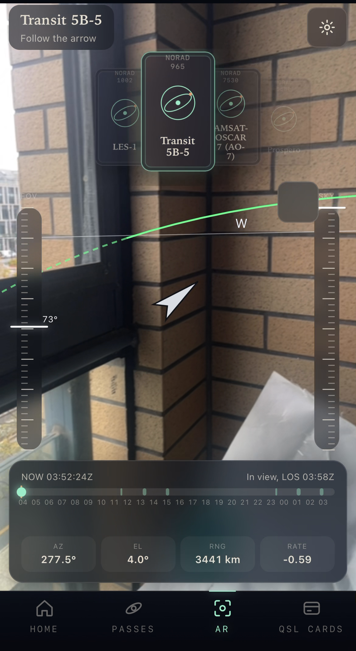
- Point. During a pass, a marker follows the computed azimuth and elevation on a sky view, optionally over the live camera picture. The pointing lock tolerance is ±10°.
- Follow the Doppler shift. The app shows the Doppler shift of the pass in kHz in real time. A simulated beacon tone, synthesized in the browser, glides with it. The tone is an artistic simulation; the kHz figure is the real computed shift.
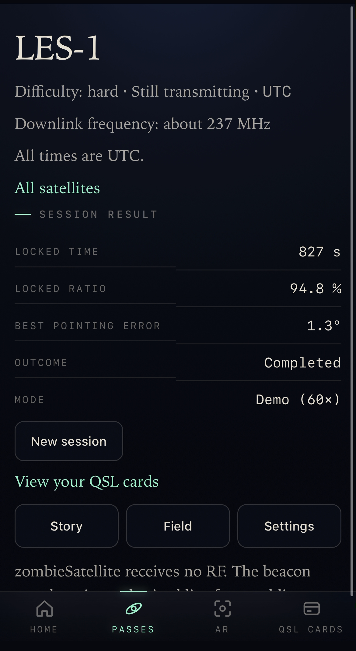
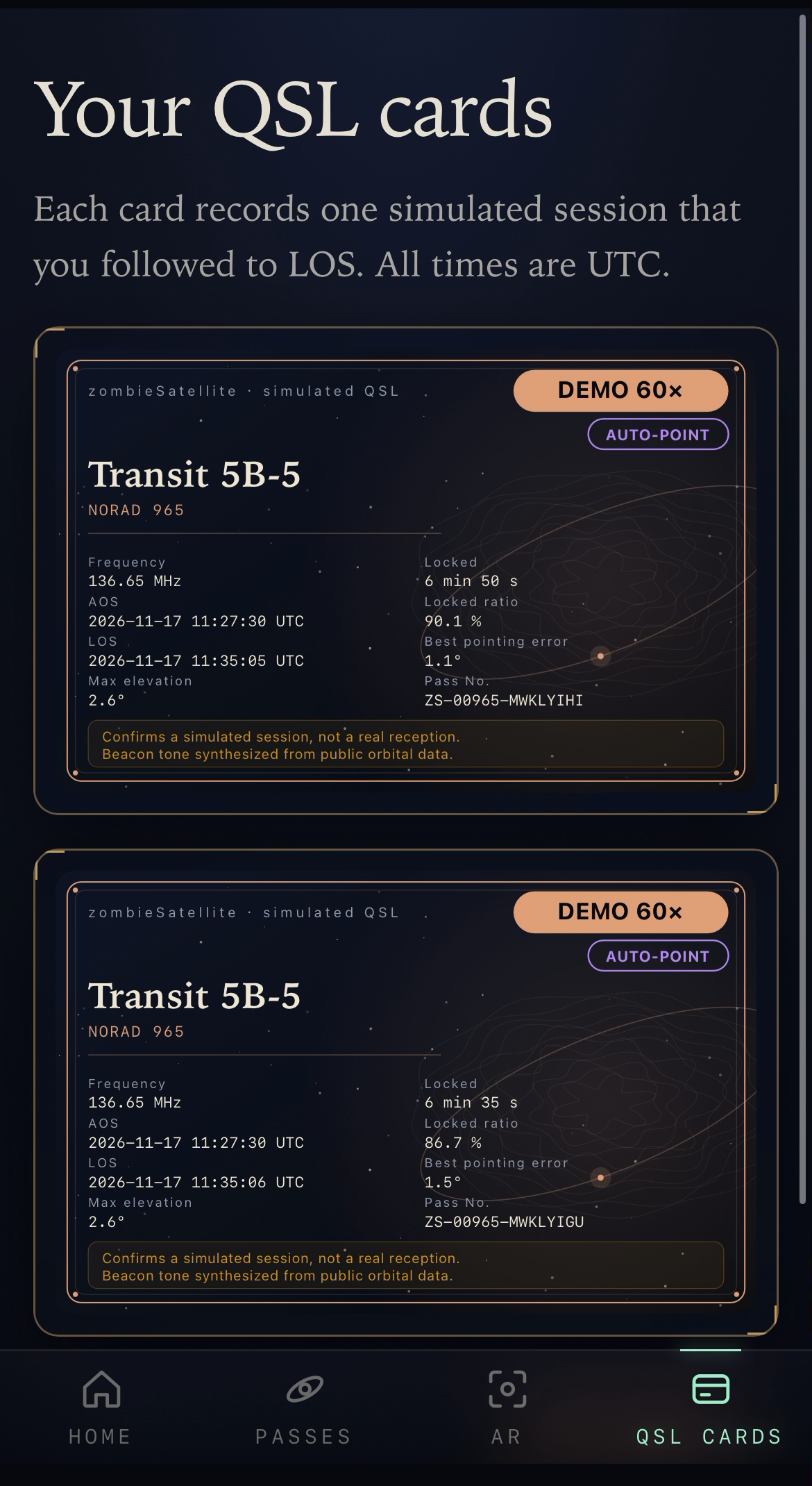
- Collect. Each completed pass issues a QSL card with the satellite, the UTC times, the maximum elevation, the frequency and an explicit note that the card confirms a simulated session.
- Try it without hardware. A 60× demo mode plays the next complete real pass in a few minutes and can aim for you.
Field companion
A second layer of features turns the app into a planning aid for someone who wants to try a real listening session with their own radio. Every screen opens in a simple view, and an "Instrument" detail shows the technical numbers one tap away.
- Sunlight and shadow. A sunlight model (the USNO approximate solar coordinates algorithm with an Earth-shadow test) marks each predicted pass as sunlit, partly sunlit or in shadow. For the satellites documented as transmitting only in sunlight, the simulated beacon goes quiet while the satellite is in shadow. This is a geometric prediction, not a measurement of any real transmitter.
- Tuning table. For a pass, the receive frequency at AOS, TCA and LOS (nominal downlink plus the computed Doppler shift), with a per-minute table that can be copied or exported as CSV. IMAGE has no documented downlink, so the app shows no frequency for it. LES-1 is described as "about 237 MHz" and its table is marked approximate.
- Pass planner. The passes of the next seven days with a minimum-elevation filter (default 10°), rise and set azimuths, UTC times, and an
.icscalendar export. - Sky track. The full pass drawn on the sky view, with AOS and LOS marks, time ticks, and the shadow segments drawn differently.
- AR view. The camera picture with the satellite, its upcoming track, the horizon, the cardinal directions, an edge arrow when the satellite is off screen, and a ±10° lock ring. The camera is a visual layer only: nothing is captured, uploaded or stored. A field-of-view calibration is available because the default 75° can drift on some phones.
- Ground-track map. A world map with the sub-satellite point, one orbit of track on each side, the visibility footprint, the observer's pin and the day and night terminator. The coastline is Natural Earth data (public domain), bundled in the repository.
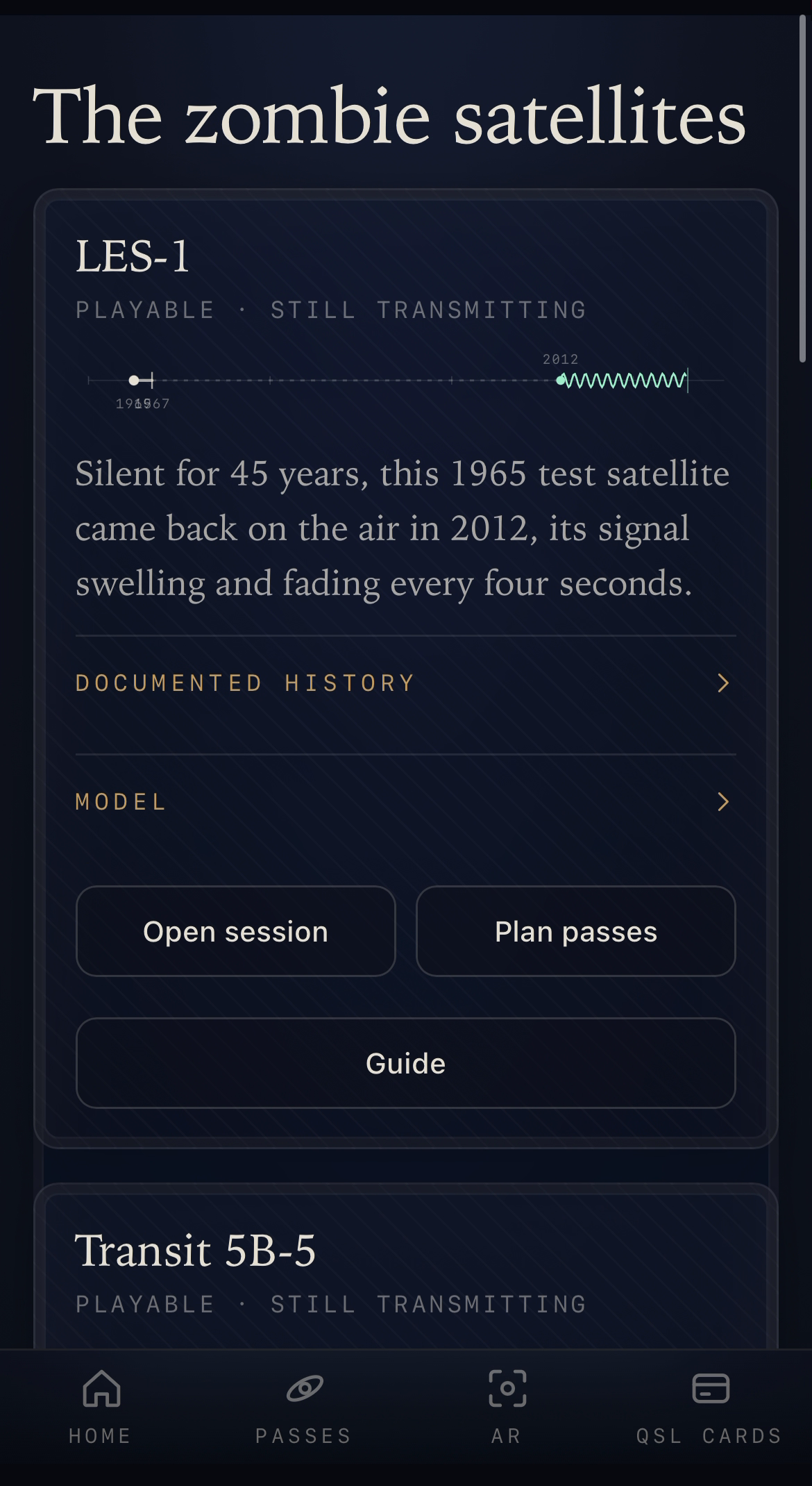
- Listening guide. Per satellite, the documented downlink, the simplest setup that the cited sources support, the sunlight condition and links to public recordings. The guide says that the listener's own radio does the receiving, and not the app.
- Models. A slowly rotating model of each satellite. No licensed original was found for any of the seven, so all seven are hand-built illustrative models, labelled as such.
- Listening log. A listener who heard a satellite with their own radio can note it. Entries are stored in the browser only, are self-reported, and are marked that way on their face. The app cannot verify them, and they are kept apart from the simulated QSL cards.
- First run. A short, skippable guide for a newcomer, shown once.
zombieSatellite receives no RF. Beacon audio is synthesized live from public orbital data. Bring your own radio for the real thing; the app does the finding, pointing and Doppler math.
Who it is for
The first audience is amateur radio and satellite hobbyists: shortwave and satellite watchers, SDR owners and people who track satellites. They already know why a pass table, a pointing direction and a Doppler figure matter, and the app puts all three on one phone screen.
The demo mode is the entry point for newcomers. It lets someone with no radio and no antenna practise the whole loop (pick a satellite, read the pass, point, follow the shift, collect the card) on a 1960s spacecraft, before they ever touch real equipment.
Why it matters
The zombie-satellite hobby exists because amateurs did the work that institutions had stopped doing. A tool that makes the first steps easier brings more people into that community. The orbital data behind it is public, so nothing in the app depends on a private service: the server only forwards the public TLE and caches it for two hours.
How we built it
- Orbit engine: SGP4 through satellite.js 6.0.2, with look angles, a pass finder with refinement, and range rate for the Doppler shift. It is checked against fixed TLE snapshots and numeric baselines carried over from the author's earlier personal project SatAware AR.
- Pointing: device orientation to camera direction, magnetic declination (WMM 2025) so that the heading is a true heading, a manual calibration offset, a drag compass fallback, and a pure marker projection with a fixed 75° vertical field of view.
- Session: a small state machine (selecting, awaiting pass, in pass, completed), a real-time clock and a 60× demo clock, and Web Audio synthesis of the beacon tone.
- QSL cards: SVG cards generated from the session result, saved as SVG or PNG, with the collection kept in the browser's local storage.
- App shell: Next.js 16 and React 19, an installable PWA (manifest, locally generated icons, a service worker that caches only the app shell), and a server route that fetches TLE data from CelesTrak for the browser, so that phones, in China in particular, never need a direct connection to celestrak.org.
- All code was newly written during the Kiroween 2026 submission period. Only the coordinate conventions and the numeric acceptance baselines come from SatAware AR.
Kiro usage
The project was built spec by spec with Kiro, in 113 commits, starting on 14 November 2026.
- Specs: eleven spec folders in
.kiro/specs: orbit-engine, zombie-catalog, ar-pointing, seance-session, qsl-card, shell-pwa-deploy, field-companion, console-ui, ar-tab, ui-refresh and mobile-polish. Most features have requirements written as EARS statements, a design and a task list, and tasks are committed one at a time. - Steering: two files in
.kiro/steering.project-scope.mdfixes the catalog, UTC, the absence of a custom backend and the rule against claiming real reception.workflow.mdsets the commit and push rules, the spec language and the verification discipline. - Verification: 25 test files use fast-check property tests or example tests. The scaffold tests scan the app's own text for wording that could suggest real reception.
- Models: Opus wrote the requirements and the designs; Sonnet did most of the implementation.
- Review gates: a human review between stages. The requirements, the design and the task list of each spec were approved by the author before the next stage started, and several designs were changed after review.
- Not used: Kiro hooks, MCP servers, Kiro powers and Kiro Crew are not part of this project. The app does not depend on them.
What Kiro did not do: deploy the app, or run the device checks. The author deployed to Vercel and runs the device checklist on real phones.
Challenges
Honest wording. The app must never suggest that it hears a real satellite. Two scaffold checks scan every page text, the copy modules and the README: a text that mentions a beacon, signal or radio must also say simulated or synthesized, and no sentence may pair a reception word with a radio term. They shaped the copy: for example, the app names its audience hobbyists and watchers, because the word listeners next to a radio term fails the scan.
Orbit data in China. A direct connection to celestrak.org is not reliable from many phones, so the browser talks only to the app's own server route.
Phone sensors. Heading comes from different sources on iOS and Android and needs a declination correction to be a true heading. On iPhone the motion sensors have to be enabled again after the user returns from another app; this is an iOS permission limitation that we recorded and did not work around.
A fixed field of view. The marker first used a fixed 75° vertical field of view, so it could sit slightly off over the camera picture on some phones. The AR tab now has a field-of-view slider, but each phone still needs its own setting.
What we learned
Writing the numeric baselines down first, and then building tests against them, made the orbit and pointing code much easier to trust. The same holds for the honesty rules: turning them into a scan made them part of the build instead of a promise in a document.
What's next
- Keeping a field-of-view profile for each device, so the slider setting survives a change of phone.
- Exports of the collection of QSL cards.
- Licensed original 3D models, where an agency or museum releases them, in place of the illustrative ones.
Credits and limits
- Coastlines: Natural Earth, public domain. Sun position: the USNO approximate solar coordinates algorithm.
- The satellite models are illustrative, built from published descriptions and dimensions; no photographs were used. The Transit 5B-5 model is a sphere, because no shape was found in the sources. They are not original engineering models.
- The listening log is self-reported and unverified.
- The shadow prediction is geometric. A real transmitter may switch on or off at slightly different moments.
Built with
(18 tags, one per line in the Devpost form)
- Next.js
- React
- TypeScript
- satellite.js (SGP4)
- Web Audio API
- DeviceOrientation API
- Geolocation API
- getUserMedia (camera)
- Service Worker (PWA)
- SVG
- CelesTrak TLE data
- WMM 2025 magnetic model
- Natural Earth coastlines
- Vercel
- Vitest
- fast-check
- pnpm
- Kiro
