-
-
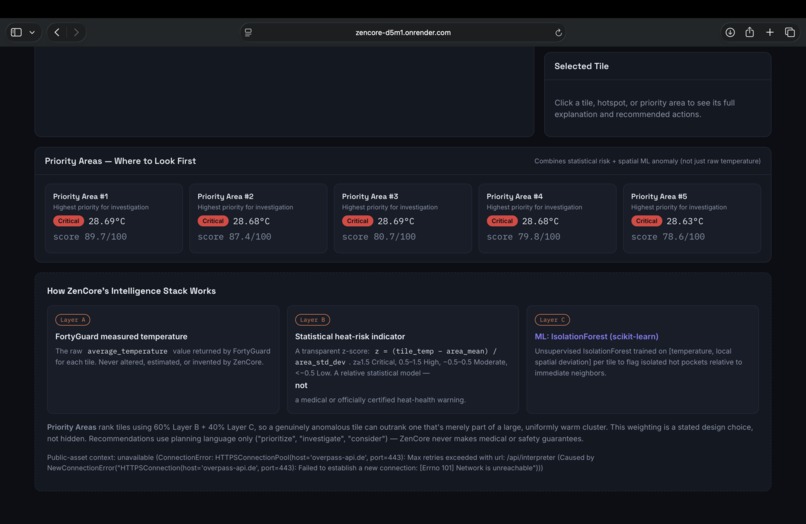
Statistical analysis, Isolation Forest anomaly detection, priority scoring, and the HeatLens AI intelligence methodology.
-
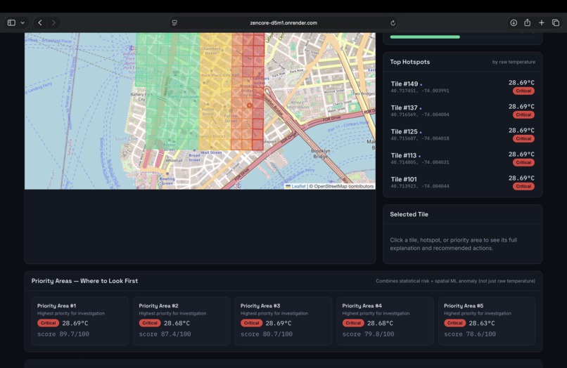
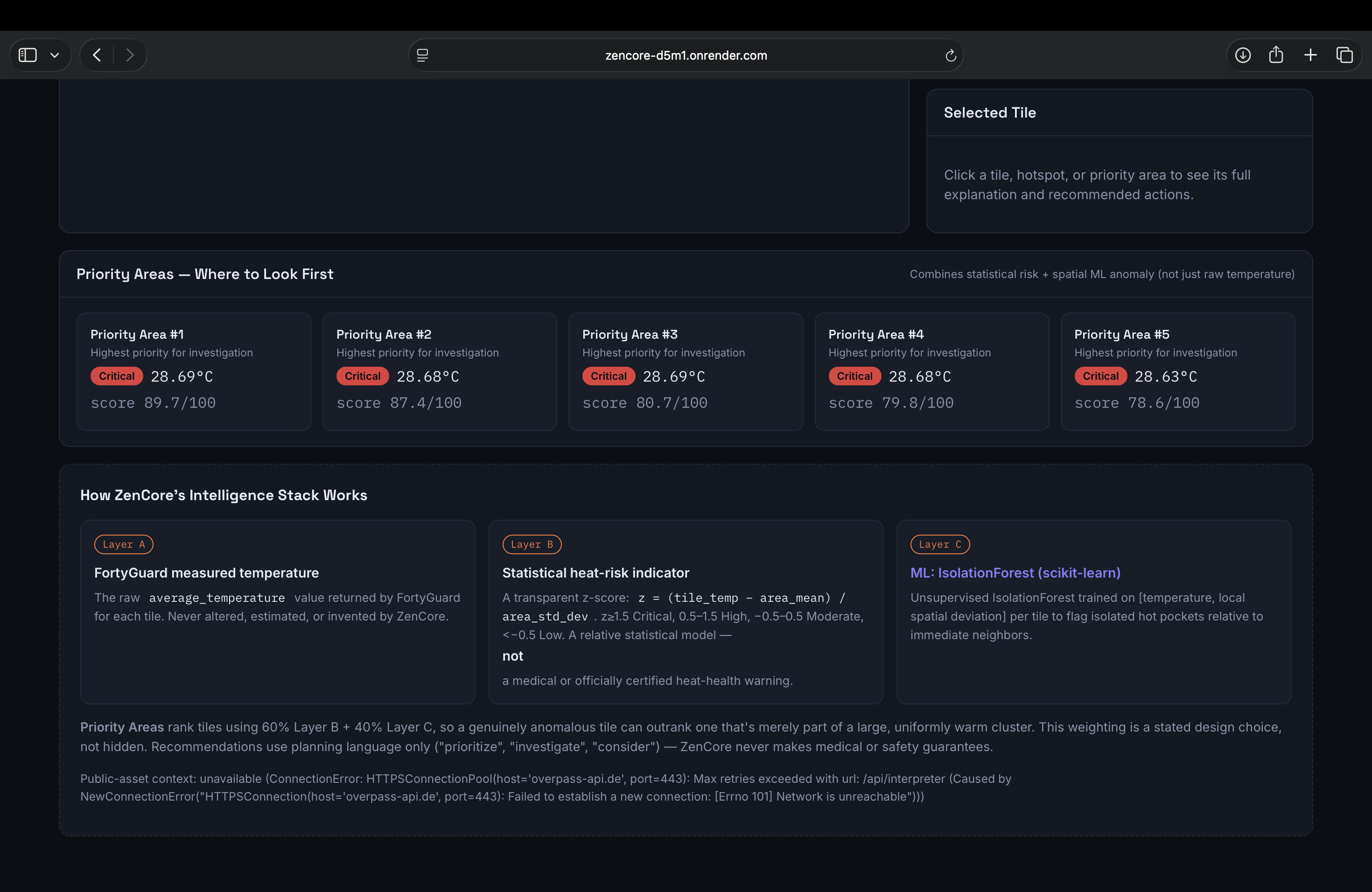
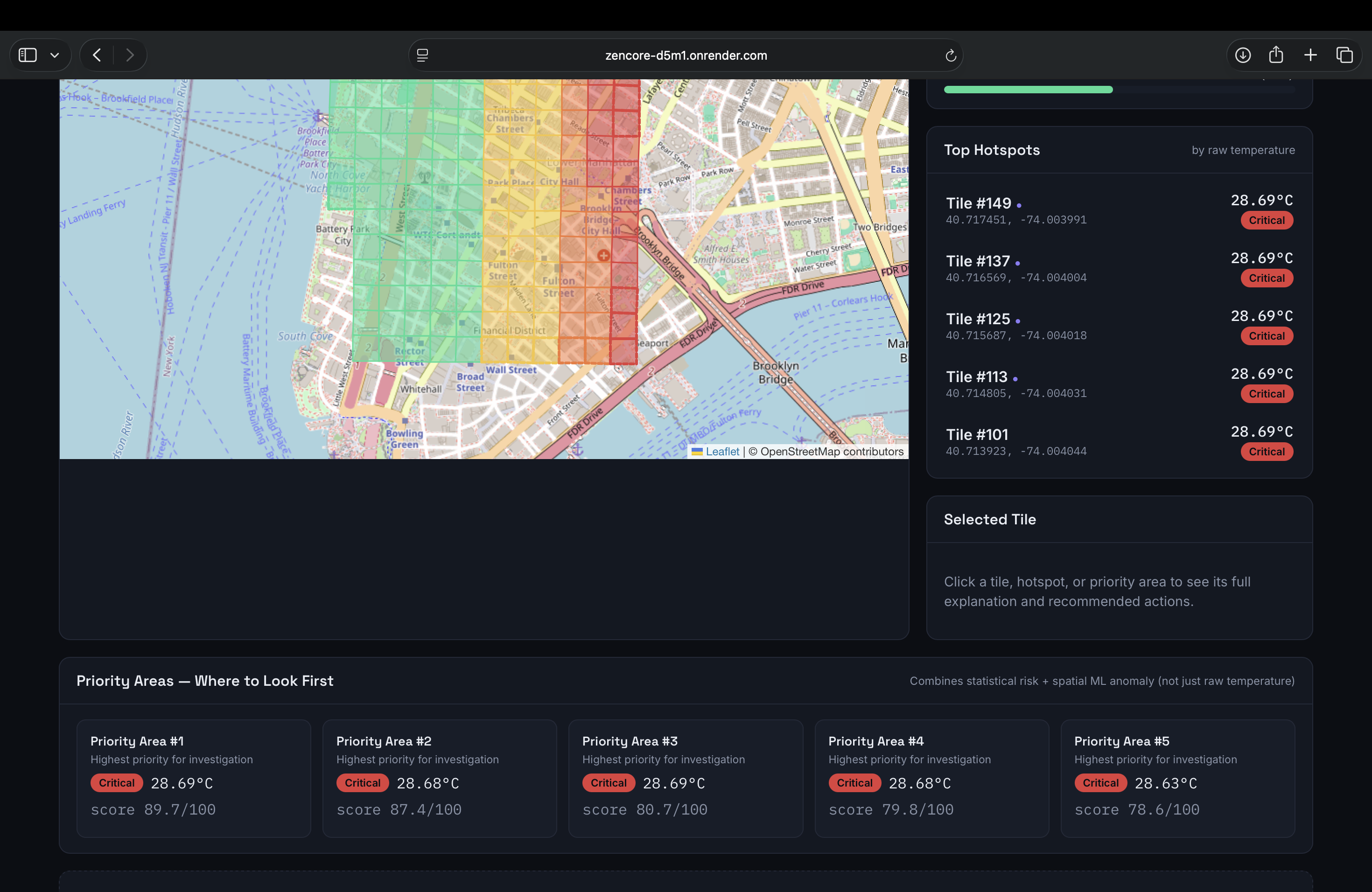
Selected heat tiles, top hotspots, and priority areas identified for focused urban cooling interventions.
-
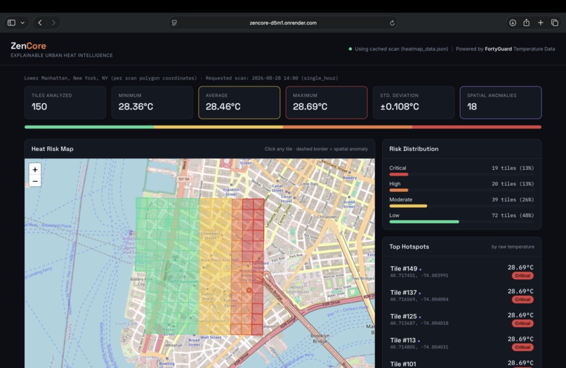
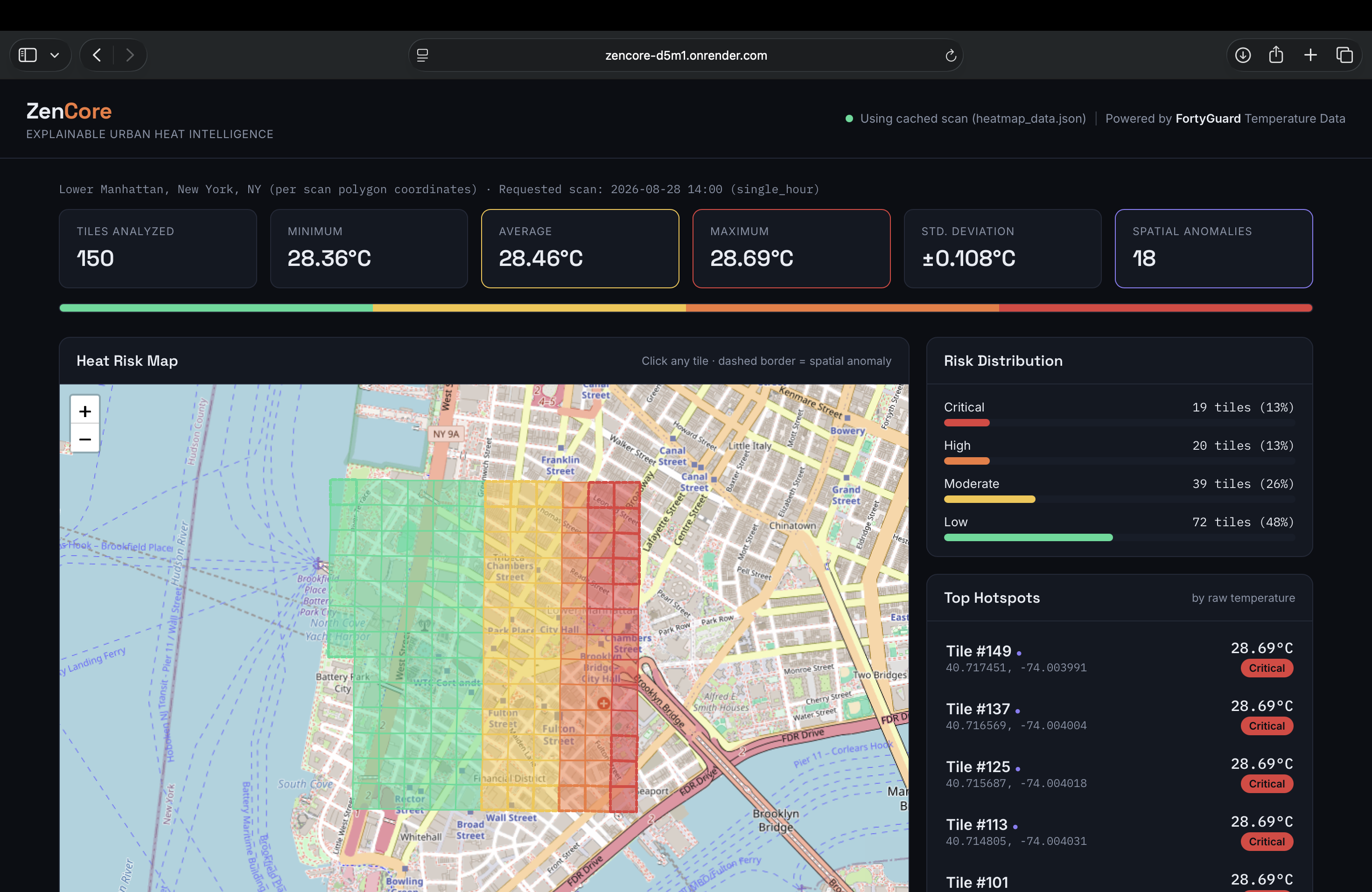
Main Heat Risk Map and Dashboard showing temperature distribution, risk levels, and key urban heat statistics.
Inspiration
Cities can experience significant differences in temperature across relatively small areas. A city-wide average can hide the specific zones where heat conditions are unusually high.
HeatLens AI is the hackathon-facing name of my urban heat intelligence project, originally developed under the codename ZenCore. The goal is to turn temperature data into an actionable urban decision-support tool.
Instead of simply displaying a heatmap, HeatLens AI identifies relatively hotter areas, detects unusual spatial temperature patterns, and helps prioritize locations where cooling interventions may deserve further investigation.
What it does
HeatLens AI analyzes real-world temperature tiles and converts them into an interactive urban heat-risk view.
The system provides:
- Interactive temperature visualization on a map
- Tile-level heat-risk classification
- Statistical analysis using mean and standard deviation
- ML-based anomaly detection using Isolation Forest
- Priority scoring for high-risk locations
- Explainable recommendations for potential cooling interventions
- Dashboard statistics including minimum, average, maximum, and standard deviation
The current implementation analyzes 150 temperature tiles and uses the ML anomaly detector as a supporting signal for unusual spatial-temperature patterns.
How we built it
HeatLens AI is built as a web application with a Flask backend and a browser-based frontend.
The temperature intelligence comes from the FortyGuard API. The backend processes the returned heatmap data and calculates relative heat-risk levels using a z-score:
z = (tile temperature - area mean) / area standard deviation
The system classifies tiles into Low, Moderate, High, and Critical categories based on their relative temperature.
Isolation Forest is used as a supporting ML signal to identify unusual spatial-temperature patterns. The resulting information is combined with temperature and risk information to calculate priority scores and generate practical recommendations.
The frontend uses an interactive Leaflet map to visualize heat distribution and allows users to inspect individual tiles, hotspots, and priority areas.
Challenges
One of the main challenges was turning raw temperature data into information that is useful for decision-making rather than simply displaying numbers.
Another challenge was combining statistical risk classification with an ML anomaly signal without presenting the ML model as a medical or certified heat-health prediction system. HeatLens AI therefore treats the ML component as a supporting signal and clearly communicates the limitations of the relative statistical risk model.
I also had to design the system so that the data pipeline, risk calculations, map visualization, anomaly detection, prioritization, and recommendations work together as a single end-to-end application.
What we learned
Building HeatLens AI helped us understand how real-world data moves through an AI-enabled application, from API data acquisition and preprocessing to statistical analysis, anomaly detection, prioritization, and visualization.
I also learned that an effective AI system is not only about choosing a machine learning model. The quality of the data pipeline, explainability, validation, visualization, and communication of limitations are equally important.
Working on the project also helped us understand how statistical methods and machine learning can complement each other. The statistical layer provides relative heat-risk classification, while Isolation Forest provides an additional signal for unusual spatial patterns.
Impact
HeatLens AI is designed as a decision-support prototype for urban heat monitoring and planning.
By highlighting relatively hotter zones and unusual spatial patterns, the system can help users focus attention on areas that may deserve further investigation or potential cooling measures.
The project can be useful as an exploratory tool for understanding localized urban heat patterns and supporting data-informed planning decisions.
HeatLens AI is intended for exploratory and planning support, not as a certified medical or heat-health prediction system.
Built With
- climate-tech
- css3
- data-visualization
- environmental-technology
- flask
- geojson
- html5
- isolation-forest
- javascript
- leaflet.js
- machine-learning
- python
- rest
- statistical-analysis


Log in or sign up for Devpost to join the conversation.