-
-
poster
-
-
-
-
-
-
-
-
-
-
Inspiration
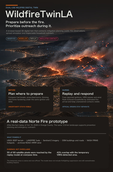
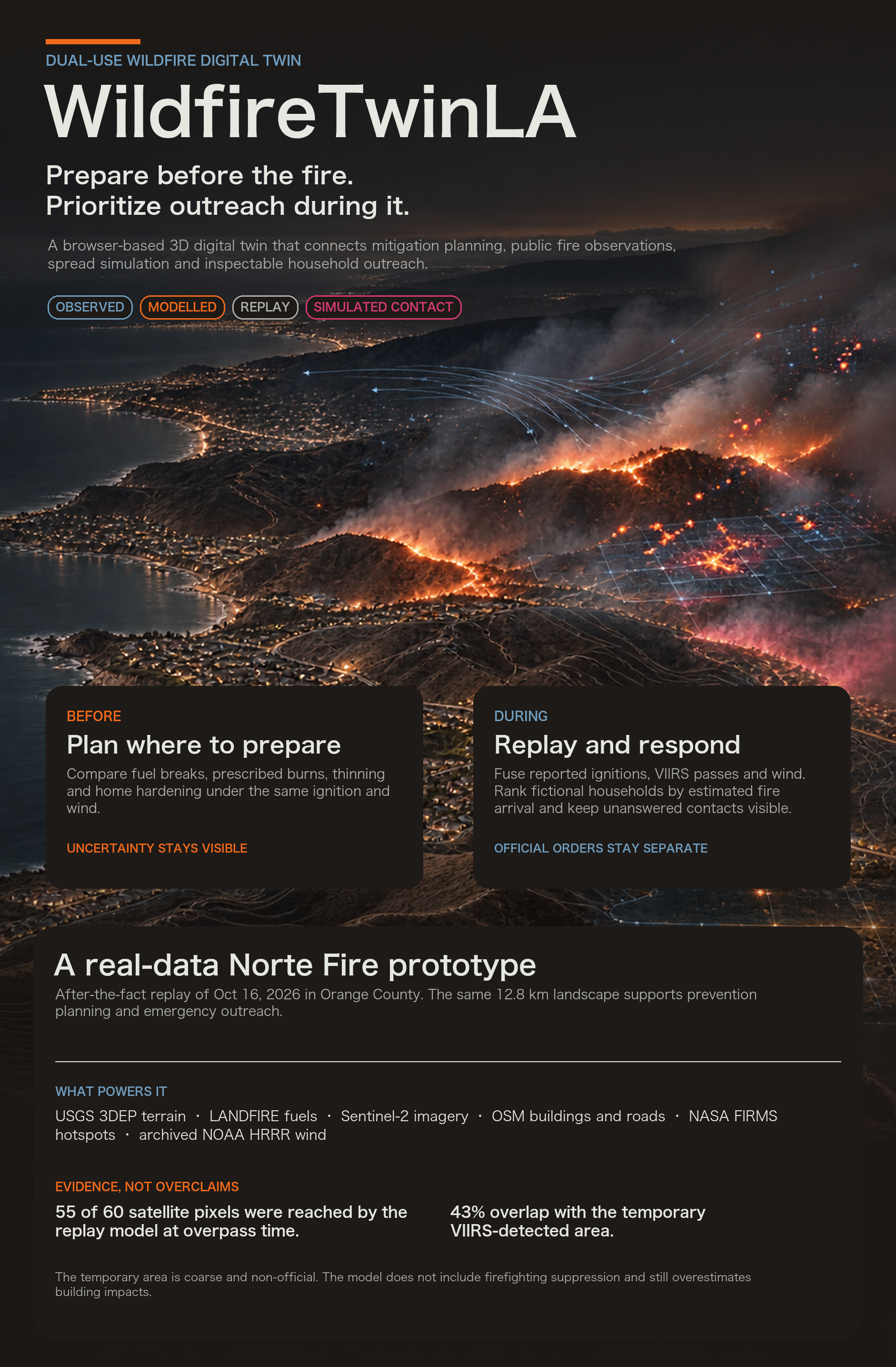
Wildfires in Los Angeles create two connected problems: communities must prepare before ignition, and responders must make fast, high-consequence decisions once a fire begins. Existing tools often separate mitigation planning, satellite observations, fire-spread modeling, and public communication. We were inspired to connect these functions in one dual-use platform that remains valuable during normal operations and becomes immediately actionable during an emergency. WildfireTwinLA is designed to help planners compare prevention strategies before a fire while supporting transparent, evidence-based outreach during an active incident.
What It Does
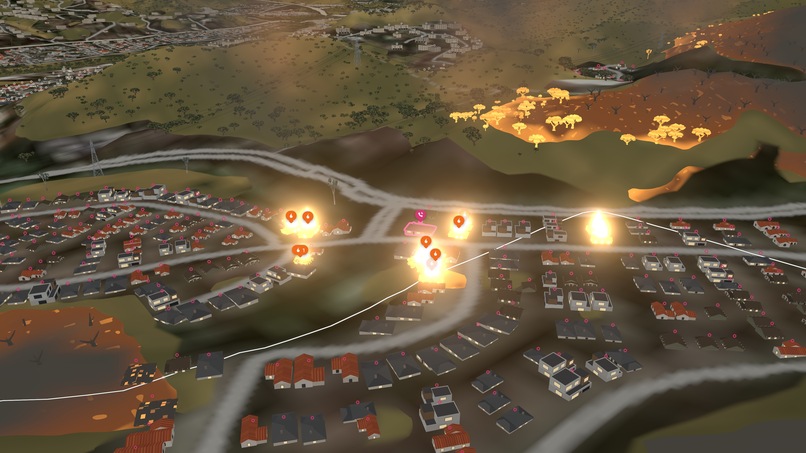
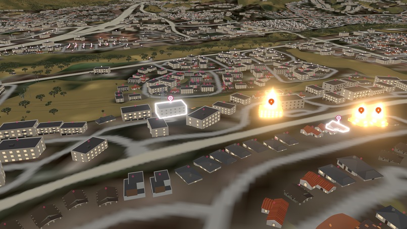
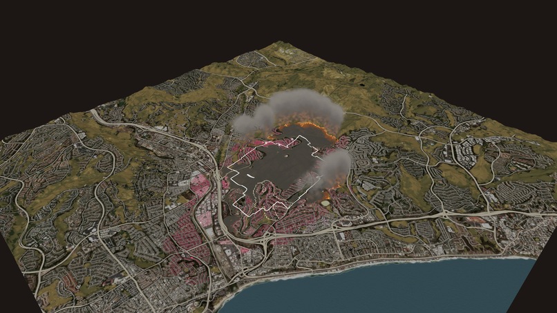
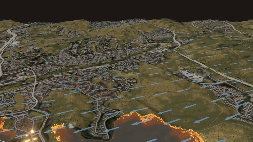
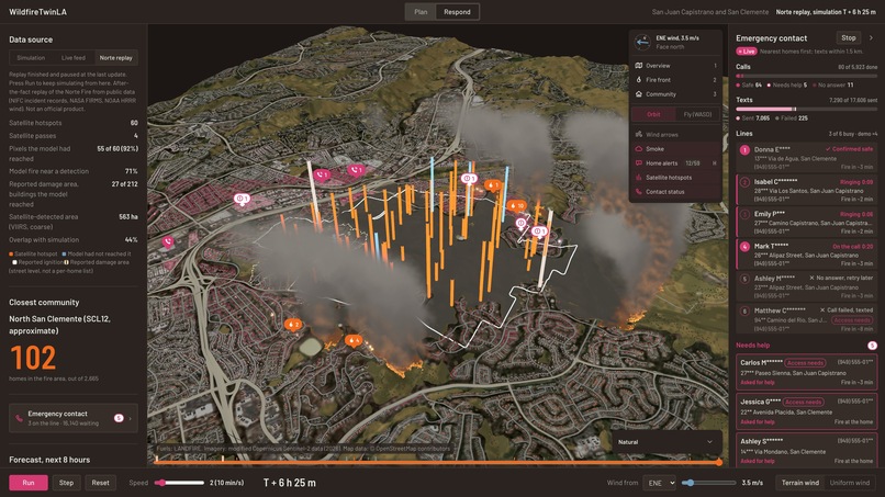
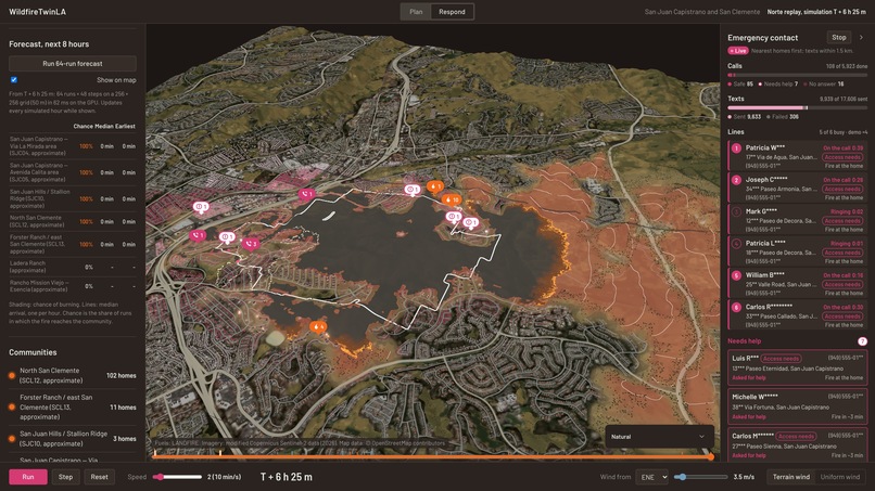
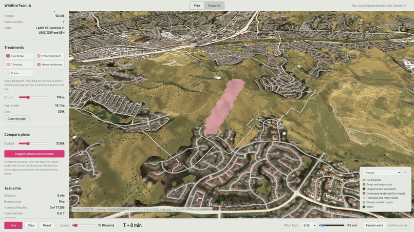
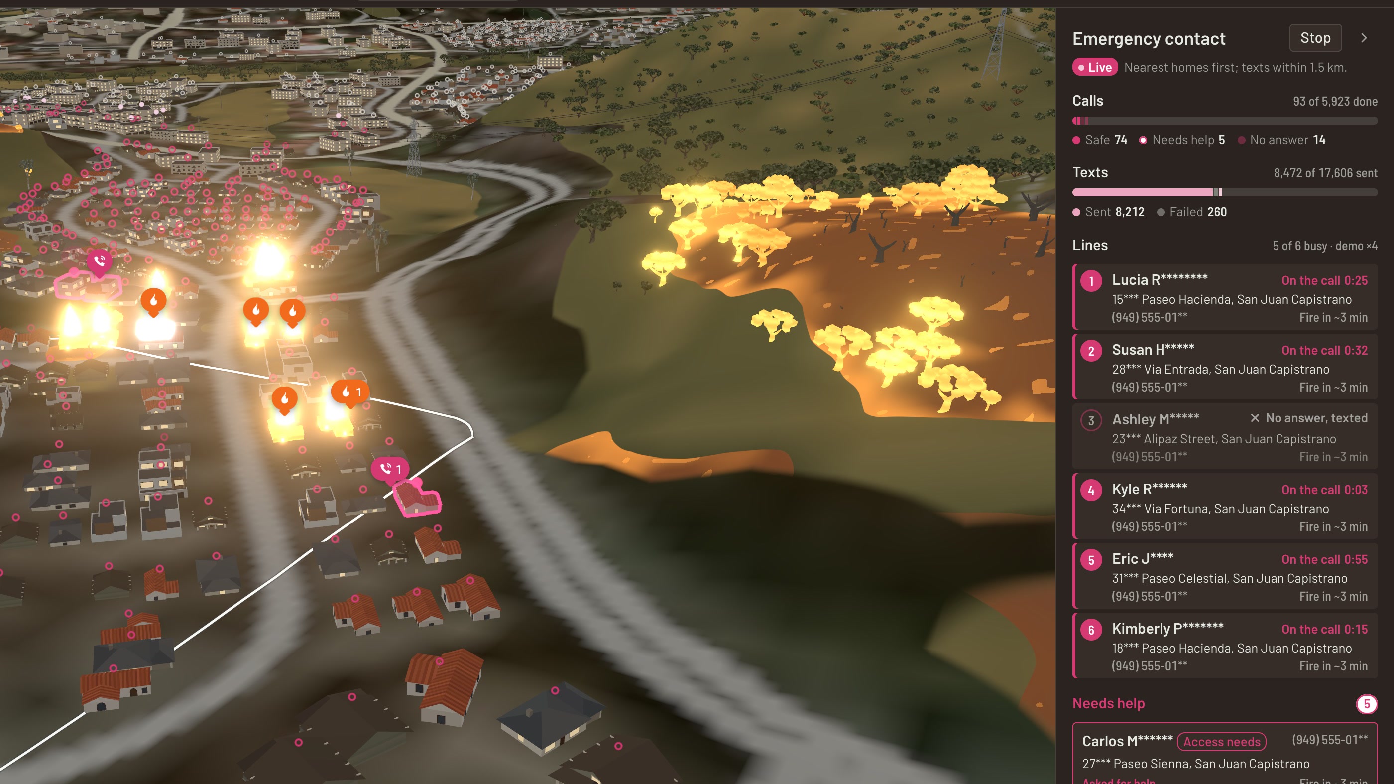
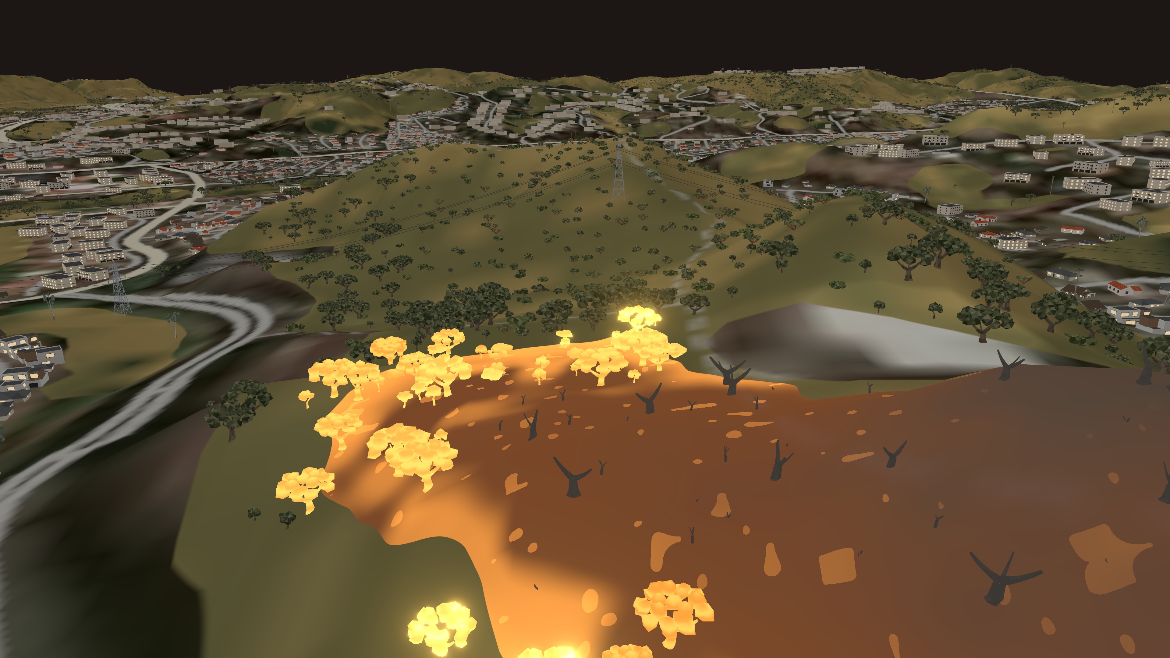
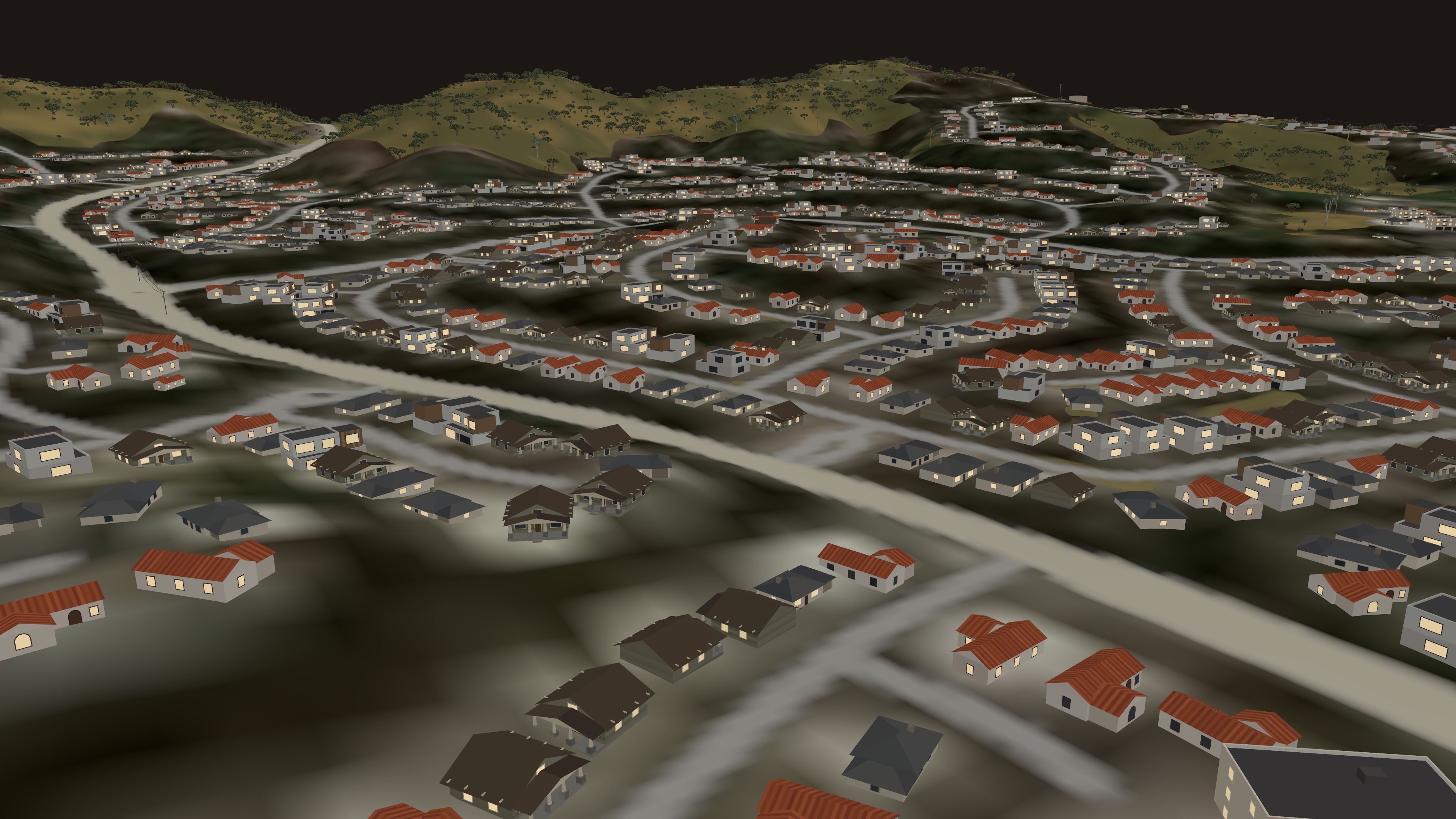
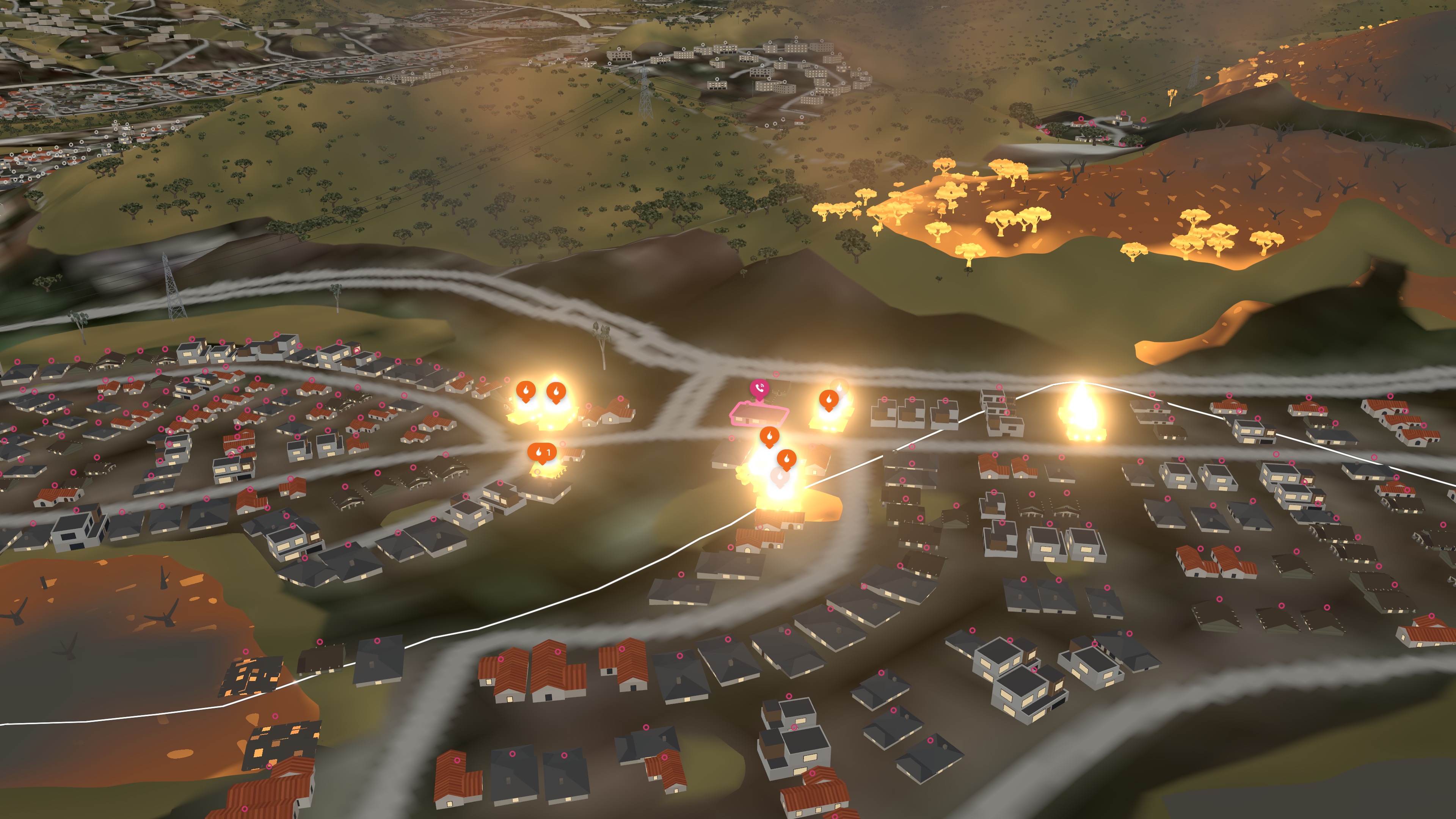
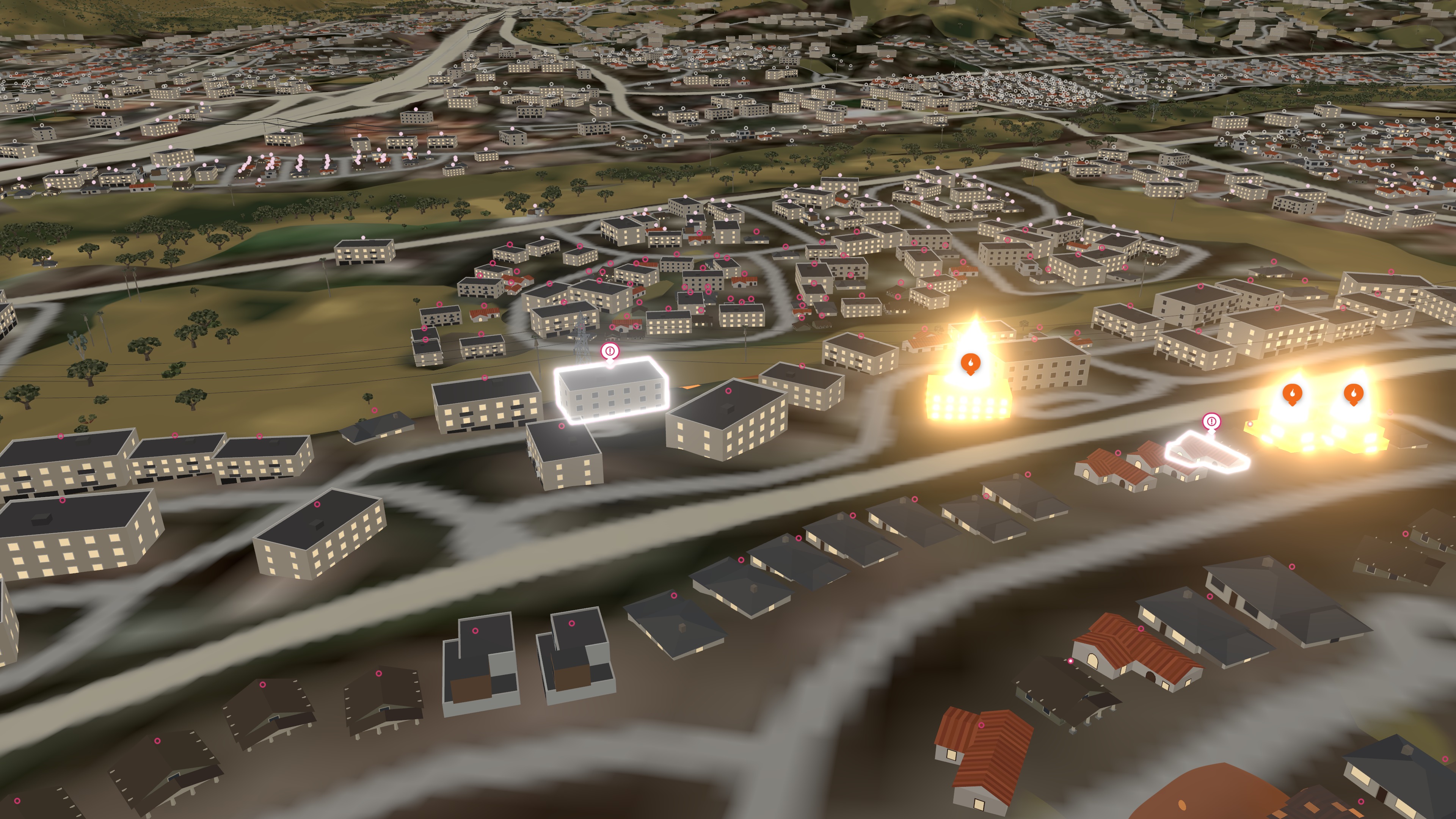
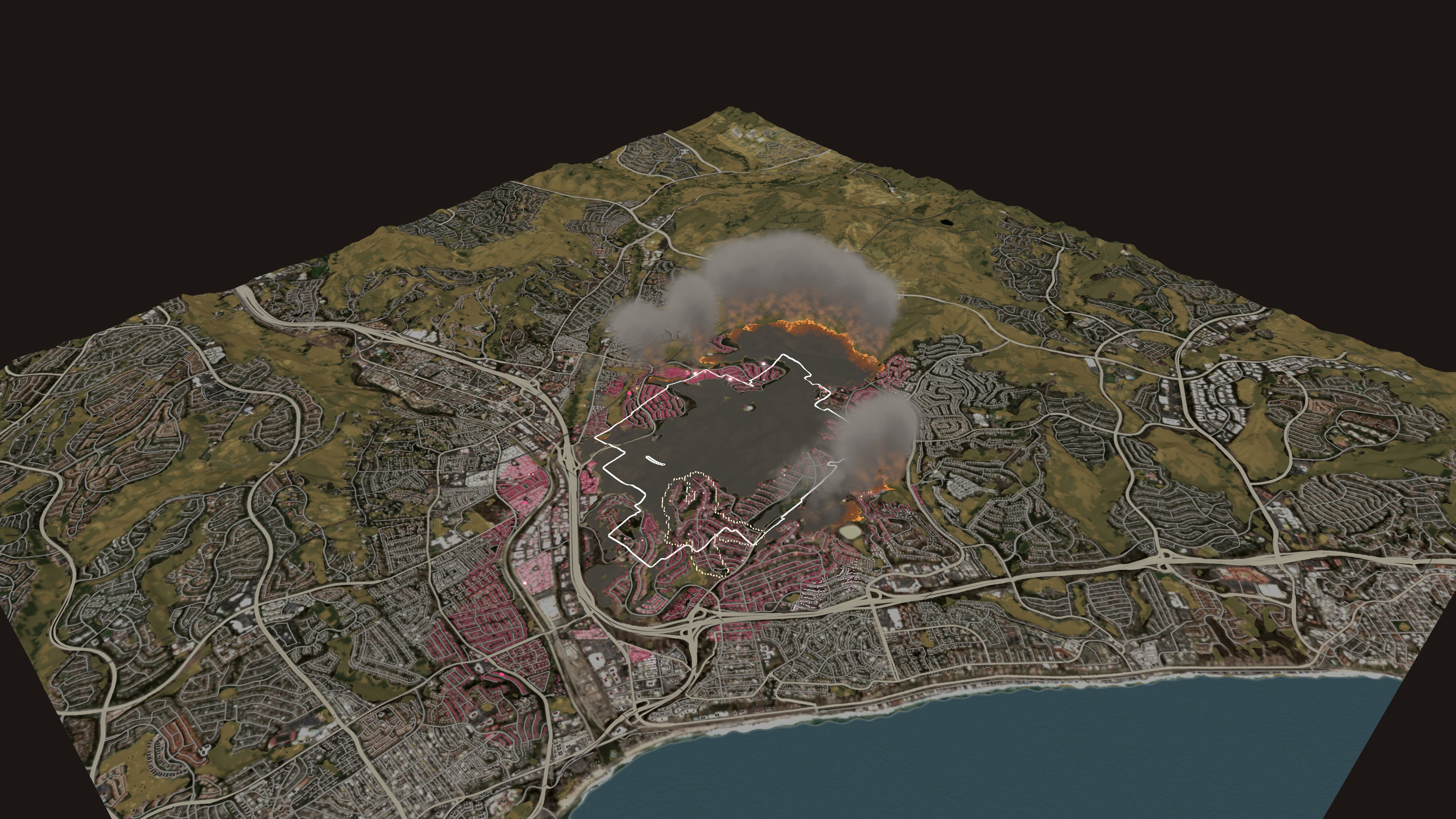
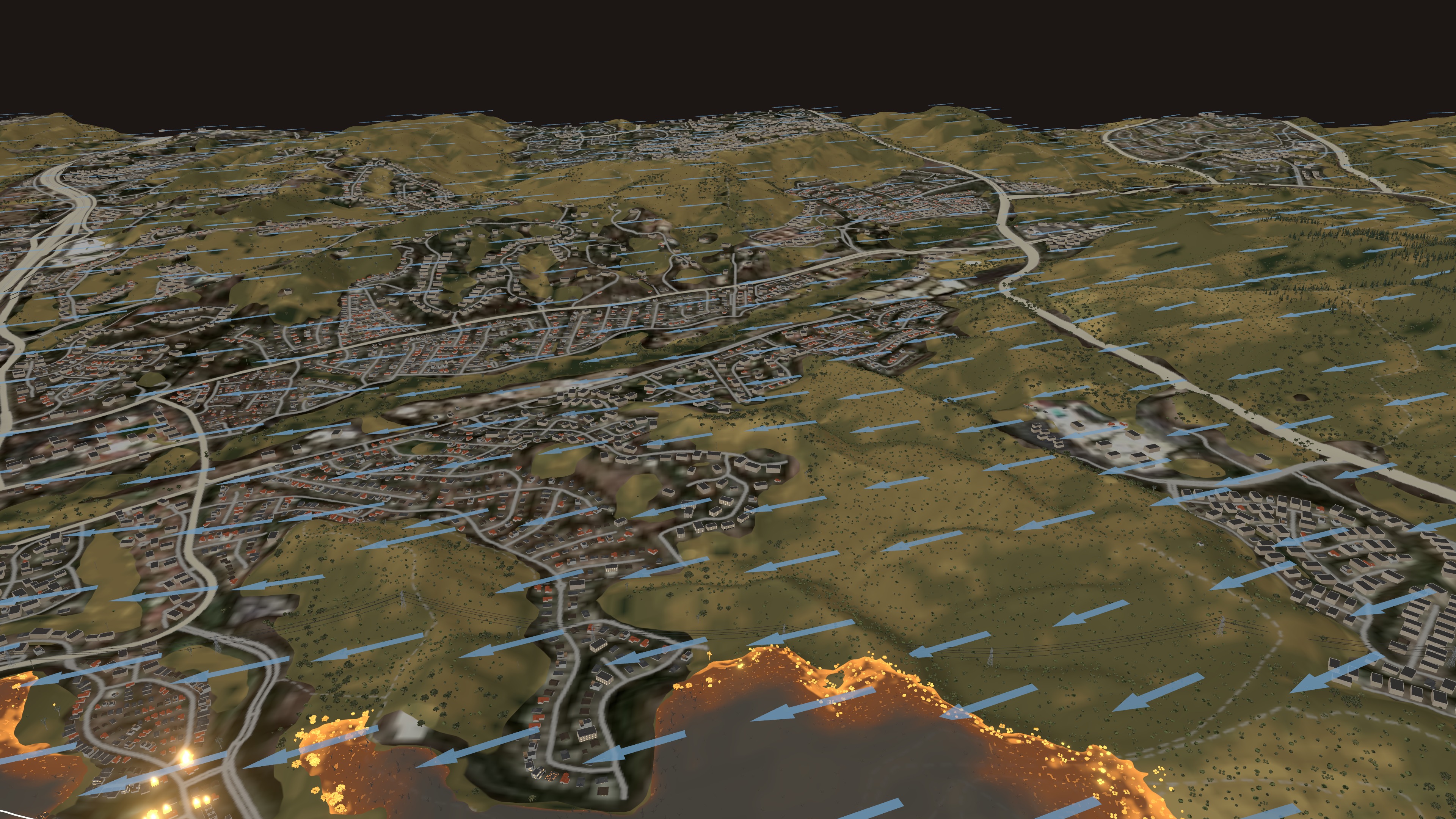
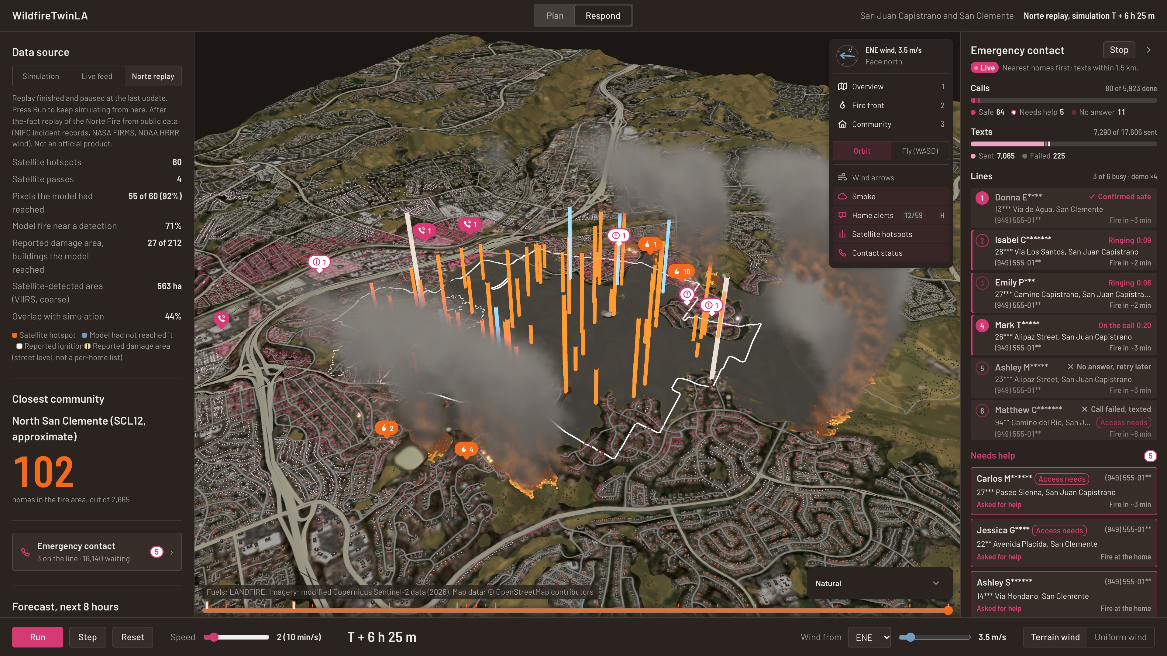
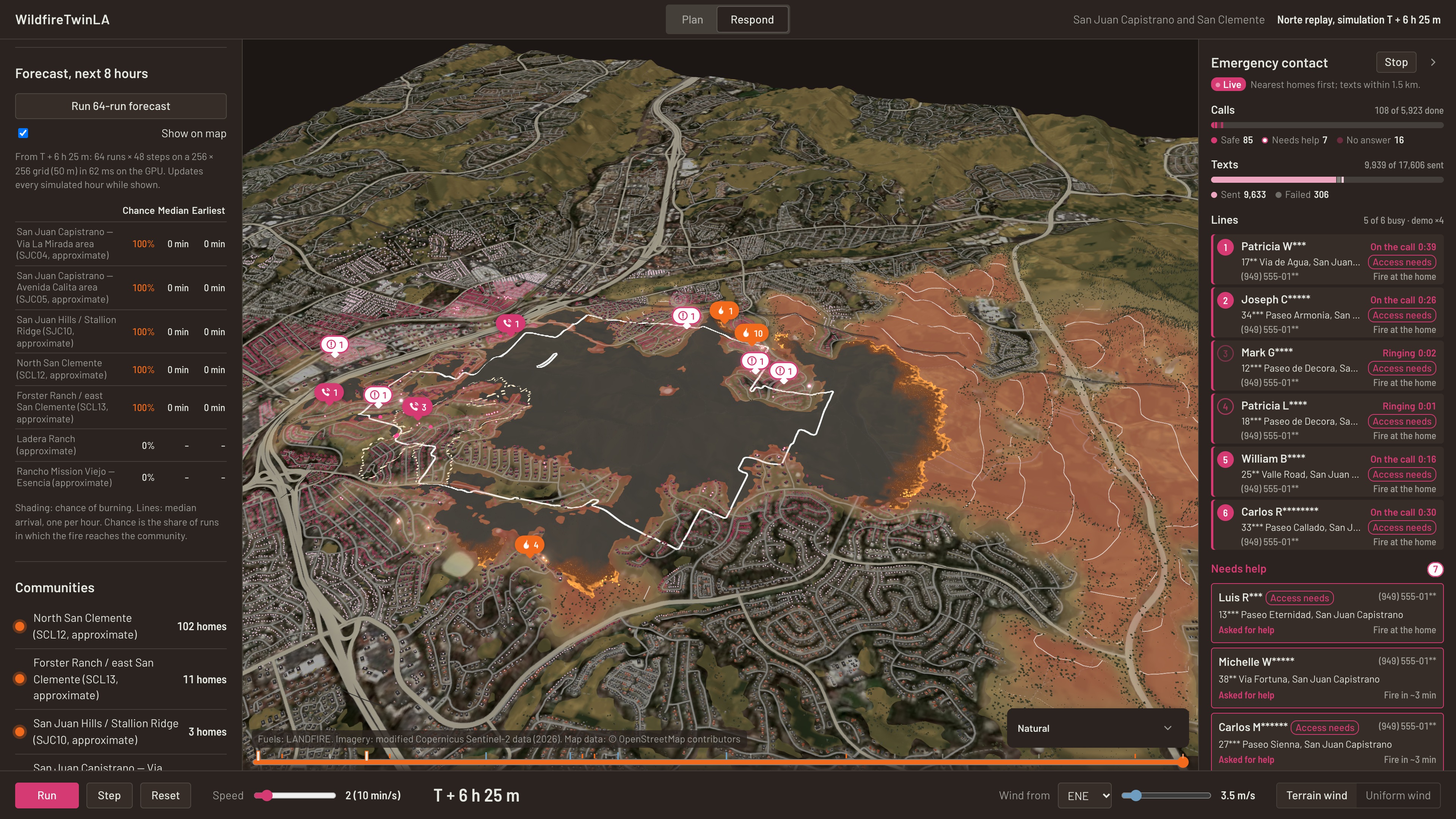
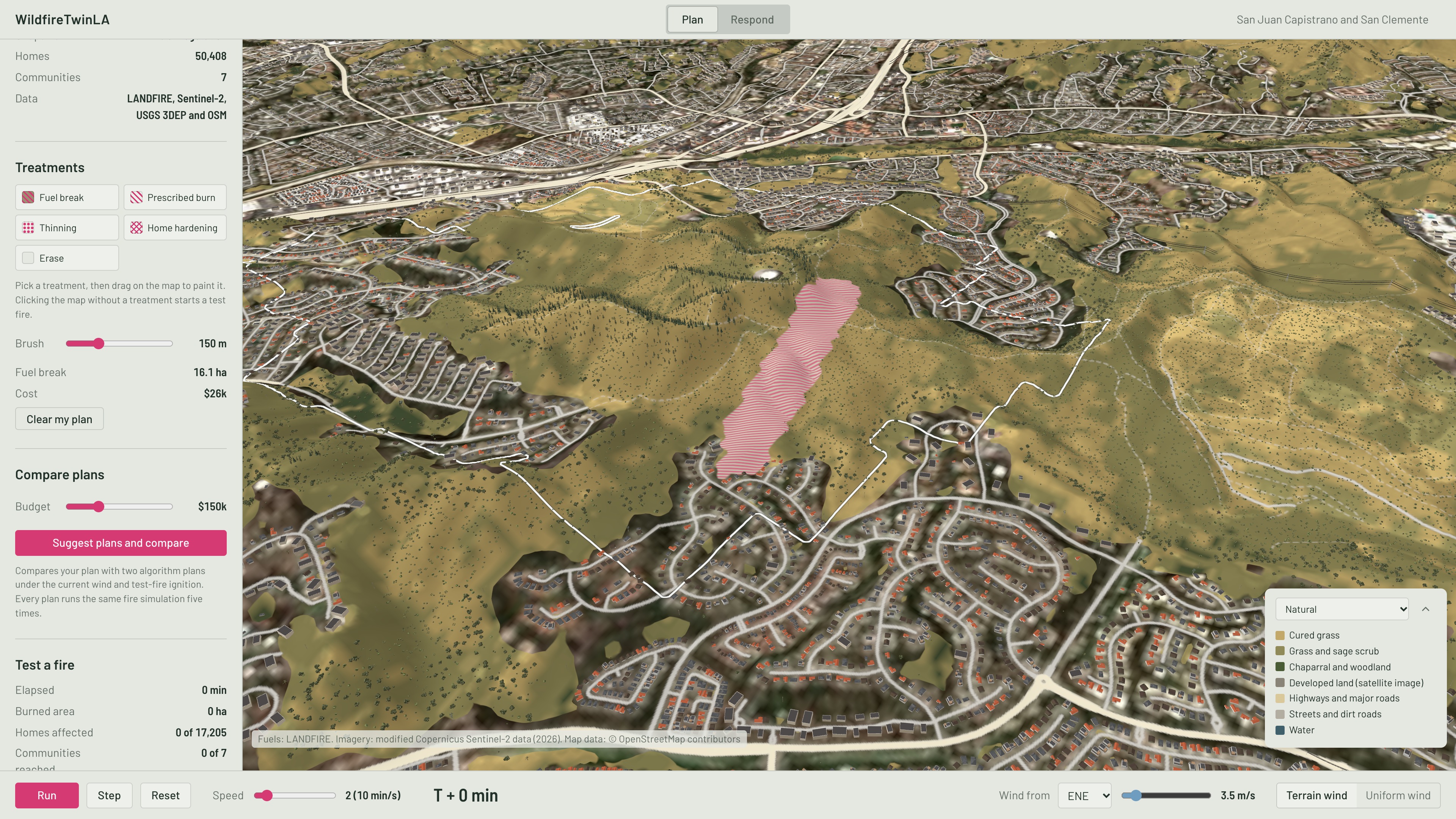
WildfireTwinLA is a browser-based 3D wildfire digital twin for the Los Angeles region. It combines terrain, vegetation fuels, satellite imagery, buildings, roads, weather, and public fire observations in an interactive map. Before a fire, users can compare fuel breaks, prescribed burns, vegetation thinning, and home-hardening strategies under consistent ignition and wind conditions. During an incident, the platform ingests and clusters fire detections, replays or simulates fire spread, estimates arrival risk for nearby communities, and streams updates to connected clients.
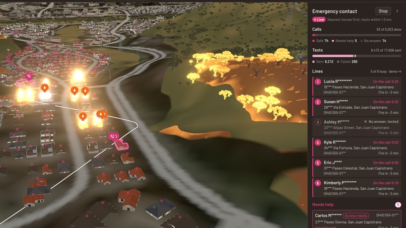
The system keeps observed, modeled, replayed, and simulated information visually separate so that users can understand the origin of each layer. Official evacuation orders are also kept separate from model-generated risk estimates. Residents may voluntarily register for notifications, and Retell integration can place simulated outreach calls while recording whether a contact was answered, failed, or requires follow-up.
How We Built It
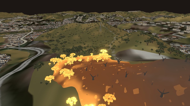
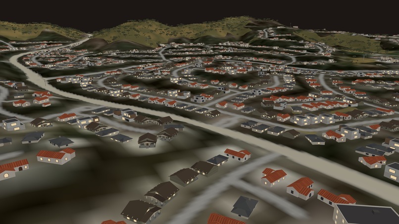
We built the visual experience with Three.js, using a browser-rendered 3D terrain mesh, satellite imagery, fuel layers, buildings, fire effects, smoke, wind visualization, and time-based replay controls. Our data pipeline converts elevation, Sentinel-2 imagery, LANDFIRE fuel information, OpenStreetMap buildings, and other geospatial sources into a consistent simulation grid.
The real-time backend is implemented with Python and FastAPI. It normalizes observations from NASA FIRMS and GOES, retrieves wind information, clusters nearby hotspots into incidents, evaluates configurable alert rules, and distributes sequenced events through WebSockets. It also supports resident opt-in and revocation, authoritative-order storage, Retell webhook verification, replay datasets, readiness checks, and Prometheus-compatible metrics. For the current demonstration, we use a public-data replay of the 2026 Norte Fire in Orange County.
Challenges We Ran Into
The largest challenge was integrating datasets with very different spatial resolutions, coordinate systems, timestamps, and update frequencies. Satellite hotspots are observations rather than precise fire perimeters, wind products operate at different scales, and building footprints are much more detailed than the fire-detection data. We therefore had to normalize every source carefully and avoid presenting coarse observations as ground truth.
Another challenge was communicating uncertainty. A visually convincing simulation can easily appear more authoritative than it really is. We designed the interface and data contracts to distinguish public observations from model output and official orders. We also encountered practical issues involving unreliable external APIs, missing incident perimeters, large geospatial files, browser rendering performance, secure webhook handling, and the legal and privacy requirements surrounding automated emergency calls.
Accomplishments That We Are Proud Of
We are proud that WildfireTwinLA operates as an integrated system rather than a collection of disconnected demonstrations. The project connects offline geospatial preprocessing, a 3D browser experience, normalized real-time ingestion, incident clustering, fire replay, risk evaluation, WebSocket delivery, resident registration, and simulated voice outreach.
We are also proud of the project's evidence-first design. In our Norte Fire prototype, the replay model reached 55 of 60 temporary satellite-detected pixels by their overpass times and produced a 43% overlap with the temporary VIIRS-derived area. These results are promising, but the product clearly labels the limitations of the comparison instead of presenting the temporary satellite footprint as an official fire perimeter.
What We Learned
We learned that a wildfire digital twin is not simply a visualization problem. It requires careful data provenance, uncertainty communication, resilient backend services, responsible alert design, and an understanding of how emergency decisions are actually made. We also learned that more detailed data does not automatically produce a more trustworthy result; spatial scale, timing, validation, and source authority matter just as much.
From an engineering perspective, we learned how to align heterogeneous geospatial datasets, stream live and replayed events through the same interface, and preserve clear boundaries between observations, predictions, and official information. Most importantly, we learned that an emergency system must remain useful before a disaster occurs. Continuous mitigation planning provides the data, scenarios, and operational familiarity that make the platform valuable when a real incident begins.
What's Next for WildfireTwinLA
Our next step is to replace prototype assumptions with stronger operational integrations and validation. We plan to incorporate authoritative fire perimeters and evacuation zones when available, improve the spread model with calibrated fuel moisture, ember transport, and suppression effects, and validate predictions across additional Southern California incidents. We also want to connect utility infrastructure so that the platform can estimate which power lines and communities are threatened and support more targeted shutoff decisions.
For deployment, we plan to add persistent geospatial storage, background job queues, stronger authentication, encrypted resident data, rate limiting, audit logs, and redundant data providers. We will also expand offline scenario caching so that critical planning and response functions remain available during network disruptions. Finally, we intend to work with fire agencies, utilities, community organizations, and legal experts to ensure that WildfireTwinLA supports, rather than replaces, official emergency decision-making.
Built With
- fastapi
- geopandas
- glsl
- nasa-firms
- noaa-hrrr
- numpy
- openstreetmap
- python
- rasterio
- sqlite
- three.js
- typescript
- vite
- webgl
- websockets

Log in or sign up for Devpost to join the conversation.