-
-
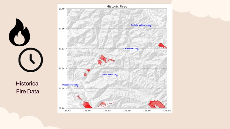
Historical Fire Data
-

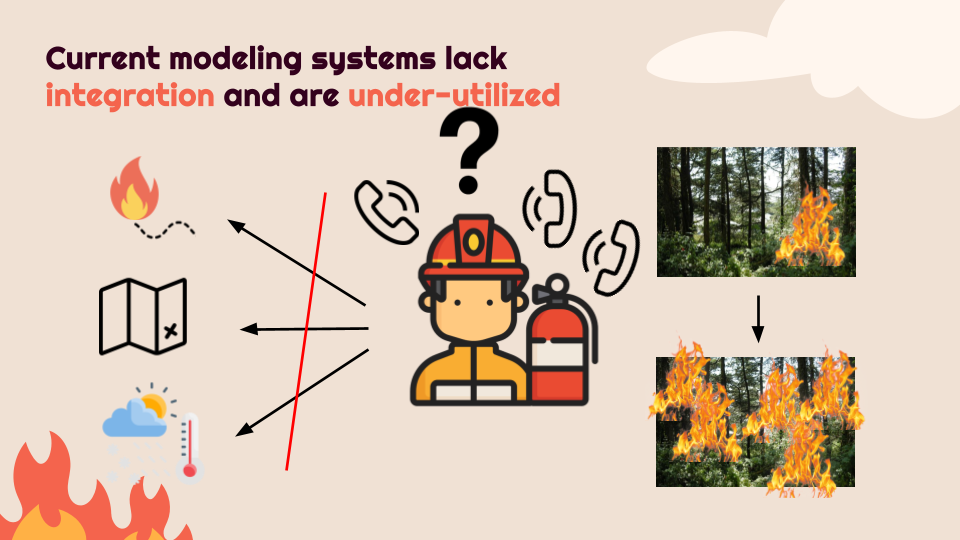
Problem Statement
-
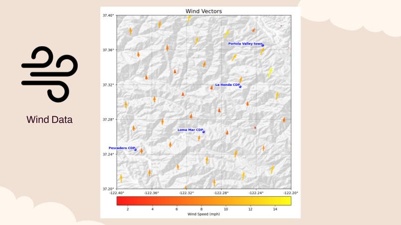
Wind Data
-
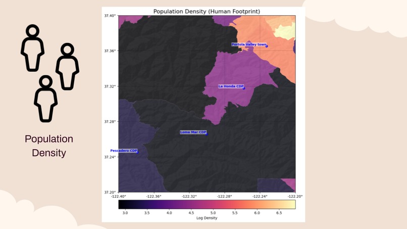
Population Density
-

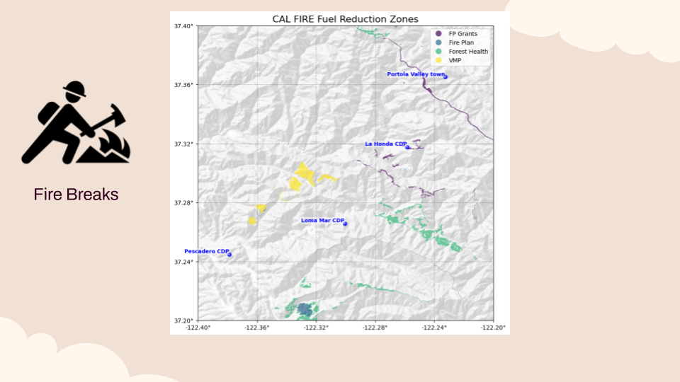
Fire Breaks
-
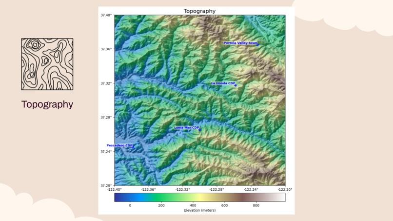
Topography


Inspiration
The first minutes of a fire determine whether it is contained or becomes a major disaster. Incident commanders must make rapid decisions about where to deploy resources and issue evacuation warnings. Although there is more data than ever to assist with this decision-making, there is presently no centralized platform that combines predictive modeling of fire spread, weather and topographical data, and historical maps of previous fires and constructed firebreaks, making it difficult for incident commanders to take advantage of the technology’s benefits.
What it does
Our project synthesizes relevant information for an incident commander during the first minutes of a fire so they can seamlessly use mapping and modeling tools to their full extent. We provide concise, up-to-date alerts about the spread of the fire and visualizations that the user can use to understand and validate the natural language alerts.
How we built it
We gathered data from numerous datasets related to factors relevant to incident commander decision-making in the early stages of a fire. The data included: (1) topography, (2) population density, (3) real-time wind data, (4) historical fire data, (5) firebreak locations. We also retrieved a model of wildfire spread to predict the fire’s trajectory so necessary evacuation notifications can be sent out before the fire spreads closer to those living in nearby population centers. We generated maps of all of these factors, and then leveraged a VLM to synthesize the maps and provide useful recommendations to the incident commander as well as relevant visualizations. To make the process as seamless as possible for the user, we chose a progressive web app interface so the information can be accessible from an cell phone.
Challenges we ran into
Our first challenge was settling on a project. On Friday night we brainstormed ideas, which ranged from campus bike rental services to identification of high-risk power lines in the event of a disaster. It was only after perusing the sustainability track challenges that we settled on our idea, which was solidified on Saturday after speaking to Jake Hess, the challenge mentor, who provided us with more information about the problem this project would help firefighters overcome. From here, some challenges we ran into were finding viable datasets for all of our dimensions of interest. Either datasets were too coarse or too granular, or the APIs were simply frustrating to deal with. We struggled in particular with our model of wildfire spread; simply finding a wildfire simulator that was accessible and extendable was extremely difficult, primarily due to dataset incompatibility. And because we gathered data from different sources, another challenge was merging the data formats into a common mapping space that we could use for inference and visualization. Our next biggest hurdle was conceptualizing how to create meaningful natural language analysis and advice for firefighters without risking providing false information. To overcome this, we provided an AI model with raw numerical data in addition to qualitative charts of each of our dimensions in order to gather both quantitative and qualitative descriptions.
Accomplishments that we're proud of
This being our first hackathon, we ran into many challenges. However, in these challenges we also were able to grow our technical skills. From dealing with geospatial data embedded into an interactive webapp to aggregating all of our datasets to predict wildfire spread, our data analysis skills are something that we are all proud to say we are stronger at. What was at first an ambitious idea—to build a model predicting wildfire spread—became easier as we broke the problem down into smaller, digestible parts. We also navigated together through using Git for a highly collaborative project, and were able to successfully delegate tasks from UI/UX, implementation of a wildfire prediction API, and the processing and visualization of our datasets all at once. We are proud of our collective commitment to providing mutual assistance to each other and always making sure no one was stuck on a task for too long.
What we learned
We learned that a product is only as strong the need it addresses, and it is vital to talk to our target users to better understand the pain points more precisely. Our pivotal moment was when we talked to Jake Hess, who served at CAL FIRE as the Assistant Region Chief of Northern California after serving for 29 years. He clearly explained the gap between the large amounts of data that exist in disparate locations and the time constraints firefighters face during a real-world fire situation, and he outlined what kinds of alerts would be most helpful to firefighters in the moment.
What's next for EmberWatch
We are so excited to announce we will be signing with a production company to create our first album called Mr. AI. You can get a sneak peek of our first single (and title song!) here: https://suno.com/s/2qN4DSnG3HOiFQGk
Built With
- calfire
- css3
- esri
- google-gemini
- html5
- noaa-climate-data-online
- python
- react
- suno
- typescript
- us-census-bureau


Log in or sign up for Devpost to join the conversation.