-
-
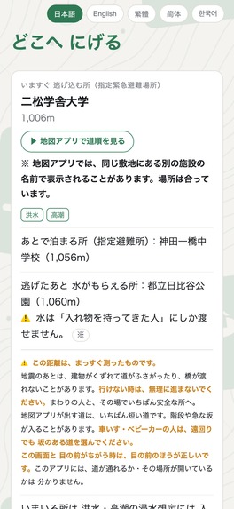
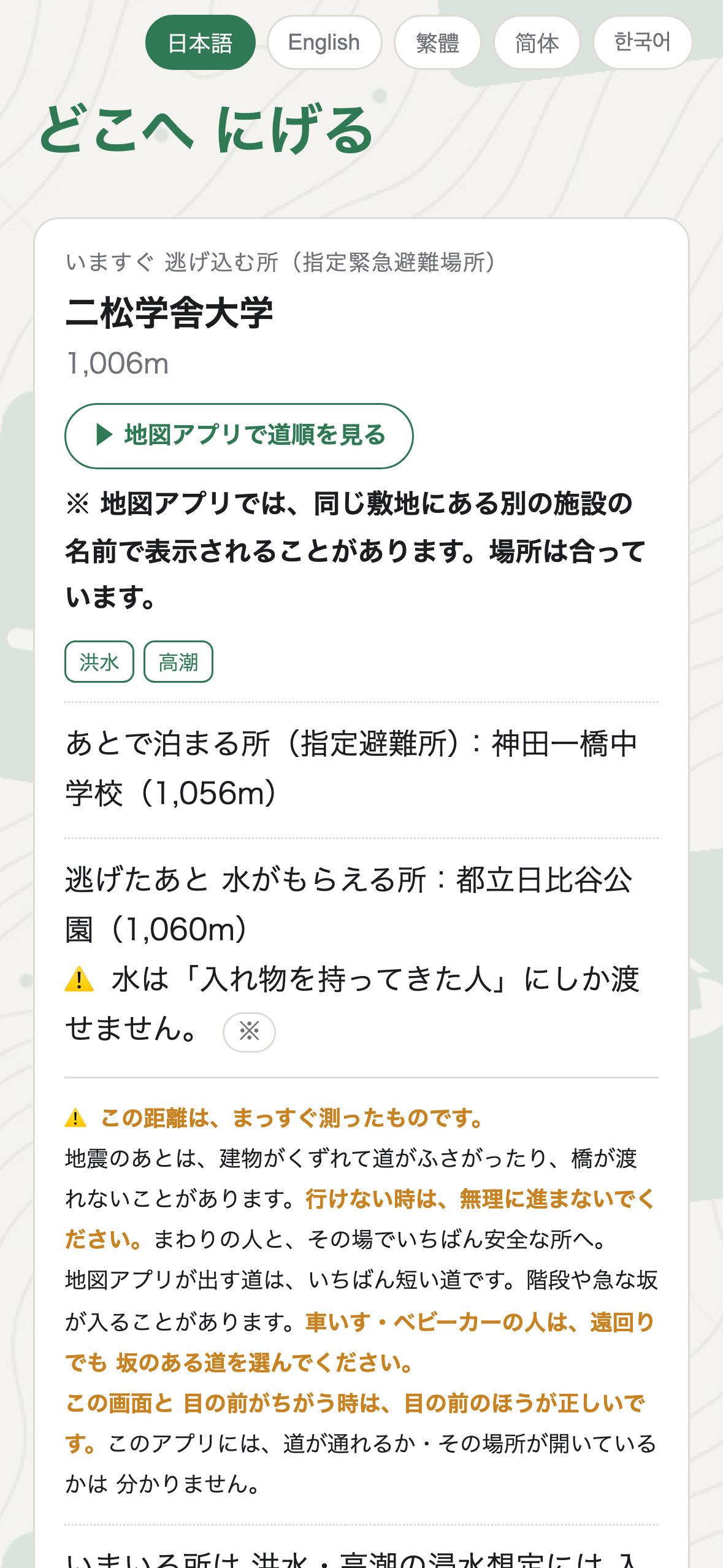
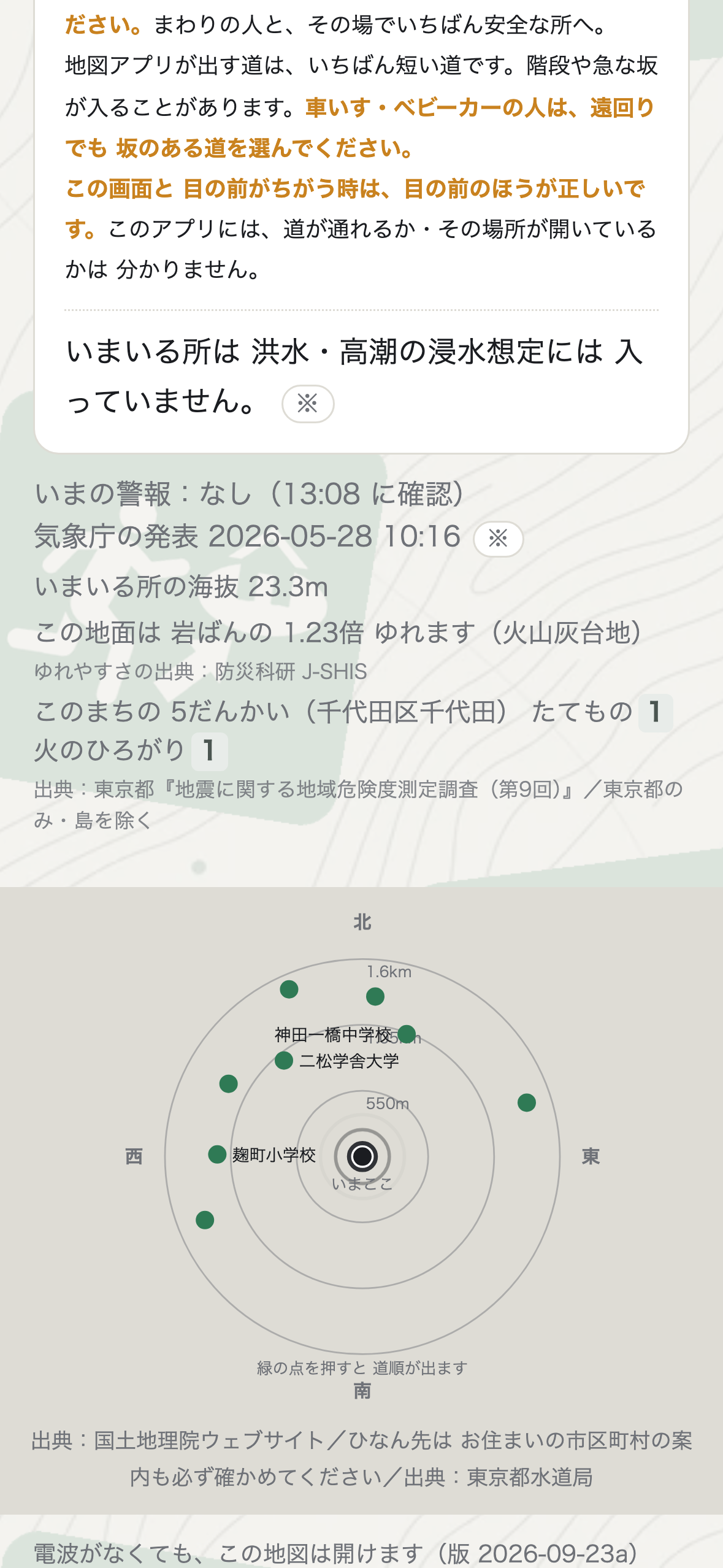
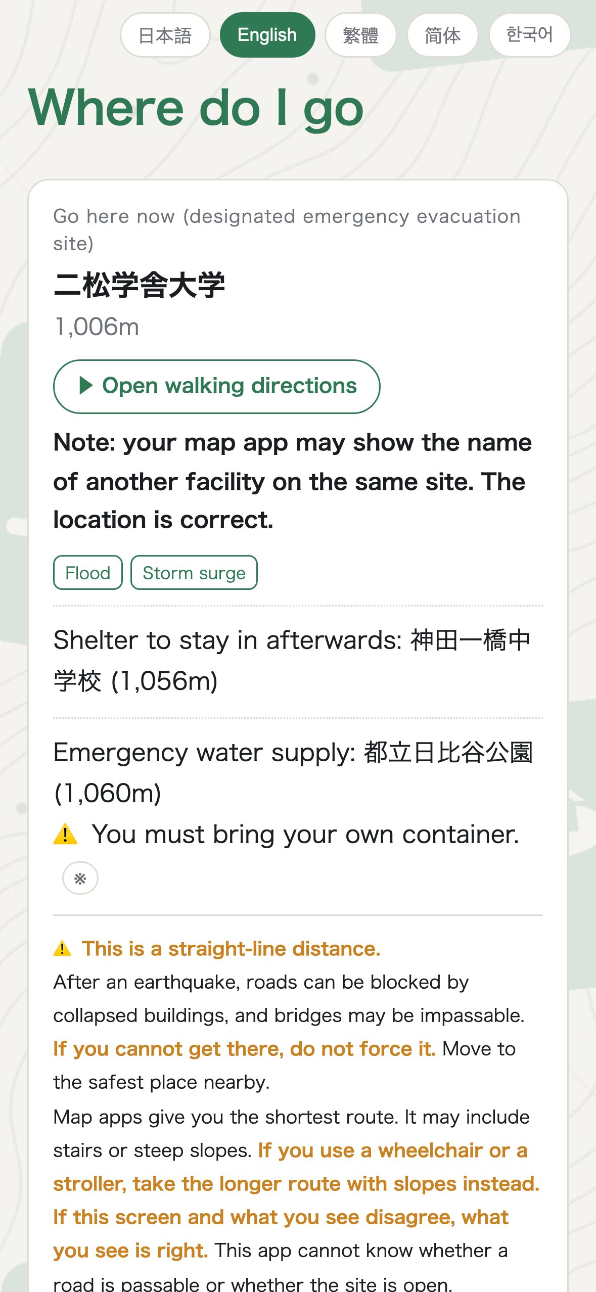
The moment it opens: the nearest official evacuation site, the distance, and which disasters it is designated for. No sign-up, no setup.
-
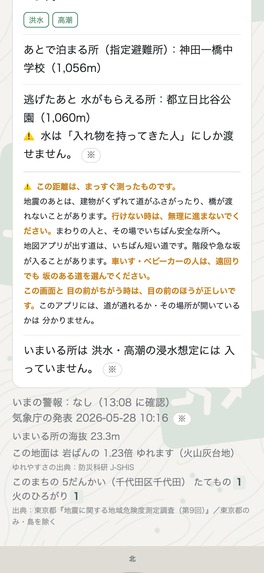
What the app admits it cannot know: distances are straight-line, roads may be blocked, and wheelchair users should take the longer route.
-
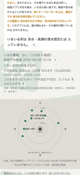
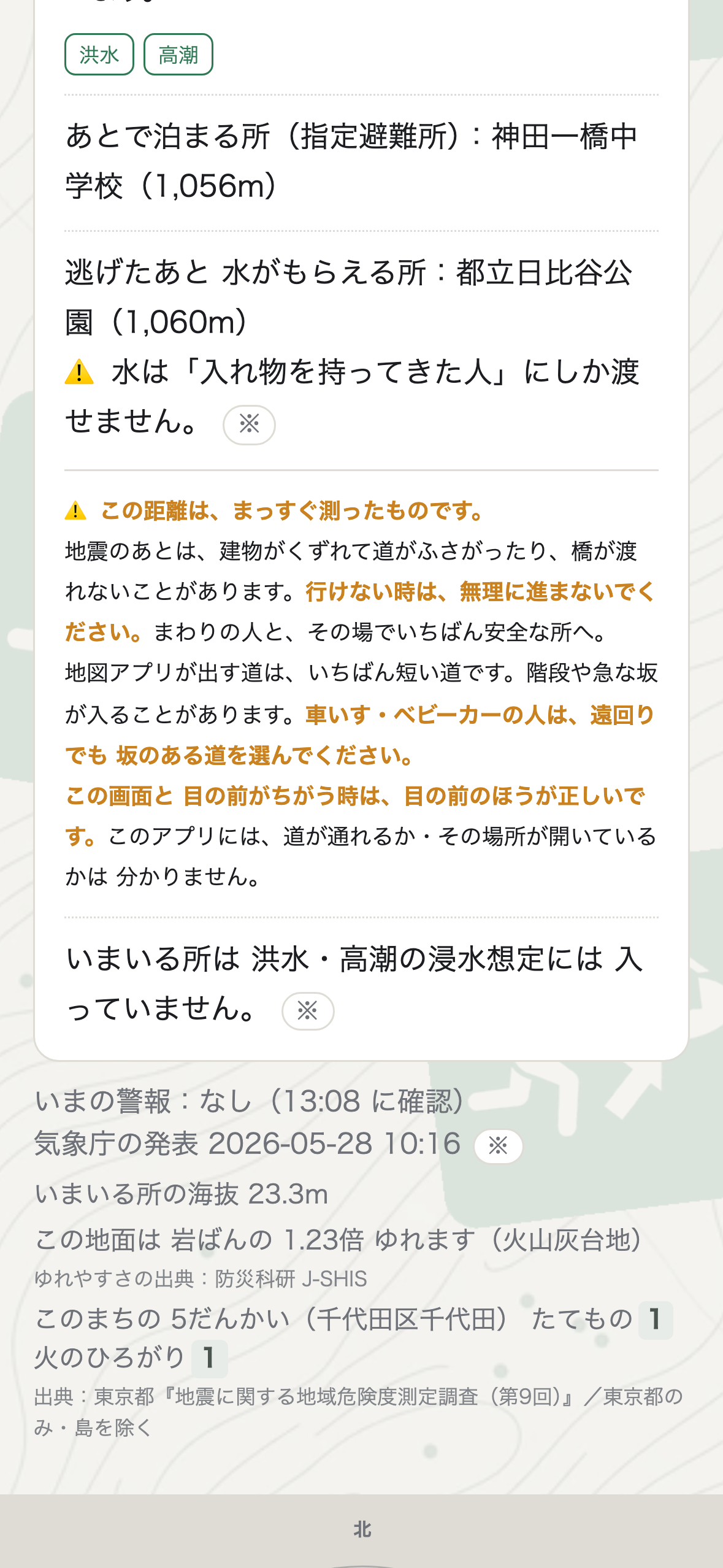
Elevation, how much harder this ground shakes than bedrock, and Tokyo's 1-5 district risk ratings. Numbers with sources - never a verdict.
-
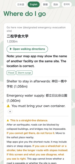
Five languages. Shelters outside Japan come from OpenStreetMap, shown under their local name and category rather than translated away.
Inspiration
Most disaster apps ask you to do something first: sign up, pick your city, allow notifications, read a tutorial. In an actual emergency, nobody does any of that. We wanted an app where the answer is already on the screen when it opens.
What it does
It shows the nearest official emergency evacuation site the moment it opens - with the distance, and which disasters that site is designated for (flood, landslide, storm surge, earthquake, tsunami, large fire, inland flooding, volcano).
It also shows what is under your feet: elevation, how much harder this ground shakes than bedrock, and for Tokyo, the district's 1-5 building-collapse and fire-spread ratings.
Three things it deliberately does not do:
- It never says "safe" or "dangerous." It shows the numbers and the source, and lets you decide.
- It never picks a location itself. Every shelter comes from government open data.
- If the nearest site is more than 1.5 km away, it says "nothing registered nearby" instead of pretending.
It works without a signal. Once you open an area, it stays on the device. And when warnings cannot be fetched, it does not say "all clear" - it says "we could not get the latest information."
How we built it
A single offline-first web app wrapped with Capacitor for Android, served from Cloudflare Workers. There is no backend of our own: the search runs entirely in the browser on the device. No accounts, no analytics, no tracking, no ads.
Purchases are handled through RevenueCat - a one-time "support this app" purchase that unlocks nothing. The app is fully usable without paying.
Data sources: Geospatial Information Authority of Japan (shelters, elevation), Japan Meteorological Agency (warnings), NIED J-SHIS (ground amplification), Tokyo Metropolitan Government (district risk ratings, CC BY 4.0), OpenStreetMap (shelters outside Japan, ODbL), OpenFreeMap (map tiles).
Challenges we ran into
Getting other countries right was harder than Japan. We first collected shelters with rectangular bounding boxes and ended up with 427 "French" locations, 333 of which were actually in Chile. Our own checker passed it, because it only verified that the country names matched - not that the data did. We rebuilt collection around actual ISO country shapes.
Deciding what not to show was the other hard part. Every instinct says to reassure the user. We removed all of it.
Accomplishments that we're proud of
7,075 shelters across 39 countries and regions, all from official or open sources. Five languages. And an app that opens with the answer already on screen, with no signal and no account.
What we learned
That honesty is a feature. The line users trust most is the one that admits the app cannot know whether a road is passable.
What's next for Where Do I Go
More countries, one per night. Hazard map overlays. And making the app usable by children - right now the store listing is rated 18+ purely to avoid stricter review rules, which is backwards for a disaster app.
Built With
- android
- capacitor
- cloudflare
- cloudflare-workers
- javascript
- open-data
- openfreemap
- openstreetmap
- revenuecat

Log in or sign up for Devpost to join the conversation.