-
-
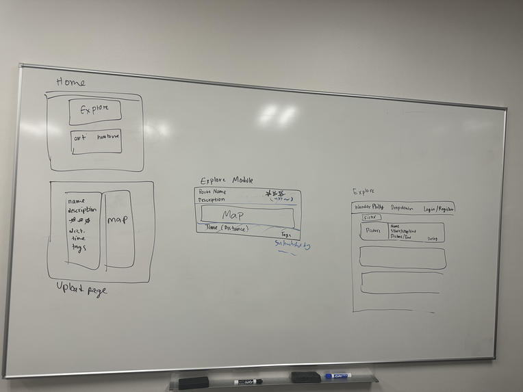
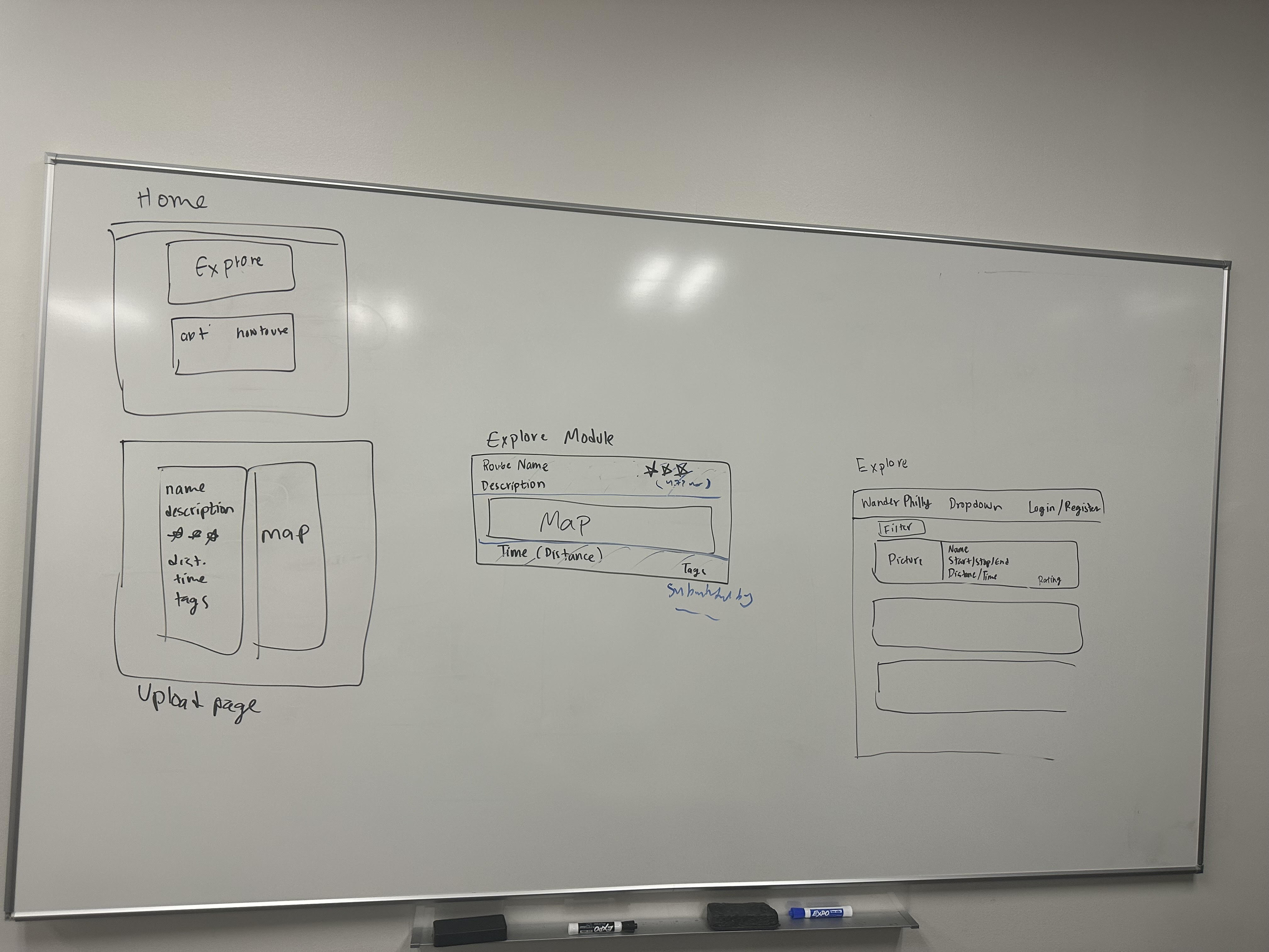
Our initial format planning
WanderPhilly: Uncover Philly’s Hidden Gems, One Walk at a Time
About the Project
WanderPhilly is a platform designed to bring together the vibrant community of Philadelphia’s walkers and explorers. The idea was inspired by our love for discovering hidden spots in the city and the realization that many local gems aren't easily accessible through traditional tourist guides. By enabling users to share and exchange their favorite walking routes, the platform fosters a sense of shared discovery while encouraging a healthy, sustainable way to explore Philly.
What Inspired Us
Living in Philadelphia, we’ve often found ourselves exploring off-the-beaten-path neighborhoods and stumbling upon scenic routes or unique local spots that aren’t featured in guidebooks or blogs. The idea of WanderPhilly came to life from our personal experiences of wanting to share these routes with others while also discovering new paths through the eyes of fellow city dwellers. The concept of crowdsourcing walking routes resonated as a way to build a community-driven platform where locals can trade their favorite walks and explore the city through different perspectives.
What We Learned
Building this project taught us several things:
- Community-Driven Design: We learned how important it is to design for the user. We focused on creating a simple, intuitive platform that allows users to easily upload and access routes. The feedback loop of sharing and discovering reinforced the value of user-generated content.
- Backend Development: Working with databases and APIs gave us deeper insight into the technical challenges of storing and serving geographic data efficiently. We also explored ways to incorporate mapping tools like OpenStreetMap and Google Maps for interactive route displays.
- Walkability Metrics: We dove into the science of walkability and learned how to integrate useful metrics such as route accessibility, scenic value, and interest level into the platform’s ranking system.
How We Built WanderPhilly
The platform was built using Python and Flask for the backend, with SQLite as the initial database. Users can register, upload their walking routes (GPS coordinates, descriptions, etc.), rate, and tag them. We also incorporated mapping APIs to visualize those routes.
Here’s a quick breakdown of the tech stack:
- Backend: Python (Flask), SQLite for the database
- Frontend: Basic HTML/CSS for the user interface, with a plan to expand to JavaScript for a more interactive experience
- Mapping: OpenStreetMap for route visualization
Challenges We Faced
- Mapping Integration: Integrating route data with a map visualization tool was initially challenging, as there were compatibility issues with formatting GPS coordinates for rendering.
- Balancing Simplicity with Features: Finding the balance between a simple user interface and providing enough functionality was a constant challenge. We wanted the platform to be user-friendly, while also ensuring the data and experience were rich and engaging.
- Community Engagement: Building the framework was just the first step. Ensuring users engage with the platform and share their routes will be the long-term challenge.
Conclusion
WanderPhilly is more than just a route-sharing platform — it’s a community-driven way to discover Philadelphia’s hidden gems. By crowdsourcing walking routes, the project promotes urban exploration in a sustainable, healthy way, while helping users uncover the unique stories each neighborhood has to offer. Moving forward, we aim to expand the platform with more interactive features, better visualizations, and deeper community integration.


Log in or sign up for Devpost to join the conversation.