-
-

A Safer Route
Inspiration
One of our most common concerns as a college student is our own safety. Staying up late and then walking home at night can be a daunting experience. We want to make sure that students feel safe walking home.
What it does
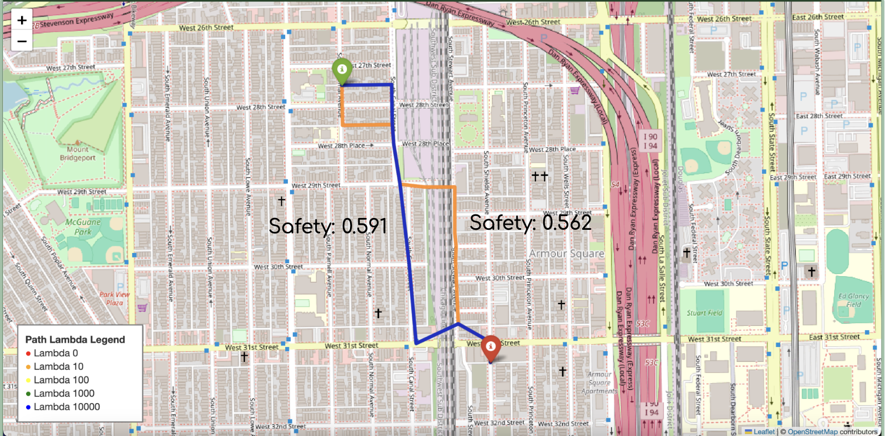
We recommend the safest possible routes, utilizing city data. We take violent crime, nearby lighting, and distance to emergency centers into consideration to curate the best route.
How we built it
Our model architecture is twofold. We first train a random forest regressor, trained to predict a safety score for regions around the city based on raw urban features. We then use this safety score in a Dijkstra's style algorithm to balance distance and safety, ensuring short, but safe routes.
Challenges we ran into
Aggregating the data to produce our predictions was quite difficult. There is a lot of noise in city data, and it was difficult to get the right features to make a solid prediction for the safety score. However, we were able to solve these issues and make a model that generalizes well.
Accomplishments that we're proud of
We are proud of our ability to power through and create a solution, despite the lack of data. Our model works well and avoids dangerous areas.
What we learned
We gained expertise in our understanding of decision trees, as well as generalization theory. We were able to tune the model to obtain the most useful features and provide an accurate assessment on the safety of a location.
What's next for Walk Safe
We intend to use crowd-sourced data to tune our model to provide an even more accurate assessment. We also will increase the scope of the model beyond the Chicago area. Once we accomplish these tasks, we intend to create an application that will truly be able to aid people.
Built With
- city-of-chicago-data-portal
- folium
- geopy
- joblib
- networkx
- numpy
- openstreetmap
- osmnx
- pandas
- python
- scikit-learn
- shapely

Log in or sign up for Devpost to join the conversation.