-
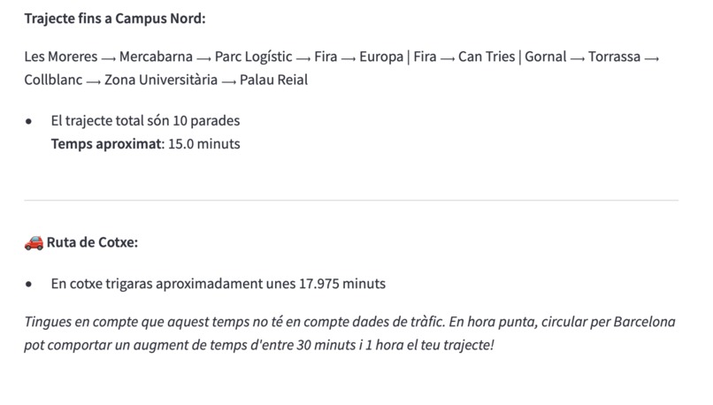
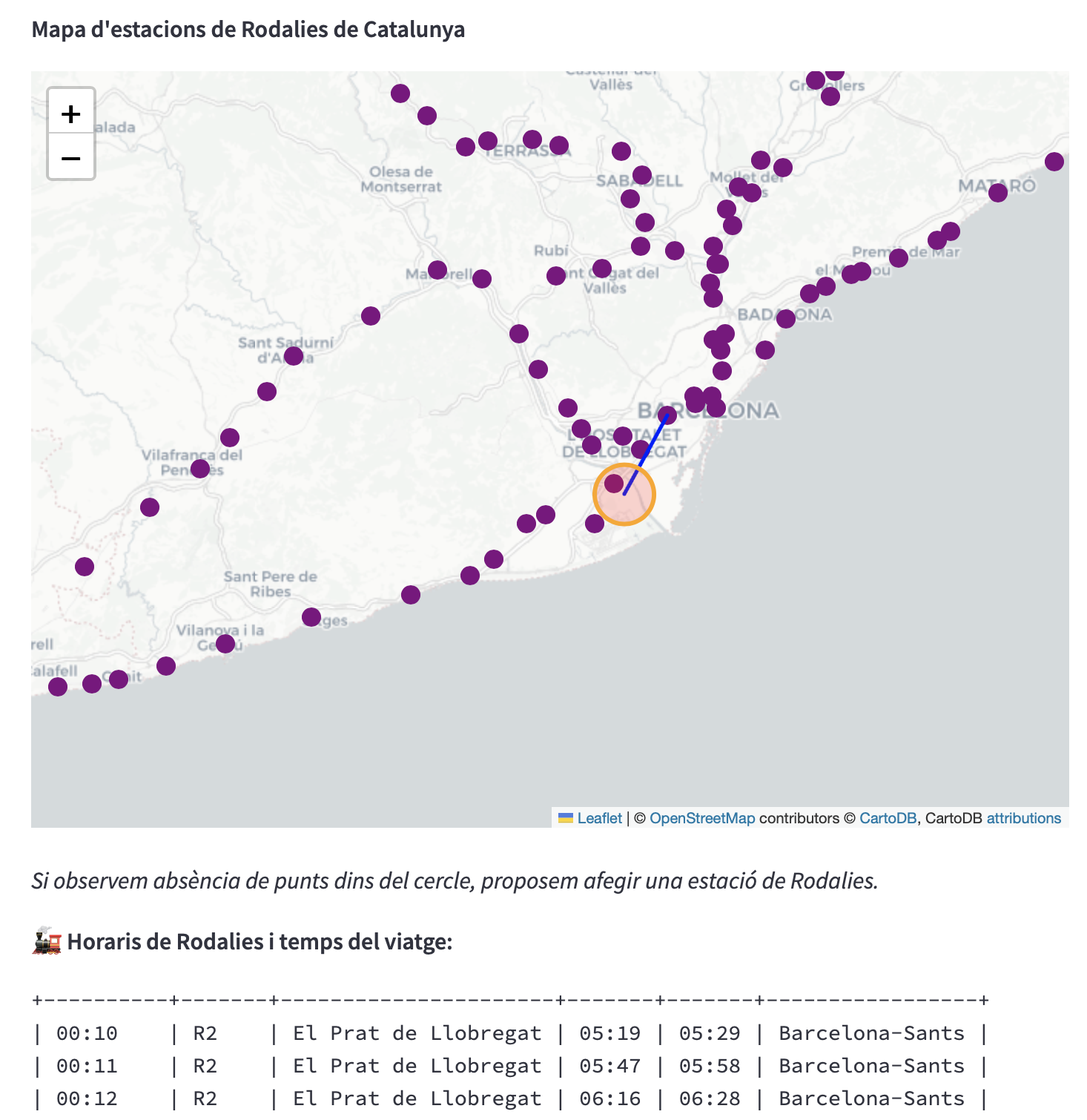
Time calculation of the trip
-

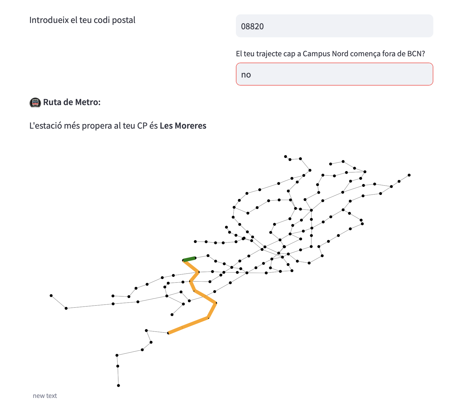
Route by underground
-
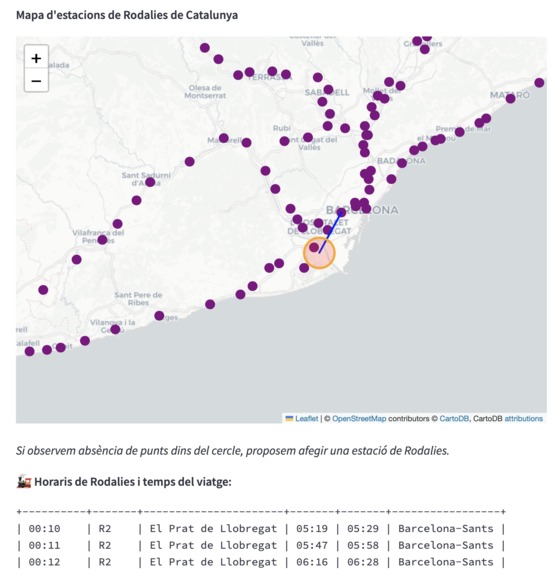
Train station map
-
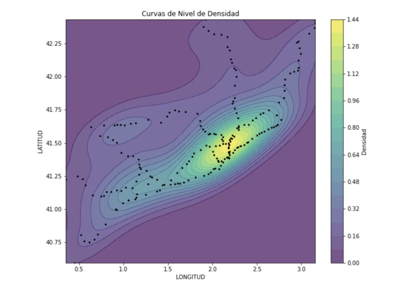
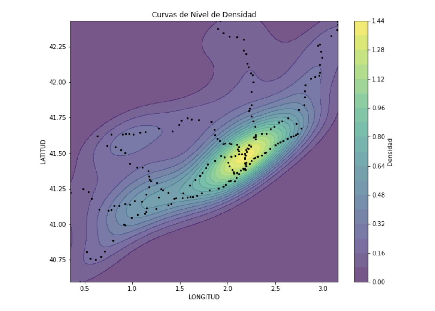
Density public transport network graph
-

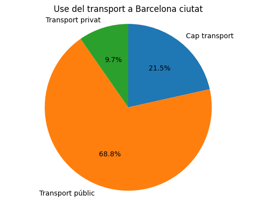
How people move in Barcelona city
-

Why not using transport in Barcelona city

Inspiration
Our inspiration for this project stemmed from the desire to enhance the commuting experience for students traveling to the faculty. We recognized the significance of optimizing transportation methods based on their locations and the existing public transport network.
What it does
The project focuses on analyzing and improving the commuting patterns of students. By considering factors such as student locations and the public transport network, we aim to provide insights into the most efficient and sustainable modes of transportation—whether it's public transportation, private vehicles, or bikes/scooters.
How we built it
We built the project by using statitics of students commuting and public information about transport network. We collected and analyzed data on student locations, public transport routes, and other relevant factors. By using Python, we crushed all this data to get insights. We also developed a visualization with streamlit in order to compute commutation timings from different locations
Challenges we ran into
Throughout the project, we encountered several challenges. Integrating and processing diverse datasets, ensuring the accuracy of location-based information (it looks like some people do not know the postal code where they live) and building a visualization to integrate all the diferent graphics and maps we created were some of the hurdles we faced.
Accomplishments that we're proud of
We take pride in successfully developing a system that provides valuable commuting insights for students. Our accomplishment lies in creating a solution that not only considers individual preferences but also contributes to sustainable and efficient transportation practices within the academic community. We managed to build a tool that approximates the commuting time for students.
What we learned
We learnt to use a tool we had never used before: Streamlit. We also learnt to deal with location data, which can bring up a lot of issues sometimes
What's next for "UPCSOSTENIBLE" - NanoTeam - Drive to survive
A big next step for us would be integrating all public transports, such as bus (both intercity and urban) to our commuting calculation tool. Due to the limited time, we had to stick with the main fix transportation systems: train and subway. We would also like to be able to draw the real line the train follows when going from origin to destination. Finally, there is a universe of possibilities for insights, it is a matter of time!
Built With
- dijkstra
- folium
- geopandas
- github
- graph
- openstreetmap
- python
- streamlit

Log in or sign up for Devpost to join the conversation.