-
-

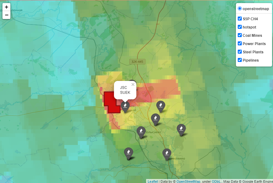
Hotspot detected on coal mine
-

Hotspot detected near pipelines
-

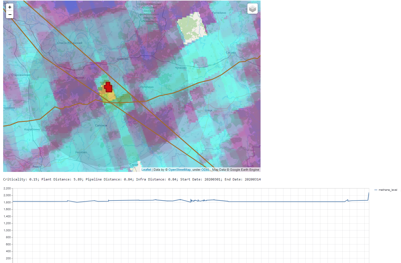
Hotspot detected along pipeline
-

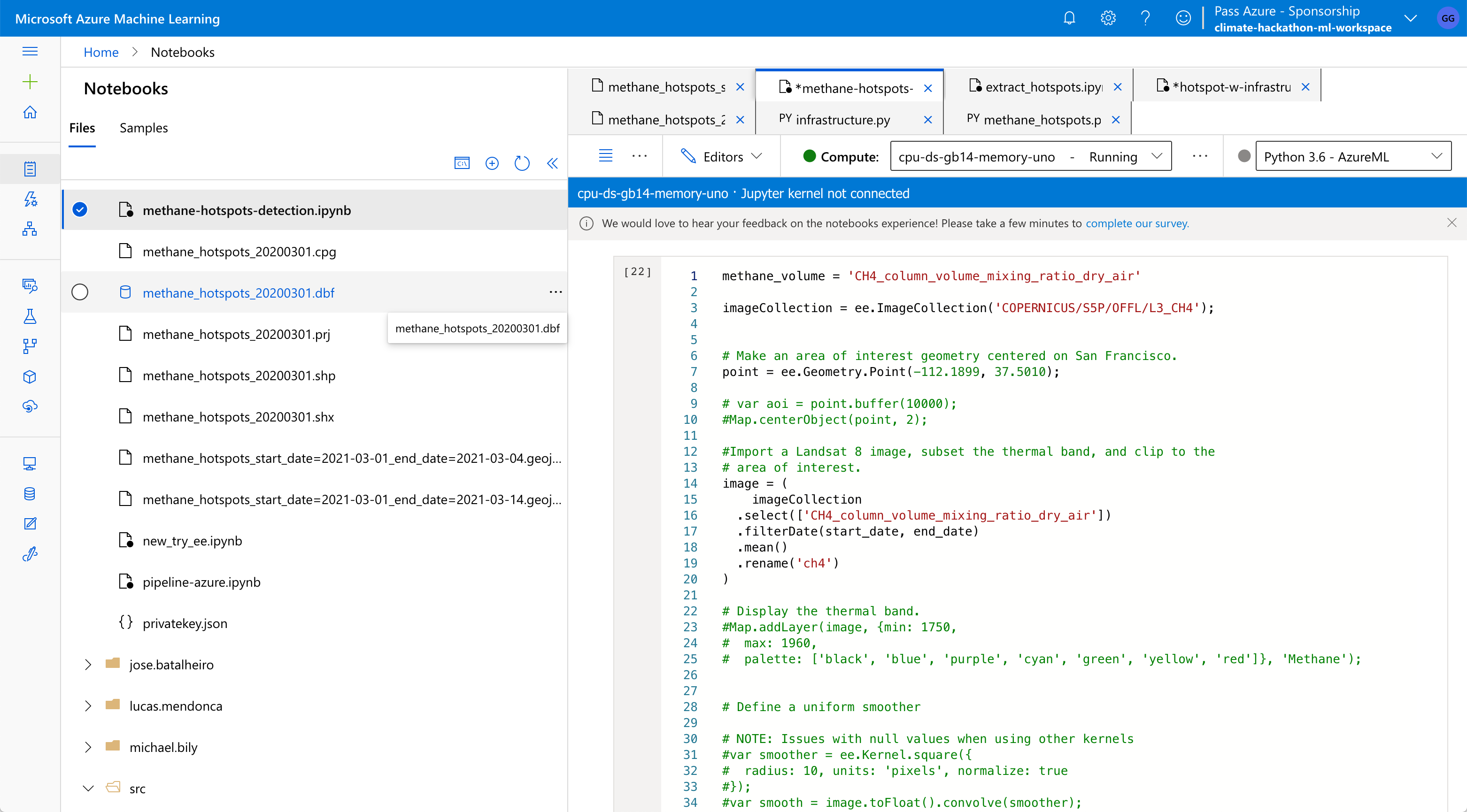
Azure ML studio used to develop the model
-

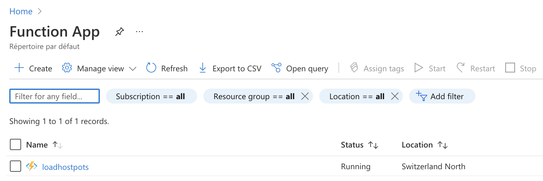
Azure Function running update
-

Screenshot of UI
-

Screeshot of UI
-

Added Infrared Layer


Inspiration
We are entering the last 2 decades before climate change becomes irreversible. Methane is a large contributor to global warming (84 times more potent than CO2) and there is a lack of accountability for large pollution events, especially by the coal/fossil and gas industry
New satellite imaging has recently allowed to keep track of methane emissions close to real-time. However, access to the data and the potential methane leak event is still complicated. We think we can make that simpler so people can be aware of new leaks as they arrive and enable them to take actions
What it does
Our tool uses satellite data from (Sentinel 5P and other sources) to automatically detect new potential methane leaks by custering abnormal emissions and linking them to the fossil infrastructure.
An easy UI allows then everyone to look at recent methane events and get more information on what happens: criticality of event, size, location, visual images.
We hope that gives an easy tool for people to track and then easily raise awareness on such events as they unfold
How we built it
- Use Google Earth Engine to access Methane (CH4), IR and wind data
- Detect methane anomalous level and extract all hotspots
- Link these "hotspots" to the fossil infratructure (mines, plants and pipelines)
- Assess the link between the event and the infrastructure and create a criticality score for events
- Automate the pipeline using Azure function so it refreshes daily
- Create a user-friendly UI to be able to monitor all events detected with all required contextual information
Challenges we ran into
- Google Earth Engine is not so user friendly and exporting data from it is challenging
- Identifying methane clusters was challenging. We think we can still improve the detection with more complex logic by better including infrared and with more complex models
Accomplishments that we're proud of
- Detect model for Methane hotspot linked to fossil infrastructure
- Developed an E2E pipeline on Azure for daily refresh
- An easy-to-use UI that run and gets refreshed automatically that can already be used
What we learned
- Working with Geosatellite data is difficult due to the size and geospatial subtleties
- Methane data is hard to access and any initiative to make it easier to work on it will be helpful to others
- Don't give up, things work out in the end
What's next for Methane Leaks - Unit8 Climate
- Get feedback on current tools
- Work on improving model and especially how to best link detected events with a precise source
- Add a way to easily share detected hotspots to social medias (e.g. Twitter)
Built With
- azure
- azure-ml
- folium
- gee
- geojson
- geopandas
- python
- scikit-learn
- streamlit
- webscraping


Log in or sign up for Devpost to join the conversation.