Inspiration
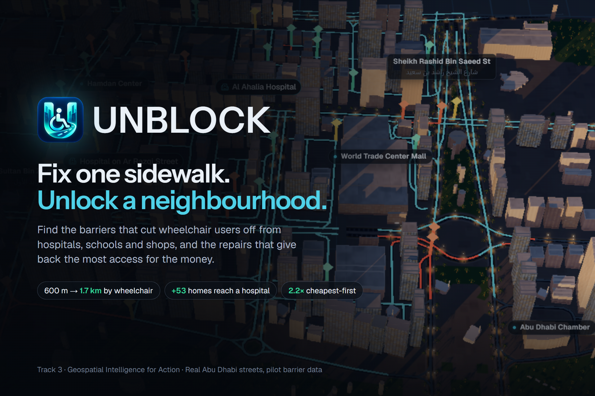
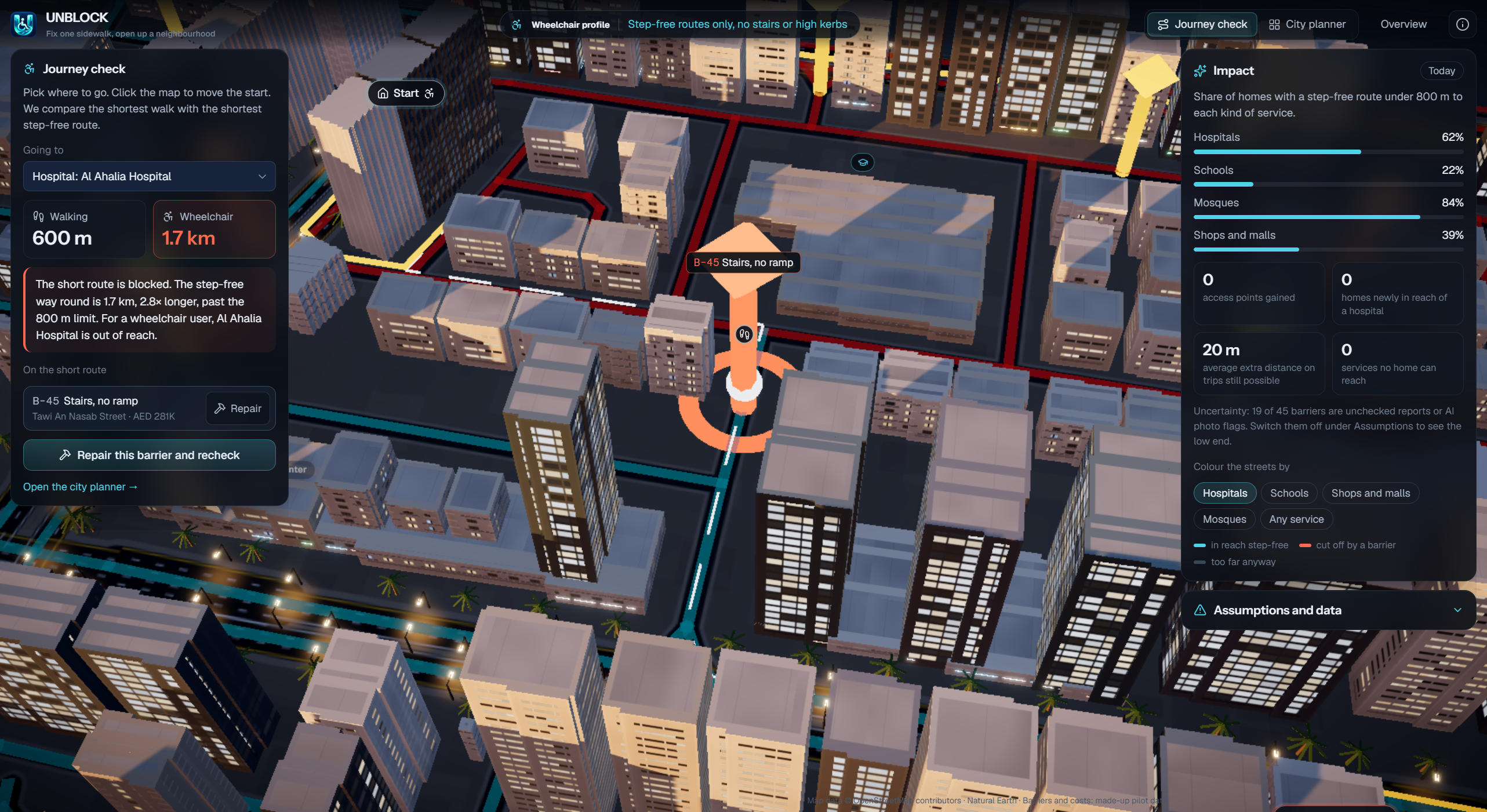
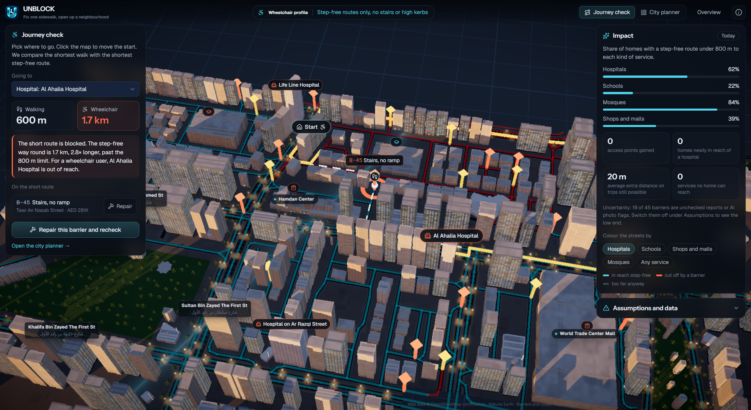
A hospital might be just 500 meters away, but for someone using a wheelchair, one missing curb ramp can make it unreachable. Cities invest millions in infrastructure, yet deciding which accessibility barriers to repair first remains difficult.
We asked a simple question: What if fixing one sidewalk could unlock an entire neighborhood?
What it Does
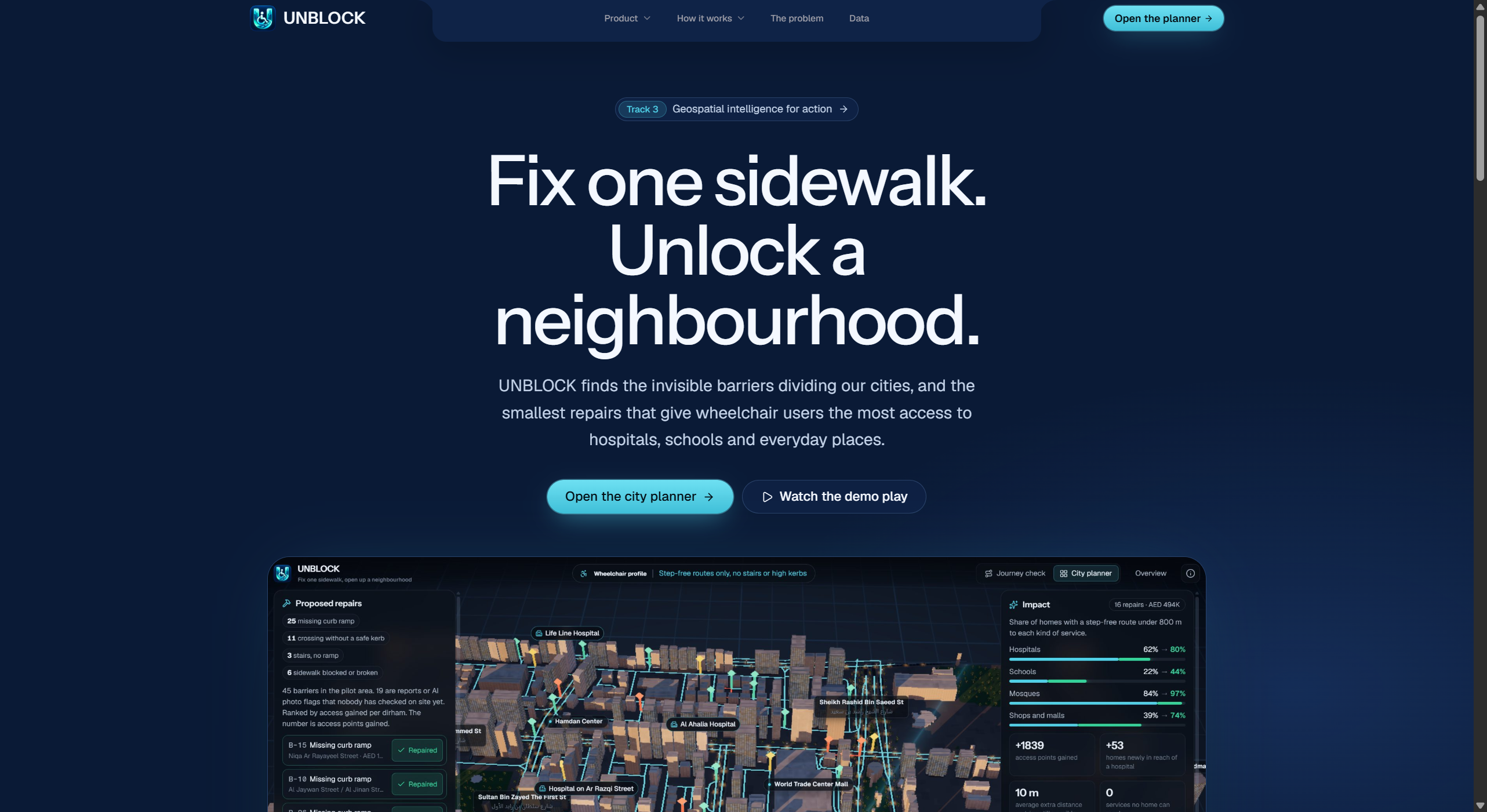
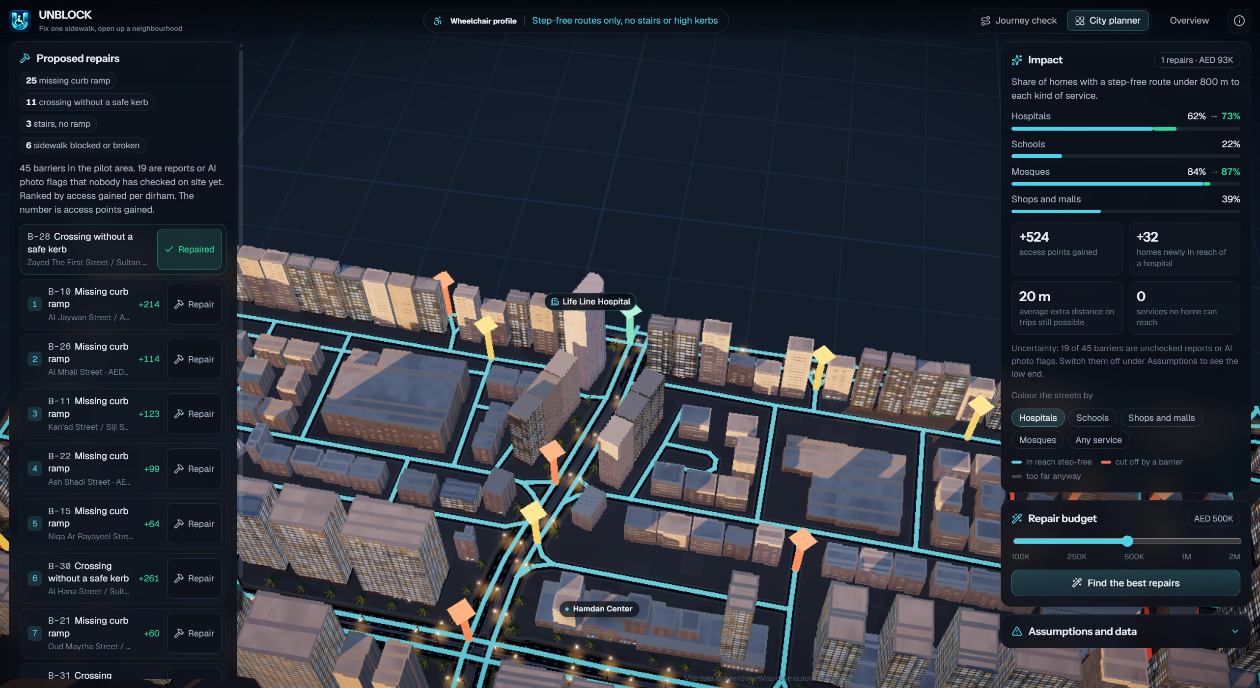
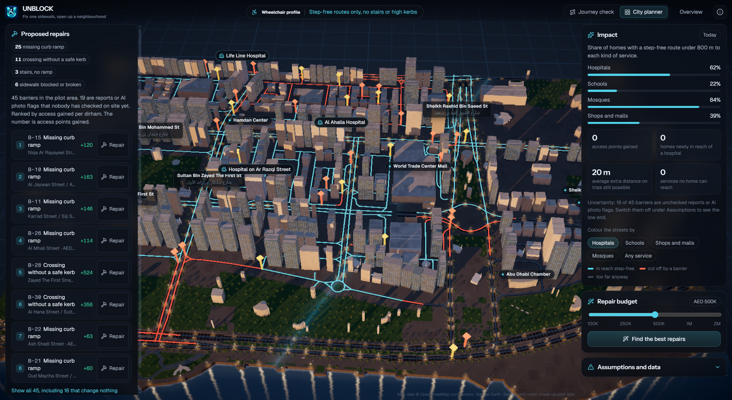
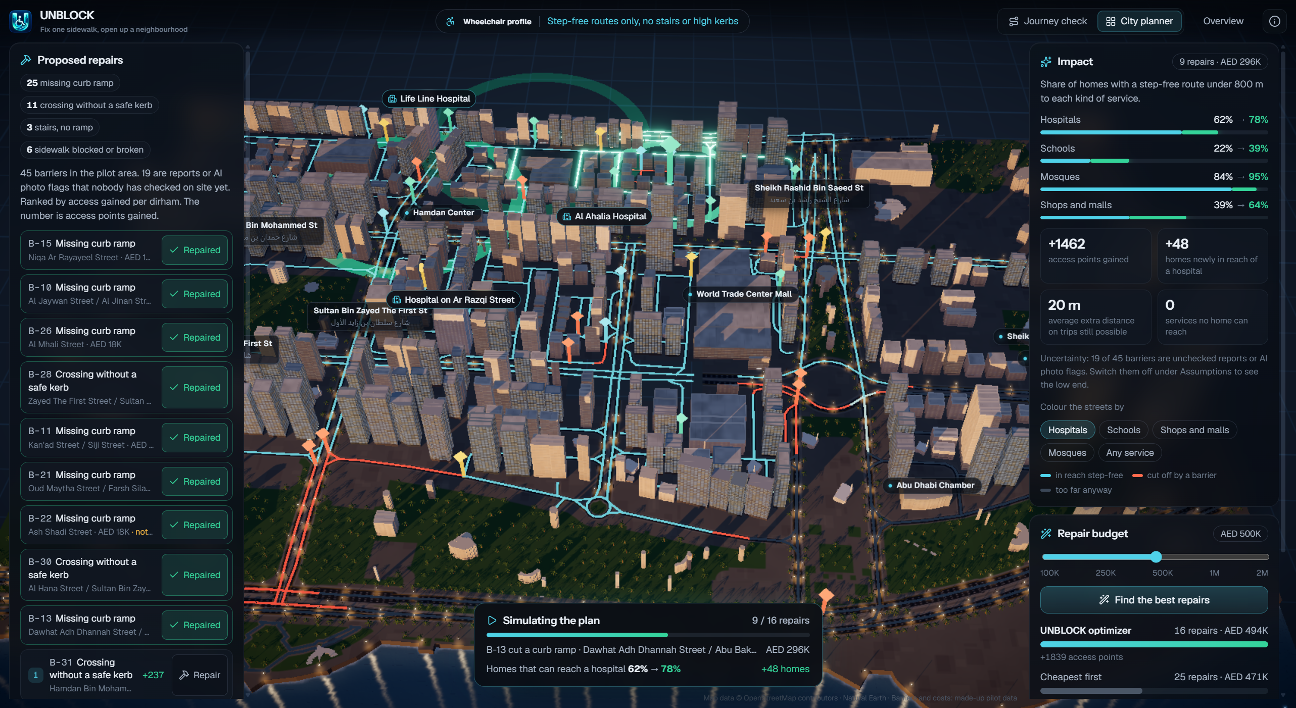
UNBLOCK is a 3D geospatial intelligence platform that helps cities identify and prioritize pedestrian accessibility improvements.
Using a digital twin of Abu Dhabi, UNBLOCK:
- Visualizes inaccessible pedestrian routes and infrastructure barriers.
- Analyzes how barriers affect access to hospitals, schools, and essential services.
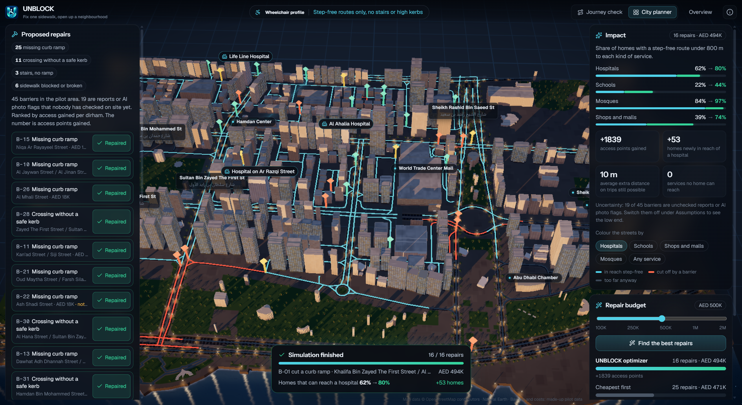
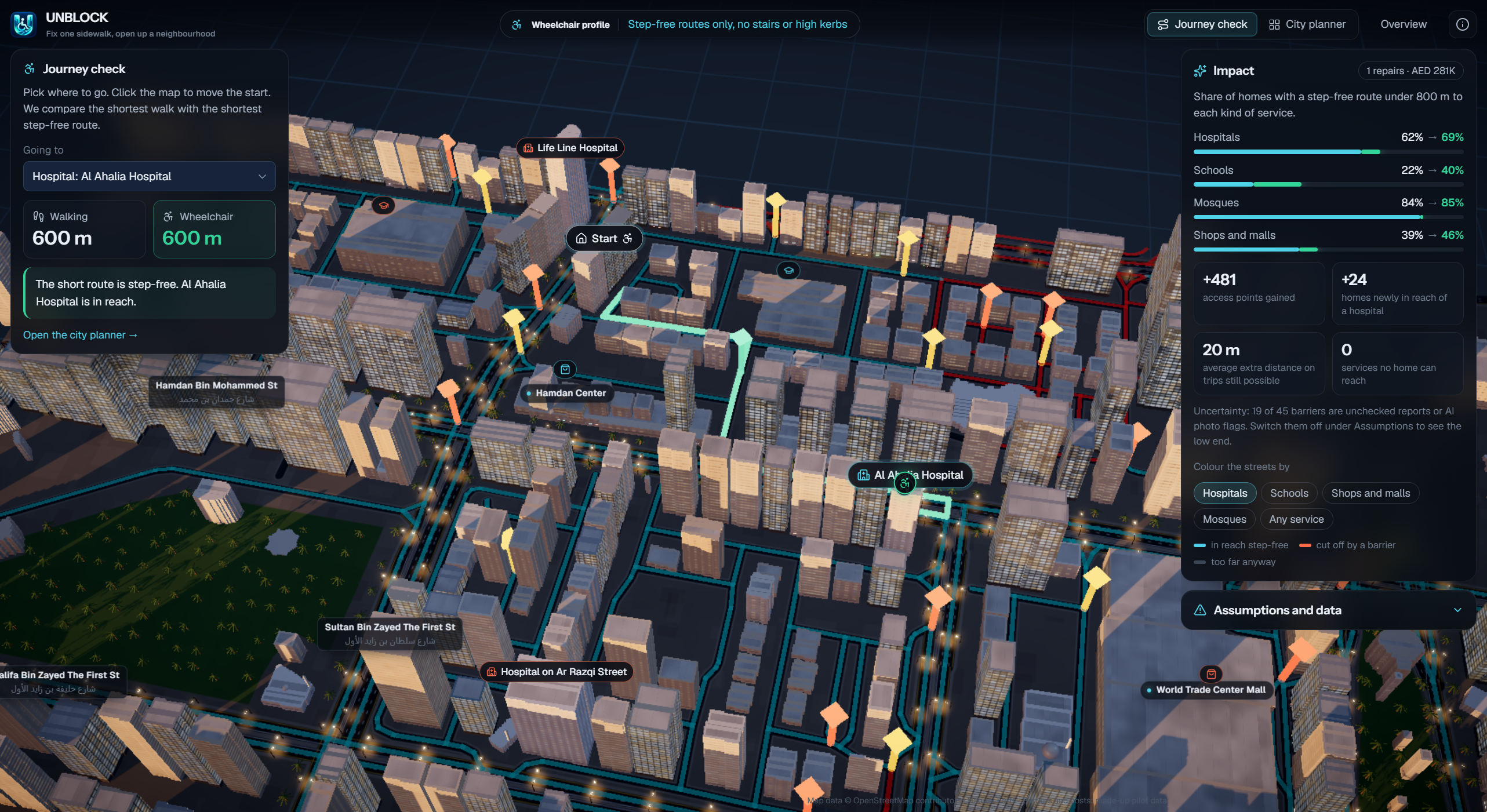
- Simulates repairs and recalculates accessible routes.
- Ranks infrastructure improvements based on accessibility gained per AED.
- Helps urban planners allocate limited repair budgets for maximum impact.
Instead of simply identifying problems, UNBLOCK shows which repairs could make the greatest difference.
How We Built It
We repurposed an existing 3D urban digital twin into an accessibility planning platform, using real street geometry from OpenStreetMap.
We developed a TypeScript graph-based accessibility engine to model pedestrian connections, blocked routes, and simulated infrastructure repairs. A budget-aware optimization system evaluates proposed improvements, while the interactive 3D interface visualizes their before-and-after effects.
Our pilot uses simulated barriers and repair costs rather than claiming verified accessibility conditions across Abu Dhabi.
Challenges We Ran Into
The biggest challenge was turning geographic street data into meaningful accessibility decisions. A road existing on a map does not guarantee wheelchair access.
We also had to account for interconnected routes, overlapping repair benefits, and the difficulty of presenting complex optimization results through a simple visual experience.
Accomplishments That We're Proud Of
- Transforming a city digital twin into a human-centered infrastructure planning tool.
- Developing a graph-based approach to measuring the impact of accessibility repairs.
- Connecting repair-budget decisions with accessible route connectivity.
- Making infrastructure trade-offs understandable through interactive 3D visualization.
What We Learned
Accessibility isn't simply about distance. It's about connectivity, independence, and equal access to essential services.
We also learned that geospatial intelligence becomes more valuable when it helps people make decisions rather than just displaying information.
What's Next
We want to integrate verified sidewalk accessibility datasets, community-reported barriers, more detailed repair-cost models, and accessibility-aware route recommendations.
Our long-term vision is to help cities prioritize infrastructure investments that make everyday life more accessible.
UNBLOCK - One repair can unlock a neighborhood.
Built With
- 3d-visualization
- accessibility
- digital-twin
- geospatial-analysis
- graph-algorithms
- node.js
- openstreetmap
- route-optimization
- simulation
- typescript
- urban-planning
- vite

Log in or sign up for Devpost to join the conversation.