-
-
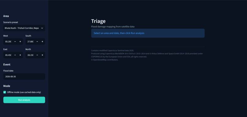
Dashboard
-
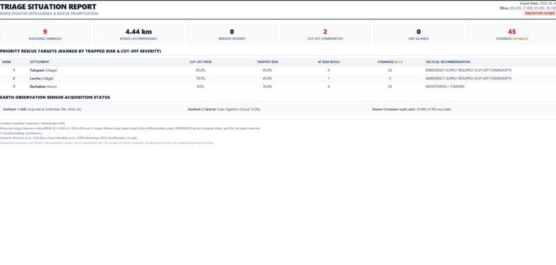
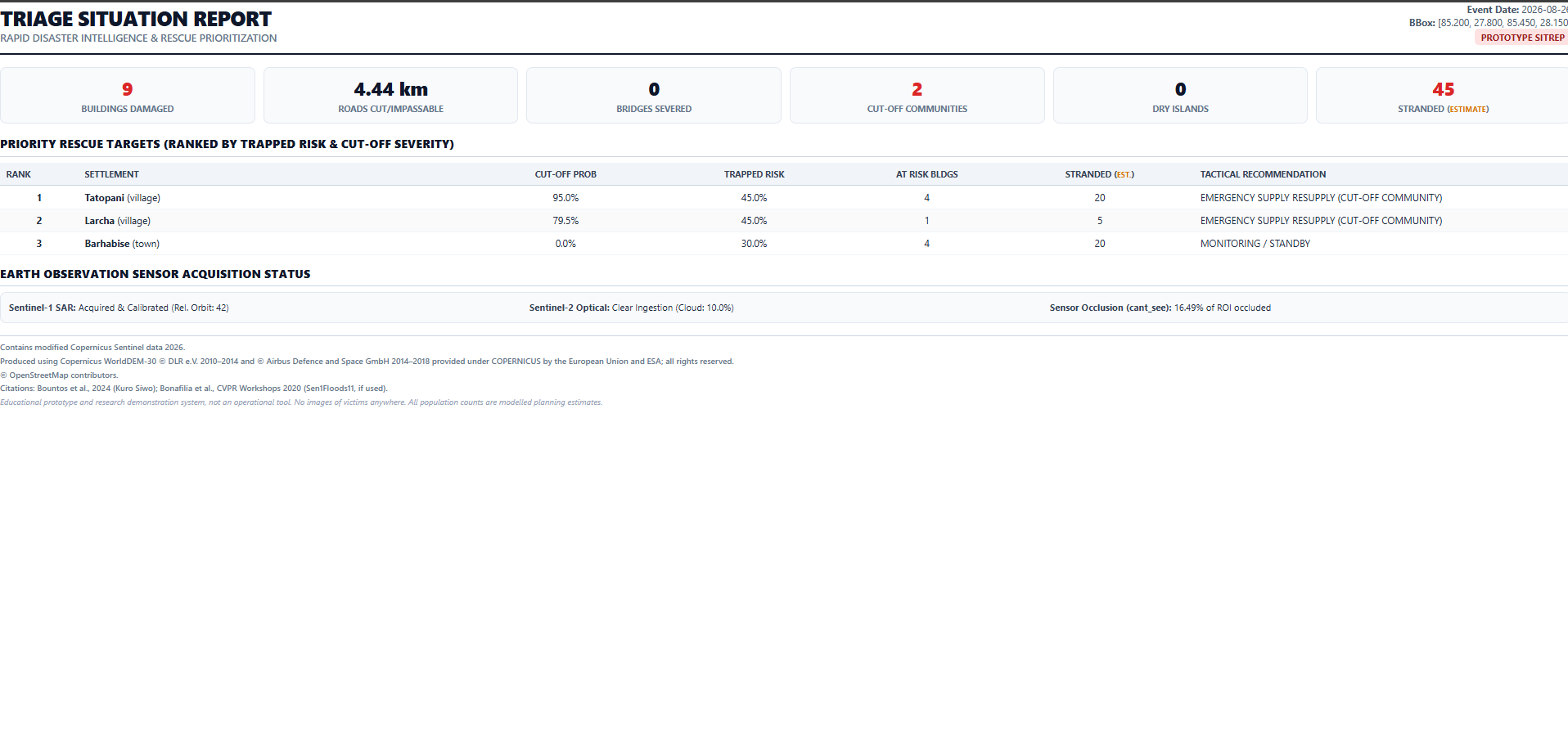
Triage HTML Situation Report
-
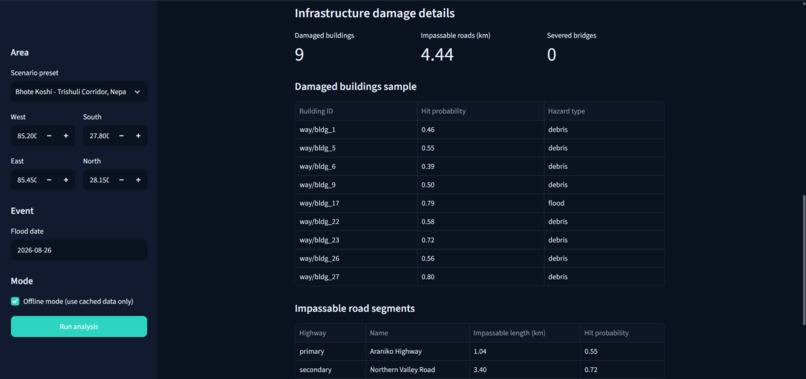
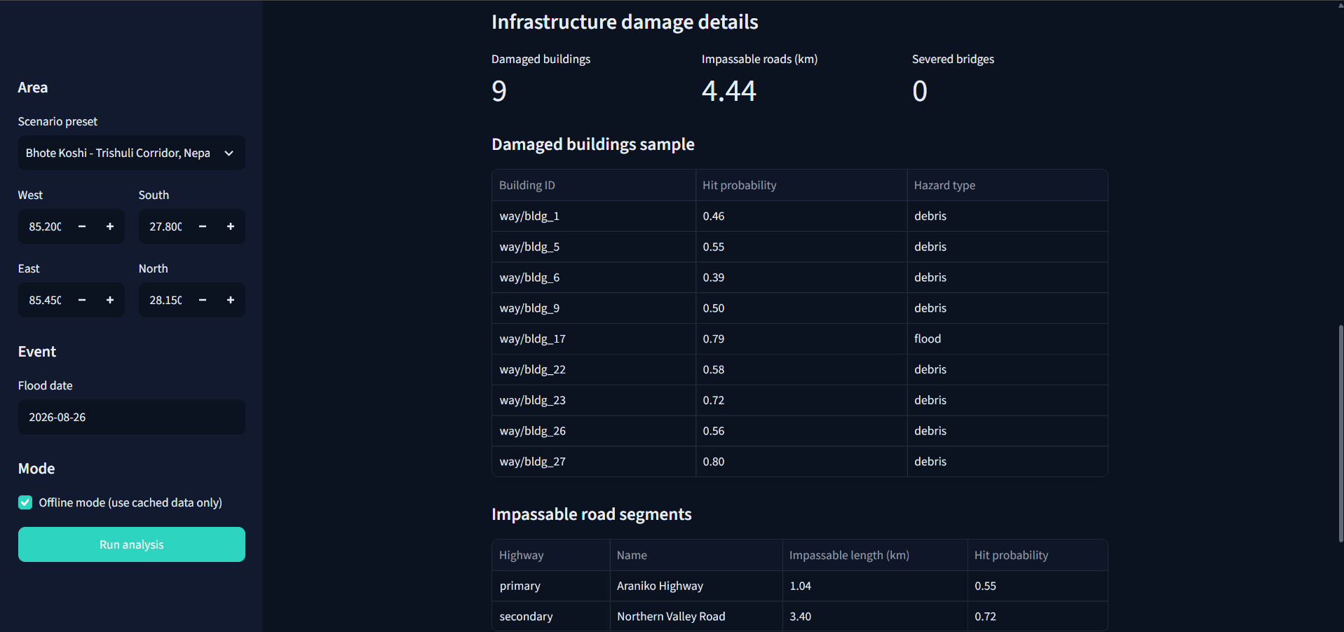
Infrastructure Damage Details
-
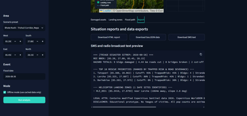
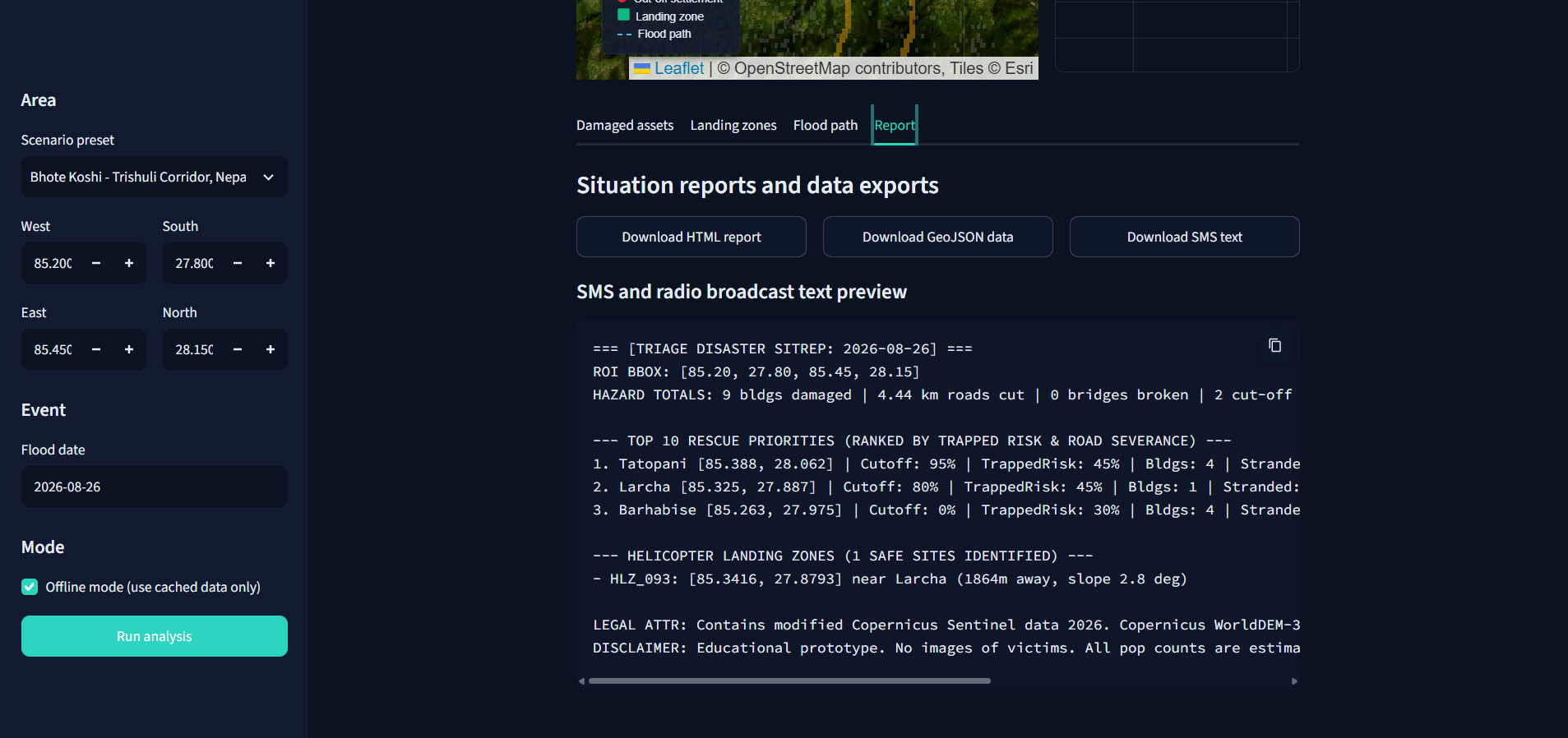
Situation Reports and Data Exports
-
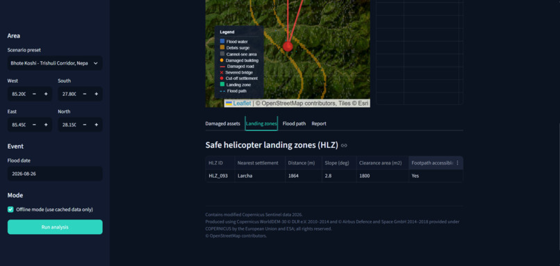
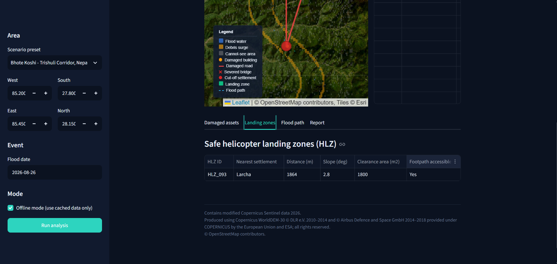
Landing Zones
-
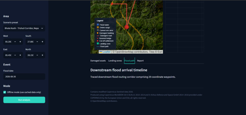
Flood Path
-
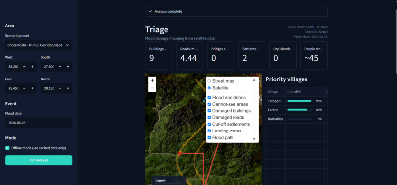
Analysis
Inspiration
During disasters, one of the greatest challenges for rescue teams is identifying which areas have suffered the most damage and which communities urgently need assistance. The August 2026 flooding in Nepal inspired us to explore how satellite technology and artificial intelligence could support faster disaster assessment. Although satellites capture valuable information about affected regions, converting that information into actionable rescue decisions remains difficult. This inspired Triage: Flood Damage Mapping from Space, a system designed to transform satellite imagery into meaningful flood assessments, infrastructure damage estimates, and rescue priorities. Our vision is simple: Use technology to help rescuers understand where help is needed most.
What it does
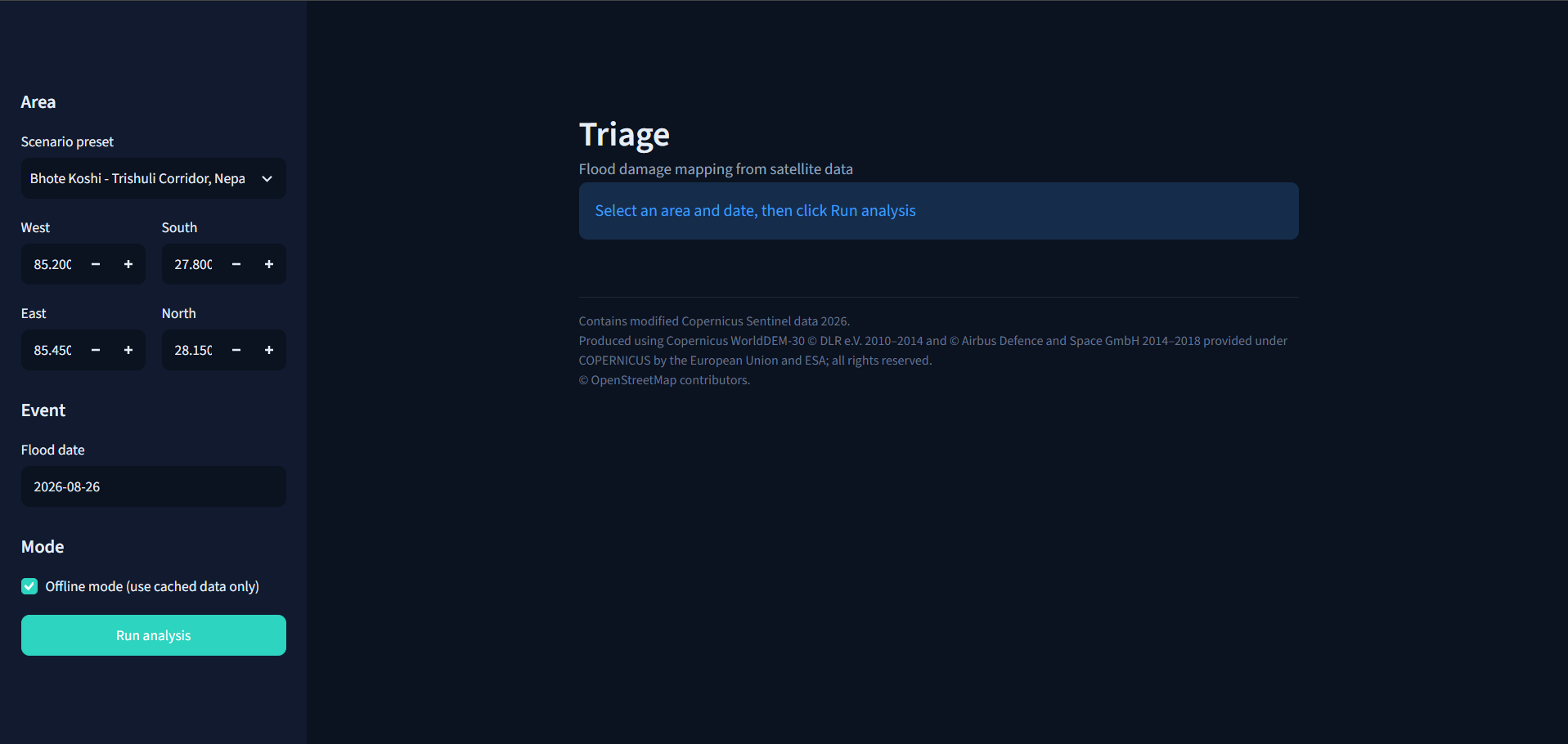
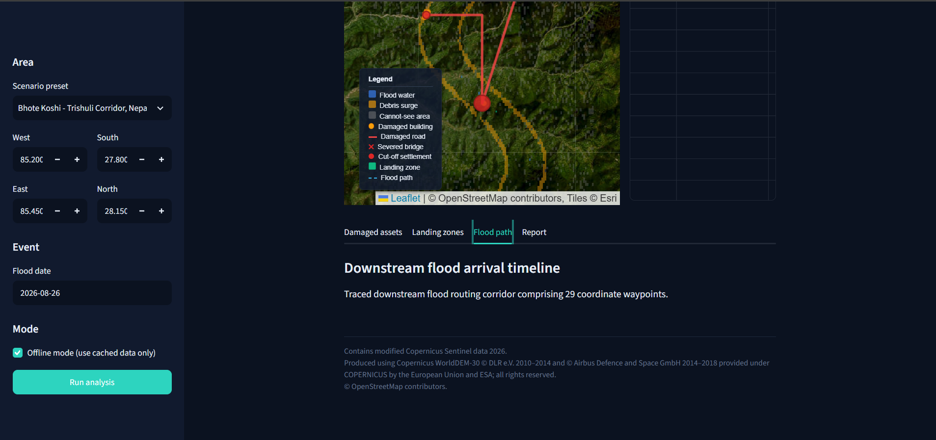
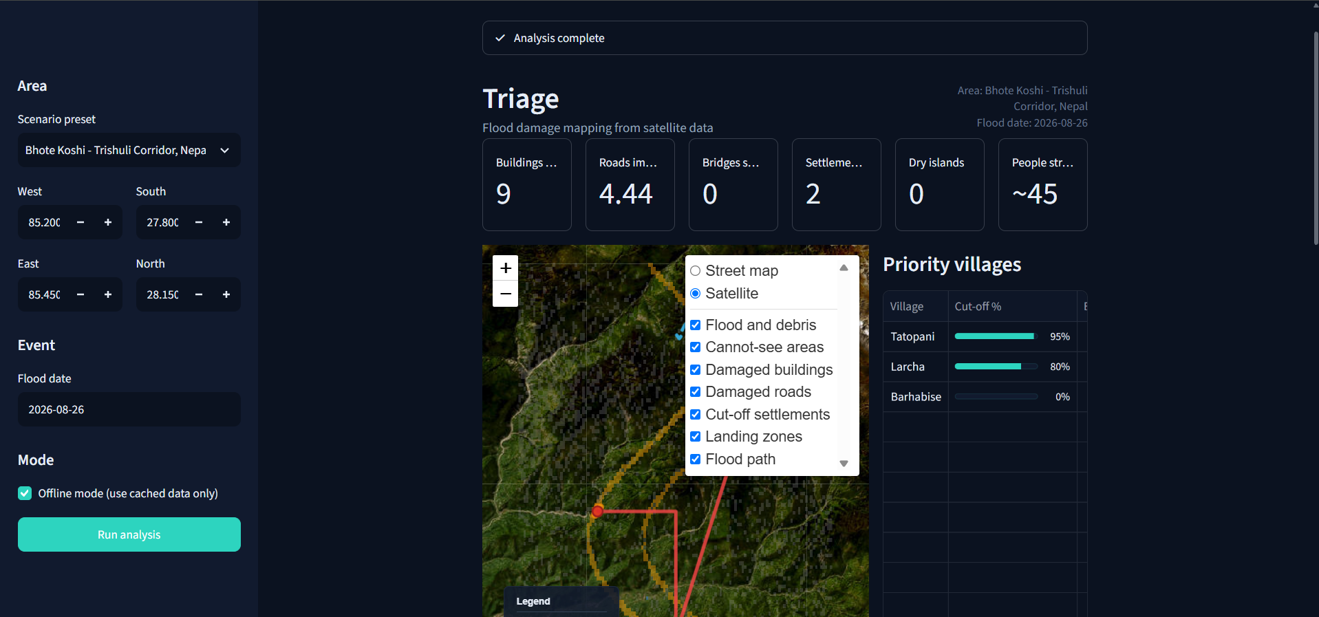
Triage is an AI-powered flood damage mapping and disaster-response decision-support system that analyzes satellite imagery and geographical information. The system is designed to: Detect flooded areas: Compare pre-flood and post-flood Sentinel-1 radar imagery to identify potential flooding. Assess infrastructure damage: Identify buildings, roads, and bridges potentially affected by flooding. Identify isolated communities: Analyze road connectivity to estimate which settlements may be cut off from essential services. Prioritize rescue operations: Rank potentially vulnerable settlements based on flood exposure, terrain, and accessibility. Analyze flood pathways: Use elevation data to estimate how flooding may travel downstream. Visualize results: Present flood assessments and geographic information through an interactive mapping dashboard. Triage also aims to support offline operation using previously downloaded data, making it suitable for disaster scenarios where internet connectivity is limited.
How we built it
We designed Triage by combining machine learning, satellite remote sensing, geospatial analysis, and graph algorithms. For satellite observations, we use Sentinel-1 Synthetic Aperture Radar data, which can capture surface information even through clouds. Sentinel-2 optical imagery can provide additional information when weather conditions allow. For AI-based flood segmentation, our detection pipeline uses a U-Net architecture with PyTorch, combining pre-event and post-event radar observations with terrain slope information. The Kuro Siwo dataset serves as a benchmark for developing and evaluating flood detection. We use Rasterio, GeoPandas, and Shapely for raster processing, spatial analysis, and infrastructure overlays. Digital elevation models provide terrain information, while OpenStreetMap supplies geographic infrastructure data. For settlement accessibility, NetworkX supports road connectivity analysis and the proposed probabilistic simulation of damaged routes. The visualization layer uses Streamlit and Folium to make the geographic results easier to interpret. Our architecture connects these components into a pipeline that moves from satellite observations toward flood assessment and rescue prioritization.
Challenges we ran into
One of our biggest technical challenges was interpreting radar imagery in mountainous regions. Steep terrain creates radar shadows and distortions that can produce misleading flood signals. Another challenge was combining satellite images, digital elevation models, and OpenStreetMap datasets, which often have different resolutions and coordinate reference systems. We also had to consider how a flood detection model trained on existing datasets would perform in Himalayan terrain, where environmental conditions may differ significantly from the training data. Incomplete geographic infrastructure records presented another challenge, particularly when estimating road accessibility in remote settlements. Finally, designing a system intended for disaster response required us to consider uncertainty, performance, and offline accessibility rather than focusing exclusively on model predictions.
Accomplishments that we're proud of
We are particularly proud of designing Triage as more than a conventional flood detection project. Instead of only identifying water-covered areas, we developed an architecture that connects flood mapping with infrastructure assessment, settlement accessibility, and rescue prioritization. Our key project contributions include: A multi-stage approach combining radar imagery, machine learning, and terrain analysis. A flood assessment architecture that considers both physical damage and community accessibility. A rescue-prioritization concept that aims to identify potentially isolated and vulnerable settlements. An emphasis on prediction confidence and clearly communicating uncertain observations. An offline-first design intended for regions where communications may fail during disasters. The feature we consider most meaningful is the attempt to turn flood information into a practical question for emergency responders: Which communities may need our attention first?
What we learned
Working on Triage taught us that building a meaningful AI solution involves much more than training a model. We learned how radar satellite imagery can support flood detection, why terrain analysis is essential in mountainous regions, and how geographic information systems can help translate model predictions into useful insights. We also realized that accuracy and uncertainty are equally important, especially when technology could influence emergency response decisions. Another major learning was the value of combining different technical fields. Machine learning detects patterns, geospatial analysis provides context, and graph algorithms help interpret how infrastructure disruption affects communities. Most importantly, we learned that the true value of technology lies in its ability to solve real-world problems.
What's next for Triage: Flood Damage Mapping from Space
Our next goal is to improve Triage's accuracy, reliability, and practical usability. We plan to strengthen the AI segmentation model using additional flood datasets, improve debris detection in mountainous terrain, and evaluate predictions against independent disaster mapping references. We also aim to refine settlement isolation analysis, rescue-priority ranking, and terrain-based identification of potential helicopter landing zones. Another important direction is improving offline functionality so that emergency responders can access previously prepared maps and reports without relying on continuous internet connectivity. In the longer term, we hope to collaborate with disaster-management professionals, validate the system through real-world case studies, and make its geographic insights more accessible through multilingual reporting. Our ultimate goal is to transform satellite data into actionable intelligence that could help emergency teams respond faster, allocate resources more effectively, and potentially save lives.
Built With
- copernicus
- folium
- geopandas
- github
- jinja
- numpy
- openeo
- openstreetmap
- python
- pytorch
- rasterio
- scikit-learn
- scipy
- streamlit


Log in or sign up for Devpost to join the conversation.