-
-

ML Model
Inspiration
We know a lot of people who feel unsafe when walking back late at night. Our aim is to make, their walk home a little bit safer.
What it does
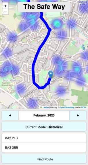
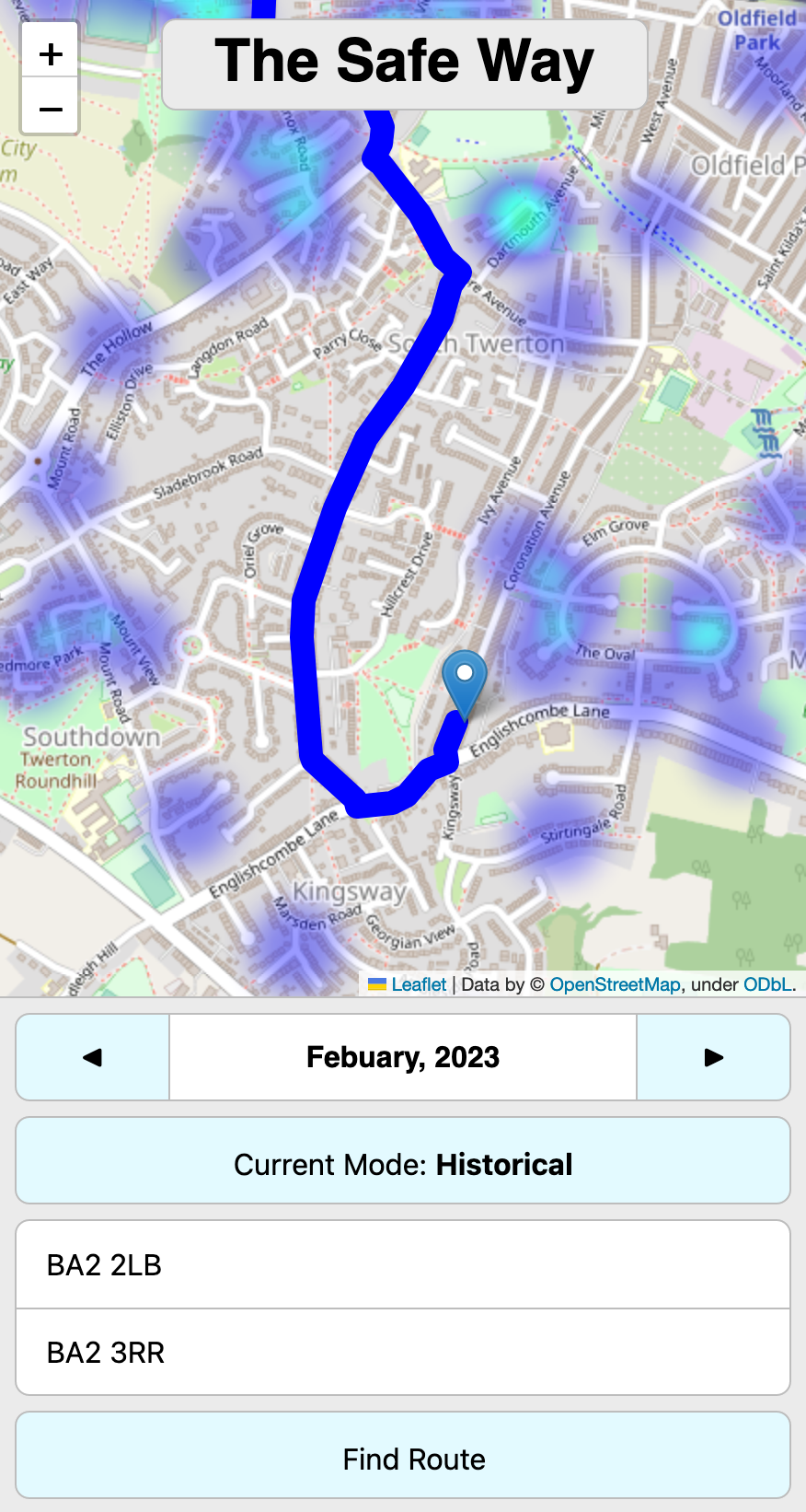
We have leveraged cutting-edge ML to predict crime patterns within Bath to help users navigate home finding the saftest routes. It is a website that provides the user with a heat map which-represents crime hotspots within the area. The application will also calculate a safe route home the user can go when prompted.
How we built it
Dataset:
- data.police.uk: (provided us with details about all the crimes in Bath and Bristol in addition to their location)
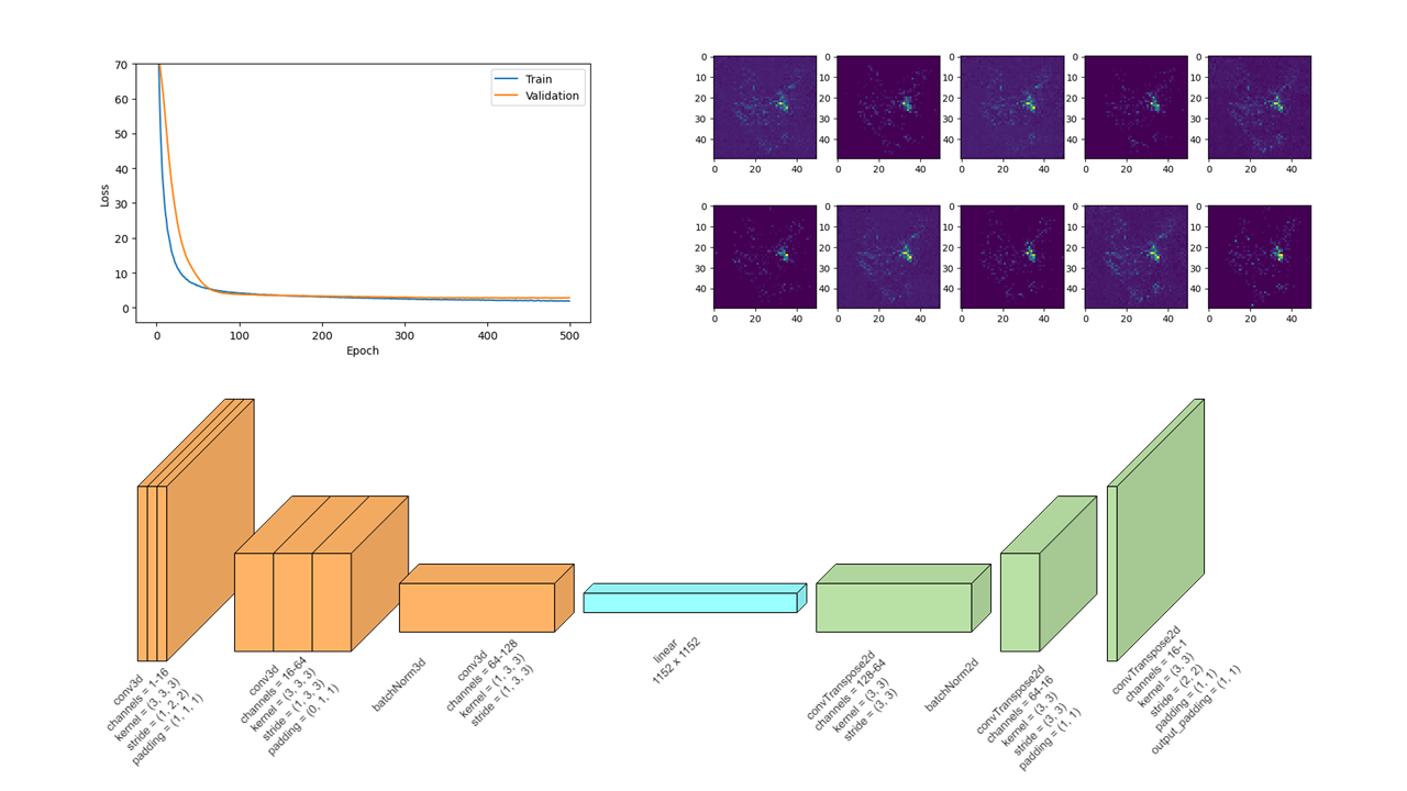
How we built the Machine Learning: The ML model is an encoder-decoder based architecture, built using 3D convolutional layers to capture the last 3 months of crime activity with respect to the location data, which would then predict the density of crime for the next month. We transformed the database of singular crime events from the police API into heatmap images for each month and used these as the training data for our model. We used various regularisation methods to help generalise our model to new data, due to the smaller size of our training data.
How we Built the Navigation: We combined an existing routing API with our own stochastic routing algorithm to avoid crime hot spots identified by our Machine Learning model.
- Open Street Map
- Open Route service
- Google's geocoding API
Challenges we ran into
Navigation was hard
Accomplishments that we're proud of
We got everything working despite having doubts at the start.
What we learned
New machine learning and data sciences techniques, a few different APIs and a lot about how direction routing algorithms work.
What's next for The Safe Way
Creating an APP, Experimenting with other cities, improving our navigation, Providing tools such as allowing friends to track you, an SOS button,
References
https://data.police.uk/ https://wiki.openstreetmap.org/wiki/Routing https://openrouteservice.org/ https://developers.google.com/maps/documentation/geocoding/overview
Built With
- css
- data.police.uk
- flask
- html
- matplotlib
- numpy
- openrouteservice
- openstreetmap
- pandas
- python
- pytorch


Log in or sign up for Devpost to join the conversation.