-
-
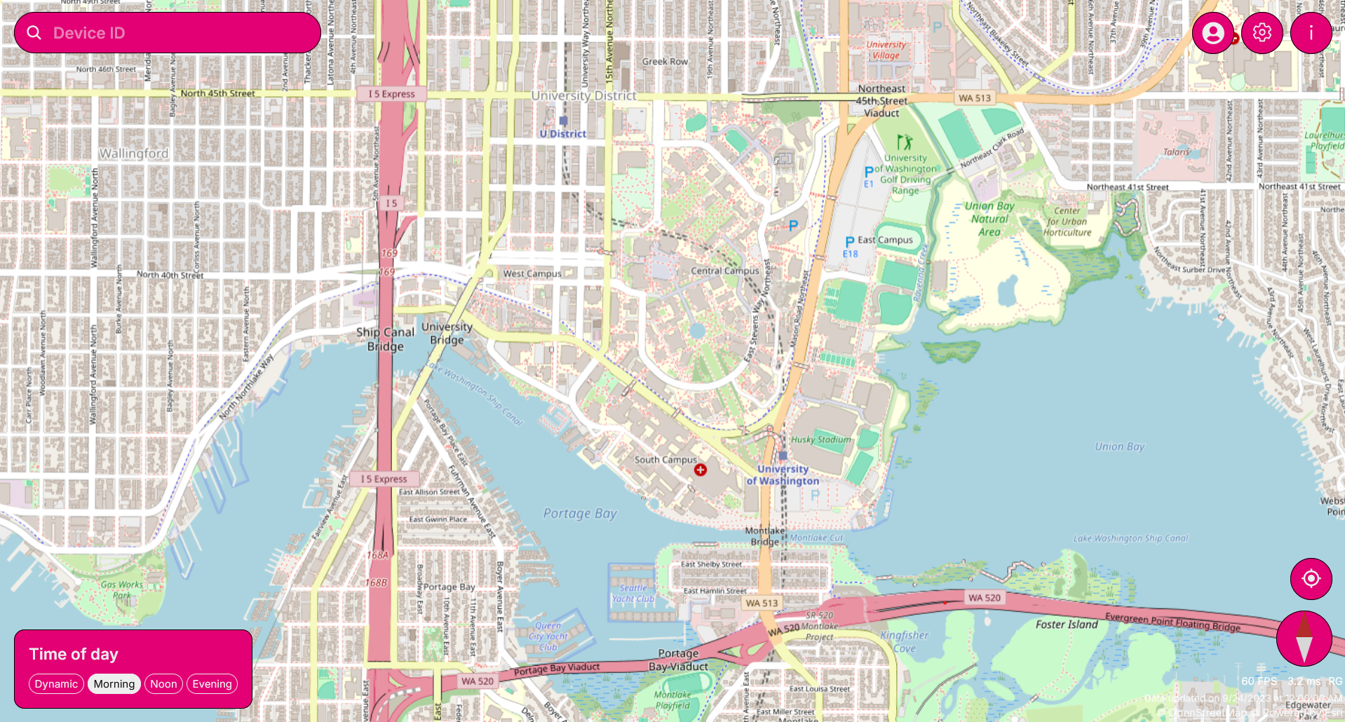
Scroll and look through map
-

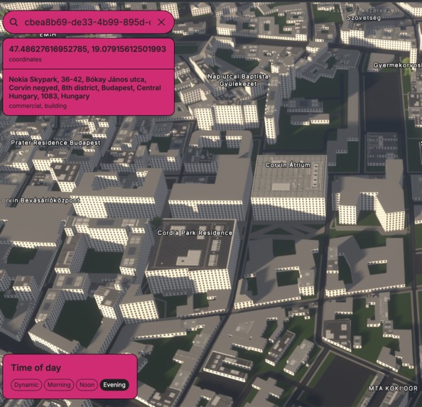
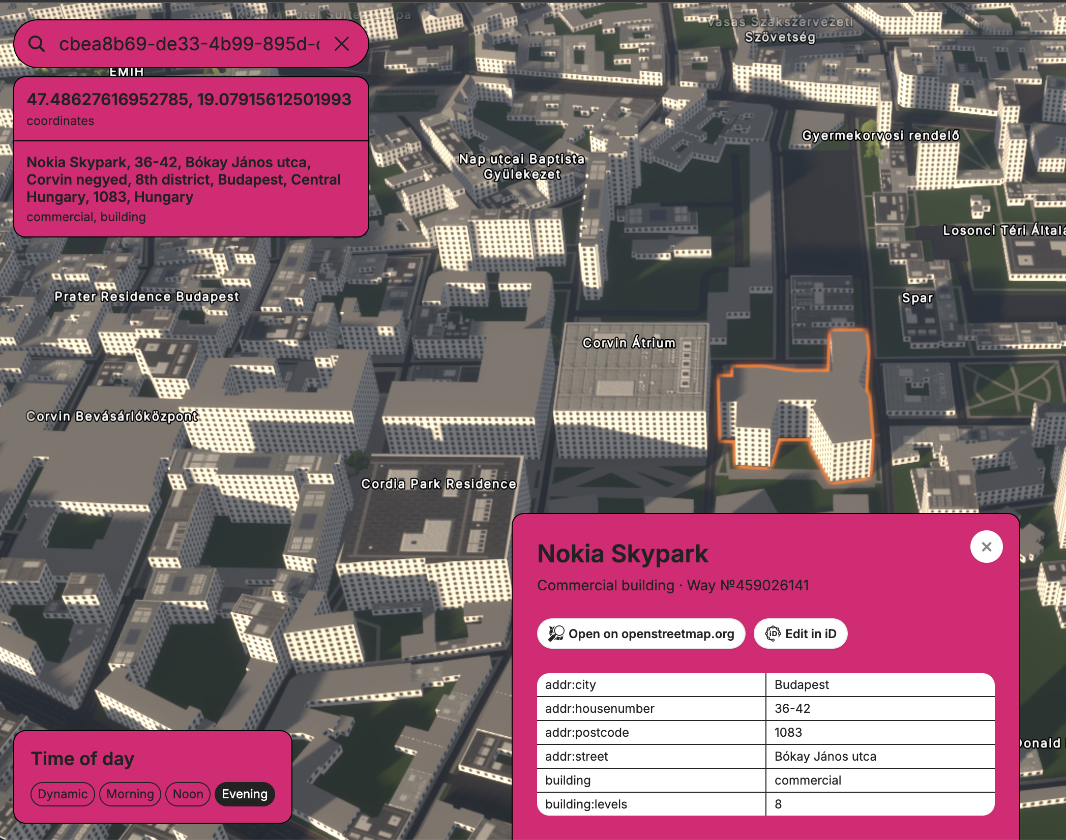
Search location to check information about it
-

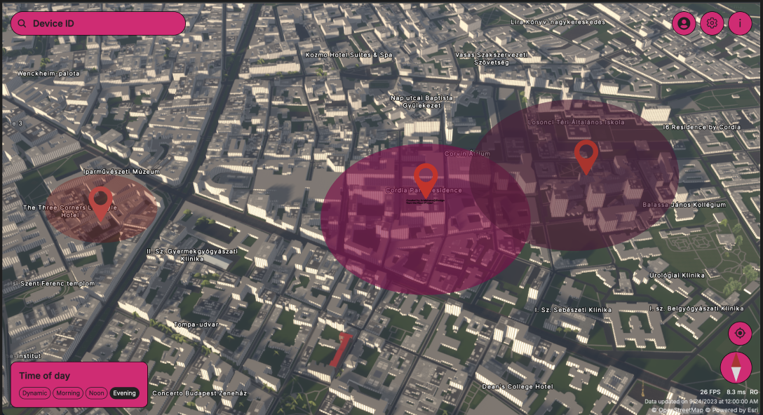
UW campus from above!
-
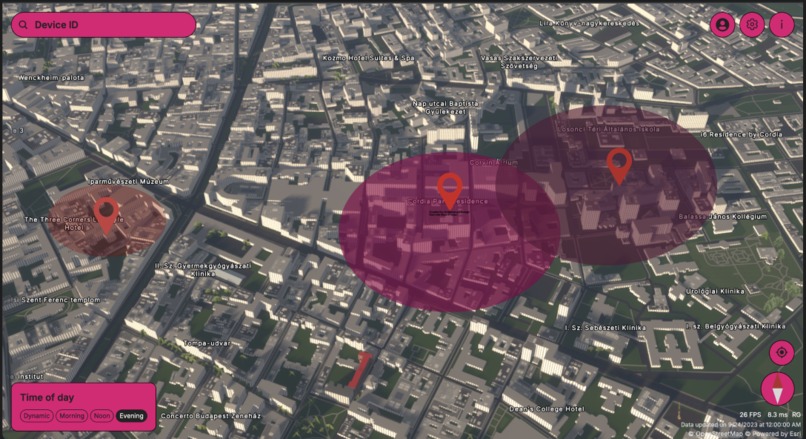
HeatMap of Signal Strength
-
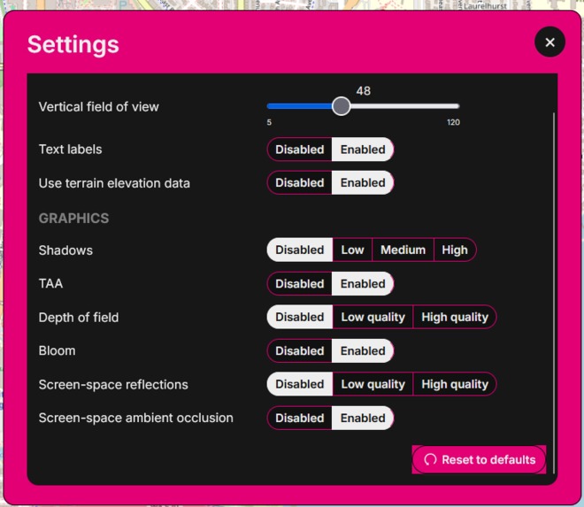
Different map settings
-

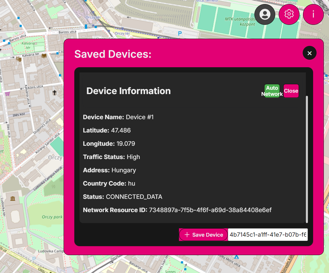
Manage user devices and check signals


Are you ever unsure where your organization's devices have a strong T-Mobile Nokia 5G network signal? Are you wondering if a loved one or important device has gone offline in a low-coverage area or needs to have strong network resources facing certain situations? Or maybe you're struggling with identifying network dead zones that impact your team or fleet's communication.
TFind is here to help. Our street-GL-based interactive web application allows you to track, manage, and analyze multiple device locations, signal strengths, and access to T-Mobile Nokia 5G network resources in real time, all visualized on a dynamic 3D map. With TFind, you can pinpoint where your devices have strong or weak signals, ensure constant connectivity for remote teams or IoT devices, and troubleshoot coverage issues to optimize your network.
What it does
TFind is a street-GL-based interactive web application designed to help users track, manage, and analyze multiple device locations, signal strengths, and access to T-Mobile Nokia 5G network resources in real-time. With an intuitive 3D map, users can pinpoint specific devices, evaluate network performance, and identify regions with strong or weak signals. Whether you’re troubleshooting connectivity issues, optimizing network coverage, or checking if a family member or employee has lost signal, TFind gives you the insights to stay informed and controlled. This tool is ideal for individuals and businesses who want to ensure reliable connectivity, avoid dead zones, and improve device management efficiency when facing certain special situations such as natural disaster, business operations, and other network resources required situation.
How we built it
We used typescript, Javascript for the front end, Three.js for 3D map rendering, and the T-Mobile Network as Code API for real-time network data. To handle device tracking and StreetGL API for precise geolocation mapping.
Challenges we ran into
Getting the pinpoint to show up on the 3D Map, connections with the API, custom cursor
Accomplishments that we're proud of
Being able to find and put information about each location on a 3D map even if we were given 2D coordinates by the API. Being able to use all the APIs and getting the project done.
What we learned
How to connect to Device Status API, Quality-of-Service on Demand, Location Retrieval API, and Congestion Insight API and use them. Navigating difficult decisions together as a team. How to hackathon.
What's next for TFind
Add a heatmap for cellphone coverage and real-time updates and integrate more Nokia APIs that enable highly customizable settings for network slicing and resource allocation. We also plan to introduce predictive analytics, helping users identify signal dead zones before they become a problem, and further improving connectivity for teams, families, and IoT devices in the field.
Built With
- node.js
- nokia-device-status
- nokia-location-retrieval
- openstreetmap
- react
- scss
- typescript


Log in or sign up for Devpost to join the conversation.