-
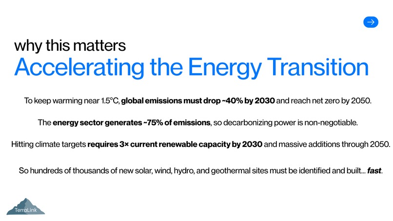
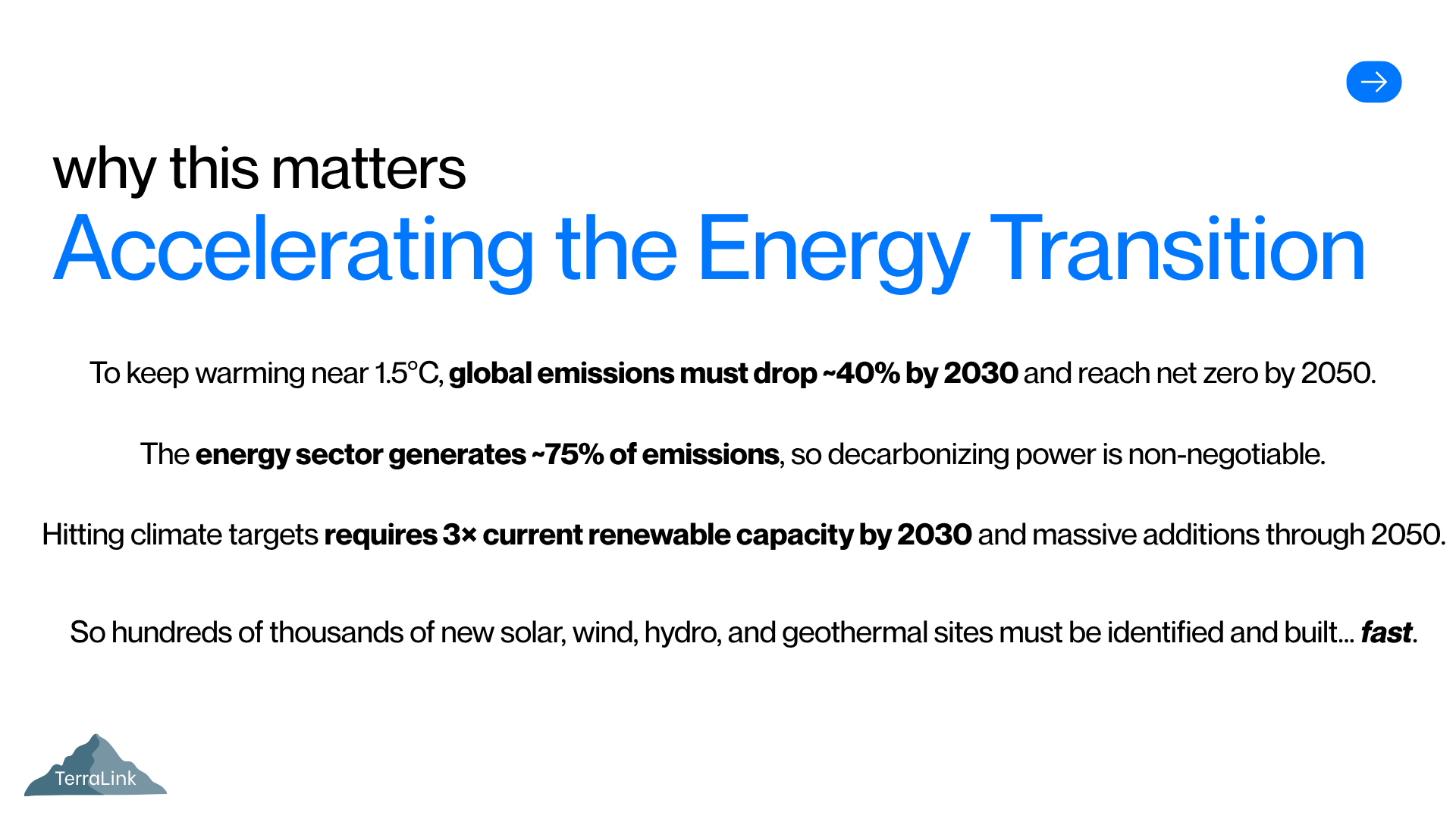
Why it matters: accelerating the energy transition
-
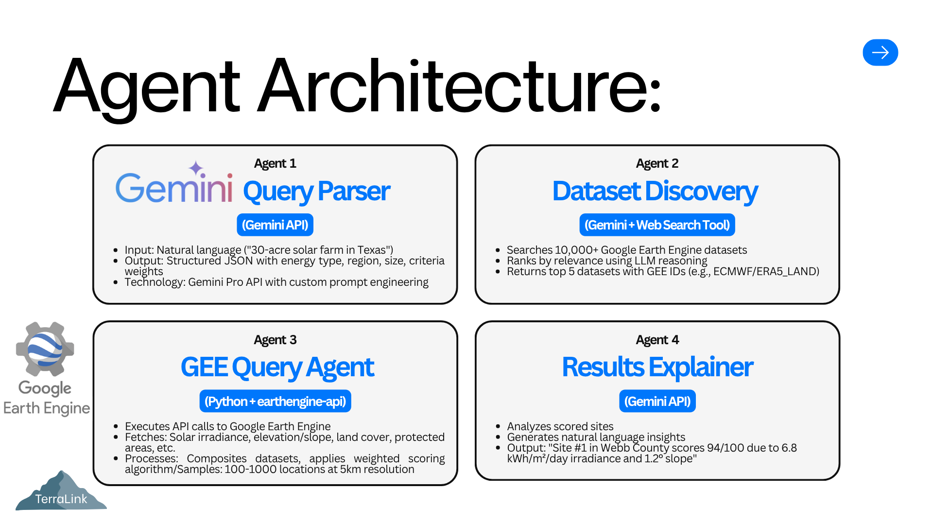
Agent architecture
-
Web app initial setup
-
Example Solar Energy Texas
-
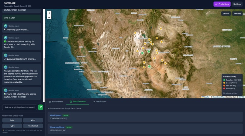
Example Wind Energy Utah
-

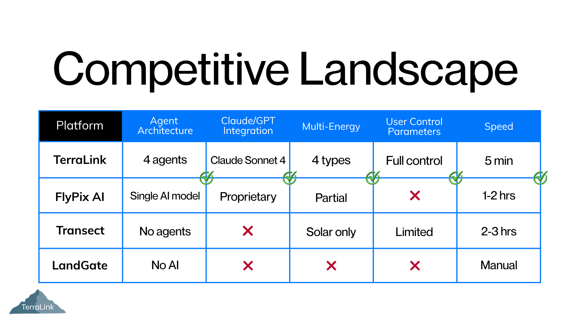
Competitive edge
-
Contact information


Inspiration
The world needs to massively scale solar, wind, hydro, and geothermal by 2050 to hit climate targets, but one of the biggest bottlenecks is simply finding where to build. Analysts from energy companies routinely spend 6-18 months on manual site selection, burning through consultant fees and delaying urgently needed projects. We realized that combining LLMs with free satellite data could flip this: an agentic system that lets anyone discover credible, climate-aligned renewable energy sites in minutes for pennies, accelerating the energy transition instead of waiting on paperwork and GIS bottlenecks.
What it does
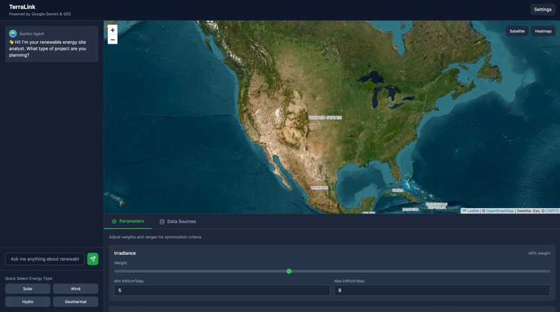
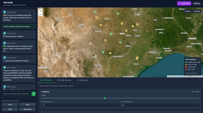
TerraLink automates renewable energy site discovery by combining multi-agent AI with Google Earth Engine's satellite data. Users describe their project in plain English ("30-acre solar farm in Texas"), and our system analyzes thousands of locations using real satellite imagery to identify the best sites, ranked by solar irradiance, terrain slope, land cover, and proximity to protected areas.
How we built it
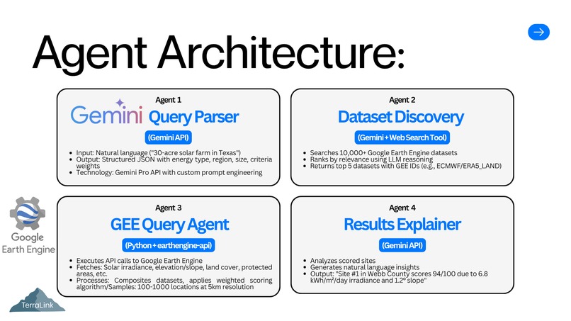
TerraLink uses a four-agent architecture orchestrated through sequential API calls:
1. Query Parser (Gemini): Converts natural language ("affordable wind sites near Austin") into structured parameters (energy type, region, acreage, criteria weights)
2. Dataset Discovery Agent: Searches Google Earth Engine's 10,000+ satellite datasets to find relevant data sources (solar irradiance, elevation, land cover, protected areas)
3. GEE Query Agent (Python): Executes Google Earth Engine API calls to fetch and process satellite imagery, then applies a weighted scoring algorithm.
4. Results Explainer (Gemini): Generates natural language insights explaining why each site scored high, with specific metrics and actionable recommendations.
The frontend (React + Tailwind CSS) provides an interactive chat interface where users can adjust criteria weights with sliders and see results update in real-time without re-querying satellites. The *backend *(Flask + Python) orchestrates agent communication, handles GEE authentication via service accounts, and manages API rate limiting across Gemini and Google Earth Engine.
Challenges we ran into
Accomplishments that we're proud of
What we learned
- Multi-agent systems are more maintainable than monolithic AI: each agent can be upgraded independently.
- Google Earth Engine is incredibly powerful but has a steep learning curve for Python API authentication and raster algebra.
- LLMs excel at translation tasks: Gemini perfectly bridges natural language ↔ structured data and data ↔ explanations.
- Caching is critical: GEE queries take 20-40 seconds; caching identical region queries is essential for UX Free satellite data changes everything: $0 imagery access means we can offer this to underserved communities.
What's next for TerraLink
- Model Context Protocol (MCP): Build MCP servers for GEE catalog search and land ownership lookup, enabling Gemini to autonomously discover datasets.
- Multi-modal Analysis: Add PDF permit parsing and drone imagery processing for comprehensive site assessments.
- Streaming Responses: Implement Server-Sent Events to show agent "thinking" in real-time.
- Predictive Modeling: Train custom ML models for energy yield forecasting based on historical weather patterns.


Log in or sign up for Devpost to join the conversation.