-
-
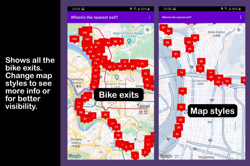
Shows all the bike exits. Change map styles to see more info, or for better visibility.
-
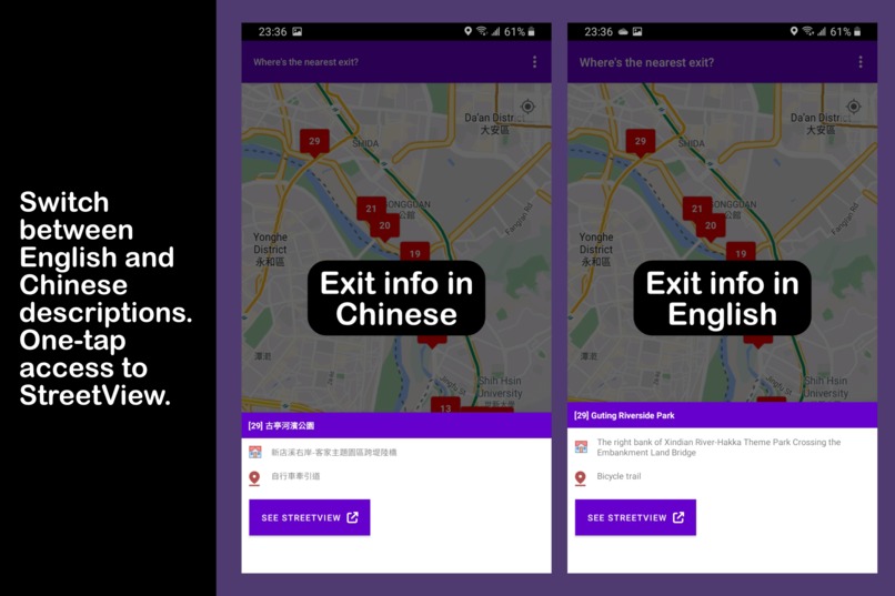
Switch between English and Chinese descriptions. One tap access to StreetView.


Inspiration
I created this app to help me navigate the long winding bike paths of the Taipei riverside. I frequently ride a bike to go home, usually after putting in extra hours at work or after watching a movie at my favorite theater.
This means a lot of my rides start way past 10pm. Unfortunately, this is also the same time most roadworks occur on the bike path, which almost always results in random sections of the bike path being blocked off. With the usual path blocked, I would then be forced to look for the nearest bike exit where I could get out to the main road and then another bike entrance to return to my usual route.
If my 'detour' occurred in an area that I was not familiar with, I would spend minutes to hours biking around trying to find an exit. I decided I would create this app to help me solve that problem.
Additionally, I also envision this app proving useful for other purposes, such as:
- Planning cycling tours or day trips
- Looking for alternative biking trails
- Finding the optimal bike path for commuting
- Scouting out one's favorite riverside park
- Tourism and travelling purposes
What it does
The app maps all known exits located along Taipei's riverside bike paths. It also offers a limited set of options to customize the map:
- Change map styles and map markers
- Switch between EN and ZH descriptions
- Link to Google street views
- Drop temporary map markers
How I built it
Exit data was taken from information published by data.gov.tw. The app uses Google Maps and uses the smartphone's GPS to determine the current location. All data is saved locally and remains on the user's device.
I've also looked into several maps that were available from various websites in Taiwan.
The app makes use of the following APIs:
- Google Maps provides a base map layer that allows users to visualize where the nearest bike exit is located based on their current GPS position.
- Coordinates for the bike exits were taken from data.gov.tw and can be shown on the map using one of the different marker types.
- To make map markers easier to find, users can also switch to a JSON-styled map that is less cluttered and offers better contrast.
- For every exit, the app makes use of Maps URLs to assemble a link that allows users to see a StreetView of the exit.
Challenges I ran into
Learning Kotlin and the Google Maps API was fun. Making it work, however, was a different issue. There were a lot of tutorials on the web, but I would estimate that around 60% of them were outdated and would refer to APIs that were already deprecated.
I feel that the Google Maps API gets updated a lot. I started this project around June 2021 and stopped mid-August of the same year. By the time I picked it up in November 2022, several dependencies were already outdated and I had to adapt my code to work with the latest versions.
What's next for Taipei Riverside Bike Exits
Note that this is my first app and is very much a work in progress. I detail all known issues, troubleshooting tips, and additional information here:
I do plan to continue working on this, as I still have a few good ideas for improvement. The app has also been recently published to the Google Play Store, so it will be exciting to see what other users have to say about the app.


Log in or sign up for Devpost to join the conversation.