-
-
Dashboard
-
Nepali
-
Summary
Inspiration
After a flood, knowing where the landscape changed is only the beginning. Responders also need to understand which infrastructure may be affected, which settlements have uncertain road access, and what evidence supports those conclusions—even when internet access disappears.
TADS Flood brings these questions into one inspectable workspace for Track B: Flood Damage Mapping.
What it does
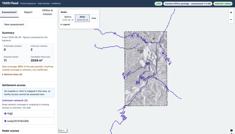
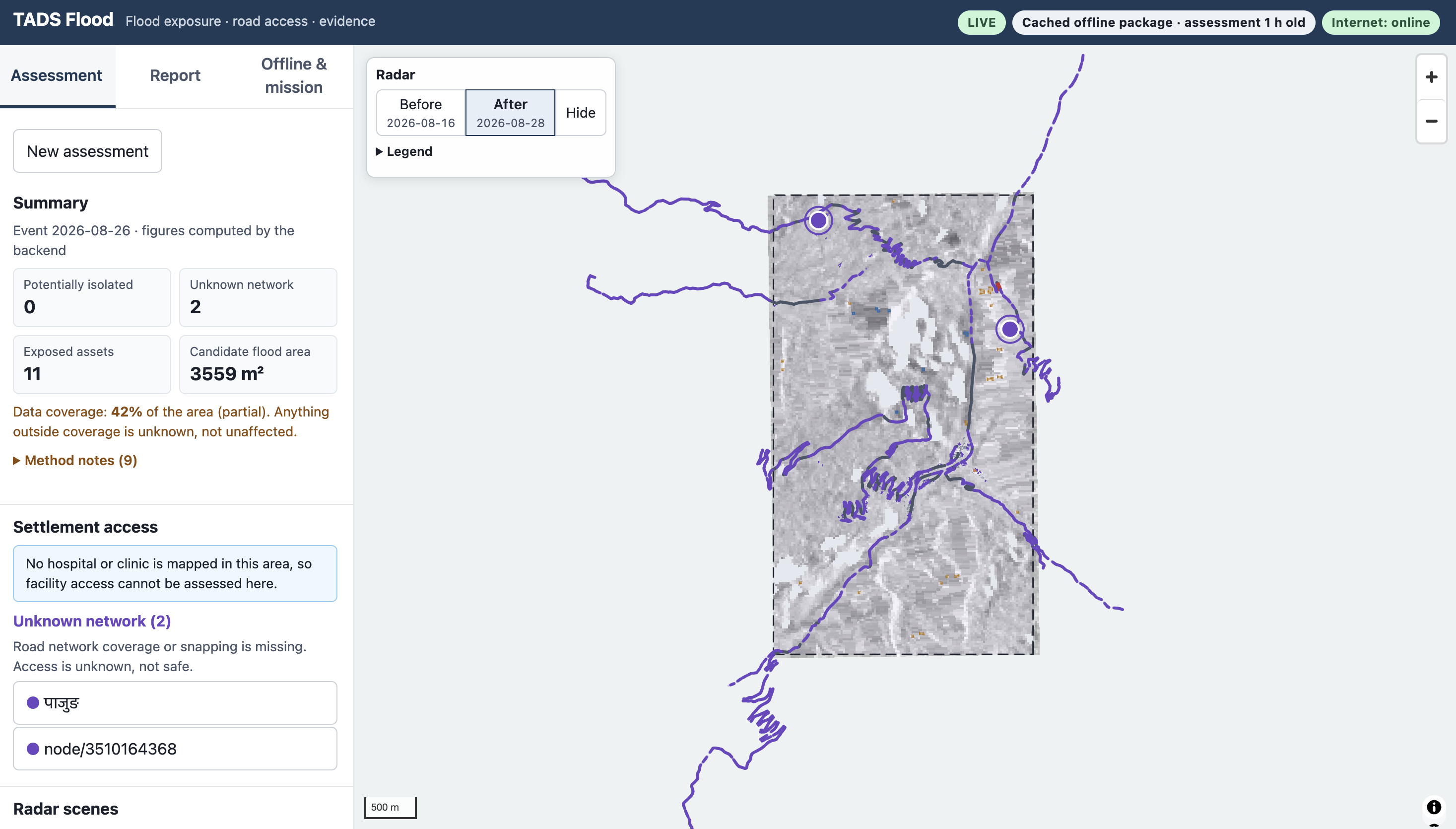
TADS Flood connects before-and-after satellite imagery to infrastructure exposure, mapped road connectivity, and cited situation briefs.
The dashboard lets users:
- Compare Sentinel-1 radar imagery before and after an event.
- Inspect candidate-exposed buildings and road edges.
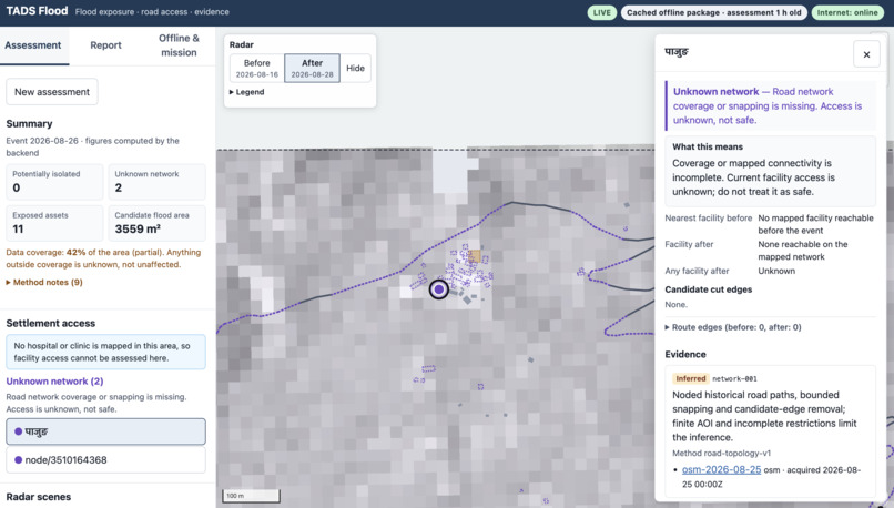
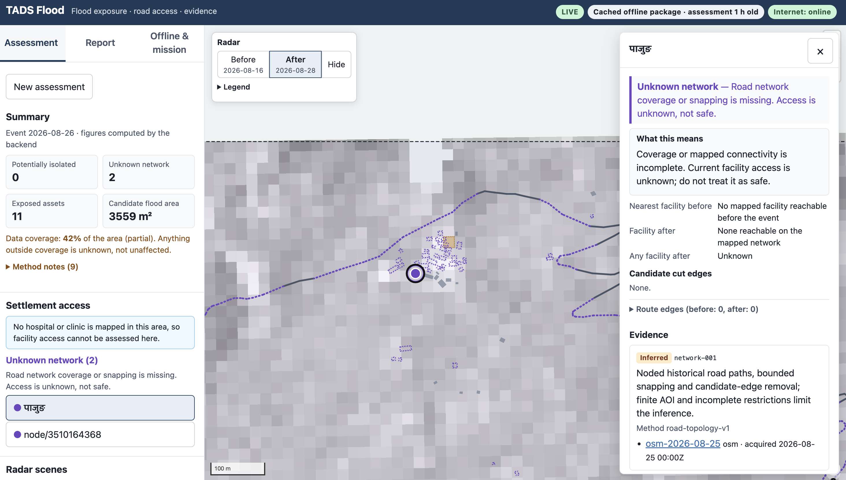
- Examine potentially isolated settlements and cases with unknown connectivity.
- Select mapped features to inspect their supporting evidence and sources.
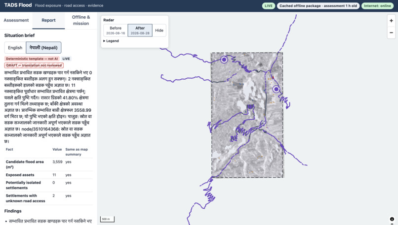
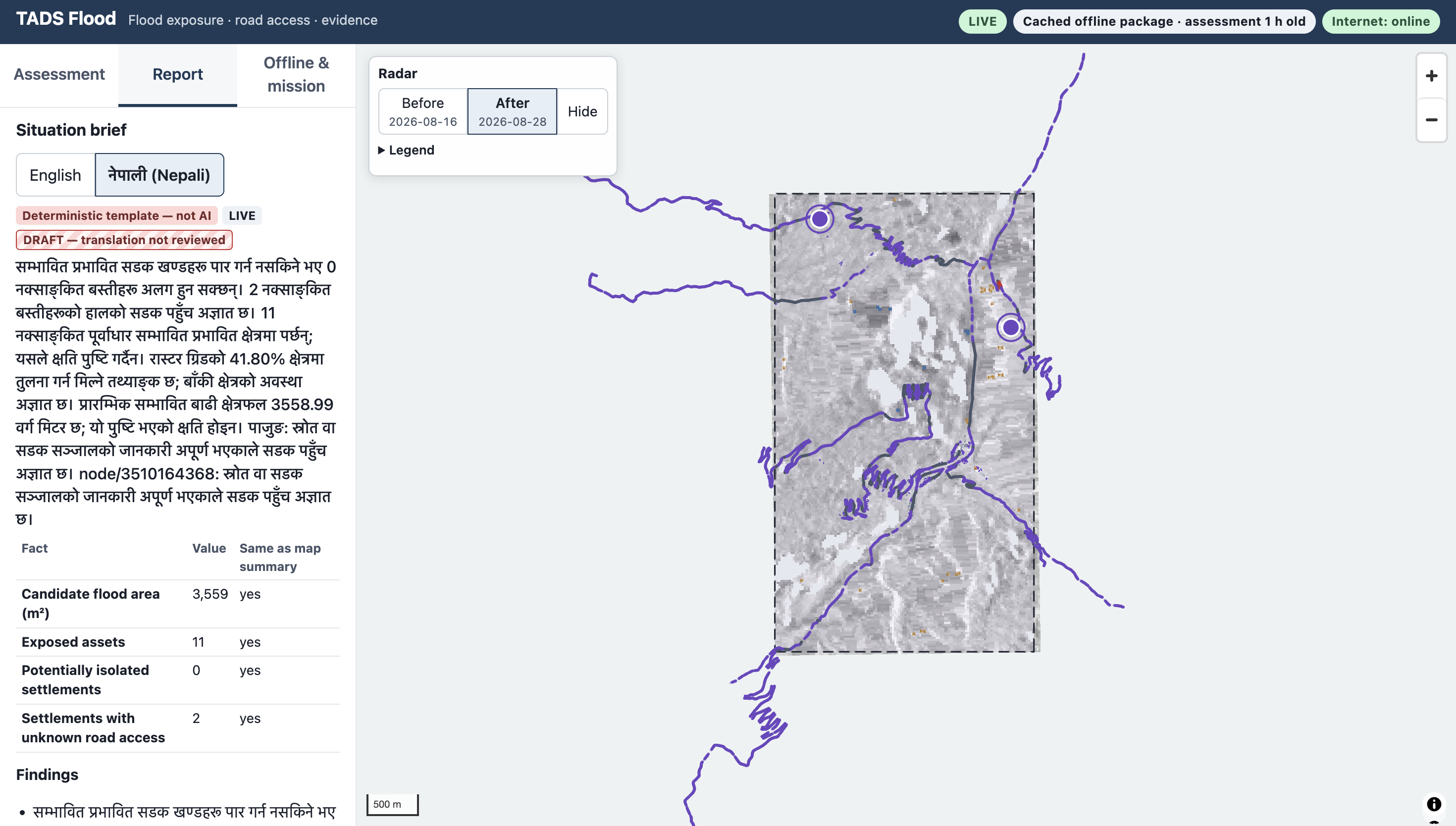
- Read English and draft Nepali situation briefs.
- Ask an AI copilot questions grounded in the computed assessment.
- Save an assessment, radar images, and generated documents for offline inspection.
A separate inspection-mission simulation explores future drone workflows. It does not operate real aircraft or provide fresh observations without connectivity.
How it was built
The backend uses Python and FastAPI, with rasterio, NumPy, Shapely, and pyproj for geospatial processing. It combines Sentinel-1 radar, Copernicus DEM, and historical OpenStreetMap infrastructure retrieved through the ohsome API.
The pipeline verifies satellite product identity, acquisition dates, orbit compatibility, and historical infrastructure timestamps. It preserves source provenance and explicitly marks missing coverage.
The frontend uses React, TypeScript, and MapLibre. IndexedDB and a service worker support cached assessment viewing and offline reload.
The AI copilot uses Ollama with a local model to select approved assessment facts. Application code supplies numerical values and evidence links. The deterministic situation brief remains separately labelled.
What we demonstrated
An actual source-backed run for Syapru Besi, using an event date of 26 August 2026, produced:
- 41.8% valid comparison coverage.
- 11 candidate-exposed assets.
- 0 potentially isolated settlements.
- 2 settlements with unknown network access.
A separate Timure area and date also completed successfully, demonstrating execution beyond the primary case. This was not an independently scored holdout evaluation.
Challenges and measured limitations
The official EMSR927 AOI01 reference describes landslide damage. Comparing our combined flood/disturbance proxy against that reference produced an IoU of 0.0057 and an F1 score of 0.0114 within jointly valid cells.
The baseline misses most reference damage. These results do not establish reliable landslide detection or water-only flood segmentation accuracy.
Steep terrain, incomplete coverage, and limited road topology remain important constraints. Candidate exposure is not confirmed damage, and a mapped connection is not a certified safe route. Nepali output remains visibly marked as draft pending fluent review.
What we learned
Data coverage and connectivity uncertainty must remain visible throughout the workflow. Source verification, reproducible evaluation, and offline reliability are valuable even when the detection baseline requires substantial improvement.
Backend, frontend, and browser checks exercise assessment validation, evidence inspection, report handling, and offline package behaviour.
What's next
Improve detection using separate development data, evaluate an independent holdout with appropriate reference classes, strengthen road-network coverage, and complete fluent Nepali review.
Real drone integration would require separate onboard perception, navigation, communications, and flight-safety validation.
Development disclosure
The project was developed with AI coding assistance. TADS is prior conceptual research; historical research archives and results are not presented as new hackathon outputs.
Source code
Implementation and setup instructions
Data acknowledgements
Contains modified Copernicus Sentinel data 2026.
Produced using Copernicus WorldDEM-30 © DLR e.V. 2010–2014 and © Airbus Defence and Space GmbH 2014–2018, provided under COPERNICUS by the European Union and ESA; all rights reserved.
© OpenStreetMap contributors.
Reference evaluation: European Union, Copernicus Emergency Management Service, EMSR927.
Built With
- copernicus-dem
- fastapi
- indexeddb
- maplibre
- numpy
- ohsome-api
- ollama
- openstreetmap
- pydantic
- pyproj
- python
- rasterio
- react
- sentinel-1
- shapely
- sqlite
- typescript

Log in or sign up for Devpost to join the conversation.