Crime, and fear of crime is a problem we face every day, and women especially bear the brunt of its consequences. I remember calling a friend in tears after being chased back to my dorm by someone with a crowbar, only to be told that this was what real womanhood looked like. It took me weeks of fearful trial and error to figure out which areas on campus were “danger” spots: the places I needed to avoid most. Soon, I learned I wasn’t alone. Around 15% of women, men, and non-binary people already reroute themselves based on the perceived danger of certain streets or areas. This danger is something that I, and so many people have to learn about the hard way.
But why should we face so much fear and harassment just to find a safe way home?
What it does
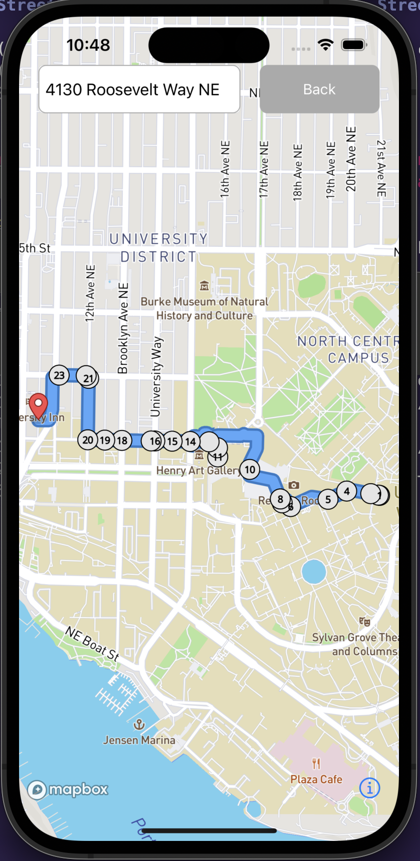
StreetSmart calculates the most direct and safe path to ones location. Our project is rooted in the question: what's one extra minute of walking if it you know you're going to be safer?
How we built it
We sourced data from the Seattle Police Departments live crime database. With this data, along with map data from OpenStreetMaps, we constructed a graph which defines connections between nodes on the map. We assigned each node a "safety score" based on the weighted sum of crimes in a radius of 0.55 miles with respect to the crime's distance to the node. Edges between nodes were assigned the final safety scores by averaging the scores of the nodes they are connecting. With this, we can perform graph search algorithms (Dijkstra's, A-star/Weighted A-star) taking edge cost into account to find the most safe and fast route to get where you want to go. The front end was built with Swift and MapBox.
Challenges we ran into
- Unfamiliarity with front end
- Osmgraph package majorly deprecated
- Sparse connections in graph, not fully connected
Accomplishments that we're proud of
- Open source contribution opportunity with new port of OSM data parser
- Graph creation with safety score edges
What's next for StreetSmart
We hope to add many new features including weighting crime data points differently based on the time of day. For example, if most crimes happened after 10pm in a certain radius, then we would deem a route through that area safer during the daytime. We also want to enhance our routing UI and add a feature for users to alert their friends when feeling unsafe. This feature then would immediately notify predetermined friends the location of the user. We also want to show the dataset on the map as a heat map to display safer areas to users.
Target Market
This is for anyone who feels unsafe walking alone. Specifically, we are targeting UW students and girls. One day, we hope to market this product to urban residents as a whole.

Log in or sign up for Devpost to join the conversation.