-
-
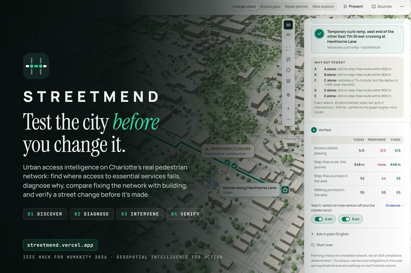
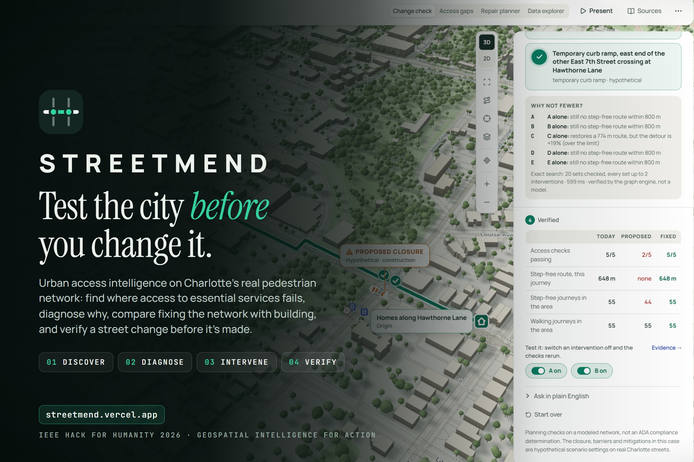
Cover: logo, “Test the city before you change it.”, the four steps, the live link and the track name
-
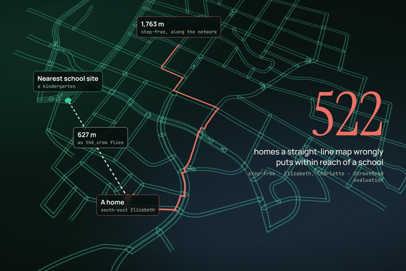
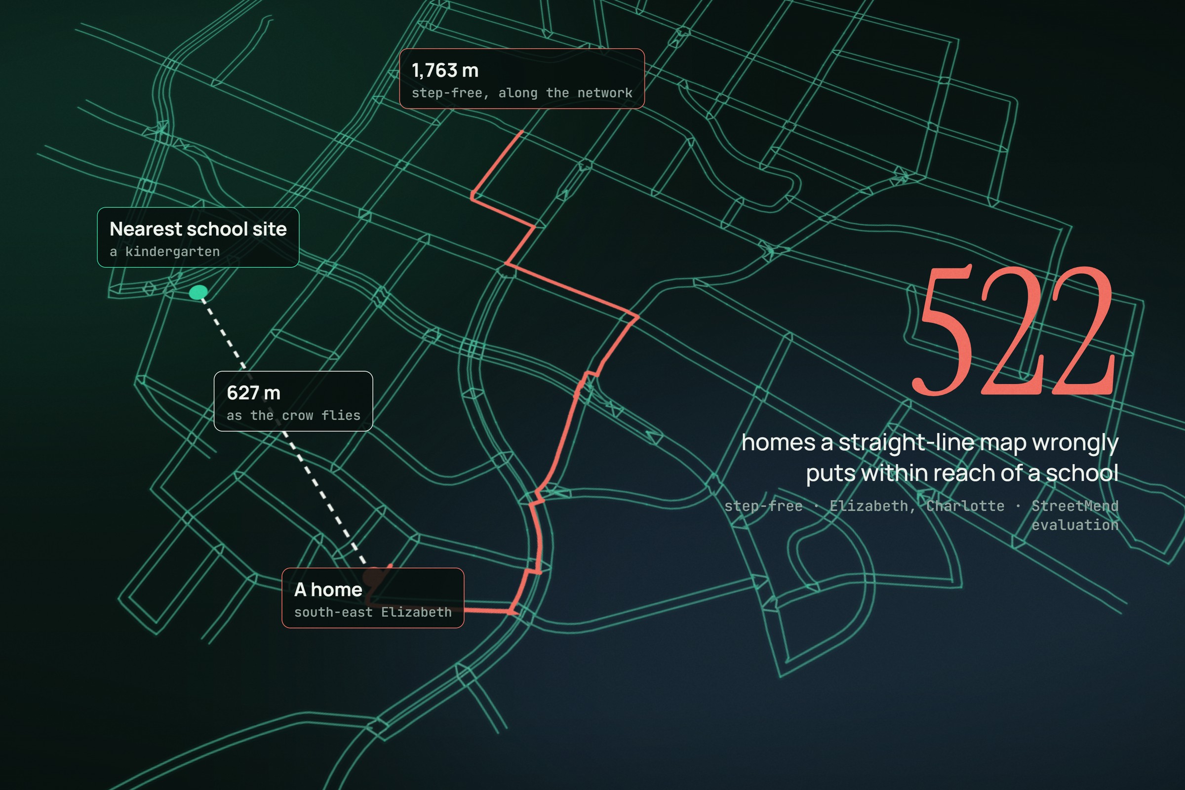
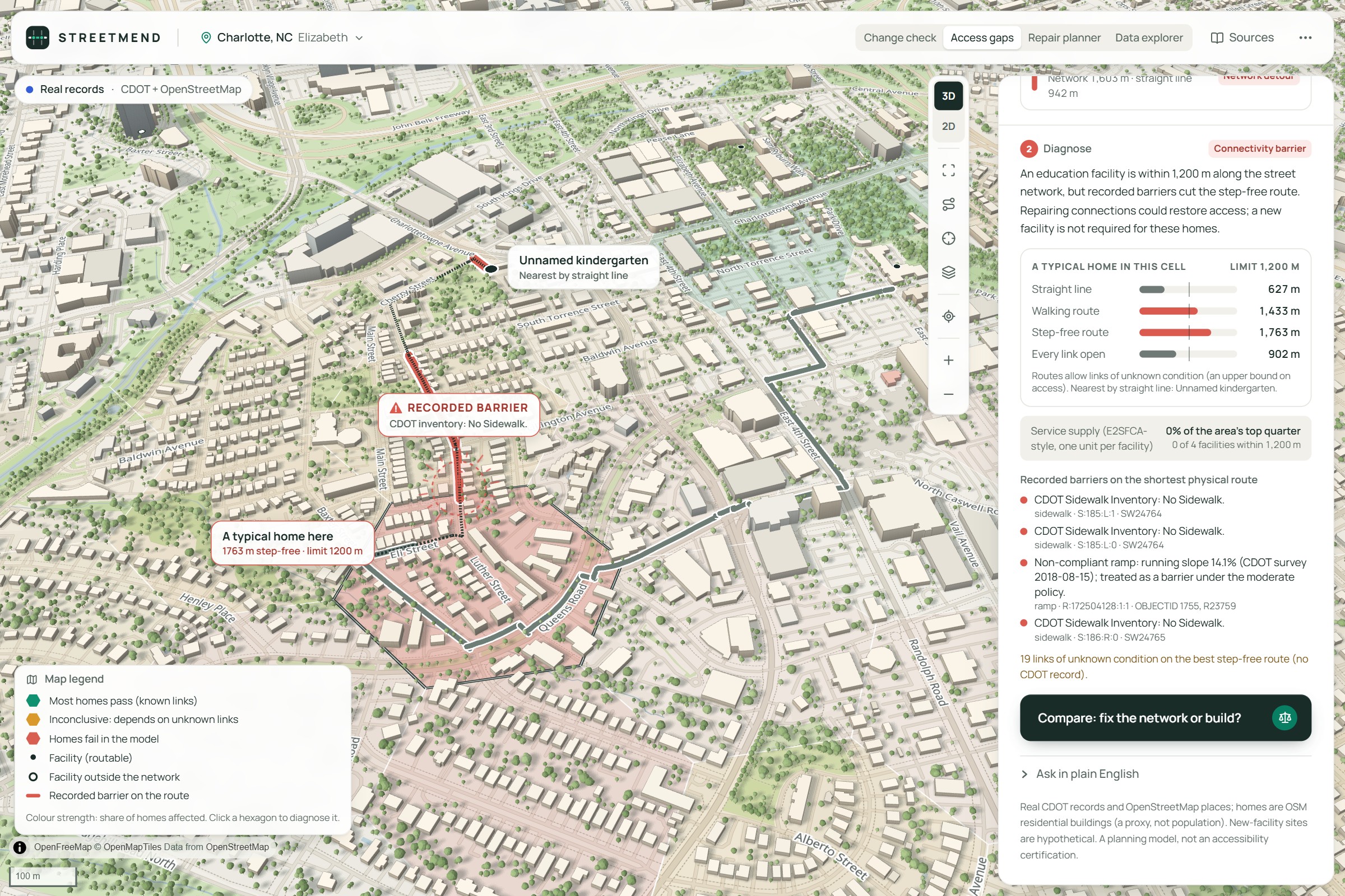
The problem: 627 m in a straight line vs 1,763 m step-free along the real network; 522 homes wrongly counted as within reach of a school
-
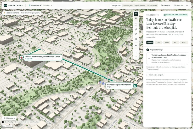
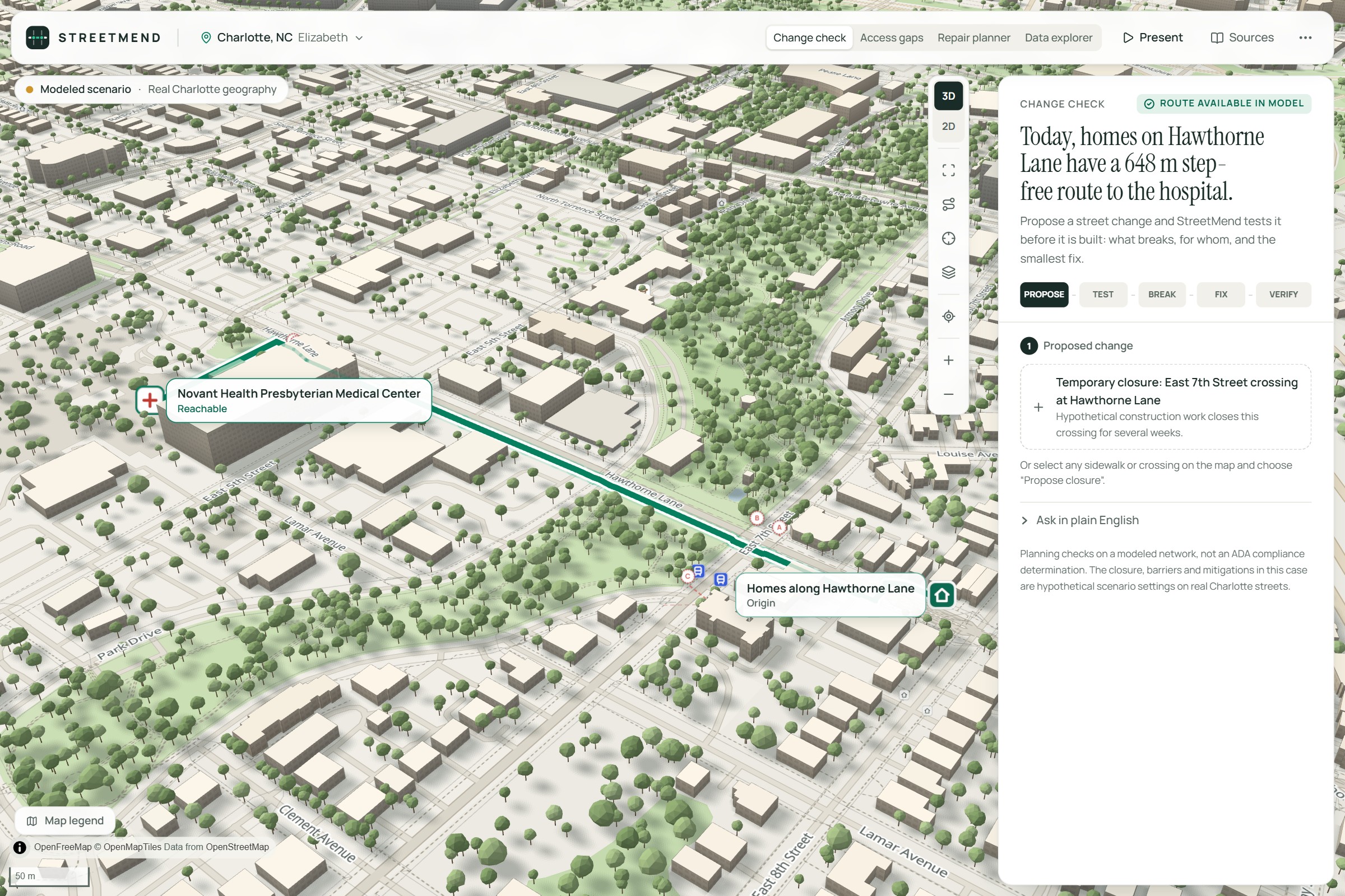
The 3D city today: a 648 m step-free route to the hospital
-
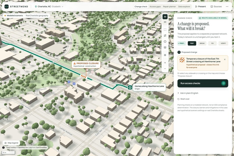
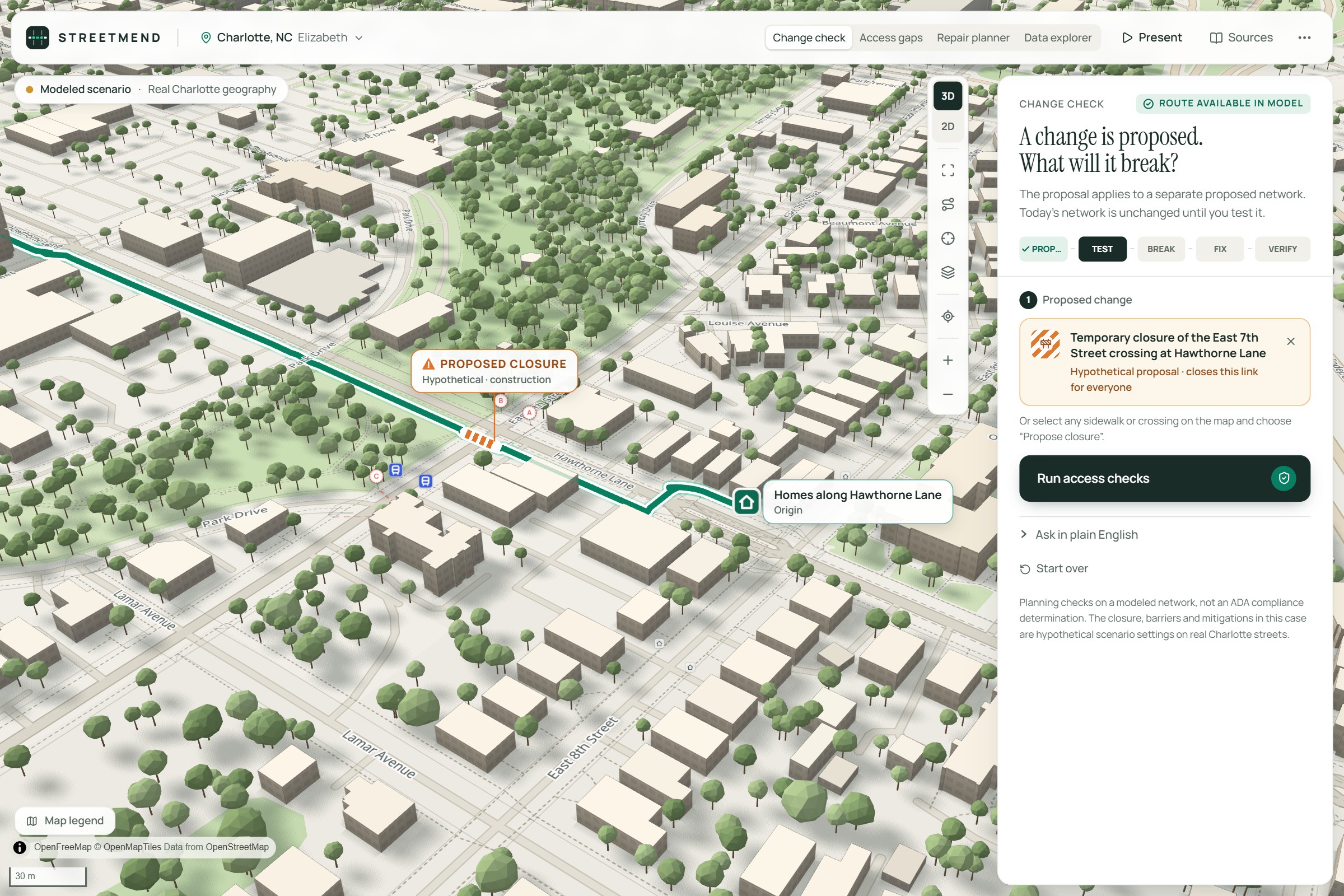
A proposed crossing closure
-
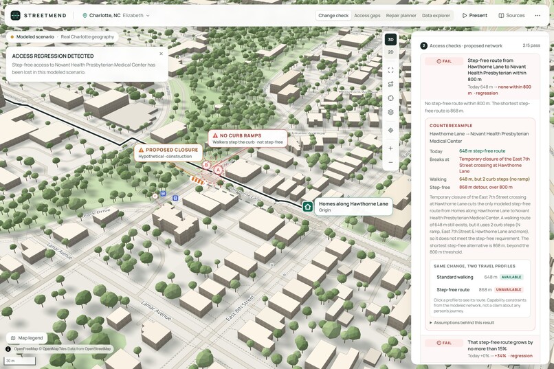
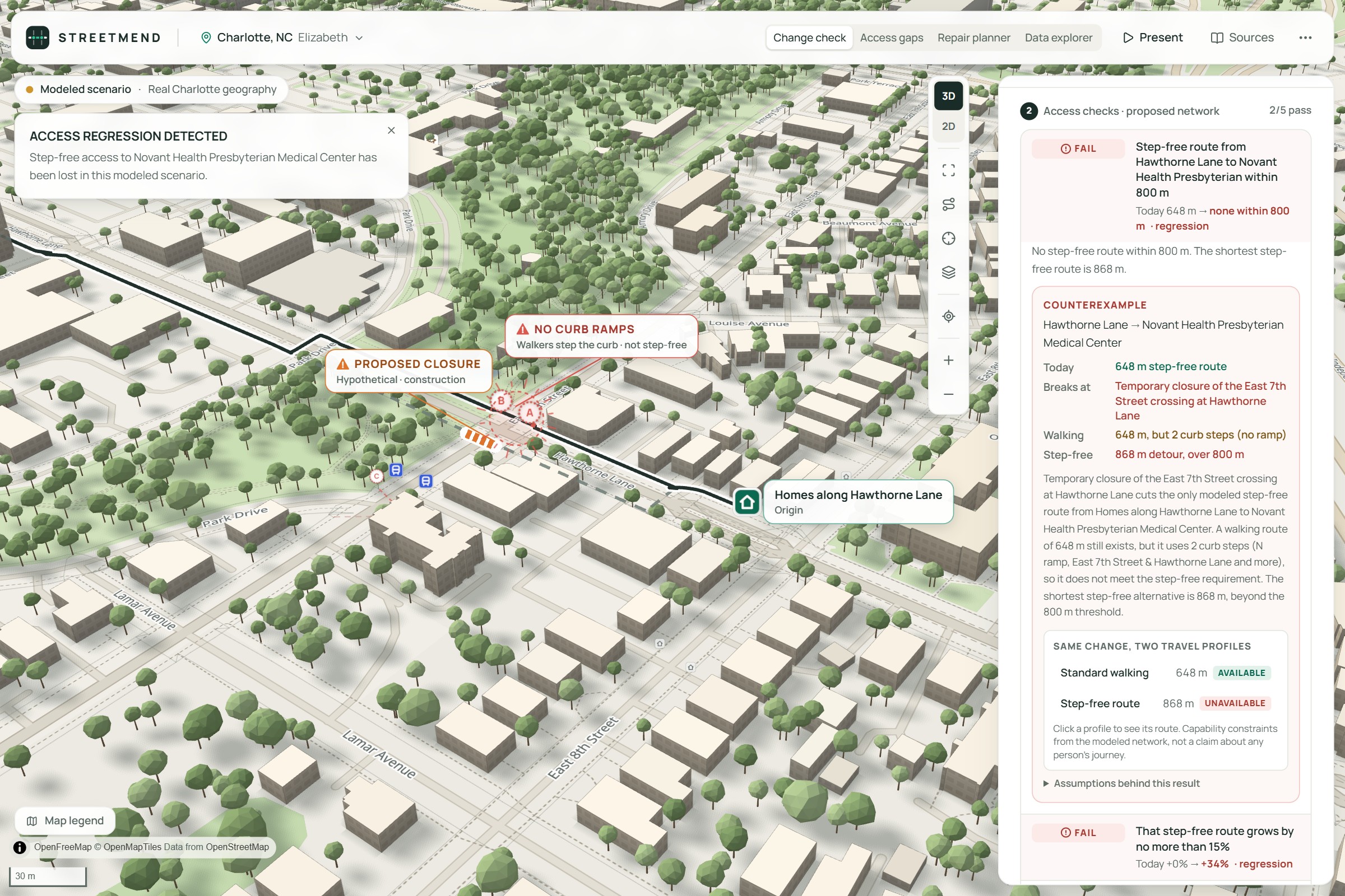
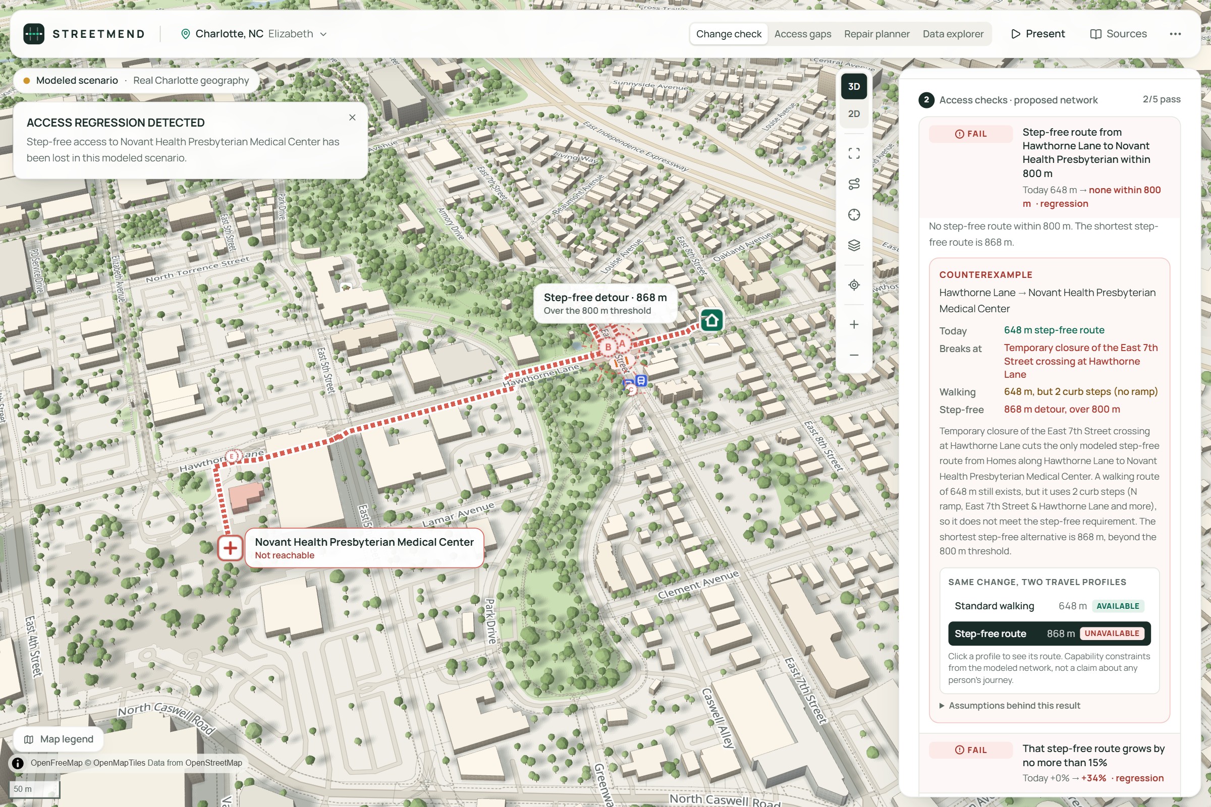
Access regression detected, with the counterexample
-
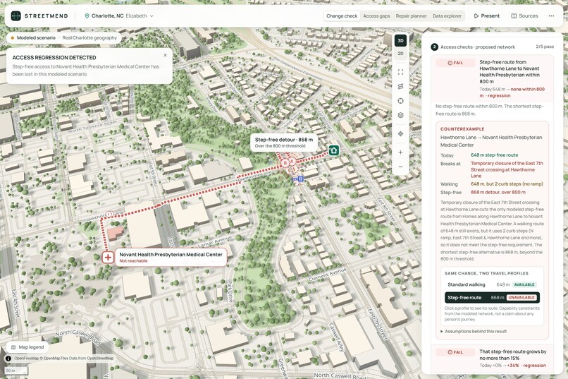
Walking still works; the step-free detour is 868 m (red dashed)
-
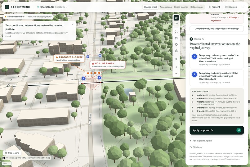
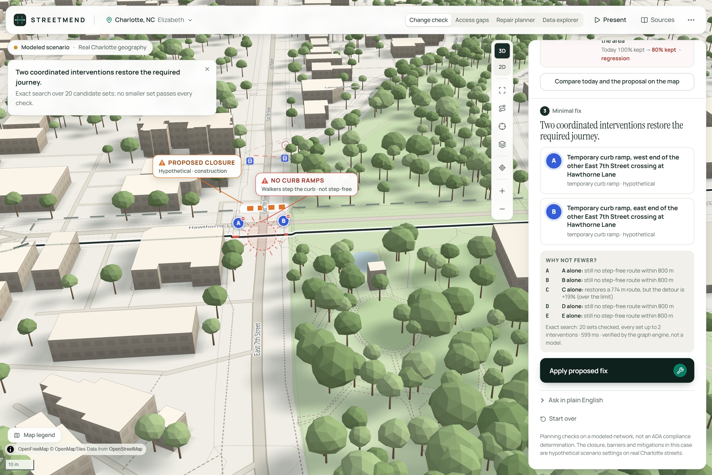
The minimal fix: two ramps that only work together
-
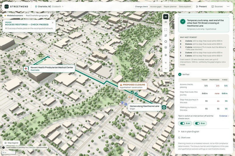
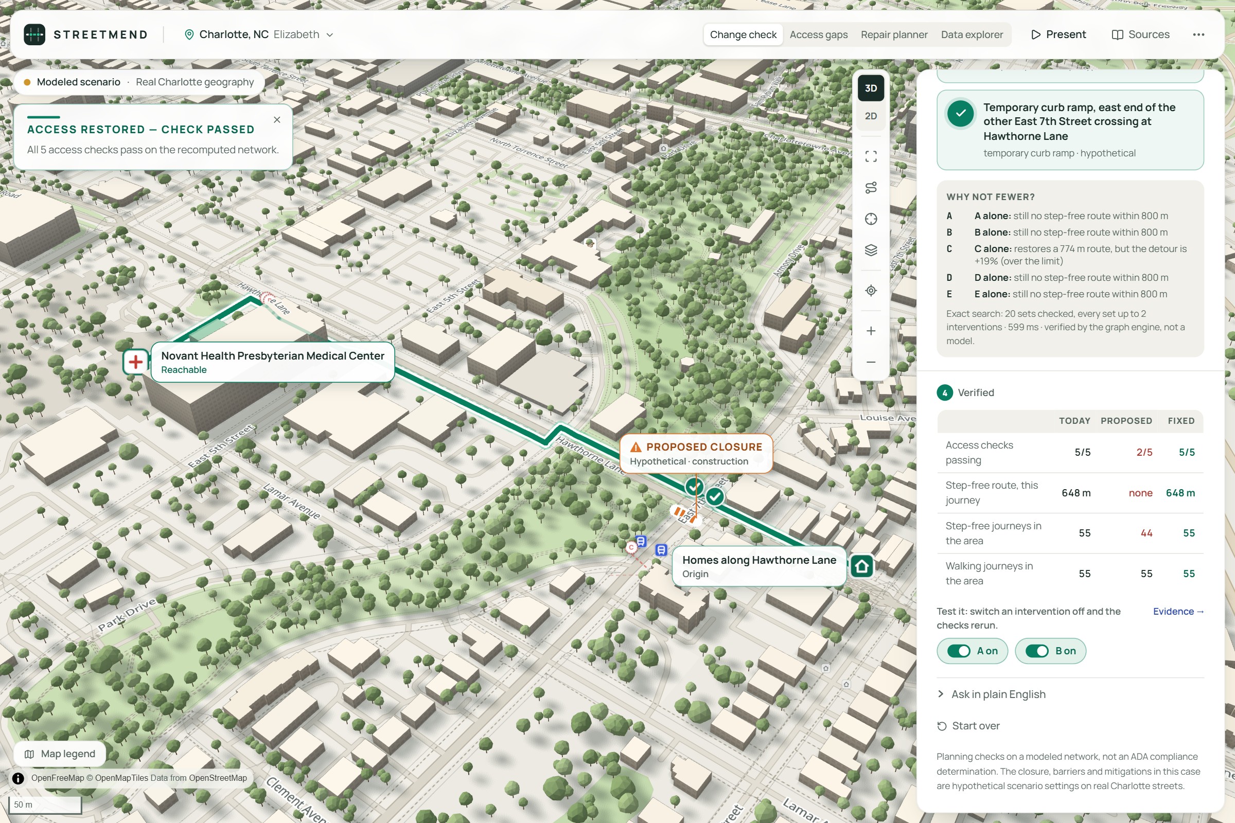
Verified: access restored, 5 of 5 checks pass
-
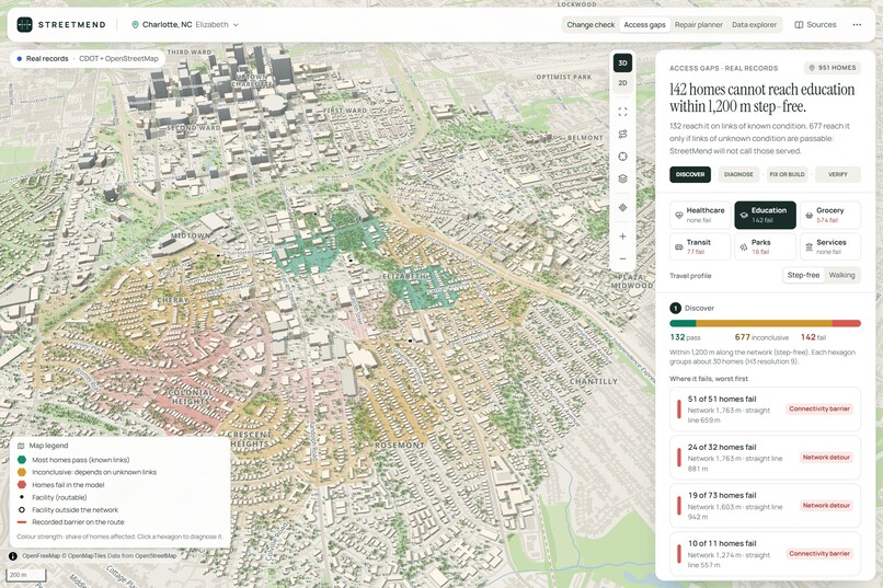
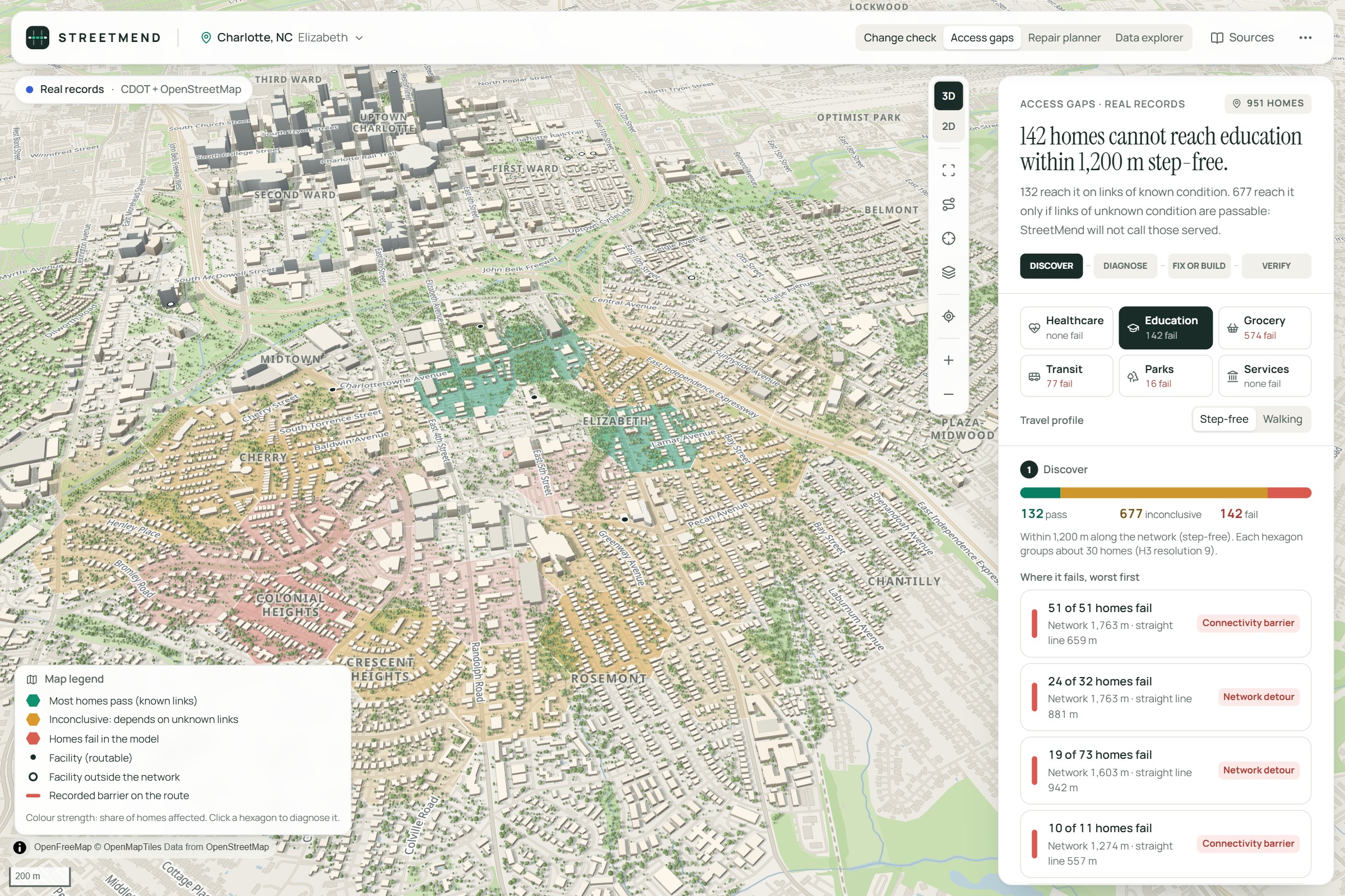
Access gaps map across 951 homes
-
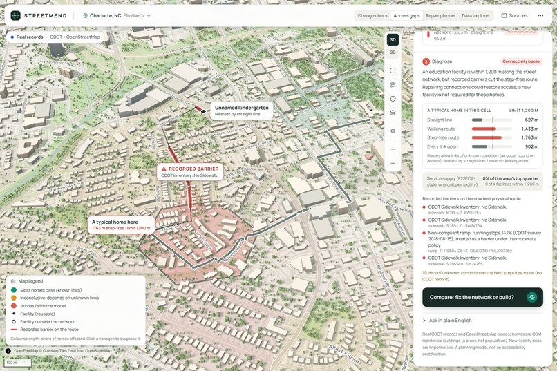
Diagnosis: a connectivity barrier (missing sidewalks)
-
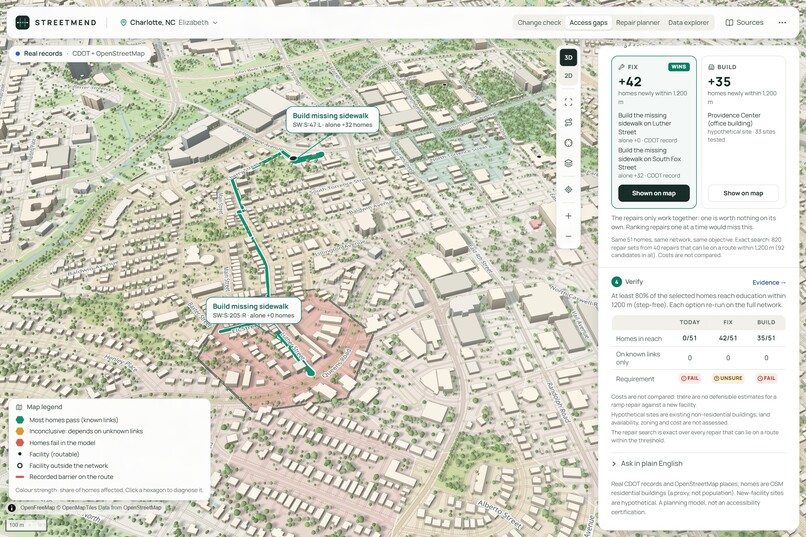
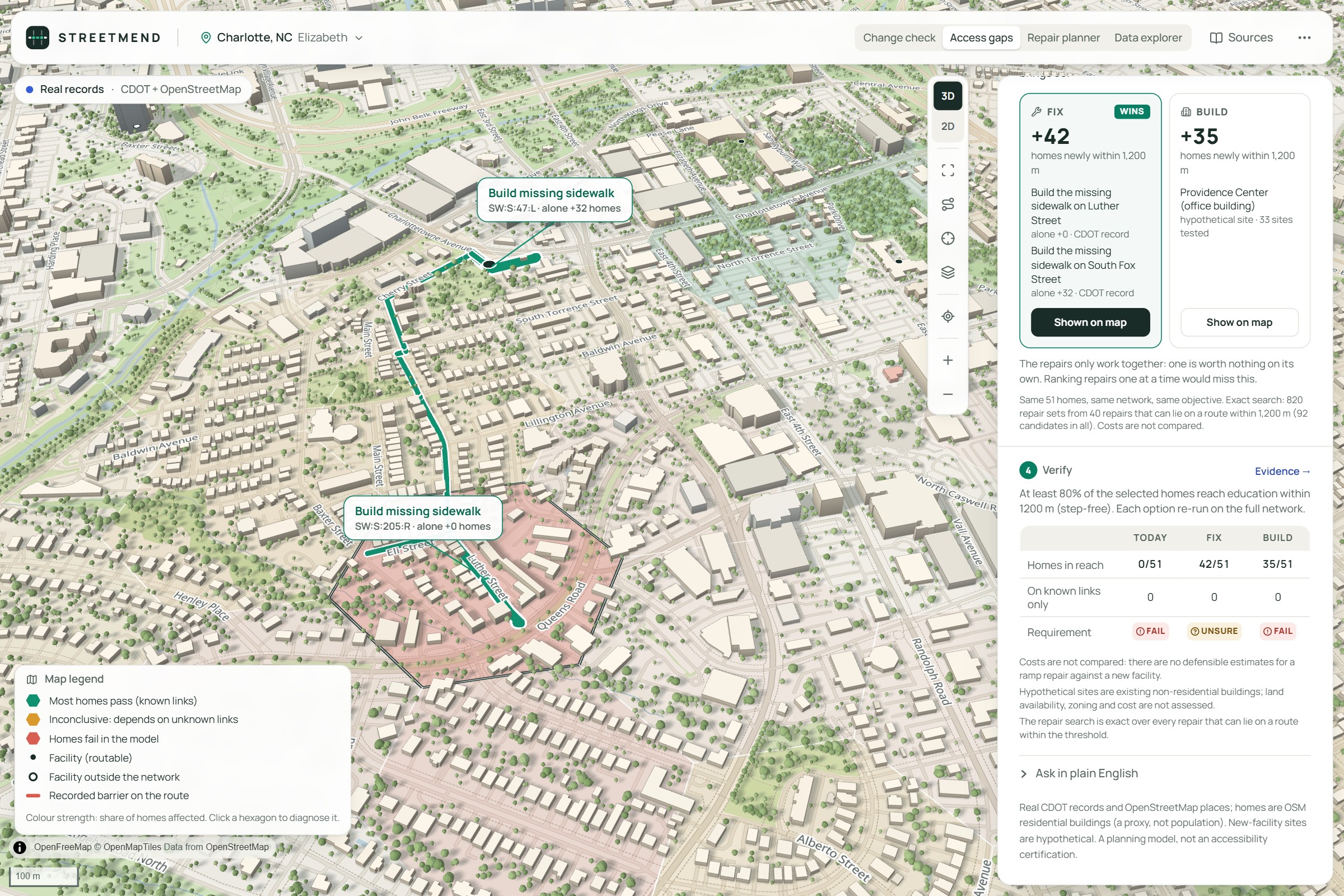
Fix or build: fixing wins with two repairs (+42 homes)
-
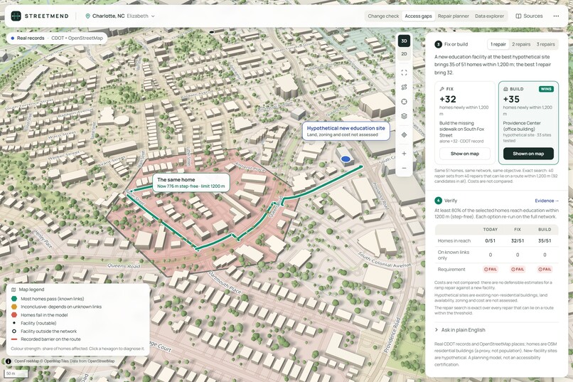
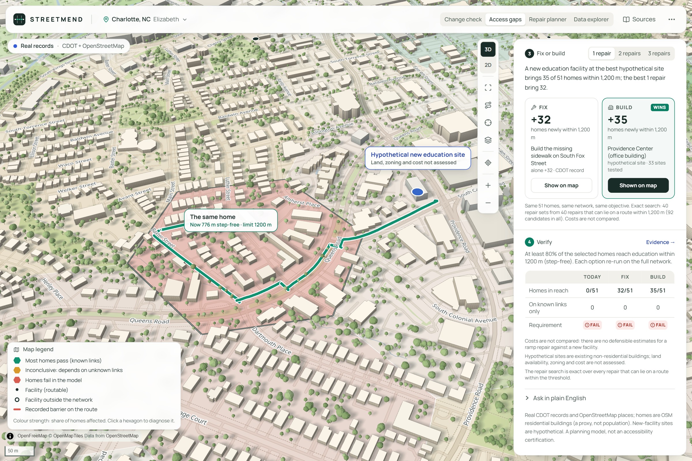
With one repair, building wins (+35 homes)
-
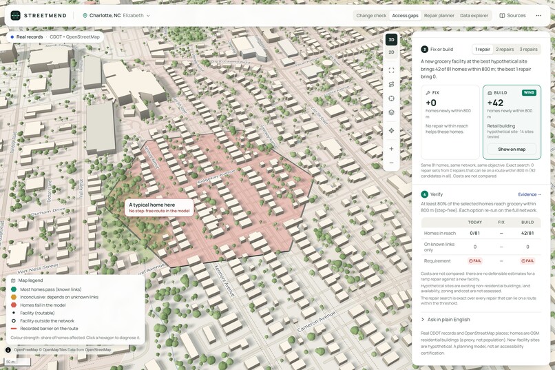
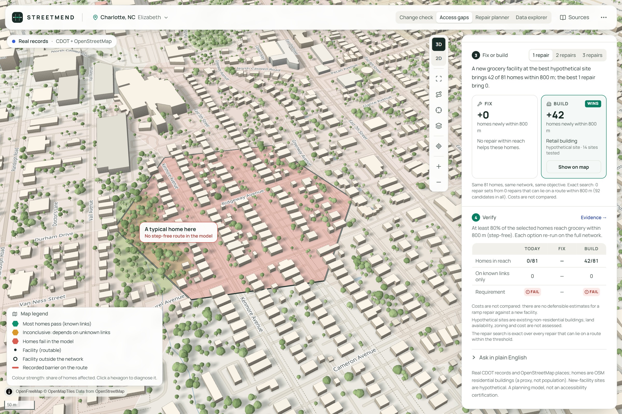
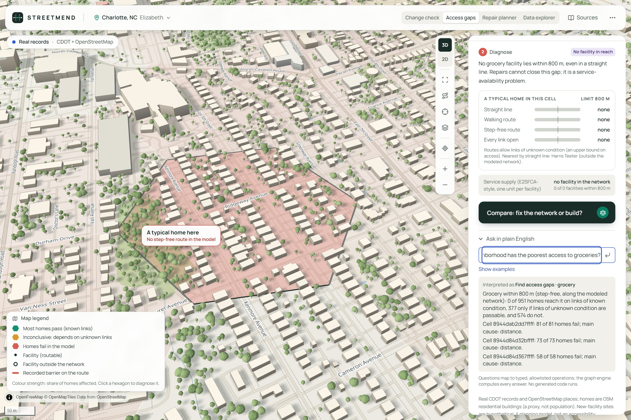
Grocery: repairs can’t help
-
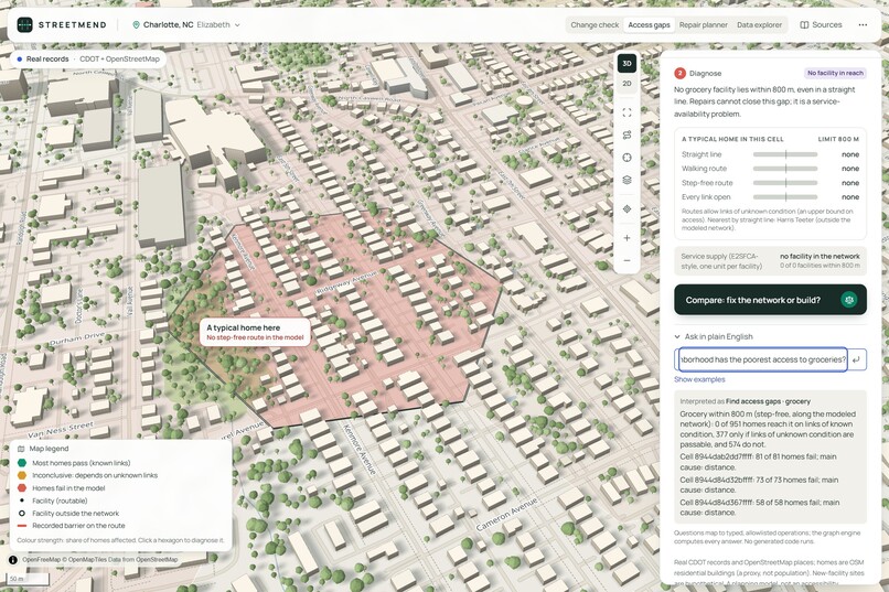
A plain-English question answered
-
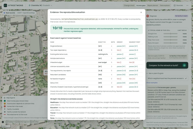
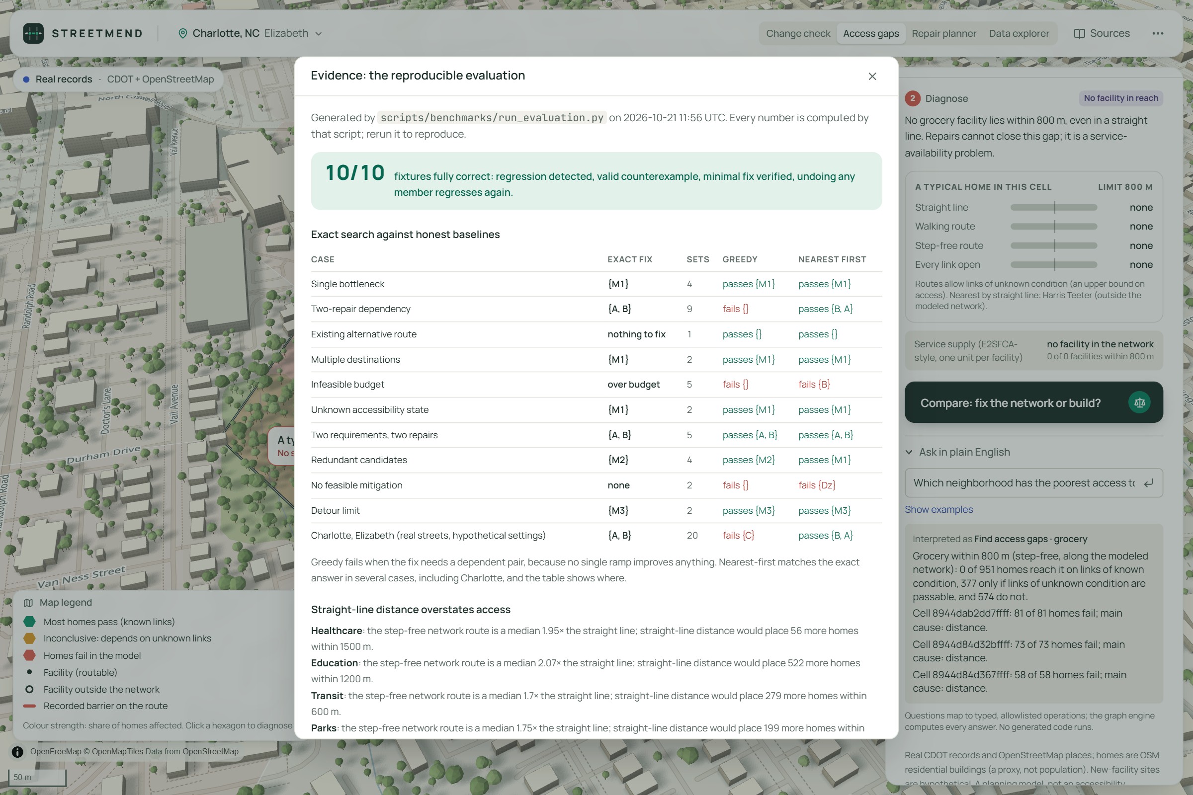
The evidence view: 10/10 benchmark cases correct
Inspiration
A hospital can be nearby but still unreachable because of a missing sidewalk or inaccessible crossing. We wanted to help cities understand these problems and test infrastructure changes before they affect people.
What it does
StreetMend finds accessibility gaps, explains their causes, and compares possible solutions. It can recommend network repairs or new facilities, simulate changes, and verify whether essential journeys become reachable.
How we built it
We used Python, FastAPI, NetworkX, and SciPy for graph analysis and optimization. React, MapLibre, and Three.js power the interactive 3D city of Charlotte. We integrated real geographic data and used Claude Code to assist development.
Challenges we ran into
Working with incomplete geographic records, modeling different accessibility needs, and finding repairs that only work when combined. Making the 3D visualization match actual graph calculations was also challenging.
Accomplishments that we're proud of
We built a working system that detects broken journeys, finds coordinated repairs, and verifies the results. We also implemented a Fix or Build comparison and automated testing.
What we learned
Being close to a destination does not mean it is accessible. We also learned how important graph theory, reliable data, and transparent decision-making are in urban planning.
What's next for StreetMend
Expand to more cities, improve accessibility data with field verification, introduce real construction-cost estimates, and help planners make better infrastructure decisions.
Built With
- claude
- code
- d3.js
- esri
- fastapi
- h3
- maplibre-gl-js
- networkx
- numpy
- ollama
- openfreemap
- openstreetmap
- osmnx
- playwright
- pydantic
- python
- qwen
- react
- scipy
- shapely
- tailwind-css
- three.js
- typescript
- vite
- zustand

Log in or sign up for Devpost to join the conversation.