-
-

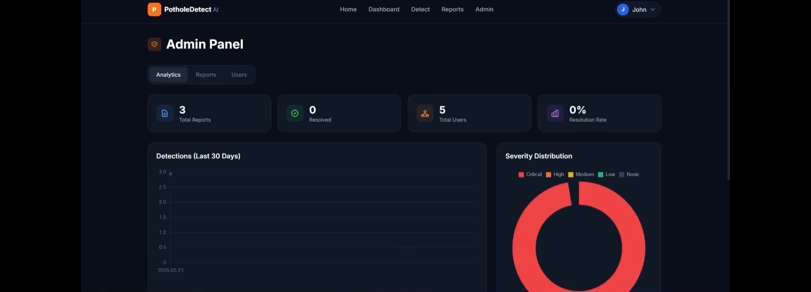
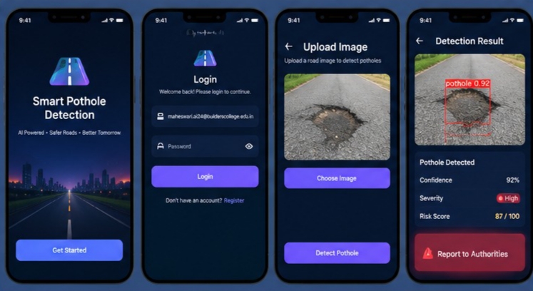
User Login and Registration Interface
-
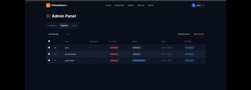
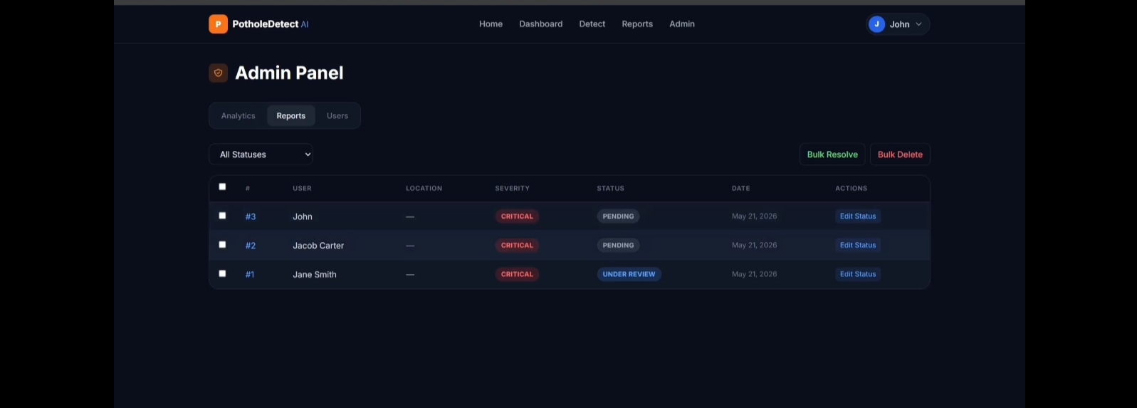
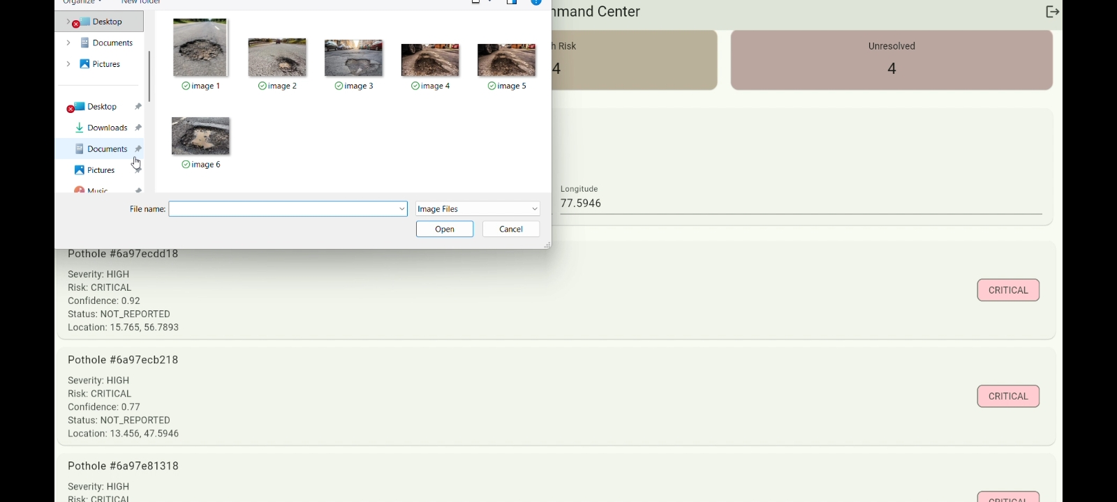
Pothole Detection History and Records
-
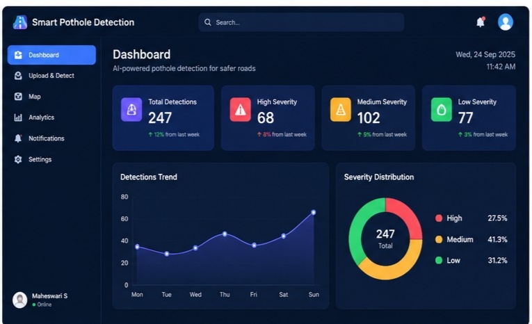
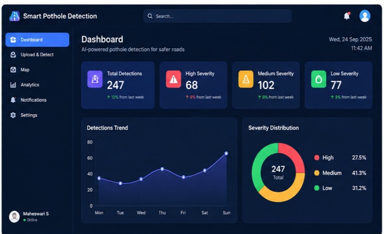
Smart Pothole Detection System – Dashboard
-
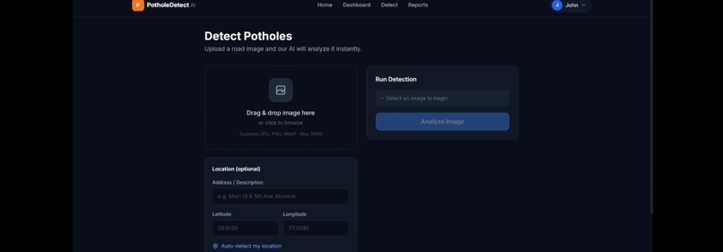
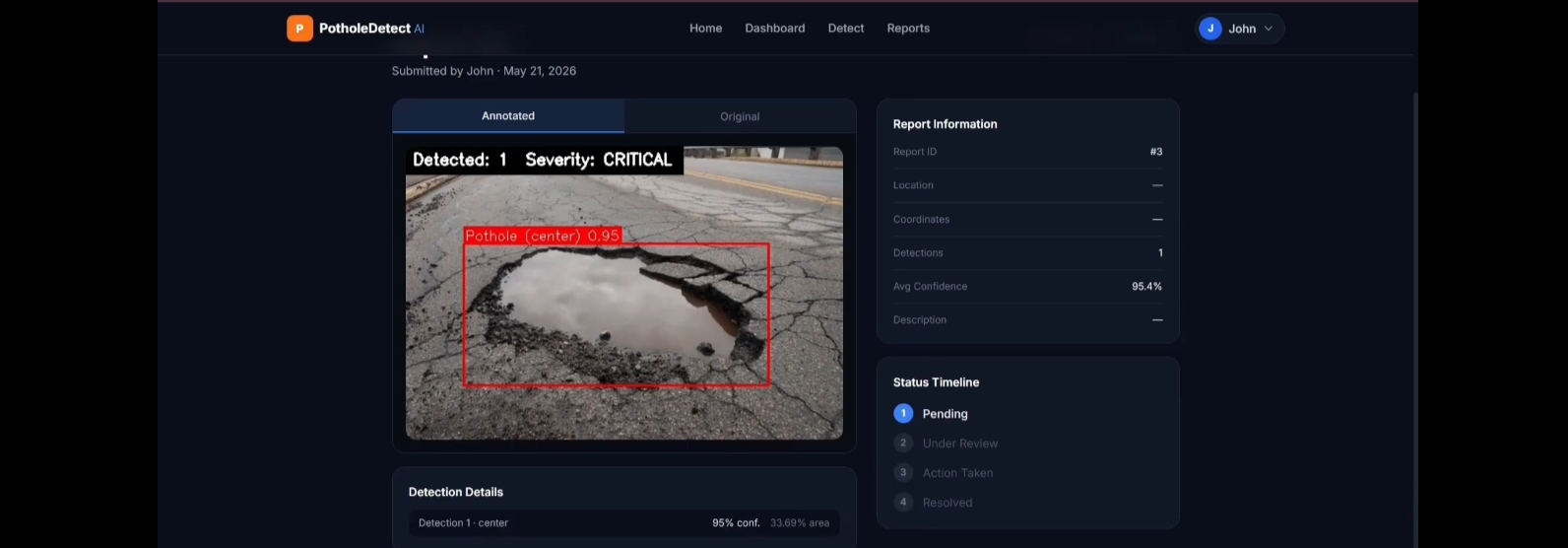
Pothole Severity and Risk Assessment
-

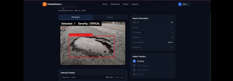
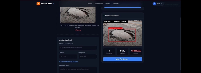
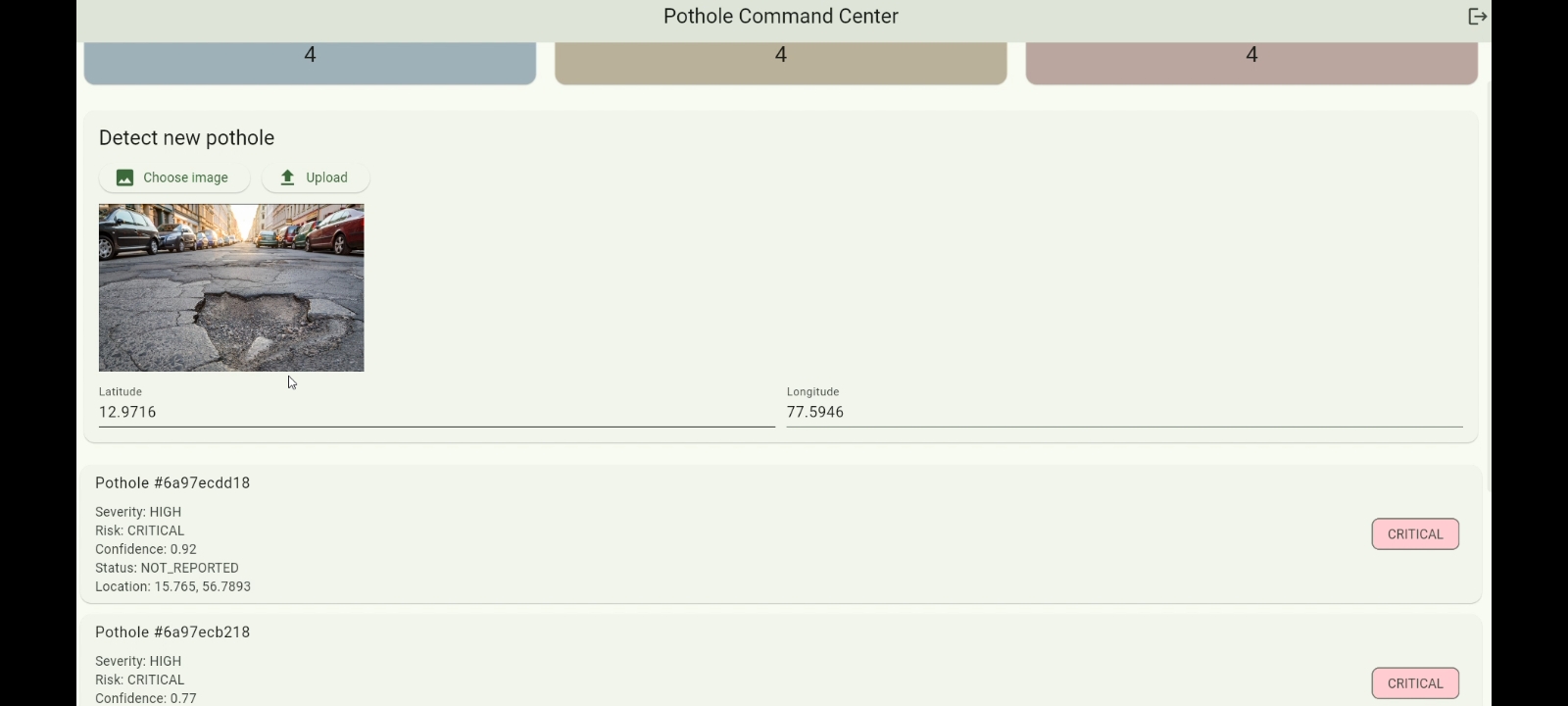
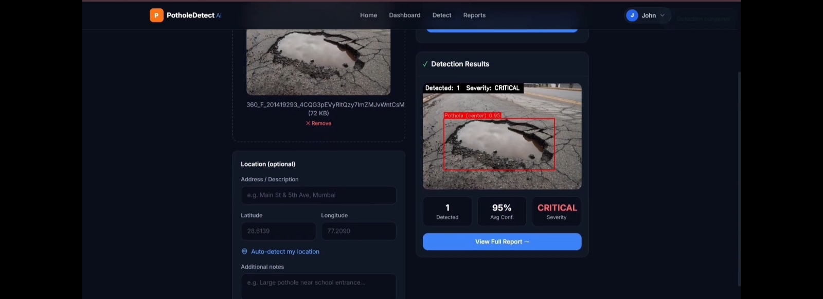
AI-Based Pothole Detection Result
-
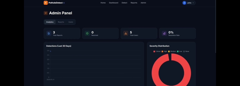
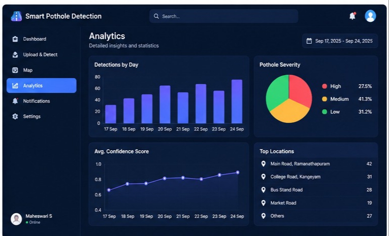
Pothole Analytics and Statistics Dashboard
-
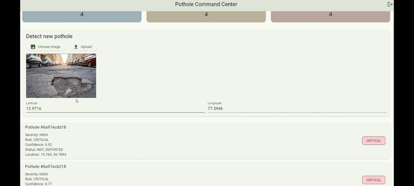
Pothole Severity and Risk Assessment
-
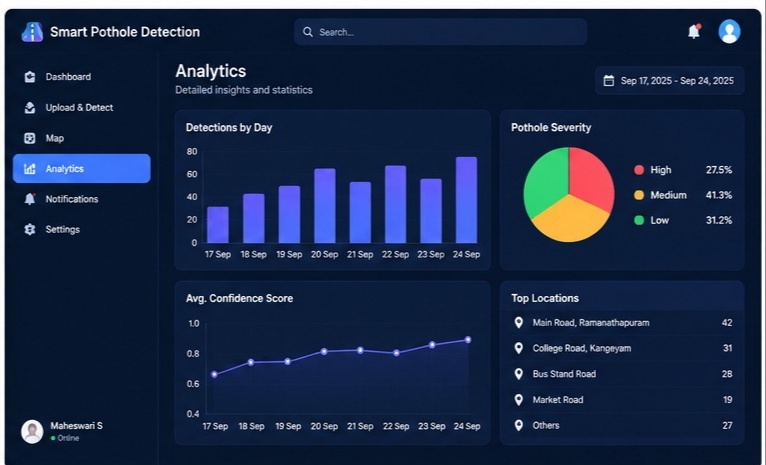
Smart Pothole Detection System Architecture
-
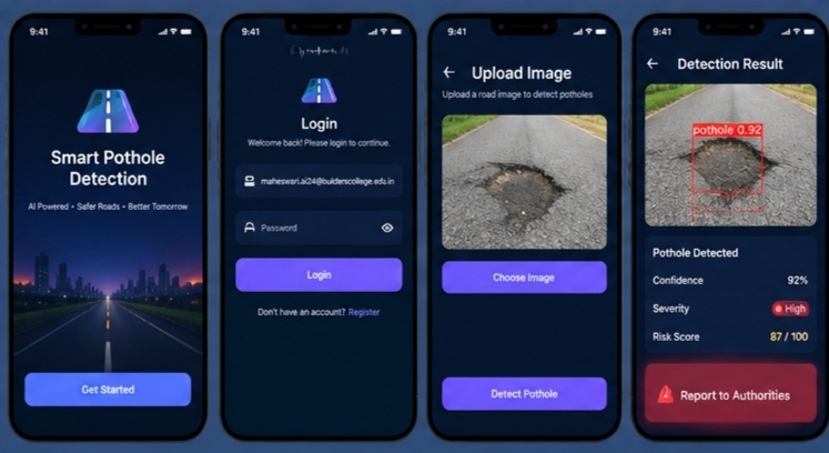
YOLO Detection with Confidence Score
-
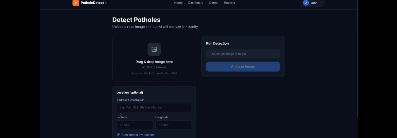
Road Image Upload for Pothole Detection
-
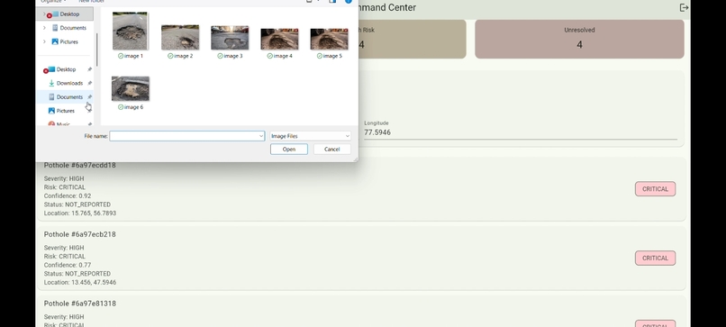
Road Image Upload for Pothole Detection
-
Flutter Mobile Application Interface


Inspiration
Potholes are a common road-safety problem that can cause accidents, vehicle damage, traffic delays, and uncomfortable journeys. The traditional method of identifying potholes mainly depends on manual inspection and public complaints, which can be slow and difficult to manage.
We wanted to build a solution that could automatically identify potholes from road images and provide useful information such as their location, severity, and risk level.
This idea inspired us to develop Smart Pothole Detection, an AI-powered system designed to make pothole identification and road maintenance smarter and faster.
What it does
Smart Pothole Detection uses AI-based object detection to identify potholes from road images.
The system:
- Detects potholes using a YOLO deep learning model
- Provides a confidence score for the detected pothole
- Estimates the severity and risk level
- Captures the pothole's GPS location
- Stores detection information in MongoDB
- Provides backend APIs using FastAPI
- Uses a Flutter mobile application for user interaction
- Supports notifications for detected road issues
- Provides monitoring and analytics for better decision-making
The overall workflow is:
Road Image → YOLO Detection → Severity & Risk Analysis → GPS Location → MongoDB → Notification & Analytics
Our aim is to help road authorities and users identify road damage more efficiently and support faster maintenance.
How we built it
We built the project by combining AI, mobile development, backend services, database management, GPS, and notification technologies.
Technology Stack
- Flutter – Mobile application
- Python – AI and backend development
- YOLO – Pothole object detection
- FastAPI – REST API backend
- MongoDB – Database
- GPS – Pothole location tracking
- Firebase – Notification support
First, we prepared a pothole dataset and trained a YOLO-based object detection model. The trained model was then integrated with the FastAPI backend.
The Flutter application communicates with the backend to upload road images and receive detection results. The detected pothole information is stored in MongoDB along with relevant details such as location and risk information.
Finally, the system provides detection results and analytics through the application.
Challenges we ran into
One of our main challenges was achieving reliable pothole detection under different road conditions.
Potholes can appear differently depending on:
- Lighting conditions
- Road surface
- Pothole size and shape
- Camera angle
- Image quality
- Weather conditions
Another challenge was integrating multiple technologies into one complete system. Connecting the Flutter application, FastAPI backend, YOLO model, MongoDB, GPS, and notification system required careful testing.
We also had to make sure that the detection results were properly transferred from the AI model to the mobile application and stored correctly in the database.
Accomplishments that we're proud of
We are proud that we developed a working end-to-end prototype instead of building only an AI model.
Our major accomplishments include:
- Successfully trained and integrated a YOLO-based pothole detection model
- Built a Flutter-based mobile application
- Developed FastAPI backend APIs
- Connected the system with MongoDB
- Integrated GPS-based pothole location tracking
- Added severity and risk analysis
- Created detection and analytics workflows
- Successfully connected AI detection with a real-world road-safety application
Most importantly, we were able to combine AI + Mobile App + Backend + Database + GPS into one practical solution.
What we learned
Through this project, we learned how to convert an AI idea into a complete real-world application.
We gained practical experience in:
- Deep learning and object detection
- YOLO model training and integration
- Flutter application development
- FastAPI and REST APIs
- MongoDB database management
- GPS-based location handling
- AI model and application integration
- Debugging and testing
- Connecting multiple technologies into a single system
We also learned that building a real-world AI solution involves much more than training a model. Proper data, integration, testing, user experience, and reliability are equally important.
What's next for Smart Pothole Detection
We plan to improve Smart Pothole Detection by adding more real-time and intelligent features.
Our future plans include:
- Real-time pothole detection using a mobile camera
- Improved detection accuracy using a larger and more diverse dataset
- Automatic road-condition mapping
- More advanced severity prediction
- Traffic-aware pothole risk analysis
- Automatic prioritization of road repairs
- Real-time alerts for nearby potholes
- Integration with smart-city and municipal road management systems
- Historical analytics to identify roads with repeated damage
Our long-term vision is to develop Smart Pothole Detection into a real-time AI-powered road monitoring platform that can help identify, prioritize, and manage road damage more efficiently.

Log in or sign up for Devpost to join the conversation.