Inspiration
The Suthra Punjab Programme for Punjab is one of the most ambitious waste-management initiatives in the world, involving Rs. 150 billion, more than 55,000 containers, GPS-tracked fleets, and serving 138 million people. However, there is still a sharp discrepancy between the official figures and what people actually experience. In peri-urban areas collection efficiency falls below 50% and can be as low as 25% in the southern districts. There is no independent means for citizens to verify that their street has actually been cleaned. As soon as field teams leave the main roads they lose contact with the network. Illegal dumping and the burning of crop residue continue largely undetected until the smog appears. Also, air-quality data stays completely disconnected from hospital admission records. A simple question inspired us: what if the same people who suffer from missed collections and poor air quality could take on the role of verification, while the same workers who have problems with offline conditions were provided with tools that actually function in the field? SuthraSense came about as a result of the gap between huge investment and trust at the last mile.
What it does
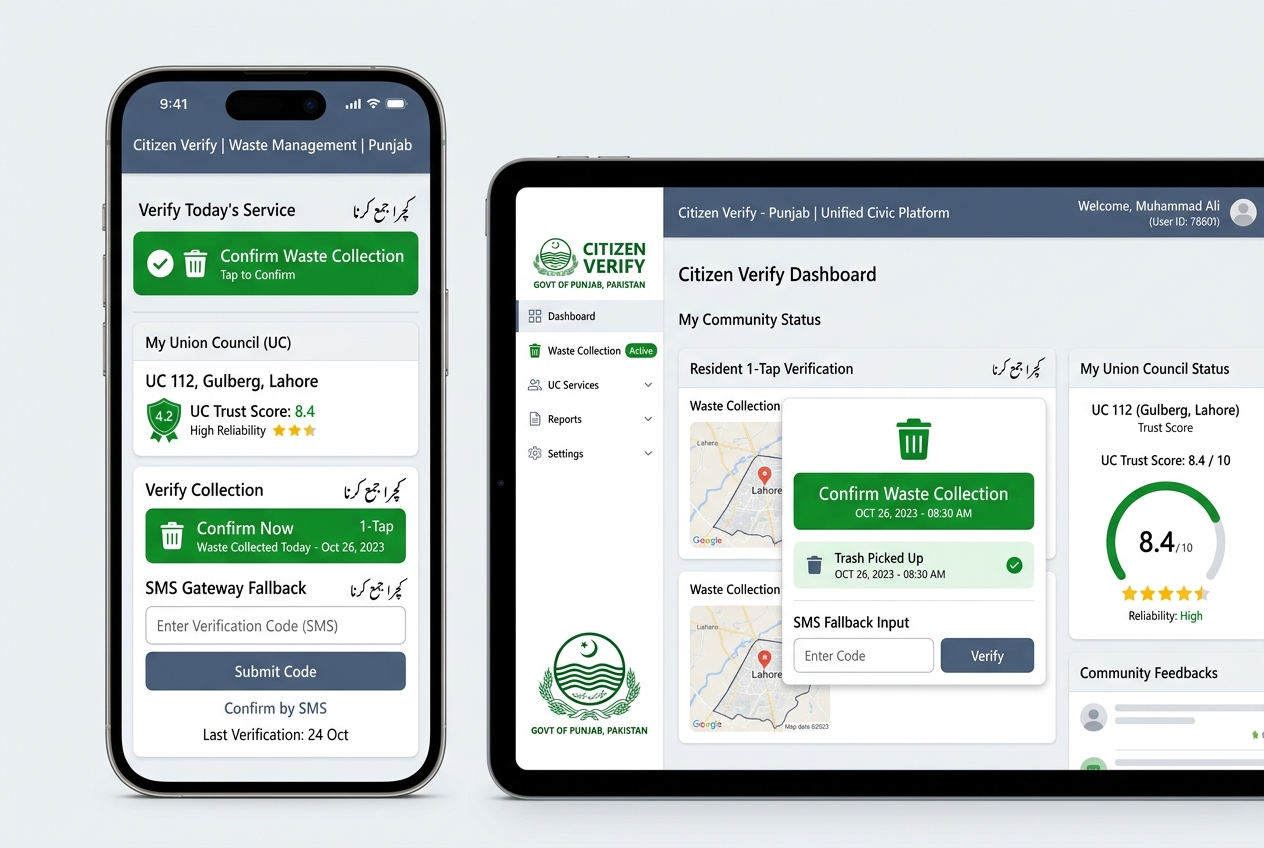
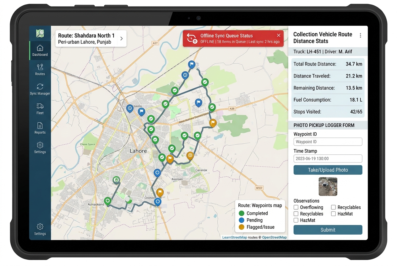
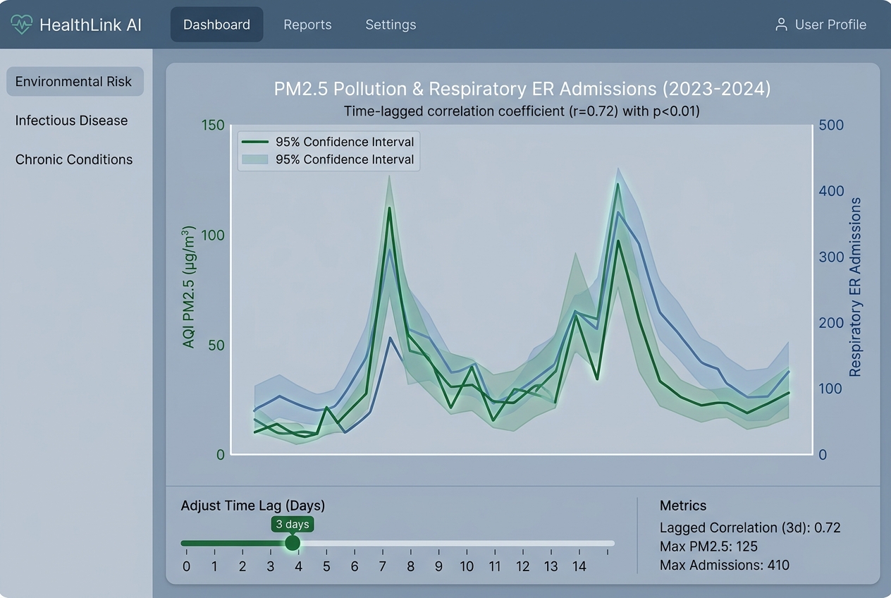
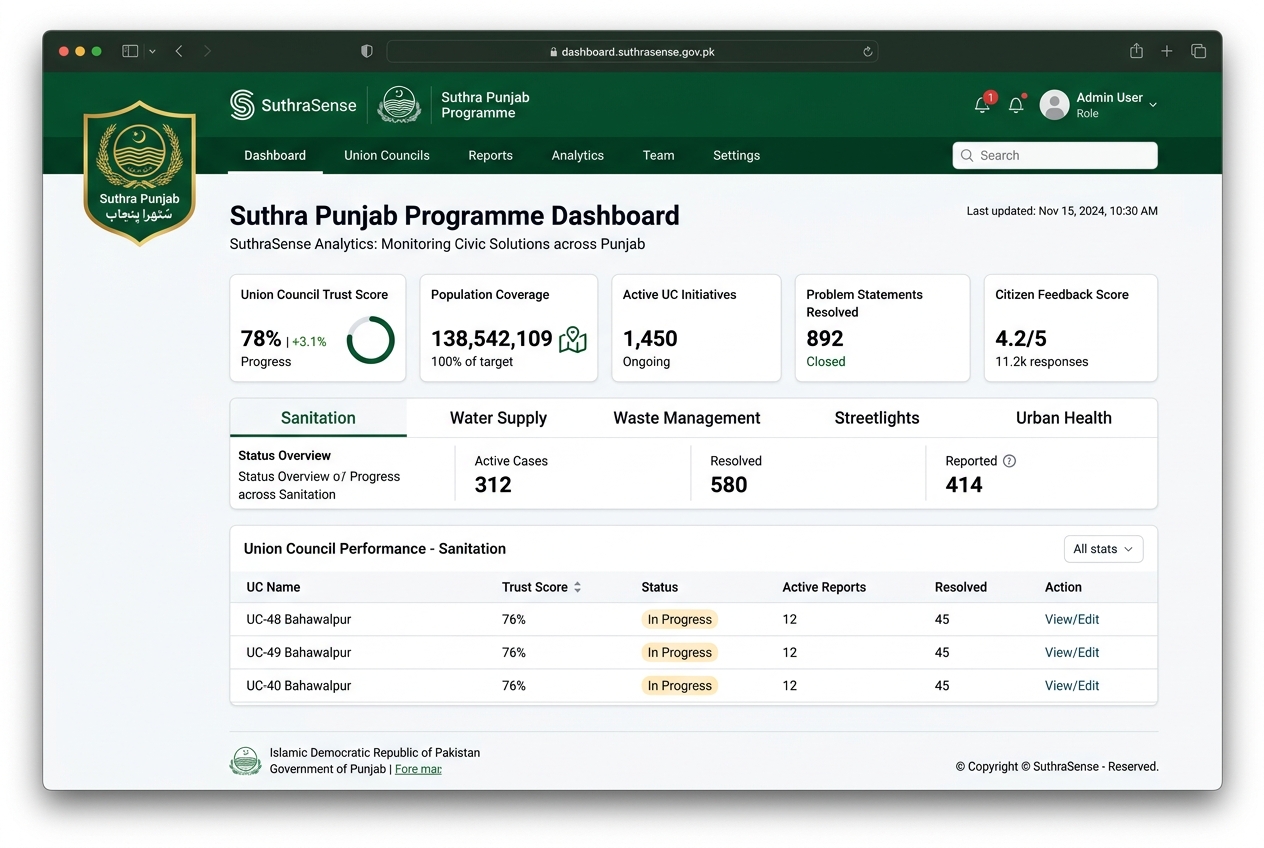
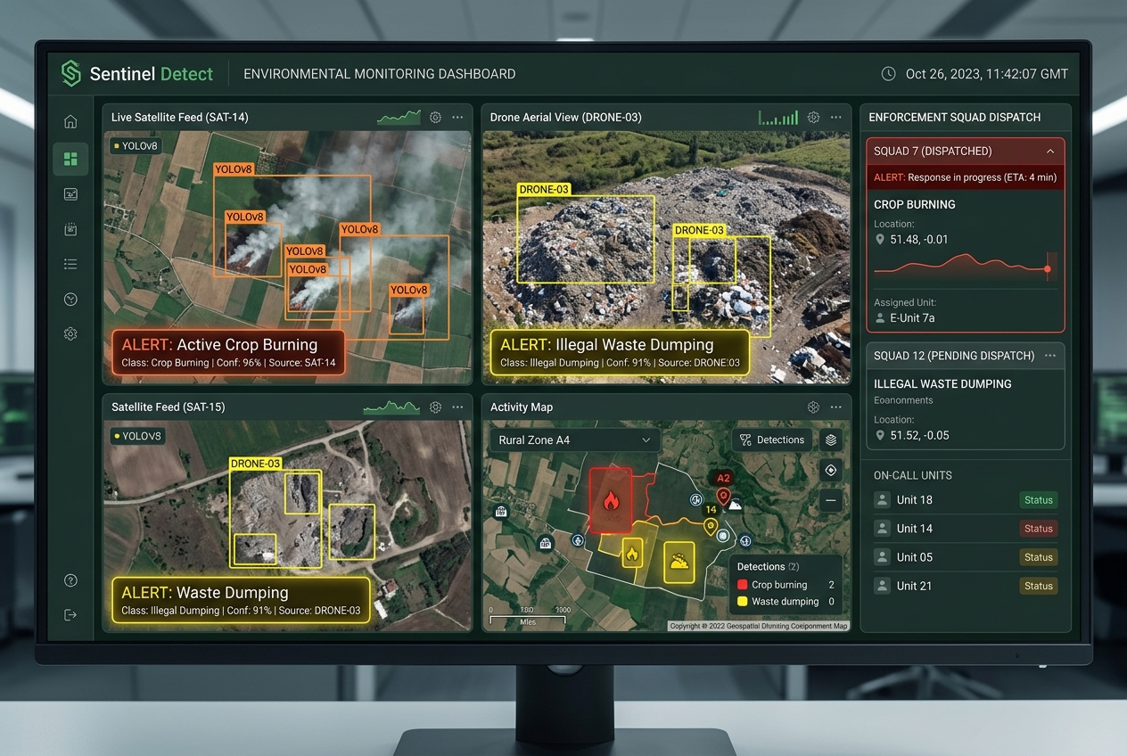
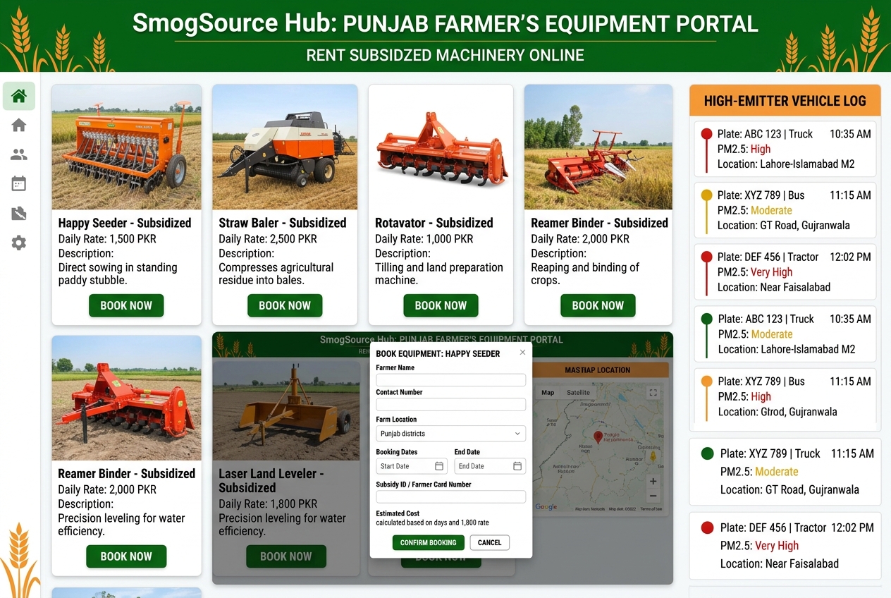
SuthraSense is a unified Clean-City Intelligence Platform with five tightly integrated modules that map directly onto the five official problem statements: Citizen Verify: Lightweight mobile/web + SMS flow that lets residents confirm or dispute completed collections and generates transparent public Trust Scores by Union Council. FieldForce Offline: Offline-first application for collection teams with route optimization, photo + GPS logging, and automatic sync when connectivity returns. HealthLink AI: Correlation engine that links existing air-quality networks with anonymized health records to surface pollution and health relationships. Sentinel Detect: Computer-vision and satellite pipeline that flags illegal dumping sites and active burning events for rapid enforcement. SmogSource Hub: Digital marketplace for straw-management equipment rental, high-emitter vehicle insights, and a unified public AQI action dashboard. The system is deliberately designed to sit on top of the infrastructure already deployed by the Government of Punjab rather than replace it.
How we built it
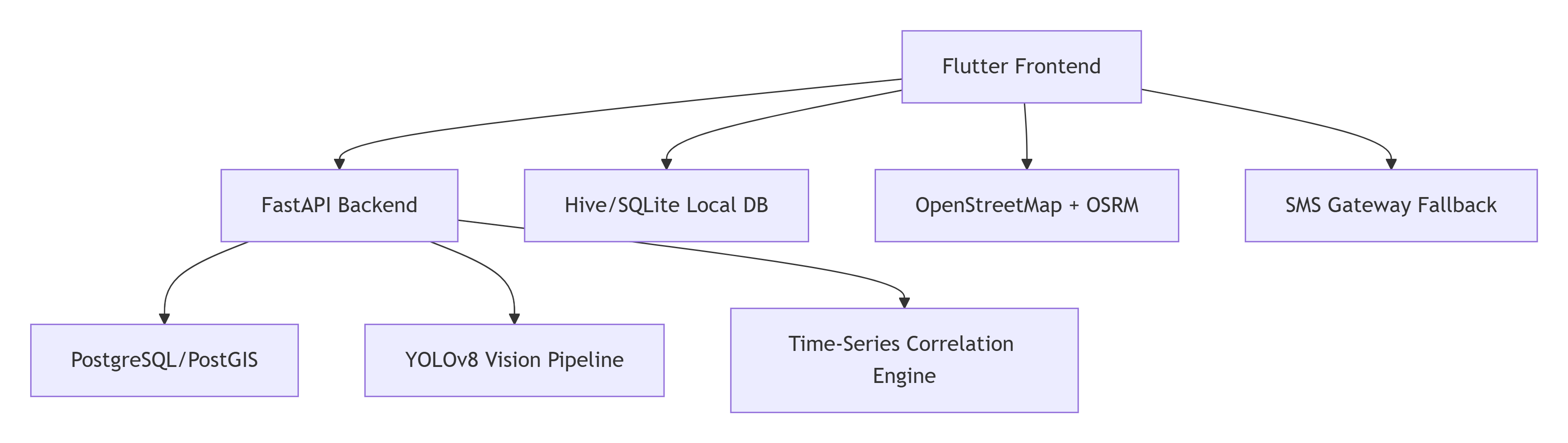
We began with a Flutter codebase in order to have one set of UI components for both citizens and field workers on Android, iOS as well as low-end web-browser systems. The local persistence is using Hive/SQLite with a good background queue. The backend developed here is FastAPI and PostgreSQL/PostGIS for geospatial requests and Trust Score aggregation. A computer vision prototype uses YOLOv8 on image samples and satellite images; Health Link employs lightweight time-series correlation. Routing and mapping is being done through OpenStreetMap and OSRM so that the whole stack can work with very little proprietary libraries. An SMS fallback is done using a local gateway pattern so that the system continues to work even when data networks are down.
Challenges we ran into
-Designing an unrivaled experience that can work offline and can yet provide users with instant and uninterrupted access to their data. -Finding a way to ensure that citizens’ anonymity must be balanced with the need for credible verification associated with their location. -Ensuring that Trust Score algorithm has to be easy enough to understand but robust enough to filter out fraudulent reports. -Working with limited health data yet allowing for calculating valid correlations by using anonymized aggregated information with respective confidence intervals. -Keeping the visual technical process simple enough but meaningful enough for actual satellite and terrestrial images. -Combining five problem statements into a cohesive demonstration of the product that can be understood in less than seven minutes. SuthraSense is the implementation of an initiative whose goal is to create an infrastructure of Suthra Punjab Programme that citizens can rely on, workers can utilize, and policymakers can actually assess by means of health-related and environmental outcomes.
Accomplishments that we're proud of
-Created a truly offline-first infrastructure that still feels modern and trustworthy, an absolute necessity for peri-urban and rural Punjab that most digital technologies don’t take into account. -Set up a citizen verification process so simple (one click or a single SMS reply) that it has a real chance of being adopted as opposed to being yet another useless mobile app of the government. -Established a transparent, public “Trust Score” system at Union Council level the first independent layer of accountability on top of the official reporting of the Suthra Punjab programme. -Successfully linked all five official Clean City problems into a single coherent modular platform instead of treating them as five different issues. -Kept the entire stack practical and with few dependencies (Flutter, FastAPI, PostGIS, OpenStreetMap, open satellite data) so that the solution can be executed economically and sustained after the hackathon. -Produced a seven-minute demo story that goes seamlessly through the journey of a field worker from an area with no signal → citizen verification → automated detection alarm → health correlation insight → alternative to burning for a farmer, allowing judges to grasp the overall story of impact.
What we learned
-By stating that 'offline-first is not just a feature but a necessity for survival in peri-urban and rural Punjab,’ they imply that the design of the system follows the intermittent conditions in the region, which has a direct consequence for the architecture of the application. The verification of citizens can only work when there is no friction involved in it, so ways for confirming/disputing via a single tap (or SMS) are far better than any rather complex form. -Trust scores can only become meaningful when they are available at the public level, granular (up to Union Council) and updated in almost real-time. -Casual correlation models between AQI and health outcomes can yield a lot of actionable early warning signals, even with imperfect data. -The trickiest issue of detection is not the accuracy of the model but its closing the loop to the enforcement team.
What's next for SuthraSense
After the hackathon, we intend to advance SuthraSense from prototype to pilot project through three distinct stages: -Partner with one or two Union Councils in peri-urban areas of Lahore or a southern Punjab region for a closed pilot of Citizen Verify + FieldForce Offline. Integrate the current Suthra Punjab geo-tagged photo workflow to validate official completion claims and citizen verifications. SMS fallback will be tested by field teams working in low-connectivity areas. NEXT STEP: -Extend the working of Sentinel Detect through free available Sentinel-2 images and some municipal CCTV footage. Launch the first version of the public Trust Score dashboard and start sending anonymized, aggregated health correlation outputs from HealthLink to district health officers. Also, launch the SmogSource equipment-rental market for some progressive farmers and agricultural service providers.
Built With
- dart
- docker
- fastapi
- figma
- flutter
- gateway
- github
- hive
- leaflet.js
- mapbox
- opencv
- openstreetmap
- osrm
- postgis
- postgresql
- prophet
- python
- react
- scikit-learn
- sms
- sqlite
- twilio
- yolov8


Log in or sign up for Devpost to join the conversation.