
Inspiration
Across East Africa, most land owners — smallholder farmers, pastoralists, and community land managers — make decisions about how to use their land with little to no scientific decision support. Should this plot be farmed, grazed, left as conservation land, or developed?
These are high-stakes decisions, but they're usually made based on tradition, guesswork, or short-term pressure rather than data on soil health, water availability, climate risk, or land cover trends.
The consequences compound over time: land degradation, falling yields, and ecosystems pushed past their carrying capacity. When drought hits, the damage is worse because the land was never suited to how it was being used in the first place. Land degradation and climate shocks feed each other — degraded land holds less water and recovers more slowly from drought, and drought-driven crop failure often pushes people toward practices (overgrazing, clearing marginal land) that degrade it further. Food insecurity is very often downstream of a land-use decision that was made without the information to make it well.
What it does
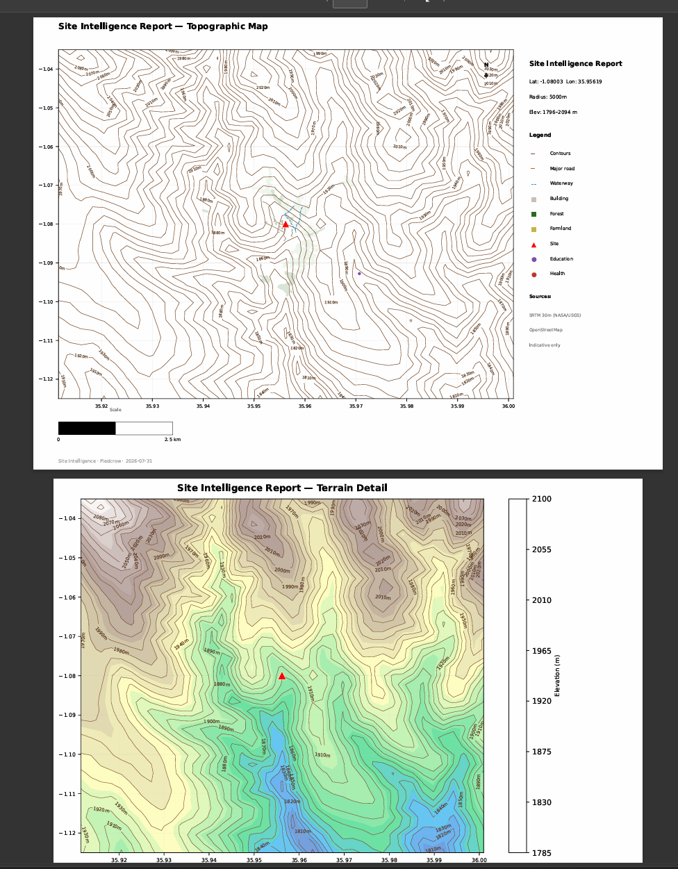
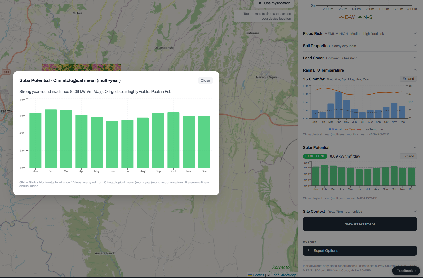
SiteIntel takes a location and evaluates it across multiple environmental dimensions at 90m resolution. — climate/solar potential, soil quality, land cover, flood risk, hydrology, and terrain.
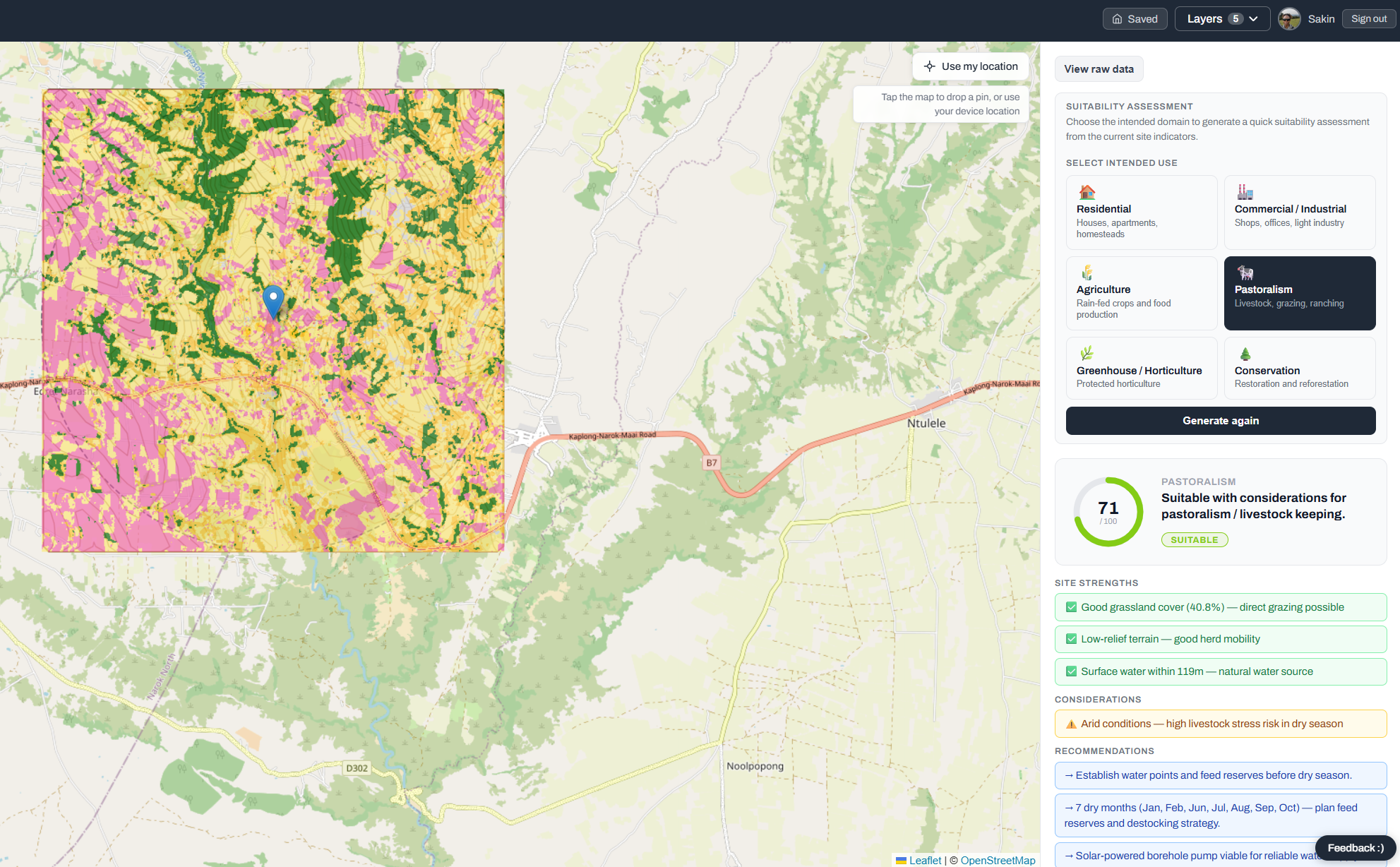
From those indicators, geospatial multi-criteria decision analysis (GIS-MCDA) is done currently using a rule-based scoring engine evaluating suitability across six land-use domains: residential, commercial, agriculture, pastoralism, greenhouse farming, and conservation. For each domain, it returns a 0–100 suitability score along with plain-language strengths, considerations, and recommendations — so a land owner isn't just handed a number, but an explanation they can act on.
How we built it
A FastAPI backend paired with a React/Leaflet frontend for interactive map-based site selection and visualization. The backend orchestrates calls to multiple external geospatial and climate data APIs, normalizes their outputs into a common set of indicators, and feeds those indicators into our domain scoring functions — deliberately built as transparent, rule-based logic rather than an opaque ML model, so recommendations stay explainable to a non-technical land owner.
Challenges we ran into
Integrating five-plus independent geospatial data sources meant handling inconsistent APIs, rate limits, and data formats. Beyond the technical challenges, the harder design problem was translating raw environmental indicators into scores and recommendations that are genuinely useful to someone without a GIS or agronomy background.
Accomplishments that we're proud of
We're proud of building a working, multi-source geospatial pipeline that turns satellite and climate data into decision support a non-expert can actually use — and doing it with transparent, explainable scoring rather than a black-box model, which matters when the decisions affect someone's livelihood. We also provide support for individual parcels of land to provide personalized and effective guidance specific to the characteristics of that land
What we learned
We learned a lot about the practical friction of stitching together geospatial APIs that were never designed to work together, and about how much design work goes into making complex environmental data legible to a non-technical audience. We also came away with a much sharper sense of how land-use decision support connects to the bigger picture of climate resilience — it's not just an agronomy problem, it's an early-warning and anticipatory-action problem too.
What's next for SiteIntel
Next, we're building out the temporal monitoring layer for saved sites, layering anticipatory-action triggers on top of that monitoring, and rolling out SMS-based access so the land owners with the most at stake — often the ones with the least connectivity — can get this decision support too.
Built With
- earthobs
- esa-worldcover
- fastapi
- gee
- gis
- isdasoil
- nasa-power
- openstreetmap
- postgresql
- python
- react
- rule-based-systems

Log in or sign up for Devpost to join the conversation.