Try Sherpa
Landing Page: gosherpa.tech
App: appsherpa.tech
Test Account
Email: mohamed314@usf.edu
Password: 12345678
Inspiration
Sherpa is named after the Sherpa people of the Himalayan regions of Nepal, India, and Tibet. We chose the name to represent guidance through difficult paths while recognizing and respecting its cultural origin.
The idea came from something we kept seeing around us. We have sisters and friends who do not always feel comfortable walking across campus alone at night. Sometimes they would stay at a friend's place, wait for someone to walk with them, or get a ride instead of walking back to their dorm.
That made us question something simple: why do navigation apps mostly optimize for the fastest route?
The shortest route might take someone through a dark part of campus. A wheelchair user might follow directions only to end up at stairs or the wrong entrance. Someone walking alone might pass within a block of an emergency tower without ever knowing it is there.
We wanted navigation to consider the person taking the route, not just the distance.
That became Sherpa.
What it does
Sherpa is a campus navigation app that helps students choose routes based on what matters to them.
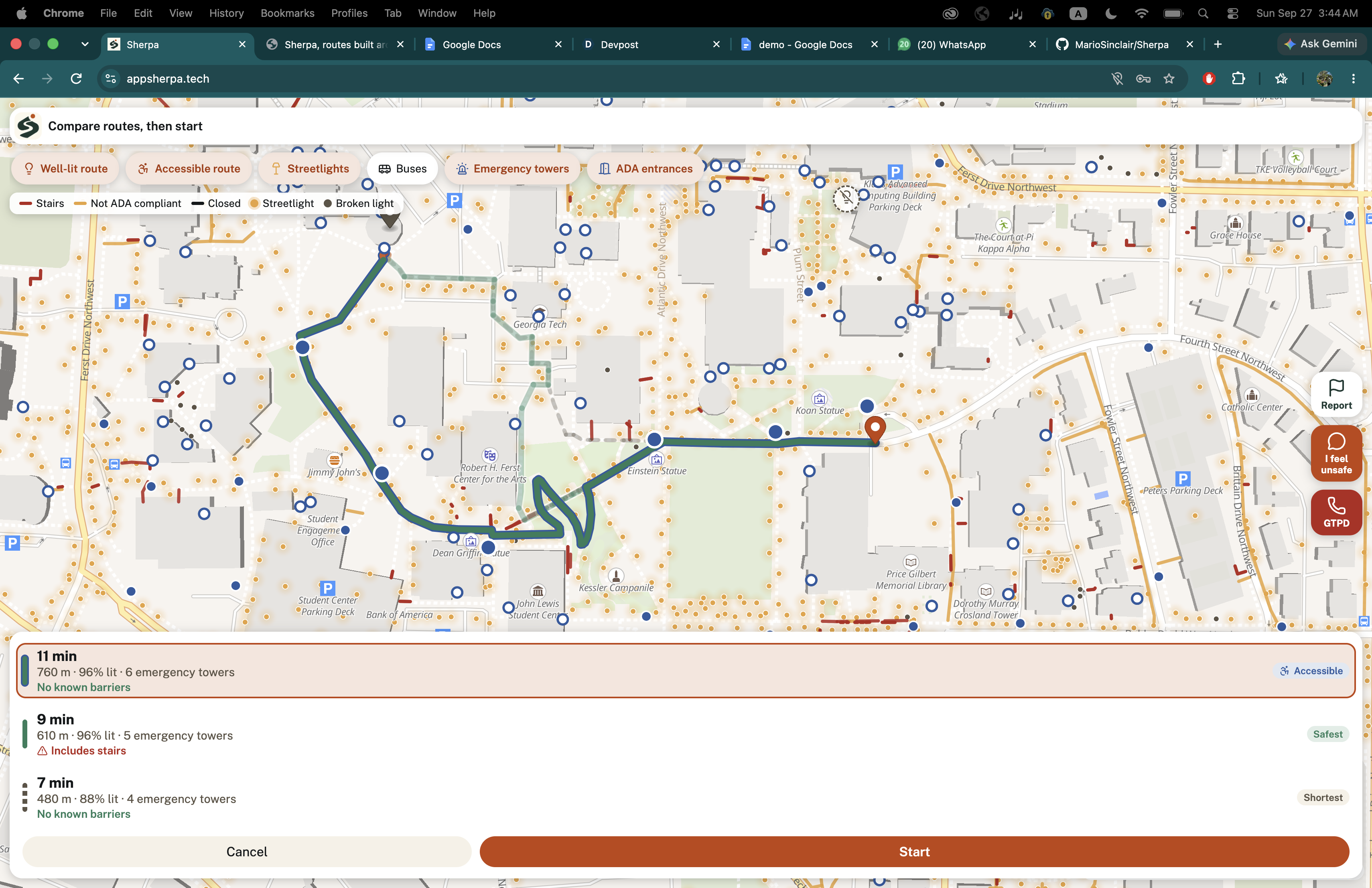
Students can choose a well-lit route that prioritizes streetlights and proximity to emergency towers, or an accessible route that avoids stairs and prioritizes ADA-compatible sidewalks and entrances.
Sherpa uses real Georgia Tech campus data for streetlights, sidewalks, ADA entrances, accessibility information, emergency towers, and live Stinger buses.
It also includes tools for situations where conditions change while someone is walking.
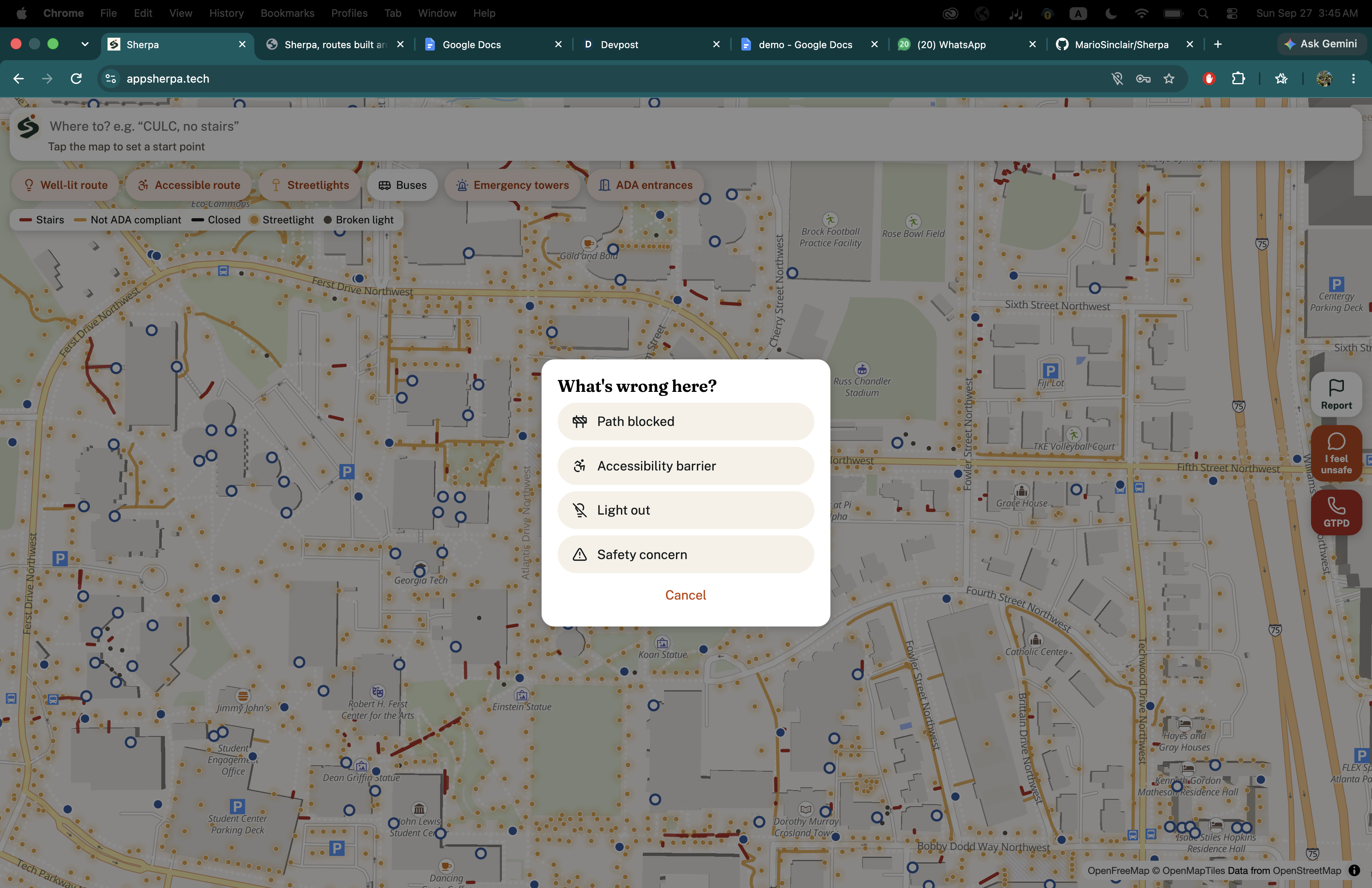
Students can report a broken streetlight, blocked sidewalk, accessibility issue, or other problem directly from the map. Other users can confirm whether the report is still accurate, helping keep the information current.
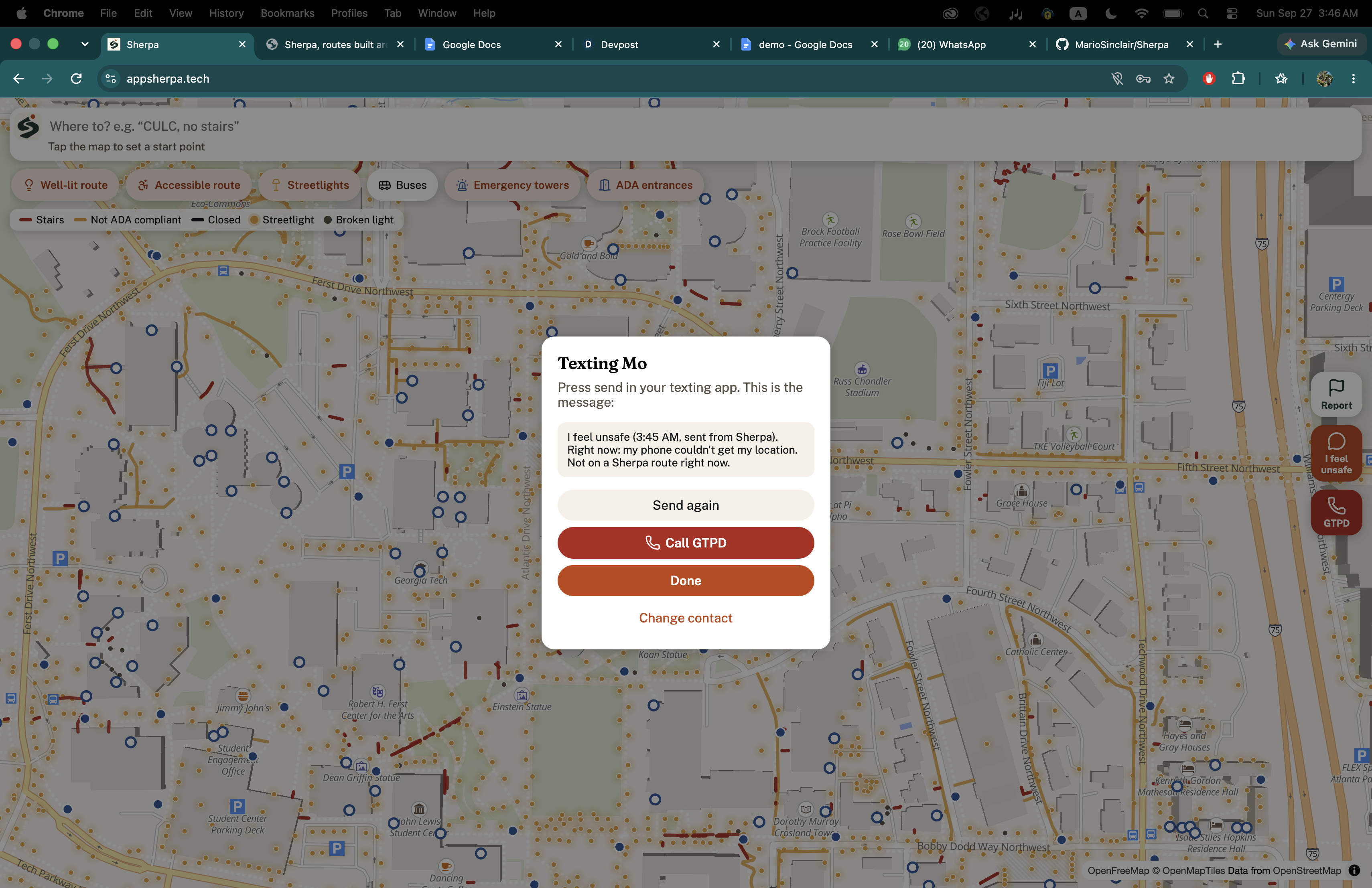
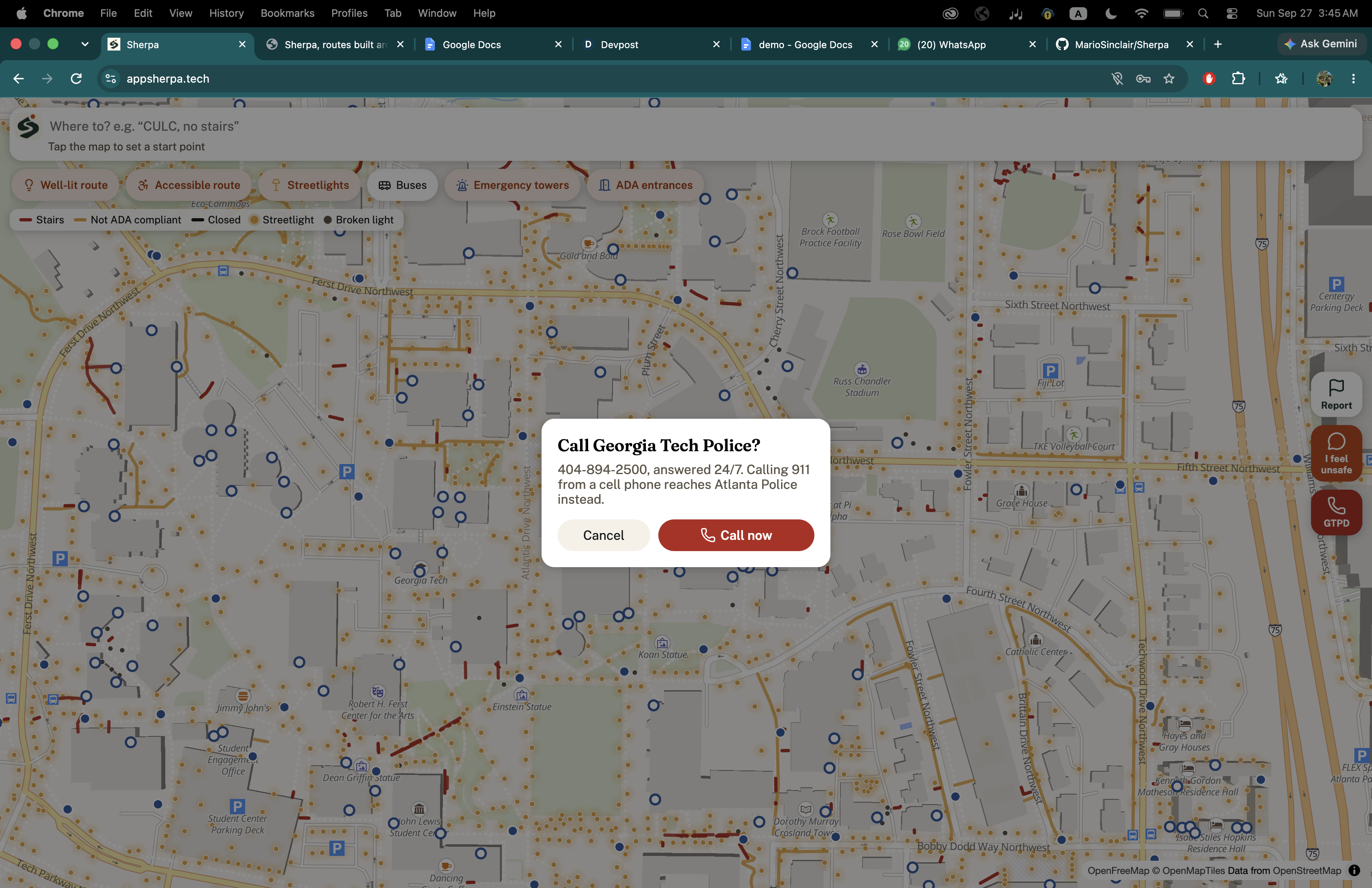
If someone feels unsafe, one tap can prepare a message for their saved emergency contact with their starting point, destination, current coordinates, and timestamp. If the situation becomes more serious, they can also quickly contact GTPD.
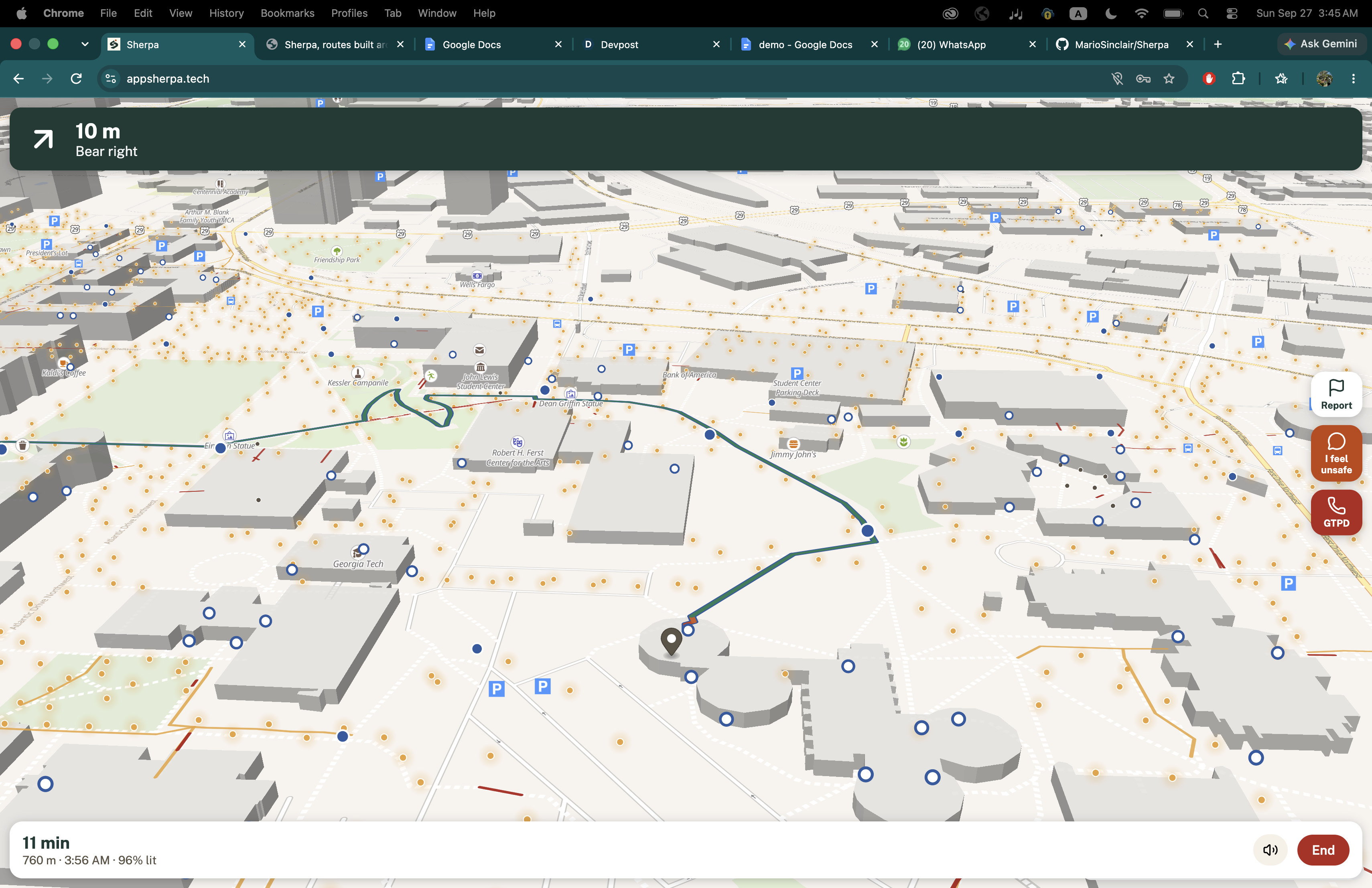
Sherpa supports live GPS navigation, turn-by-turn directions, automatic rerouting, and Stinger bus integration when taking the bus actually makes the trip better.
The idea is simple: most maps tell you how to get there. Sherpa helps you decide how you want to get there.
How we built it
We built Sherpa as a routing system, not just a different interface on top of an existing directions API.
The backend uses Python and Flask, with OpenStreetMap data processed through OSMnx and NetworkX to build Georgia Tech's walking network. We then connected that graph to real Georgia Tech facilities data for streetlights, ADA sidewalks, accessible entrances, emergency towers, and official sidewalk closures.
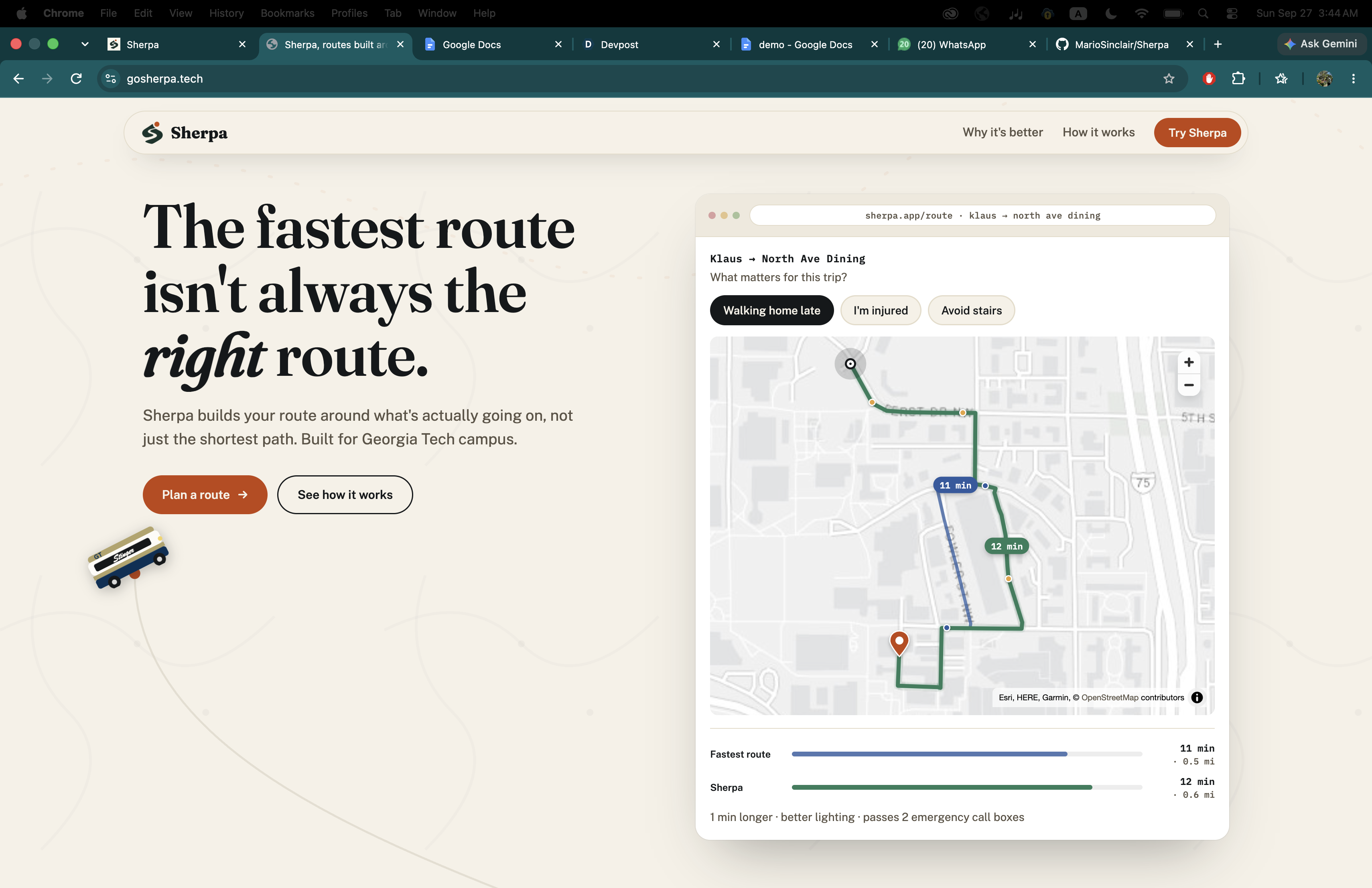
Instead of treating every path equally, Sherpa scores route segments based on the selected mode. Well-lit routes favor paths with better lighting and nearby emergency infrastructure, while accessible routes avoid stairs and heavily penalize known accessibility barriers. We still calculate the normal shortest path alongside the scored route so students can clearly see the tradeoff, such as walking one extra minute for a better-lit route.
One of the harder parts was matching accessibility data correctly. The closest sidewalk is not always the right sidewalk, especially when paths cross, so we compare both distance and direction before attaching accessibility data to the routing graph.
We also built our own turn-by-turn navigation system. Sherpa tracks the user's GPS location, generates directions, detects when they leave the route, and reroutes when necessary.
For transit, we integrated Georgia Tech's live Stinger bus data. Since the public feed is undocumented, we had to work out how routes, stops, and loop directions were represented, including cases where a bus passes the same area in both directions. Sherpa can then compare a full walk-bus-walk trip against walking and only recommend the bus when it actually helps.
Community reports are stored in Supabase. When multiple students report the same issue in the same area, Sherpa can treat it as confirmed, warn users already traveling nearby, and route future trips around it.
We also added natural-language trip requests using Claude with structured output, so someone can type something like "take me to Tech Tower with no stairs." AI helps interpret the request, but the actual routing system works independently of it.
The frontend uses JavaScript and MapLibre GL to display routes, live location, streetlights, emergency towers, ADA information, reports, and buses. We also built a separate responsive landing page with its own interactive route comparison and GT Stinger animation to explain the product before users enter the app..
Accomplishments that we're proud of
The thing we are most proud of is that Sherpa forced us to think about problems outside our own experience.
We built around situations faced by students who may feel unsafe walking alone and students who cannot assume that every "walking route" is actually accessible to them.
Technically, we are proud that Sherpa became more than a map demo. We combined official campus GIS data, OpenStreetMap routing, live Stinger buses, community reports, live GPS navigation, accessibility data, and account security into one working system.
Most importantly, those systems actually affect the route a student receives.
What we learned
We learned how much real-world routing depends on the data behind it, not just the algorithm. A big part of the project was figuring out how to combine campus GIS data, OpenStreetMap, live bus information, and student reports even though they all update differently and do not always line up perfectly.
We also learned how sensitive route scoring is. Small changes to how we weight lighting, accessibility, or reports can completely change the path, so we had to tune it carefully to keep routes useful and realistic.
More personally, we learned to think beyond how we ourselves move around campus and design for people who may experience the same space very differently.
What's next for Sherpa
The next step is taking Sherpa beyond Georgia Tech, starting with our own campus at USF.
From there, we want to expand to other universities across the U.S. anywhere campus infrastructure, accessibility, and transit data is available.
We also want reports in Sherpa to connect directly to the people who can act on them. A broken streetlight could automatically reach facilities, while a serious safety issue could be directed to the appropriate campus authority.
Long term, we want universities to be able to integrate Sherpa with their own transportation, facilities, accessibility, and public safety systems.
Our goal is for campus navigation to stop asking only, “What is the shortest route?”
It should also ask, “What is the right route for you?” using simple input from students and learning their preferences over time.
Built With
- css
- flask
- geopandas
- html5
- javascript
- maplibre
- openstreetmap
- python

Log in or sign up for Devpost to join the conversation.